Launch List
API endpoint that returns all Launch objects or a single launch.
EXAMPLE - /launch/
GET: Return a list of all Launch objects.
FILTERS: Fields - 'name', 'id(s)', 'lsp_id', 'lsp_name', 'serial_number', 'launcher_config__id', 'rocket__spacecraftflight__spacecraft__name'
MODE: 'normal', 'list', 'detailed' EXAMPLE: ?mode=list
SEARCH: Searches through the launch name, rocket name, launch agency, mission name & spacecraft name. EXAMPLE - ?search=SpaceX
GET /2.0.0/launch/?format=api&offset=6970&ordering=-name
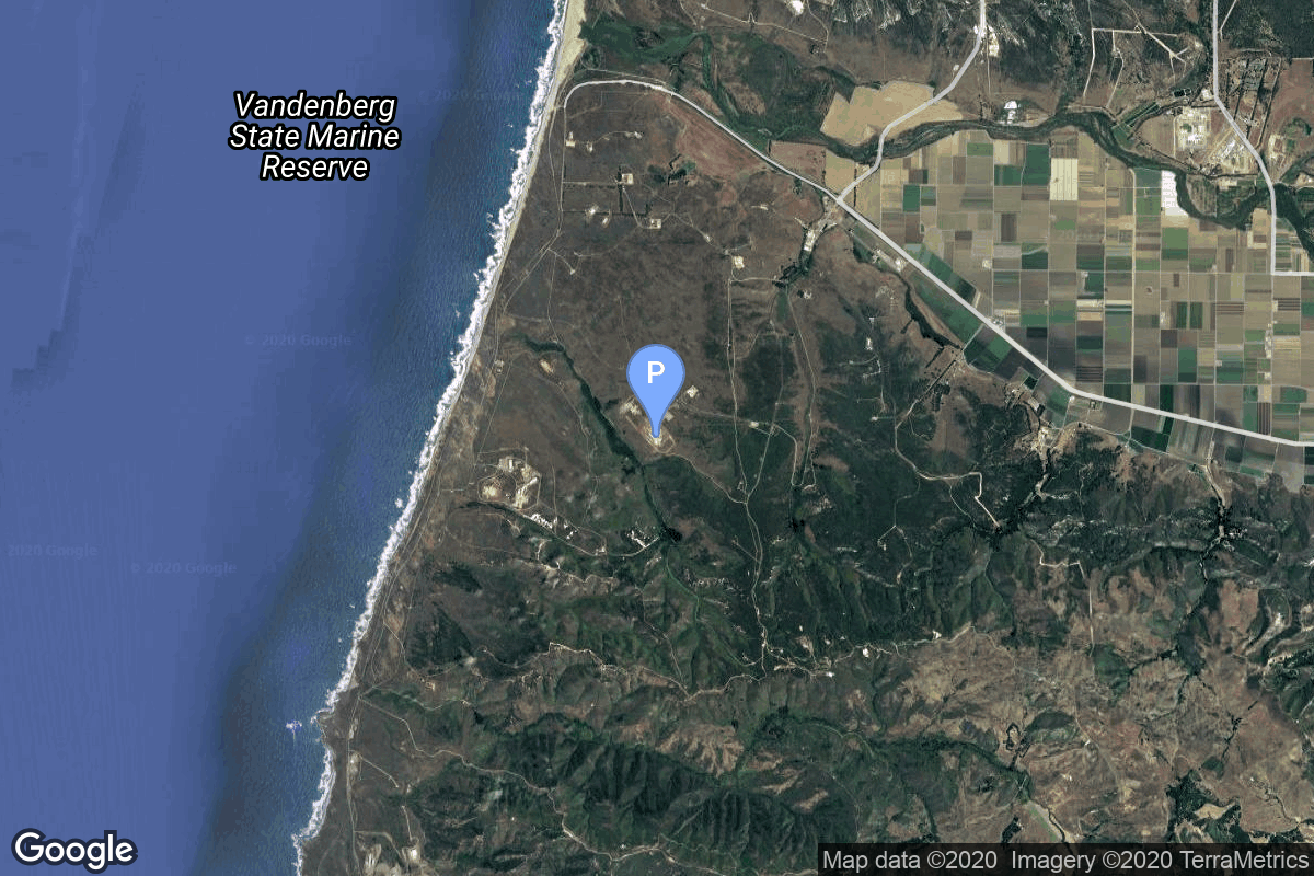
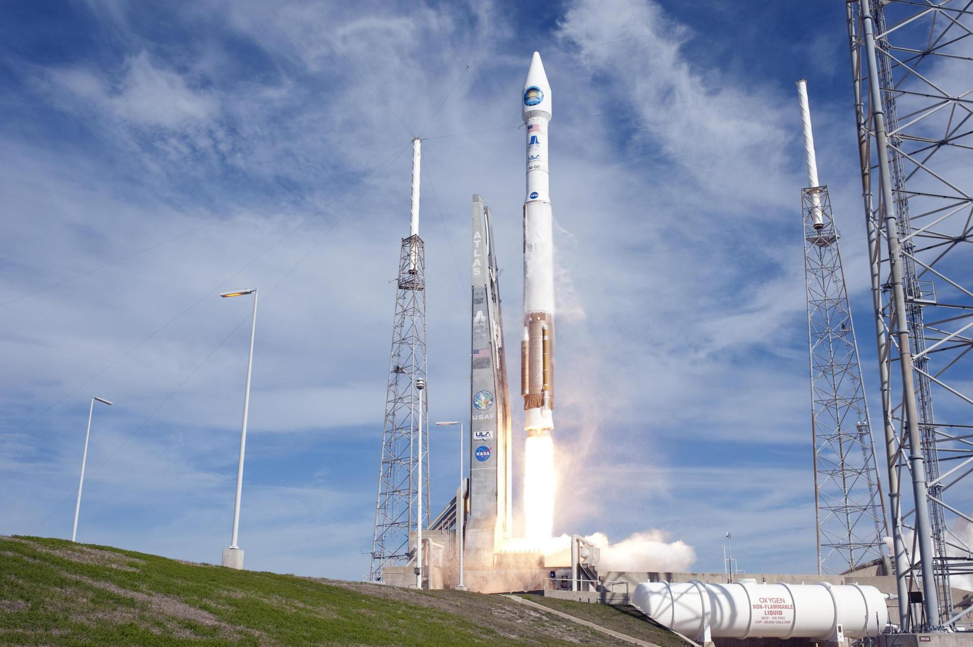
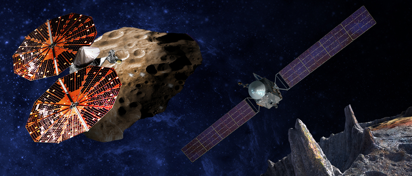
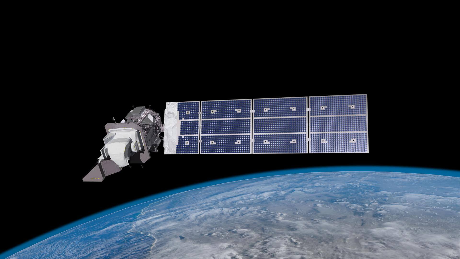
{ "count": 7673, "next": "https://ll.thespacedevs.com/2.0.0/launch/?format=api&limit=10&offset=6980&ordering=-name", "previous": "https://ll.thespacedevs.com/2.0.0/launch/?format=api&limit=10&offset=6960&ordering=-name", "results": [ { "id": "9999f7f7-9425-4daf-bdc9-14770029cea8", "url": "https://ll.thespacedevs.com/2.0.0/launch/9999f7f7-9425-4daf-bdc9-14770029cea8/?format=api", "launch_library_id": 644, "slug": "atlas-v-401-nrol-36-multipayload-mission", "name": "Atlas V 401 | NROL-36 (Multipayload mission)", "status": { "id": 3, "name": "Success" }, "net": "2012-09-13T21:39:00Z", "window_end": "2012-09-13T21:39:00Z", "window_start": "2012-09-13T21:39:00Z", "inhold": false, "tbdtime": false, "tbddate": false, "probability": null, "holdreason": "", "failreason": null, "hashtag": null, "launch_service_provider": { "id": 124, "url": "https://ll.thespacedevs.com/2.0.0/agencies/124/?format=api", "name": "United Launch Alliance", "type": "Commercial" }, "rocket": { "id": 1629, "configuration": { "id": 16, "launch_library_id": 26, "url": "https://ll.thespacedevs.com/2.0.0/config/launcher/16/?format=api", "name": "Atlas V 401", "family": "Atlas", "full_name": "Atlas V 401", "variant": "401" } }, "mission": null, "pad": { "id": 24, "url": "https://ll.thespacedevs.com/2.0.0/pad/24/?format=api", "agency_id": 161, "name": "Space Launch Complex 3E", "info_url": null, "wiki_url": "https://en.wikipedia.org/wiki/Vandenberg_Space_Launch_Complex_3#SLC-3E", "map_url": "https://www.google.com/maps?q=34.64,-120.5895", "latitude": "34.64", "longitude": "-120.5895", "location": { "id": 11, "url": "https://ll.thespacedevs.com/2.0.0/location/11/?format=api", "name": "Vandenberg SFB, CA, USA", "country_code": "USA", "map_image": "https://thespacedevs-prod.nyc3.digitaloceanspaces.com/media/map_images/location_11_20200803142416.jpg", "total_launch_count": 843, "total_landing_count": 29 }, "map_image": "https://thespacedevs-prod.nyc3.digitaloceanspaces.com/media/map_images/pad_24_20200803143552.jpg", "total_launch_count": 48 }, "webcast_live": false, "image": "https://thespacedevs-prod.nyc3.digitaloceanspaces.com/media/images/atlas_v_image_20201212013334.jpeg", "infographic": null, "program": [] }, { "id": "ad8b208d-f650-4d34-98c8-92c72c3de312", "url": "https://ll.thespacedevs.com/2.0.0/launch/ad8b208d-f650-4d34-98c8-92c72c3de312/?format=api", "launch_library_id": 105, "slug": "atlas-v-401-nrol-33-quasar", "name": "Atlas V 401 | NROL-33 (Quasar)", "status": { "id": 3, "name": "Success" }, "net": "2014-05-22T13:09:00Z", "window_end": "2014-05-22T13:09:00Z", "window_start": "2014-05-22T13:09:00Z", "inhold": false, "tbdtime": false, "tbddate": false, "probability": null, "holdreason": "", "failreason": null, "hashtag": null, "launch_service_provider": { "id": 124, "url": "https://ll.thespacedevs.com/2.0.0/agencies/124/?format=api", "name": "United Launch Alliance", "type": "Commercial" }, "rocket": { "id": 1757, "configuration": { "id": 16, "launch_library_id": 26, "url": "https://ll.thespacedevs.com/2.0.0/config/launcher/16/?format=api", "name": "Atlas V 401", "family": "Atlas", "full_name": "Atlas V 401", "variant": "401" } }, "mission": { "id": 733, "launch_library_id": 90, "name": "NROL-33 (Quasar)", "description": "Classified payload for the National Reconnaissance Office.", "launch_designator": null, "type": "Government/Top Secret", "orbit": { "id": 4, "name": "Geosynchronous Transfer Orbit", "abbrev": "GSTO" } }, "pad": { "id": 29, "url": "https://ll.thespacedevs.com/2.0.0/pad/29/?format=api", "agency_id": null, "name": "Space Launch Complex 41", "info_url": null, "wiki_url": "https://en.wikipedia.org/wiki/Cape_Canaveral_Air_Force_Station_Space_Launch_Complex_41", "map_url": "https://www.google.com/maps?q=28.58341025,-80.58303644", "latitude": "28.58341025", "longitude": "-80.58303644", "location": { "id": 12, "url": "https://ll.thespacedevs.com/2.0.0/location/12/?format=api", "name": "Cape Canaveral SFS, FL, USA", "country_code": "USA", "map_image": "https://thespacedevs-prod.nyc3.digitaloceanspaces.com/media/map_images/location_12_20200803142519.jpg", "total_launch_count": 1065, "total_landing_count": 69 }, "map_image": "https://thespacedevs-prod.nyc3.digitaloceanspaces.com/media/map_images/pad_29_20200803143528.jpg", "total_launch_count": 118 }, "webcast_live": false, "image": "https://thespacedevs-prod.nyc3.digitaloceanspaces.com/media/images/atlas_v_image_20201212013334.jpeg", "infographic": null, "program": [] }, { "id": "2e77e64a-1d0d-4fb4-914d-c7a2fac953ce", "url": "https://ll.thespacedevs.com/2.0.0/launch/2e77e64a-1d0d-4fb4-914d-c7a2fac953ce/?format=api", "launch_library_id": 1559, "slug": "atlas-v-401-nrol-30-noss-3-usa-194", "name": "Atlas V 401 | NROL-30 & NOSS-3 (USA-194)", "status": { "id": 3, "name": "Success" }, "net": "2007-06-15T15:12:00Z", "window_end": "2007-06-15T15:12:00Z", "window_start": "2007-06-15T15:12:00Z", "inhold": false, "tbdtime": false, "tbddate": false, "probability": null, "holdreason": "", "failreason": "", "hashtag": null, "launch_service_provider": { "id": 124, "url": "https://ll.thespacedevs.com/2.0.0/agencies/124/?format=api", "name": "United Launch Alliance", "type": "Commercial" }, "rocket": { "id": 541, "configuration": { "id": 16, "launch_library_id": 26, "url": "https://ll.thespacedevs.com/2.0.0/config/launcher/16/?format=api", "name": "Atlas V 401", "family": "Atlas", "full_name": "Atlas V 401", "variant": "401" } }, "mission": { "id": 545, "launch_library_id": 716, "name": "NROL-30 & NOSS-3 (USA-194)", "description": "A military reconnaissance satellite, it's purpose is classified, launched with NOSS-3. An intelligence satellite for the US Navy.", "launch_designator": null, "type": "Government/Top Secret", "orbit": { "id": 8, "name": "Low Earth Orbit", "abbrev": "LEO" } }, "pad": { "id": 29, "url": "https://ll.thespacedevs.com/2.0.0/pad/29/?format=api", "agency_id": null, "name": "Space Launch Complex 41", "info_url": null, "wiki_url": "https://en.wikipedia.org/wiki/Cape_Canaveral_Air_Force_Station_Space_Launch_Complex_41", "map_url": "https://www.google.com/maps?q=28.58341025,-80.58303644", "latitude": "28.58341025", "longitude": "-80.58303644", "location": { "id": 12, "url": "https://ll.thespacedevs.com/2.0.0/location/12/?format=api", "name": "Cape Canaveral SFS, FL, USA", "country_code": "USA", "map_image": "https://thespacedevs-prod.nyc3.digitaloceanspaces.com/media/map_images/location_12_20200803142519.jpg", "total_launch_count": 1065, "total_landing_count": 69 }, "map_image": "https://thespacedevs-prod.nyc3.digitaloceanspaces.com/media/map_images/pad_29_20200803143528.jpg", "total_launch_count": 118 }, "webcast_live": false, "image": "https://thespacedevs-prod.nyc3.digitaloceanspaces.com/media/images/atlas_v_image_20201212013334.jpeg", "infographic": null, "program": [] }, { "id": "23b1dac9-9ba6-473a-bcf4-94b0a21ea1b9", "url": "https://ll.thespacedevs.com/2.0.0/launch/23b1dac9-9ba6-473a-bcf4-94b0a21ea1b9/?format=api", "launch_library_id": 1561, "slug": "atlas-v-401-nrol-24-usa-198", "name": "Atlas V 401 | NROL-24 (USA-198)", "status": { "id": 3, "name": "Success" }, "net": "2007-12-10T22:05:00Z", "window_end": "2007-12-10T22:05:00Z", "window_start": "2007-12-10T22:05:00Z", "inhold": false, "tbdtime": false, "tbddate": false, "probability": 0, "holdreason": "", "failreason": "", "hashtag": "", "launch_service_provider": { "id": 124, "url": "https://ll.thespacedevs.com/2.0.0/agencies/124/?format=api", "name": "United Launch Alliance", "type": "Commercial" }, "rocket": { "id": 1386, "configuration": { "id": 16, "launch_library_id": 26, "url": "https://ll.thespacedevs.com/2.0.0/config/launcher/16/?format=api", "name": "Atlas V 401", "family": "Atlas", "full_name": "Atlas V 401", "variant": "401" } }, "mission": { "id": 544, "launch_library_id": 718, "name": "NROL-24 (USA-198)", "description": "A military reconnaissance satellite, it's purpose is classified.", "launch_designator": null, "type": "Government/Top Secret", "orbit": { "id": 0, "name": "Elliptical Orbit", "abbrev": "Elliptical" } }, "pad": { "id": 29, "url": "https://ll.thespacedevs.com/2.0.0/pad/29/?format=api", "agency_id": null, "name": "Space Launch Complex 41", "info_url": null, "wiki_url": "https://en.wikipedia.org/wiki/Cape_Canaveral_Air_Force_Station_Space_Launch_Complex_41", "map_url": "https://www.google.com/maps?q=28.58341025,-80.58303644", "latitude": "28.58341025", "longitude": "-80.58303644", "location": { "id": 12, "url": "https://ll.thespacedevs.com/2.0.0/location/12/?format=api", "name": "Cape Canaveral SFS, FL, USA", "country_code": "USA", "map_image": "https://thespacedevs-prod.nyc3.digitaloceanspaces.com/media/map_images/location_12_20200803142519.jpg", "total_launch_count": 1065, "total_landing_count": 69 }, "map_image": "https://thespacedevs-prod.nyc3.digitaloceanspaces.com/media/map_images/pad_29_20200803143528.jpg", "total_launch_count": 118 }, "webcast_live": false, "image": "https://thespacedevs-prod.nyc3.digitaloceanspaces.com/media/images/atlas_v_image_20201212013334.jpeg", "infographic": null, "program": [] }, { "id": "404bc5c5-79b8-4c7e-9919-a18ca202e38c", "url": "https://ll.thespacedevs.com/2.0.0/launch/404bc5c5-79b8-4c7e-9919-a18ca202e38c/?format=api", "launch_library_id": 579, "slug": "atlas-v-401-maven", "name": "Atlas V 401 | MAVEN", "status": { "id": 3, "name": "Success" }, "net": "2013-11-18T18:28:00Z", "window_end": "2013-11-18T18:28:00Z", "window_start": "2013-11-18T18:28:00Z", "inhold": false, "tbdtime": false, "tbddate": false, "probability": null, "holdreason": "", "failreason": null, "hashtag": null, "launch_service_provider": { "id": 124, "url": "https://ll.thespacedevs.com/2.0.0/agencies/124/?format=api", "name": "United Launch Alliance", "type": "Commercial" }, "rocket": { "id": 1715, "configuration": { "id": 16, "launch_library_id": 26, "url": "https://ll.thespacedevs.com/2.0.0/config/launcher/16/?format=api", "name": "Atlas V 401", "family": "Atlas", "full_name": "Atlas V 401", "variant": "401" } }, "mission": { "id": 38, "launch_library_id": 63, "name": "MAVEN", "description": "MAVEN is a Mars orbiter with a mission to study the martian atmosphere and how it was lost over time.", "launch_designator": null, "type": "Planetary Science", "orbit": { "id": 6, "name": "Heliocentric N/A", "abbrev": "Helio-N/A" } }, "pad": { "id": 29, "url": "https://ll.thespacedevs.com/2.0.0/pad/29/?format=api", "agency_id": null, "name": "Space Launch Complex 41", "info_url": null, "wiki_url": "https://en.wikipedia.org/wiki/Cape_Canaveral_Air_Force_Station_Space_Launch_Complex_41", "map_url": "https://www.google.com/maps?q=28.58341025,-80.58303644", "latitude": "28.58341025", "longitude": "-80.58303644", "location": { "id": 12, "url": "https://ll.thespacedevs.com/2.0.0/location/12/?format=api", "name": "Cape Canaveral SFS, FL, USA", "country_code": "USA", "map_image": "https://thespacedevs-prod.nyc3.digitaloceanspaces.com/media/map_images/location_12_20200803142519.jpg", "total_launch_count": 1065, "total_landing_count": 69 }, "map_image": "https://thespacedevs-prod.nyc3.digitaloceanspaces.com/media/map_images/pad_29_20200803143528.jpg", "total_launch_count": 118 }, "webcast_live": false, "image": "https://thespacedevs-prod.nyc3.digitaloceanspaces.com/media/images/atlas_v_image_20201212013334.jpeg", "infographic": null, "program": [] }, { "id": "d23062f3-86d7-4b99-80f1-4c31cb07fcc0", "url": "https://ll.thespacedevs.com/2.0.0/launch/d23062f3-86d7-4b99-80f1-4c31cb07fcc0/?format=api", "launch_library_id": null, "slug": "atlas-v-401-mars-reconnaissance-orbiter", "name": "Atlas V 401 | Mars Reconnaissance Orbiter", "status": { "id": 3, "name": "Success" }, "net": "2005-08-12T11:43:00Z", "window_end": "2005-08-12T11:43:00Z", "window_start": "2005-08-12T11:43:00Z", "inhold": false, "tbdtime": false, "tbddate": false, "probability": null, "holdreason": "", "failreason": null, "hashtag": null, "launch_service_provider": { "id": 82, "url": "https://ll.thespacedevs.com/2.0.0/agencies/82/?format=api", "name": "Lockheed Martin", "type": "Commercial" }, "rocket": { "id": 7236, "configuration": { "id": 16, "launch_library_id": 26, "url": "https://ll.thespacedevs.com/2.0.0/config/launcher/16/?format=api", "name": "Atlas V 401", "family": "Atlas", "full_name": "Atlas V 401", "variant": "401" } }, "mission": { "id": 5625, "launch_library_id": null, "name": "Mars Reconnaissance Orbiter", "description": "Mars Reconnaissance Orbiter (MRO) is a spacecraft designed to study the geology and climate of Mars, provide reconnaissance of future landing sites, and relay data from surface missions back to Earth. It was launched on August 12, 2005 and reached Mars on March 10, 2006. In November 2006, after five months of aerobraking, it entered its final science orbit and began its primary science phase.", "launch_designator": null, "type": "Planetary Science", "orbit": { "id": 19, "name": "Mars Orbit", "abbrev": "Mars" } }, "pad": { "id": 29, "url": "https://ll.thespacedevs.com/2.0.0/pad/29/?format=api", "agency_id": null, "name": "Space Launch Complex 41", "info_url": null, "wiki_url": "https://en.wikipedia.org/wiki/Cape_Canaveral_Air_Force_Station_Space_Launch_Complex_41", "map_url": "https://www.google.com/maps?q=28.58341025,-80.58303644", "latitude": "28.58341025", "longitude": "-80.58303644", "location": { "id": 12, "url": "https://ll.thespacedevs.com/2.0.0/location/12/?format=api", "name": "Cape Canaveral SFS, FL, USA", "country_code": "USA", "map_image": "https://thespacedevs-prod.nyc3.digitaloceanspaces.com/media/map_images/location_12_20200803142519.jpg", "total_launch_count": 1065, "total_landing_count": 69 }, "map_image": "https://thespacedevs-prod.nyc3.digitaloceanspaces.com/media/map_images/pad_29_20200803143528.jpg", "total_launch_count": 118 }, "webcast_live": false, "image": "https://thespacedevs-prod.nyc3.digitaloceanspaces.com/media/images/atlas_v_image_20201212013334.jpeg", "infographic": null, "program": [] }, { "id": "7e2d0fe7-6156-442d-be4e-cbac85f259e5", "url": "https://ll.thespacedevs.com/2.0.0/launch/7e2d0fe7-6156-442d-be4e-cbac85f259e5/?format=api", "launch_library_id": 1683, "slug": "atlas-v-401-lucy", "name": "Atlas V 401 | Lucy", "status": { "id": 3, "name": "Success" }, "net": "2021-10-16T09:34:00Z", "window_end": "2021-10-16T10:49:00Z", "window_start": "2021-10-16T09:34:00Z", "inhold": false, "tbdtime": false, "tbddate": false, "probability": 90, "holdreason": "", "failreason": "", "hashtag": null, "launch_service_provider": { "id": 124, "url": "https://ll.thespacedevs.com/2.0.0/agencies/124/?format=api", "name": "United Launch Alliance", "type": "Commercial" }, "rocket": { "id": 2209, "configuration": { "id": 16, "launch_library_id": 26, "url": "https://ll.thespacedevs.com/2.0.0/config/launcher/16/?format=api", "name": "Atlas V 401", "family": "Atlas", "full_name": "Atlas V 401", "variant": "401" } }, "mission": { "id": 5849, "launch_library_id": null, "name": "Lucy", "description": "Lucy is the first mission to explore and study Trojan asteroids. The Trojans are a type of asteroids that orbit the Sun in two groups, in front of and behind Jupiter in its orbit around our star. Since these asteroids have been in such stable orbits for billions of years, they are of great interest as remnants of early Solar System.\r\nLucy is a NASA mission led by NASA Goddard and Southwest Research Institute in Boulder, Colorado. Over the course of 12 years, Lucy will fly by seven different Trojan asteroids and also one main belt asteroid. The complex trajectory to visit all targets will include several Earth gravity assists.", "launch_designator": null, "type": "Robotic Exploration", "orbit": { "id": 6, "name": "Heliocentric N/A", "abbrev": "Helio-N/A" } }, "pad": { "id": 29, "url": "https://ll.thespacedevs.com/2.0.0/pad/29/?format=api", "agency_id": null, "name": "Space Launch Complex 41", "info_url": null, "wiki_url": "https://en.wikipedia.org/wiki/Cape_Canaveral_Air_Force_Station_Space_Launch_Complex_41", "map_url": "https://www.google.com/maps?q=28.58341025,-80.58303644", "latitude": "28.58341025", "longitude": "-80.58303644", "location": { "id": 12, "url": "https://ll.thespacedevs.com/2.0.0/location/12/?format=api", "name": "Cape Canaveral SFS, FL, USA", "country_code": "USA", "map_image": "https://thespacedevs-prod.nyc3.digitaloceanspaces.com/media/map_images/location_12_20200803142519.jpg", "total_launch_count": 1065, "total_landing_count": 69 }, "map_image": "https://thespacedevs-prod.nyc3.digitaloceanspaces.com/media/map_images/pad_29_20200803143528.jpg", "total_launch_count": 118 }, "webcast_live": false, "image": "https://thespacedevs-prod.nyc3.digitaloceanspaces.com/media/images/atlas_v_image_20201212013334.jpeg", "infographic": null, "program": [ { "id": 33, "url": "https://ll.thespacedevs.com/2.0.0/program/33/?format=api", "name": "Discovery Program", "description": "The Discovery Program is a series of Solar System exploration missions funded by the U.S. National Aeronautics and Space Administration (NASA) through its Planetary Missions Program Office. The cost of each mission is capped at a lower level than missions from NASA's New Frontiers or Flagship Programs. As a result, Discovery missions tend to be more focused on a specific scientific goal rather than serving a general purpose.", "agencies": [ { "id": 44, "url": "https://ll.thespacedevs.com/2.0.0/agencies/44/?format=api", "name": "National Aeronautics and Space Administration", "type": "Government" } ], "image_url": "https://thespacedevs-prod.nyc3.digitaloceanspaces.com/media/images/discovery2520p_program_20231231122246.jpeg", "start_date": "1990-01-01T00:00:00Z", "end_date": null, "info_url": "https://www.nasa.gov/planetarymissions/discovery-program/", "wiki_url": "https://en.wikipedia.org/wiki/Discovery_Program" } ] }, { "id": "d8d10fbf-b900-40c7-95ef-fb2f07489f6f", "url": "https://ll.thespacedevs.com/2.0.0/launch/d8d10fbf-b900-40c7-95ef-fb2f07489f6f/?format=api", "launch_library_id": 1565, "slug": "atlas-v-401-lrolcross", "name": "Atlas V 401 | LRO/LCROSS", "status": { "id": 3, "name": "Success" }, "net": "2009-06-18T21:32:00Z", "window_end": "2009-06-18T21:32:00Z", "window_start": "2009-06-18T21:32:00Z", "inhold": false, "tbdtime": false, "tbddate": false, "probability": null, "holdreason": "", "failreason": "", "hashtag": null, "launch_service_provider": { "id": 124, "url": "https://ll.thespacedevs.com/2.0.0/agencies/124/?format=api", "name": "United Launch Alliance", "type": "Commercial" }, "rocket": { "id": 1419, "configuration": { "id": 16, "launch_library_id": 26, "url": "https://ll.thespacedevs.com/2.0.0/config/launcher/16/?format=api", "name": "Atlas V 401", "family": "Atlas", "full_name": "Atlas V 401", "variant": "401" } }, "mission": { "id": 799, "launch_library_id": 722, "name": "LRO/LCROSS", "description": "LRO is the Lunar Reconnaissance Orbiter for NASA. Used to map the moon to identify safe landing sites, locating potential resources, characterizing the radiation environment and demonstrating new technologies. The LCROSS is the Lunar Crater Observation and Sensing Satellite, also for NASA. A low cost satellite in order to confirm the existance of water in the southern lunar crater, Cabeus.", "launch_designator": null, "type": "Planetary Science", "orbit": { "id": 11, "name": "Lunar Orbit", "abbrev": "LO" } }, "pad": { "id": 29, "url": "https://ll.thespacedevs.com/2.0.0/pad/29/?format=api", "agency_id": null, "name": "Space Launch Complex 41", "info_url": null, "wiki_url": "https://en.wikipedia.org/wiki/Cape_Canaveral_Air_Force_Station_Space_Launch_Complex_41", "map_url": "https://www.google.com/maps?q=28.58341025,-80.58303644", "latitude": "28.58341025", "longitude": "-80.58303644", "location": { "id": 12, "url": "https://ll.thespacedevs.com/2.0.0/location/12/?format=api", "name": "Cape Canaveral SFS, FL, USA", "country_code": "USA", "map_image": "https://thespacedevs-prod.nyc3.digitaloceanspaces.com/media/map_images/location_12_20200803142519.jpg", "total_launch_count": 1065, "total_landing_count": 69 }, "map_image": "https://thespacedevs-prod.nyc3.digitaloceanspaces.com/media/map_images/pad_29_20200803143528.jpg", "total_launch_count": 118 }, "webcast_live": false, "image": "https://thespacedevs-prod.nyc3.digitaloceanspaces.com/media/images/atlas_v_image_20201212013334.jpeg", "infographic": null, "program": [] }, { "id": "f8a96988-9ba4-4480-84c4-496492e67e23", "url": "https://ll.thespacedevs.com/2.0.0/launch/f8a96988-9ba4-4480-84c4-496492e67e23/?format=api", "launch_library_id": 1404, "slug": "atlas-v-401-landsat-9", "name": "Atlas V 401 | Landsat 9", "status": { "id": 3, "name": "Success" }, "net": "2021-09-27T18:12:00Z", "window_end": "2021-09-27T18:42:00Z", "window_start": "2021-09-27T18:12:00Z", "inhold": false, "tbdtime": false, "tbddate": false, "probability": 90, "holdreason": "", "failreason": "", "hashtag": null, "launch_service_provider": { "id": 124, "url": "https://ll.thespacedevs.com/2.0.0/agencies/124/?format=api", "name": "United Launch Alliance", "type": "Commercial" }, "rocket": { "id": 166, "configuration": { "id": 16, "launch_library_id": 26, "url": "https://ll.thespacedevs.com/2.0.0/config/launcher/16/?format=api", "name": "Atlas V 401", "family": "Atlas", "full_name": "Atlas V 401", "variant": "401" } }, "mission": { "id": 464, "launch_library_id": 620, "name": "Landsat 9", "description": "Landsat 9 is a partnership between NASA and the U.S. Geological Survey to continue the Landsat program's critical role in monitoring, understanding and managing the land resources needed to sustain human life. Landsat 9, like Landsat 8, has a higher imaging capacity than past Landsats, allowing more valuable data to be added to the Landsat global land archive. Its operational orbit is a sun-synchronous orbit at an altitude of 705 km for a mission lifetime of at least 5 years.", "launch_designator": null, "type": "Earth Science", "orbit": { "id": 17, "name": "Sun-Synchronous Orbit", "abbrev": "SSO" } }, "pad": { "id": 24, "url": "https://ll.thespacedevs.com/2.0.0/pad/24/?format=api", "agency_id": 161, "name": "Space Launch Complex 3E", "info_url": null, "wiki_url": "https://en.wikipedia.org/wiki/Vandenberg_Space_Launch_Complex_3#SLC-3E", "map_url": "https://www.google.com/maps?q=34.64,-120.5895", "latitude": "34.64", "longitude": "-120.5895", "location": { "id": 11, "url": "https://ll.thespacedevs.com/2.0.0/location/11/?format=api", "name": "Vandenberg SFB, CA, USA", "country_code": "USA", "map_image": "https://thespacedevs-prod.nyc3.digitaloceanspaces.com/media/map_images/location_11_20200803142416.jpg", "total_launch_count": 843, "total_landing_count": 29 }, "map_image": "https://thespacedevs-prod.nyc3.digitaloceanspaces.com/media/map_images/pad_24_20200803143552.jpg", "total_launch_count": 48 }, "webcast_live": false, "image": "https://thespacedevs-prod.nyc3.digitaloceanspaces.com/media/images/atlas_v_image_20201212013334.jpeg", "infographic": null, "program": [ { "id": 31, "url": "https://ll.thespacedevs.com/2.0.0/program/31/?format=api", "name": "Landsat", "description": "The Landsat program is the longest-running enterprise for acquisition of satellite imagery of Earth. It is a joint NASA / USGS program.", "agencies": [ { "id": 44, "url": "https://ll.thespacedevs.com/2.0.0/agencies/44/?format=api", "name": "National Aeronautics and Space Administration", "type": "Government" } ], "image_url": "https://thespacedevs-prod.nyc3.digitaloceanspaces.com/media/images/landsat_program_20231230154736.jpeg", "start_date": "1972-07-23T00:00:00Z", "end_date": null, "info_url": null, "wiki_url": "https://en.wikipedia.org/wiki/Landsat_program" } ] }, { "id": "f9b109c7-494a-4dd4-a4ef-daca7ddeb763", "url": "https://ll.thespacedevs.com/2.0.0/launch/f9b109c7-494a-4dd4-a4ef-daca7ddeb763/?format=api", "launch_library_id": 523, "slug": "atlas-v-401-landsat-8-dcm", "name": "Atlas V 401 | Landsat 8 (DCM)", "status": { "id": 3, "name": "Success" }, "net": "2013-02-11T18:02:00Z", "window_end": "2013-02-11T18:02:00Z", "window_start": "2013-02-11T18:02:00Z", "inhold": false, "tbdtime": false, "tbddate": false, "probability": null, "holdreason": "", "failreason": "", "hashtag": null, "launch_service_provider": { "id": 124, "url": "https://ll.thespacedevs.com/2.0.0/agencies/124/?format=api", "name": "United Launch Alliance", "type": "Commercial" }, "rocket": { "id": 1662, "configuration": { "id": 16, "launch_library_id": 26, "url": "https://ll.thespacedevs.com/2.0.0/config/launcher/16/?format=api", "name": "Atlas V 401", "family": "Atlas", "full_name": "Atlas V 401", "variant": "401" } }, "mission": { "id": 6728, "launch_library_id": null, "name": "Landsat 8 (DCM)", "description": "Landsat 8 is an American Earth observation satellite launched on 11 February 2013. It is the eighth satellite in the Landsat program; the seventh to reach orbit successfully. Originally called the Landsat Data Continuity Mission (LDCM), it is a collaboration between NASA and the United States Geological Survey (USGS). NASA Goddard Space Flight Center in Greenbelt, Maryland, provided development, mission systems engineering, and acquisition of the launch vehicle while the USGS provided for development of the ground systems and will conduct on-going mission operations. It comprises the camera of the Operational Land Imager (OLI) and the Thermal Infrared Sensor (TIRS), which can be used to study Earth surface temperature and is used to study global warming.", "launch_designator": null, "type": "Earth Science", "orbit": { "id": 17, "name": "Sun-Synchronous Orbit", "abbrev": "SSO" } }, "pad": { "id": 24, "url": "https://ll.thespacedevs.com/2.0.0/pad/24/?format=api", "agency_id": 161, "name": "Space Launch Complex 3E", "info_url": null, "wiki_url": "https://en.wikipedia.org/wiki/Vandenberg_Space_Launch_Complex_3#SLC-3E", "map_url": "https://www.google.com/maps?q=34.64,-120.5895", "latitude": "34.64", "longitude": "-120.5895", "location": { "id": 11, "url": "https://ll.thespacedevs.com/2.0.0/location/11/?format=api", "name": "Vandenberg SFB, CA, USA", "country_code": "USA", "map_image": "https://thespacedevs-prod.nyc3.digitaloceanspaces.com/media/map_images/location_11_20200803142416.jpg", "total_launch_count": 843, "total_landing_count": 29 }, "map_image": "https://thespacedevs-prod.nyc3.digitaloceanspaces.com/media/map_images/pad_24_20200803143552.jpg", "total_launch_count": 48 }, "webcast_live": false, "image": "https://thespacedevs-prod.nyc3.digitaloceanspaces.com/media/images/atlas_v_image_20201212013334.jpeg", "infographic": null, "program": [ { "id": 31, "url": "https://ll.thespacedevs.com/2.0.0/program/31/?format=api", "name": "Landsat", "description": "The Landsat program is the longest-running enterprise for acquisition of satellite imagery of Earth. It is a joint NASA / USGS program.", "agencies": [ { "id": 44, "url": "https://ll.thespacedevs.com/2.0.0/agencies/44/?format=api", "name": "National Aeronautics and Space Administration", "type": "Government" } ], "image_url": "https://thespacedevs-prod.nyc3.digitaloceanspaces.com/media/images/landsat_program_20231230154736.jpeg", "start_date": "1972-07-23T00:00:00Z", "end_date": null, "info_url": null, "wiki_url": "https://en.wikipedia.org/wiki/Landsat_program" } ] } ] }