Launch List
API endpoint that returns all Launch objects or a single launch.
EXAMPLE - /launch/
GET: Return a list of all Launch objects.
FILTERS: Fields - 'name', 'id(s)', 'lsp_id', 'lsp_name', 'serial_number', 'launcher_config__id', 'rocket__spacecraftflight__spacecraft__name'
MODE: 'normal', 'list', 'detailed' EXAMPLE: ?mode=list
SEARCH: Searches through the launch name, rocket name, launch agency, mission name & spacecraft name. EXAMPLE - ?search=SpaceX
GET /2.0.0/launch/?format=api&offset=6950&ordering=-net
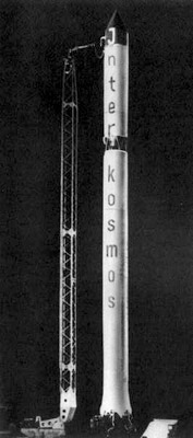
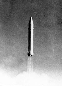
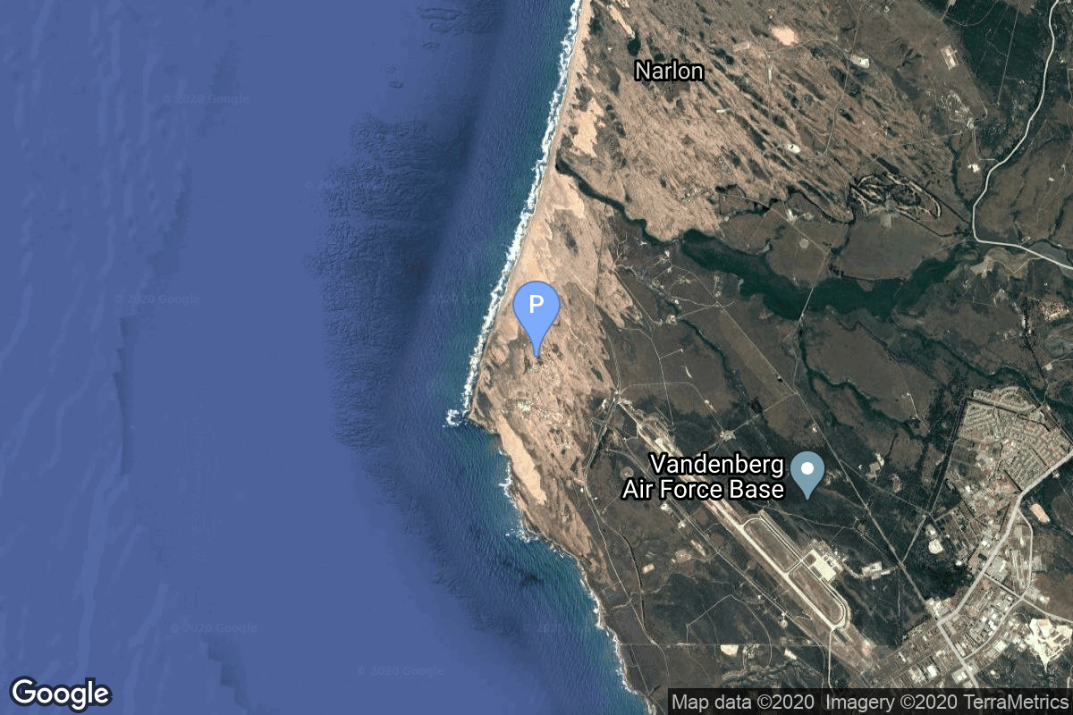
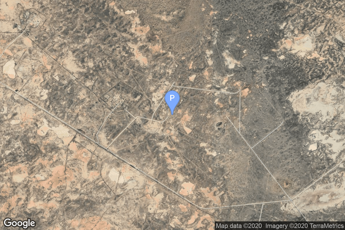
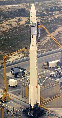
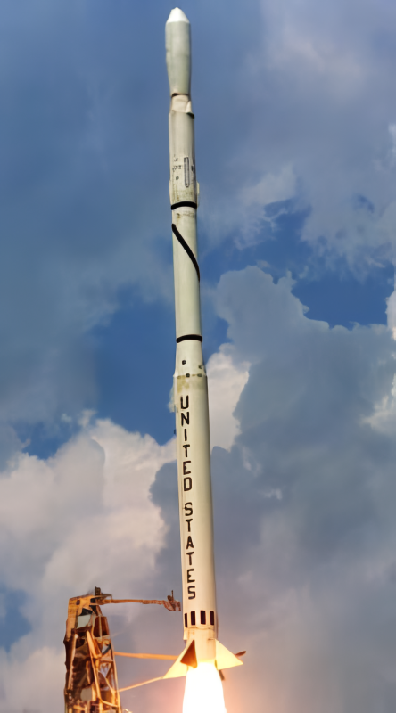
{ "count": 7859, "next": "https://ll.thespacedevs.com/2.0.0/launch/?format=api&limit=10&offset=6960&ordering=-net", "previous": "https://ll.thespacedevs.com/2.0.0/launch/?format=api&limit=10&offset=6940&ordering=-net", "results": [ { "id": "32b94378-cc8a-4880-8463-61feeedc1a4e", "url": "https://ll.thespacedevs.com/2.0.0/launch/32b94378-cc8a-4880-8463-61feeedc1a4e/?format=api", "launch_library_id": null, "slug": "kosmos-11k63-ds-p1-yu-14", "name": "Kosmos 11K63 | DS-P1-Yu 14", "status": { "id": 3, "name": "Success" }, "net": "1968-05-30T20:29:49Z", "window_end": "1968-05-30T20:29:49Z", "window_start": "1968-05-30T20:29:49Z", "inhold": false, "tbdtime": false, "tbddate": false, "probability": null, "holdreason": "", "failreason": null, "hashtag": null, "launch_service_provider": { "id": 66, "url": "https://ll.thespacedevs.com/2.0.0/agencies/66/?format=api", "name": "Soviet Space Program", "type": "Government" }, "rocket": { "id": 3786, "configuration": { "id": 327, "launch_library_id": null, "url": "https://ll.thespacedevs.com/2.0.0/config/launcher/327/?format=api", "name": "Kosmos 11K63", "family": "Kosmos", "full_name": "Kosmos 11K63", "variant": "11K63" } }, "mission": { "id": 2204, "launch_library_id": null, "name": "DS-P1-Yu 14", "description": "The DS-P1-Yu series of satellites was used to calibrate space surveillance and early warning radars.", "launch_designator": null, "type": "Test Target", "orbit": { "id": 8, "name": "Low Earth Orbit", "abbrev": "LEO" } }, "pad": { "id": 3, "url": "https://ll.thespacedevs.com/2.0.0/pad/3/?format=api", "agency_id": 163, "name": "133/3 (133L)", "info_url": null, "wiki_url": "", "map_url": "https://www.google.com/maps?q=62.886999,40.846984", "latitude": "62.886999", "longitude": "40.846984", "location": { "id": 6, "url": "https://ll.thespacedevs.com/2.0.0/location/6/?format=api", "name": "Plesetsk Cosmodrome, Russian Federation", "country_code": "RUS", "map_image": "https://thespacedevs-prod.nyc3.digitaloceanspaces.com/media/map_images/location_6_20200803142434.jpg", "total_launch_count": 1685, "total_landing_count": 0 }, "map_image": "https://thespacedevs-prod.nyc3.digitaloceanspaces.com/media/map_images/pad_3_20200803143438.jpg", "total_launch_count": 159 }, "webcast_live": false, "image": "https://thespacedevs-prod.nyc3.digitaloceanspaces.com/media/images/kosmos_11k63_image_20251104091702.jpg", "infographic": null, "program": [] }, { "id": "88478abb-2568-4e84-858a-0f42a1cf5752", "url": "https://ll.thespacedevs.com/2.0.0/launch/88478abb-2568-4e84-858a-0f42a1cf5752/?format=api", "launch_library_id": null, "slug": "r-36o-8k69-ogch-19", "name": "R-36O 8K69 | OGCh 19", "status": { "id": 3, "name": "Success" }, "net": "1968-05-27T23:15:01Z", "window_end": "1968-05-27T23:15:01Z", "window_start": "1968-05-27T23:15:01Z", "inhold": false, "tbdtime": false, "tbddate": false, "probability": null, "holdreason": "", "failreason": null, "hashtag": null, "launch_service_provider": { "id": 66, "url": "https://ll.thespacedevs.com/2.0.0/agencies/66/?format=api", "name": "Soviet Space Program", "type": "Government" }, "rocket": { "id": 3785, "configuration": { "id": 351, "launch_library_id": null, "url": "https://ll.thespacedevs.com/2.0.0/config/launcher/351/?format=api", "name": "R-36O 8K69", "family": "R-36O", "full_name": "R-36O 8K69", "variant": "8K69" } }, "mission": { "id": 2203, "launch_library_id": null, "name": "OGCh 19", "description": "Missile equipped with the 8F021 warhead", "launch_designator": null, "type": "Government/Top Secret", "orbit": { "id": 8, "name": "Low Earth Orbit", "abbrev": "LEO" } }, "pad": { "id": 160, "url": "https://ll.thespacedevs.com/2.0.0/pad/160/?format=api", "agency_id": null, "name": "161/35", "info_url": null, "wiki_url": "https://en.wikipedia.org/wiki/Baikonur_Cosmodrome", "map_url": "https://www.google.com/maps?q=46.034,63.060806", "latitude": "46.034", "longitude": "63.060806", "location": { "id": 15, "url": "https://ll.thespacedevs.com/2.0.0/location/15/?format=api", "name": "Baikonur Cosmodrome, Republic of Kazakhstan", "country_code": "KAZ", "map_image": "https://thespacedevs-prod.nyc3.digitaloceanspaces.com/media/map_images/location_15_20200803142517.jpg", "total_launch_count": 1563, "total_landing_count": 0 }, "map_image": "https://thespacedevs-prod.nyc3.digitaloceanspaces.com/media/map_images/pad_160_20200803143414.jpg", "total_launch_count": 7 }, "webcast_live": false, "image": "https://thespacedevs-prod.nyc3.digitaloceanspaces.com/media/images/r-360_during_fl_image_20251102175933.jpg", "infographic": null, "program": [] }, { "id": "f3316097-2fdd-4ef2-9184-1120bd1175e6", "url": "https://ll.thespacedevs.com/2.0.0/launch/f3316097-2fdd-4ef2-9184-1120bd1175e6/?format=api", "launch_library_id": null, "slug": "kosmos-11k63-ds-p1-yu-13", "name": "Kosmos 11K63 | DS-P1-Yu 13", "status": { "id": 3, "name": "Success" }, "net": "1968-05-24T07:04:50Z", "window_end": "1968-05-24T07:04:50Z", "window_start": "1968-05-24T07:04:50Z", "inhold": false, "tbdtime": false, "tbddate": false, "probability": null, "holdreason": "", "failreason": null, "hashtag": null, "launch_service_provider": { "id": 66, "url": "https://ll.thespacedevs.com/2.0.0/agencies/66/?format=api", "name": "Soviet Space Program", "type": "Government" }, "rocket": { "id": 3784, "configuration": { "id": 327, "launch_library_id": null, "url": "https://ll.thespacedevs.com/2.0.0/config/launcher/327/?format=api", "name": "Kosmos 11K63", "family": "Kosmos", "full_name": "Kosmos 11K63", "variant": "11K63" } }, "mission": { "id": 2202, "launch_library_id": null, "name": "DS-P1-Yu 13", "description": "The DS-P1-Yu series of satellites was used to calibrate space surveillance and early warning radars.", "launch_designator": null, "type": "Test Target", "orbit": { "id": 8, "name": "Low Earth Orbit", "abbrev": "LEO" } }, "pad": { "id": 140, "url": "https://ll.thespacedevs.com/2.0.0/pad/140/?format=api", "agency_id": null, "name": "86/4", "info_url": null, "wiki_url": "https://en.wikipedia.org/wiki/Kapustin_Yar", "map_url": "https://www.google.com/maps?q=48.56935,46.293219", "latitude": "48.56935", "longitude": "46.293219", "location": { "id": 30, "url": "https://ll.thespacedevs.com/2.0.0/location/30/?format=api", "name": "Kapustin Yar, Russian Federation", "country_code": "RUS", "map_image": "https://thespacedevs-prod.nyc3.digitaloceanspaces.com/media/map_images/location_30_20200803142515.jpg", "total_launch_count": 101, "total_landing_count": 0 }, "map_image": "https://thespacedevs-prod.nyc3.digitaloceanspaces.com/media/map_images/pad_140_20200803143350.jpg", "total_launch_count": 24 }, "webcast_live": false, "image": "https://thespacedevs-prod.nyc3.digitaloceanspaces.com/media/images/kosmos_11k63_image_20251104091702.jpg", "infographic": null, "program": [] }, { "id": "ed395810-0fee-42a9-a428-2c911748bedc", "url": "https://ll.thespacedevs.com/2.0.0/launch/ed395810-0fee-42a9-a428-2c911748bedc/?format=api", "launch_library_id": null, "slug": "thor-burner-2-dsap-4b-f1", "name": "Thor Burner 2 | DSAP-4B F1", "status": { "id": 3, "name": "Success" }, "net": "1968-05-23T04:38:12Z", "window_end": "1968-05-23T04:38:12Z", "window_start": "1968-05-23T04:38:12Z", "inhold": false, "tbdtime": false, "tbddate": false, "probability": null, "holdreason": "", "failreason": null, "hashtag": null, "launch_service_provider": { "id": 161, "url": "https://ll.thespacedevs.com/2.0.0/agencies/161/?format=api", "name": "United States Air Force", "type": "Government" }, "rocket": { "id": 3783, "configuration": { "id": 395, "launch_library_id": null, "url": "https://ll.thespacedevs.com/2.0.0/config/launcher/395/?format=api", "name": "Thor Burner 2", "family": "Thor", "full_name": "Thor Burner 2", "variant": "Burner 2" } }, "mission": { "id": 2201, "launch_library_id": null, "name": "DSAP-4B F1", "description": "DSAP-4B (Defense Satellite Application Program Block 4B) was the sixth version of the military meteorological satellites of the Defense Meteorological Satellite Program.", "launch_designator": null, "type": "Earth Science", "orbit": { "id": 17, "name": "Sun-Synchronous Orbit", "abbrev": "SSO" } }, "pad": { "id": 171, "url": "https://ll.thespacedevs.com/2.0.0/pad/171/?format=api", "agency_id": null, "name": "Space Launch Complex 10W", "info_url": null, "wiki_url": "https://en.wikipedia.org/wiki/Vandenberg_Air_Force_Base_Space_Launch_Complex_10", "map_url": "https://www.google.com/maps?q=34.7652778,-120.6244162", "latitude": "34.7652778", "longitude": "-120.6244162", "location": { "id": 11, "url": "https://ll.thespacedevs.com/2.0.0/location/11/?format=api", "name": "Vandenberg SFB, CA, USA", "country_code": "USA", "map_image": "https://thespacedevs-prod.nyc3.digitaloceanspaces.com/media/map_images/location_11_20200803142416.jpg", "total_launch_count": 883, "total_landing_count": 34 }, "map_image": "https://thespacedevs-prod.nyc3.digitaloceanspaces.com/media/map_images/pad_171_20200803143449.jpg", "total_launch_count": 31 }, "webcast_live": false, "image": null, "infographic": null, "program": [] }, { "id": "acfbcc89-e3a8-4568-a07e-190573f82582", "url": "https://ll.thespacedevs.com/2.0.0/launch/acfbcc89-e3a8-4568-a07e-190573f82582/?format=api", "launch_library_id": null, "slug": "r-36o-8k69-ogch-18", "name": "R-36O 8K69 | OGCh 18", "status": { "id": 3, "name": "Success" }, "net": "1968-05-20T22:05:02Z", "window_end": "1968-05-20T22:05:02Z", "window_start": "1968-05-20T22:05:02Z", "inhold": false, "tbdtime": false, "tbddate": false, "probability": null, "holdreason": "", "failreason": null, "hashtag": null, "launch_service_provider": { "id": 66, "url": "https://ll.thespacedevs.com/2.0.0/agencies/66/?format=api", "name": "Soviet Space Program", "type": "Government" }, "rocket": { "id": 3782, "configuration": { "id": 351, "launch_library_id": null, "url": "https://ll.thespacedevs.com/2.0.0/config/launcher/351/?format=api", "name": "R-36O 8K69", "family": "R-36O", "full_name": "R-36O 8K69", "variant": "8K69" } }, "mission": { "id": 2200, "launch_library_id": null, "name": "OGCh 18", "description": "Missile equipped with the 8F021 warhead", "launch_designator": null, "type": "Government/Top Secret", "orbit": { "id": 8, "name": "Low Earth Orbit", "abbrev": "LEO" } }, "pad": { "id": 161, "url": "https://ll.thespacedevs.com/2.0.0/pad/161/?format=api", "agency_id": null, "name": "162/36", "info_url": null, "wiki_url": "https://en.wikipedia.org/wiki/Baikonur_Cosmodrome", "map_url": "https://www.google.com/maps?q=46.032,63.064806", "latitude": "46.032", "longitude": "63.064806", "location": { "id": 15, "url": "https://ll.thespacedevs.com/2.0.0/location/15/?format=api", "name": "Baikonur Cosmodrome, Republic of Kazakhstan", "country_code": "KAZ", "map_image": "https://thespacedevs-prod.nyc3.digitaloceanspaces.com/media/map_images/location_15_20200803142517.jpg", "total_launch_count": 1563, "total_landing_count": 0 }, "map_image": "https://thespacedevs-prod.nyc3.digitaloceanspaces.com/media/map_images/pad_161_20200803143442.jpg", "total_launch_count": 9 }, "webcast_live": false, "image": "https://thespacedevs-prod.nyc3.digitaloceanspaces.com/media/images/r-360_during_fl_image_20251102175933.jpg", "infographic": null, "program": [] }, { "id": "5bb34d1b-99d0-4efd-a11d-47853100fd71", "url": "https://ll.thespacedevs.com/2.0.0/launch/5bb34d1b-99d0-4efd-a11d-47853100fd71/?format=api", "launch_library_id": null, "slug": "thorad-slv-2g-agena-d-nimbus-b", "name": "Thorad SLV-2G Agena D | Nimbus B", "status": { "id": 4, "name": "Failure" }, "net": "1968-05-18T08:23:00Z", "window_end": "1968-05-18T08:23:00Z", "window_start": "1968-05-18T08:23:00Z", "inhold": false, "tbdtime": false, "tbddate": false, "probability": null, "holdreason": "", "failreason": null, "hashtag": null, "launch_service_provider": { "id": 161, "url": "https://ll.thespacedevs.com/2.0.0/agencies/161/?format=api", "name": "United States Air Force", "type": "Government" }, "rocket": { "id": 3781, "configuration": { "id": 418, "launch_library_id": null, "url": "https://ll.thespacedevs.com/2.0.0/config/launcher/418/?format=api", "name": "Thorad SLV-2G Agena D", "family": "Thor", "full_name": "Thorad SLV-2G Agena D", "variant": "SLV-2G Agena D" } }, "mission": { "id": 2199, "launch_library_id": null, "name": "Nimbus B", "description": "The Nimbus-B meteorological R&D satellite was designed to serve as a stabilized, earth-oriented platform for the testing of advanced systems for sensing and collecting meteorological data. It was lost due to a malfunction in the booster guidance system.", "launch_designator": null, "type": "Earth Science", "orbit": { "id": 17, "name": "Sun-Synchronous Orbit", "abbrev": "SSO" } }, "pad": { "id": 98, "url": "https://ll.thespacedevs.com/2.0.0/pad/98/?format=api", "agency_id": 161, "name": "Space Launch Complex 2E", "info_url": null, "wiki_url": "https://en.wikipedia.org/wiki/Vandenberg_Space_Launch_Complex_2", "map_url": "https://www.google.com/maps?q=34.7516,-120.6192", "latitude": "34.7516", "longitude": "-120.6192", "location": { "id": 11, "url": "https://ll.thespacedevs.com/2.0.0/location/11/?format=api", "name": "Vandenberg SFB, CA, USA", "country_code": "USA", "map_image": "https://thespacedevs-prod.nyc3.digitaloceanspaces.com/media/map_images/location_11_20200803142416.jpg", "total_launch_count": 883, "total_landing_count": 34 }, "map_image": "https://thespacedevs-prod.nyc3.digitaloceanspaces.com/media/map_images/pad_98_20200803143228.jpg", "total_launch_count": 47 }, "webcast_live": false, "image": "https://thespacedevs-prod.nyc3.digitaloceanspaces.com/media/images/thorad-slv2g_ag_image_20251102061406.jpg", "infographic": null, "program": [] }, { "id": "79809b7b-558a-47d3-bca1-5c0445278876", "url": "https://ll.thespacedevs.com/2.0.0/launch/79809b7b-558a-47d3-bca1-5c0445278876/?format=api", "launch_library_id": null, "slug": "scout-b-esro-2b", "name": "Scout B | ESRO 2B", "status": { "id": 3, "name": "Success" }, "net": "1968-05-17T02:06:00Z", "window_end": "1968-05-17T02:06:00Z", "window_start": "1968-05-17T02:06:00Z", "inhold": false, "tbdtime": false, "tbddate": false, "probability": null, "holdreason": "", "failreason": null, "hashtag": null, "launch_service_provider": { "id": 1019, "url": "https://ll.thespacedevs.com/2.0.0/agencies/1019/?format=api", "name": "European Space Research Organisation", "type": "Multinational" }, "rocket": { "id": 3780, "configuration": { "id": 358, "launch_library_id": null, "url": "https://ll.thespacedevs.com/2.0.0/config/launcher/358/?format=api", "name": "Scout B", "family": "Scout", "full_name": "Scout B", "variant": "B" } }, "mission": { "id": 2198, "launch_library_id": null, "name": "ESRO 2B", "description": "ESRO 2 (European Space Research Organisation), Iris (International Radiation Investigation Satellite) was a 75 kg spin-stabilized spacecraft.", "launch_designator": null, "type": "Astrophysics", "orbit": { "id": 13, "name": "Polar Orbit", "abbrev": "PO" } }, "pad": { "id": 154, "url": "https://ll.thespacedevs.com/2.0.0/pad/154/?format=api", "agency_id": null, "name": "Space Launch Complex 5", "info_url": "https://www.astronautix.com/v/vandenbergslc5.html", "wiki_url": "https://en.wikipedia.org/wiki/Vandenberg_Air_Force_Base_Space_Launch_Complex_5", "map_url": "https://www.google.com/maps?q=34.6080,-120.6247", "latitude": "34.608", "longitude": "-120.6247", "location": { "id": 11, "url": "https://ll.thespacedevs.com/2.0.0/location/11/?format=api", "name": "Vandenberg SFB, CA, USA", "country_code": "USA", "map_image": "https://thespacedevs-prod.nyc3.digitaloceanspaces.com/media/map_images/location_11_20200803142416.jpg", "total_launch_count": 883, "total_landing_count": 34 }, "map_image": "https://thespacedevs-prod.nyc3.digitaloceanspaces.com/media/map_images/pad_154_20200803143408.jpg", "total_launch_count": 69 }, "webcast_live": false, "image": "https://thespacedevs-prod.nyc3.digitaloceanspaces.com/media/images/scout-b_2528se_image_20251109064911.png", "infographic": null, "program": [] }, { "id": "4f5bb597-656b-4011-99c6-7490c85fa912", "url": "https://ll.thespacedevs.com/2.0.0/launch/4f5bb597-656b-4011-99c6-7490c85fa912/?format=api", "launch_library_id": null, "slug": "kosmos-3m-zaliv-2", "name": "Kosmos-3M | Zaliv 2", "status": { "id": 3, "name": "Success" }, "net": "1968-05-07T13:58:00Z", "window_end": "1968-05-07T13:58:00Z", "window_start": "1968-05-07T13:58:00Z", "inhold": false, "tbdtime": false, "tbddate": false, "probability": null, "holdreason": "", "failreason": null, "hashtag": null, "launch_service_provider": { "id": 66, "url": "https://ll.thespacedevs.com/2.0.0/agencies/66/?format=api", "name": "Soviet Space Program", "type": "Government" }, "rocket": { "id": 3779, "configuration": { "id": 102, "launch_library_id": 122, "url": "https://ll.thespacedevs.com/2.0.0/config/launcher/102/?format=api", "name": "Kosmos-3M", "family": "Kosmos", "full_name": "Kosmos-3M (11K65M)", "variant": "-3M" } }, "mission": { "id": 2197, "launch_library_id": null, "name": "Zaliv 2", "description": "The first soviet navigation system called Tsiklon consisted of Zaliv satellites in low earth orbit.", "launch_designator": null, "type": "Navigation", "orbit": { "id": 8, "name": "Low Earth Orbit", "abbrev": "LEO" } }, "pad": { "id": 167, "url": "https://ll.thespacedevs.com/2.0.0/pad/167/?format=api", "agency_id": null, "name": "132/2", "info_url": null, "wiki_url": "https://en.wikipedia.org/wiki/Plesetsk_Cosmodrome", "map_url": "https://www.google.com/maps?q=62.883,40.869806", "latitude": "62.883", "longitude": "40.869806", "location": { "id": 6, "url": "https://ll.thespacedevs.com/2.0.0/location/6/?format=api", "name": "Plesetsk Cosmodrome, Russian Federation", "country_code": "RUS", "map_image": "https://thespacedevs-prod.nyc3.digitaloceanspaces.com/media/map_images/location_6_20200803142434.jpg", "total_launch_count": 1685, "total_landing_count": 0 }, "map_image": "https://thespacedevs-prod.nyc3.digitaloceanspaces.com/media/map_images/pad_167_20200803143417.jpg", "total_launch_count": 172 }, "webcast_live": false, "image": "https://thespacedevs-prod.nyc3.digitaloceanspaces.com/media/images/kosmos-3m_durin_image_20251101171325.jpg", "infographic": null, "program": [] }, { "id": "26fc1d9b-2d7c-432f-b1f2-6eca7570250a", "url": "https://ll.thespacedevs.com/2.0.0/launch/26fc1d9b-2d7c-432f-b1f2-6eca7570250a/?format=api", "launch_library_id": null, "slug": "thorad-slv-2g-agena-d-kh-4b-3", "name": "Thorad SLV-2G Agena D | KH-4B 3", "status": { "id": 3, "name": "Success" }, "net": "1968-05-01T21:31:00Z", "window_end": "1968-05-01T21:31:00Z", "window_start": "1968-05-01T21:31:00Z", "inhold": false, "tbdtime": false, "tbddate": false, "probability": null, "holdreason": "", "failreason": null, "hashtag": null, "launch_service_provider": { "id": 161, "url": "https://ll.thespacedevs.com/2.0.0/agencies/161/?format=api", "name": "United States Air Force", "type": "Government" }, "rocket": { "id": 3778, "configuration": { "id": 418, "launch_library_id": null, "url": "https://ll.thespacedevs.com/2.0.0/config/launcher/418/?format=api", "name": "Thorad SLV-2G Agena D", "family": "Thor", "full_name": "Thorad SLV-2G Agena D", "variant": "SLV-2G Agena D" } }, "mission": { "id": 2196, "launch_library_id": null, "name": "KH-4B 3", "description": "The KH-4B (Keyhole-4B) was sixth optical reconnaissance satellite version in the Corona-program.", "launch_designator": null, "type": "Government/Top Secret", "orbit": { "id": 8, "name": "Low Earth Orbit", "abbrev": "LEO" } }, "pad": { "id": 93, "url": "https://ll.thespacedevs.com/2.0.0/pad/93/?format=api", "agency_id": 161, "name": "Space Launch Complex 3W", "info_url": null, "wiki_url": "https://en.wikipedia.org/wiki/Vandenberg_Space_Launch_Complex_3#SLC-3W", "map_url": "https://www.google.com/maps?q=34.644,-120.593", "latitude": "34.644", "longitude": "-120.593", "location": { "id": 11, "url": "https://ll.thespacedevs.com/2.0.0/location/11/?format=api", "name": "Vandenberg SFB, CA, USA", "country_code": "USA", "map_image": "https://thespacedevs-prod.nyc3.digitaloceanspaces.com/media/map_images/location_11_20200803142416.jpg", "total_launch_count": 883, "total_landing_count": 34 }, "map_image": "https://thespacedevs-prod.nyc3.digitaloceanspaces.com/media/map_images/pad_93_20200803143225.jpg", "total_launch_count": 81 }, "webcast_live": false, "image": "https://thespacedevs-prod.nyc3.digitaloceanspaces.com/media/images/thorad-slv2g_ag_image_20251102061406.jpg", "infographic": null, "program": [] }, { "id": "b88510fe-9d5a-4dbd-b30b-fcd1d96295a6", "url": "https://ll.thespacedevs.com/2.0.0/launch/b88510fe-9d5a-4dbd-b30b-fcd1d96295a6/?format=api", "launch_library_id": null, "slug": "kosmos-11k63-ds-u2-d-2", "name": "Kosmos 11K63 | DS-U2-D 2", "status": { "id": 3, "name": "Success" }, "net": "1968-04-26T04:42:56Z", "window_end": "1968-04-26T04:42:56Z", "window_start": "1968-04-26T04:42:56Z", "inhold": false, "tbdtime": false, "tbddate": false, "probability": null, "holdreason": "", "failreason": null, "hashtag": null, "launch_service_provider": { "id": 66, "url": "https://ll.thespacedevs.com/2.0.0/agencies/66/?format=api", "name": "Soviet Space Program", "type": "Government" }, "rocket": { "id": 3777, "configuration": { "id": 327, "launch_library_id": null, "url": "https://ll.thespacedevs.com/2.0.0/config/launcher/327/?format=api", "name": "Kosmos 11K63", "family": "Kosmos", "full_name": "Kosmos 11K63", "variant": "11K63" } }, "mission": { "id": 2195, "launch_library_id": null, "name": "DS-U2-D 2", "description": "The DS-U2-D satellites were a series of Soviet technolgy demonstration satellites launched as part of the Dnepropetrovsk Sputnik program.", "launch_designator": null, "type": "Earth Science", "orbit": { "id": 8, "name": "Low Earth Orbit", "abbrev": "LEO" } }, "pad": { "id": 140, "url": "https://ll.thespacedevs.com/2.0.0/pad/140/?format=api", "agency_id": null, "name": "86/4", "info_url": null, "wiki_url": "https://en.wikipedia.org/wiki/Kapustin_Yar", "map_url": "https://www.google.com/maps?q=48.56935,46.293219", "latitude": "48.56935", "longitude": "46.293219", "location": { "id": 30, "url": "https://ll.thespacedevs.com/2.0.0/location/30/?format=api", "name": "Kapustin Yar, Russian Federation", "country_code": "RUS", "map_image": "https://thespacedevs-prod.nyc3.digitaloceanspaces.com/media/map_images/location_30_20200803142515.jpg", "total_launch_count": 101, "total_landing_count": 0 }, "map_image": "https://thespacedevs-prod.nyc3.digitaloceanspaces.com/media/map_images/pad_140_20200803143350.jpg", "total_launch_count": 24 }, "webcast_live": false, "image": "https://thespacedevs-prod.nyc3.digitaloceanspaces.com/media/images/kosmos_11k63_image_20251104091702.jpg", "infographic": null, "program": [] } ] }