Launch List
API endpoint that returns all Launch objects or a single launch.
EXAMPLE - /launch/
GET: Return a list of all Launch objects.
FILTERS: Fields - 'name', 'id(s)', 'lsp_id', 'lsp_name', 'serial_number', 'launcher_config__id', 'rocket__spacecraftflight__spacecraft__name'
MODE: 'normal', 'list', 'detailed' EXAMPLE: ?mode=list
SEARCH: Searches through the launch name, rocket name, launch agency, mission name & spacecraft name. EXAMPLE - ?search=SpaceX
GET /2.0.0/launch/?format=api&offset=6910&ordering=-net
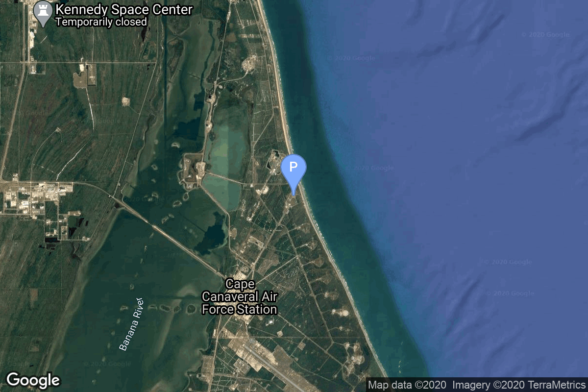
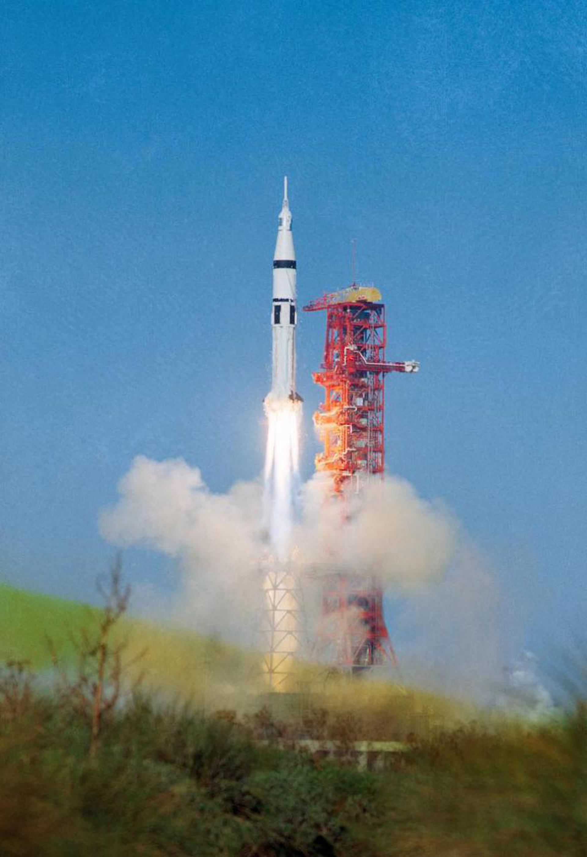
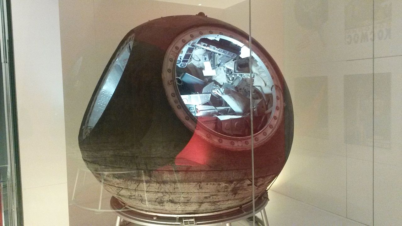
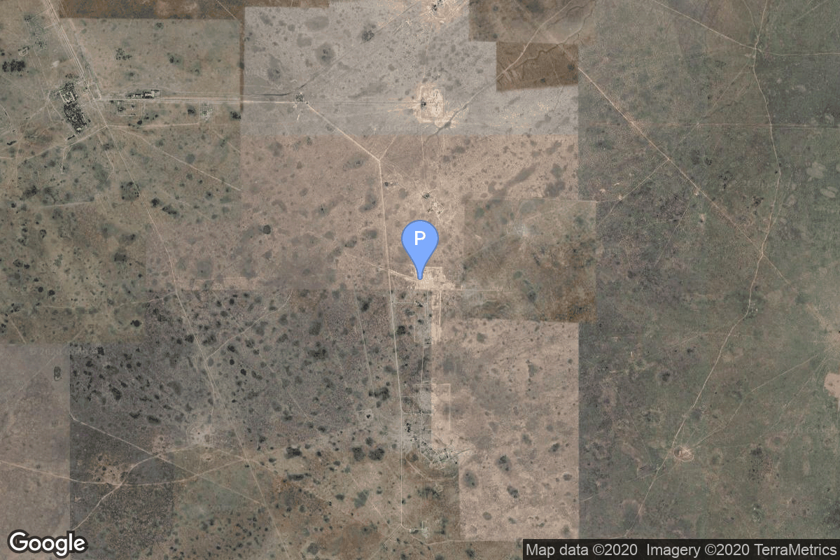
{ "count": 7503, "next": "https://ll.thespacedevs.com/2.0.0/launch/?format=api&limit=10&offset=6920&ordering=-net", "previous": "https://ll.thespacedevs.com/2.0.0/launch/?format=api&limit=10&offset=6900&ordering=-net", "results": [ { "id": "66f74968-c296-457c-891b-8308f3bb243e", "url": "https://ll.thespacedevs.com/2.0.0/launch/66f74968-c296-457c-891b-8308f3bb243e/?format=api", "launch_library_id": null, "slug": "saturn-ib-apollo-as-201", "name": "Saturn IB | Apollo AS-201", "status": { "id": 3, "name": "Success" }, "net": "1966-02-26T16:12:01Z", "window_end": "1966-02-26T16:12:01Z", "window_start": "1966-02-26T16:12:01Z", "inhold": false, "tbdtime": false, "tbddate": false, "probability": null, "holdreason": "", "failreason": "", "hashtag": null, "launch_service_provider": { "id": 44, "url": "https://ll.thespacedevs.com/2.0.0/agencies/44/?format=api", "name": "National Aeronautics and Space Administration", "type": "Government" }, "rocket": { "id": 3496, "configuration": { "id": 163, "launch_library_id": 135, "url": "https://ll.thespacedevs.com/2.0.0/config/launcher/163/?format=api", "name": "Saturn IB", "family": "Saturn", "full_name": "Saturn IB", "variant": "IB" } }, "mission": { "id": 1916, "launch_library_id": null, "name": "Apollo AS-201", "description": "Suborbital uncrewed test flight of the Apollo CSM and Saturn IB launch vehicle.", "launch_designator": null, "type": "Test Flight", "orbit": { "id": 15, "name": "Suborbital", "abbrev": "Sub" } }, "pad": { "id": 19, "url": "https://ll.thespacedevs.com/2.0.0/pad/19/?format=api", "agency_id": null, "name": "Launch Complex 34", "info_url": null, "wiki_url": "https://en.wikipedia.org/wiki/Cape_Canaveral_Air_Force_Station_Launch_Complex_34", "map_url": "https://www.google.com/maps?q=28.521811,-80.56113", "latitude": "28.521811", "longitude": "-80.56113", "location": { "id": 12, "url": "https://ll.thespacedevs.com/2.0.0/location/12/?format=api", "name": "Cape Canaveral SFS, FL, USA", "country_code": "USA", "map_image": "https://thespacedevs-prod.nyc3.digitaloceanspaces.com/media/map_images/location_12_20200803142519.jpg", "total_launch_count": 1023, "total_landing_count": 64 }, "map_image": "https://thespacedevs-prod.nyc3.digitaloceanspaces.com/media/map_images/pad_19_20200803143428.jpg", "total_launch_count": 9 }, "webcast_live": false, "image": "https://thespacedevs-prod.nyc3.digitaloceanspaces.com/media/images/saturn2520ib_image_20190222030046.jpeg", "infographic": null, "program": [ { "id": 4, "url": "https://ll.thespacedevs.com/2.0.0/program/4/?format=api", "name": "Apollo", "description": "The Apollo program was the third United States human spaceflight program carried out by the National Aeronautics and Space Administration (NASA), which succeeded in landing the first humans on the Moon from 1969 to 1972.", "agencies": [ { "id": 44, "url": "https://ll.thespacedevs.com/2.0.0/agencies/44/?format=api", "name": "National Aeronautics and Space Administration", "type": "Government" } ], "image_url": "https://thespacedevs-prod.nyc3.digitaloceanspaces.com/media/images/apollo_program_20200820200202.png", "start_date": "1966-11-16T00:00:00Z", "end_date": "1972-12-19T19:24:59Z", "info_url": "https://www.nasa.gov/mission_pages/apollo/index.html", "wiki_url": "https://en.wikipedia.org/wiki/Apollo_program" } ] }, { "id": "d375bdd3-c7ea-42a8-bd4f-c3b31a2c9959", "url": "https://ll.thespacedevs.com/2.0.0/launch/d375bdd3-c7ea-42a8-bd4f-c3b31a2c9959/?format=api", "launch_library_id": null, "slug": "voskhod-voskhod-3kv-3", "name": "Voskhod | Voskhod-3KV 3", "status": { "id": 3, "name": "Success" }, "net": "1966-02-22T20:09:36Z", "window_end": "1966-02-22T20:09:36Z", "window_start": "1966-02-22T20:09:36Z", "inhold": false, "tbdtime": false, "tbddate": false, "probability": null, "holdreason": "", "failreason": "", "hashtag": null, "launch_service_provider": { "id": 66, "url": "https://ll.thespacedevs.com/2.0.0/agencies/66/?format=api", "name": "Soviet Space Program", "type": "Government" }, "rocket": { "id": 3495, "configuration": { "id": 104, "launch_library_id": 138, "url": "https://ll.thespacedevs.com/2.0.0/config/launcher/104/?format=api", "name": "Voskhod", "family": "R-7", "full_name": "Voskhod", "variant": "Voskhod" } }, "mission": { "id": 1915, "launch_library_id": null, "name": "Voskhod-3KV 3", "description": "Long duration test flight of the Voskhod capsule carrying two dogs (Veterok and Ugolyok) which returned safely on Earth after 22 days in orbit.", "launch_designator": null, "type": "Test Flight", "orbit": { "id": 8, "name": "Low Earth Orbit", "abbrev": "LEO" } }, "pad": { "id": 20, "url": "https://ll.thespacedevs.com/2.0.0/pad/20/?format=api", "agency_id": null, "name": "31/6", "info_url": null, "wiki_url": "https://en.wikipedia.org/wiki/Baikonur_Cosmodrome_Site_31", "map_url": "https://www.google.com/maps?q=45.996034,63.564003", "latitude": "45.996034", "longitude": "63.564003", "location": { "id": 15, "url": "https://ll.thespacedevs.com/2.0.0/location/15/?format=api", "name": "Baikonur Cosmodrome, Republic of Kazakhstan", "country_code": "KAZ", "map_image": "https://thespacedevs-prod.nyc3.digitaloceanspaces.com/media/map_images/location_15_20200803142517.jpg", "total_launch_count": 1555, "total_landing_count": 0 }, "map_image": "https://thespacedevs-prod.nyc3.digitaloceanspaces.com/media/map_images/pad_20_20200803143516.jpg", "total_launch_count": 422 }, "webcast_live": false, "image": null, "infographic": null, "program": [ { "id": 10, "url": "https://ll.thespacedevs.com/2.0.0/program/10/?format=api", "name": "Voskhod", "description": "The Voskhod programme was the second Soviet human spaceflight project. Two one-day crewed missions were flown using the Voskhod spacecraft and rocket, one in 1964 and one in 1965, and two dogs flew on a 22-day mission in 1966.", "agencies": [ { "id": 66, "url": "https://ll.thespacedevs.com/2.0.0/agencies/66/?format=api", "name": "Soviet Space Program", "type": "Government" } ], "image_url": "https://thespacedevs-prod.nyc3.digitaloceanspaces.com/media/images/voskhod_program_20200820205643.jpg", "start_date": "1964-10-06T07:12:00Z", "end_date": "1966-03-16T14:09:00Z", "info_url": null, "wiki_url": "https://en.wikipedia.org/wiki/Voskhod_programme" } ] }, { "id": "48a83dec-120b-4a1c-b4fb-4b555fc1e5b9", "url": "https://ll.thespacedevs.com/2.0.0/launch/48a83dec-120b-4a1c-b4fb-4b555fc1e5b9/?format=api", "launch_library_id": null, "slug": "kosmos-2i-63s1-ds-k-40-2", "name": "Kosmos-2I 63S1 | DS-K-40 2", "status": { "id": 4, "name": "Failure" }, "net": "1966-02-21T13:30:00Z", "window_end": "1966-02-21T13:30:00Z", "window_start": "1966-02-21T13:30:00Z", "inhold": false, "tbdtime": false, "tbddate": false, "probability": null, "holdreason": "", "failreason": null, "hashtag": null, "launch_service_provider": { "id": 66, "url": "https://ll.thespacedevs.com/2.0.0/agencies/66/?format=api", "name": "Soviet Space Program", "type": "Government" }, "rocket": { "id": 3494, "configuration": { "id": 190, "launch_library_id": 211, "url": "https://ll.thespacedevs.com/2.0.0/config/launcher/190/?format=api", "name": "Kosmos-2I 63S1", "family": "Kosmos", "full_name": "Kosmos-2I", "variant": "" } }, "mission": { "id": 1914, "launch_library_id": null, "name": "DS-K-40 2", "description": "DS-K-40 was a series of experimental ELINT satellites developed by Yuzhnoye to test technologies for the Tselina-O program.", "launch_designator": null, "type": "Government/Top Secret", "orbit": { "id": 8, "name": "Low Earth Orbit", "abbrev": "LEO" } }, "pad": { "id": 139, "url": "https://ll.thespacedevs.com/2.0.0/pad/139/?format=api", "agency_id": null, "name": "86/1", "info_url": null, "wiki_url": "https://en.wikipedia.org/wiki/Kapustin_Yar", "map_url": "https://www.google.com/maps?q=48.56935,46.293219", "latitude": "48.56935", "longitude": "46.293219", "location": { "id": 30, "url": "https://ll.thespacedevs.com/2.0.0/location/30/?format=api", "name": "Kapustin Yar, Russian Federation", "country_code": "RUS", "map_image": "https://thespacedevs-prod.nyc3.digitaloceanspaces.com/media/map_images/location_30_20200803142515.jpg", "total_launch_count": 101, "total_landing_count": 0 }, "map_image": "https://thespacedevs-prod.nyc3.digitaloceanspaces.com/media/map_images/pad_139_20200803143345.jpg", "total_launch_count": 26 }, "webcast_live": false, "image": "https://thespacedevs-prod.nyc3.digitaloceanspaces.com/media/images/kosmos-2i252063s1_image_20191201205435.jpg", "infographic": null, "program": [] }, { "id": "e5739be4-8a99-4a61-86f1-eb1e21411f78", "url": "https://ll.thespacedevs.com/2.0.0/launch/e5739be4-8a99-4a61-86f1-eb1e21411f78/?format=api", "launch_library_id": null, "slug": "voskhod-zenit-4-15", "name": "Voskhod | Zenit-4 15", "status": { "id": 3, "name": "Success" }, "net": "1966-02-19T08:49:00Z", "window_end": "1966-02-19T08:49:00Z", "window_start": "1966-02-19T08:49:00Z", "inhold": false, "tbdtime": false, "tbddate": false, "probability": null, "holdreason": "", "failreason": null, "hashtag": null, "launch_service_provider": { "id": 66, "url": "https://ll.thespacedevs.com/2.0.0/agencies/66/?format=api", "name": "Soviet Space Program", "type": "Government" }, "rocket": { "id": 3493, "configuration": { "id": 104, "launch_library_id": 138, "url": "https://ll.thespacedevs.com/2.0.0/config/launcher/104/?format=api", "name": "Voskhod", "family": "R-7", "full_name": "Voskhod", "variant": "Voskhod" } }, "mission": { "id": 1913, "launch_library_id": null, "name": "Zenit-4 15", "description": "Zenit-4 film-return reconnaissance satellite.", "launch_designator": null, "type": "Government/Top Secret", "orbit": { "id": 8, "name": "Low Earth Orbit", "abbrev": "LEO" } }, "pad": { "id": 20, "url": "https://ll.thespacedevs.com/2.0.0/pad/20/?format=api", "agency_id": null, "name": "31/6", "info_url": null, "wiki_url": "https://en.wikipedia.org/wiki/Baikonur_Cosmodrome_Site_31", "map_url": "https://www.google.com/maps?q=45.996034,63.564003", "latitude": "45.996034", "longitude": "63.564003", "location": { "id": 15, "url": "https://ll.thespacedevs.com/2.0.0/location/15/?format=api", "name": "Baikonur Cosmodrome, Republic of Kazakhstan", "country_code": "KAZ", "map_image": "https://thespacedevs-prod.nyc3.digitaloceanspaces.com/media/map_images/location_15_20200803142517.jpg", "total_launch_count": 1555, "total_landing_count": 0 }, "map_image": "https://thespacedevs-prod.nyc3.digitaloceanspaces.com/media/map_images/pad_20_20200803143516.jpg", "total_launch_count": 422 }, "webcast_live": false, "image": null, "infographic": null, "program": [] }, { "id": "3795303e-8662-4def-aaec-05144cee34af", "url": "https://ll.thespacedevs.com/2.0.0/launch/3795303e-8662-4def-aaec-05144cee34af/?format=api", "launch_library_id": null, "slug": "diamant-a-diapason-d-1a", "name": "Diamant A | Diapason D-1A", "status": { "id": 3, "name": "Success" }, "net": "1966-02-17T08:33:36Z", "window_end": "1966-02-17T08:33:36Z", "window_start": "1966-02-17T08:33:36Z", "inhold": false, "tbdtime": false, "tbddate": false, "probability": null, "holdreason": "", "failreason": null, "hashtag": null, "launch_service_provider": { "id": 46, "url": "https://ll.thespacedevs.com/2.0.0/agencies/46/?format=api", "name": "National Center of Space Research", "type": "Government" }, "rocket": { "id": 3492, "configuration": { "id": 311, "launch_library_id": null, "url": "https://ll.thespacedevs.com/2.0.0/config/launcher/311/?format=api", "name": "Diamant A", "family": "Diamant", "full_name": "Diamant A", "variant": "A" } }, "mission": { "id": 1912, "launch_library_id": null, "name": "Diapason D-1A", "description": "Diapason was a small cylindrical satellite, 20 cm long and 50 cm in diameter which was used for making geodetic measurements.", "launch_designator": null, "type": "Earth Science", "orbit": { "id": 8, "name": "Low Earth Orbit", "abbrev": "LEO" } }, "pad": { "id": 141, "url": "https://ll.thespacedevs.com/2.0.0/pad/141/?format=api", "agency_id": null, "name": "Brigitte", "info_url": null, "wiki_url": "https://en.wikipedia.org/wiki/Hammaguir", "map_url": "https://www.google.com/maps?q=30.7787318,-3.0669721", "latitude": "30.7787318", "longitude": "-3.0669721", "location": { "id": 147, "url": "https://ll.thespacedevs.com/2.0.0/location/147/?format=api", "name": "Interarmy Special Vehicles Test Centre, French Algeria", "country_code": "FRA", "map_image": "https://thespacedevs-prod.nyc3.digitaloceanspaces.com/media/map_images/location_147_20240808092142.jpg", "total_launch_count": 4, "total_landing_count": 0 }, "map_image": "https://thespacedevs-prod.nyc3.digitaloceanspaces.com/media/map_images/pad_141_20200803143211.jpg", "total_launch_count": 4 }, "webcast_live": false, "image": "https://thespacedevs-prod.nyc3.digitaloceanspaces.com/media/images/diamant_a_lifto_image_20240411170731.png", "infographic": null, "program": [] }, { "id": "a083fe50-faf7-4f87-8f74-f027bc469fda", "url": "https://ll.thespacedevs.com/2.0.0/launch/a083fe50-faf7-4f87-8f74-f027bc469fda/?format=api", "launch_library_id": null, "slug": "atlas-slv-3-agena-d-kh-7-25", "name": "Atlas SLV-3 Agena D | KH-7 25", "status": { "id": 3, "name": "Success" }, "net": "1966-02-15T20:30:00Z", "window_end": "1966-02-15T20:30:00Z", "window_start": "1966-02-15T20:30:00Z", "inhold": false, "tbdtime": false, "tbddate": false, "probability": null, "holdreason": "", "failreason": null, "hashtag": null, "launch_service_provider": { "id": 161, "url": "https://ll.thespacedevs.com/2.0.0/agencies/161/?format=api", "name": "United States Air Force", "type": "Government" }, "rocket": { "id": 3491, "configuration": { "id": 258, "launch_library_id": null, "url": "https://ll.thespacedevs.com/2.0.0/config/launcher/258/?format=api", "name": "Atlas SLV-3 Agena D", "family": "Atlas", "full_name": "Atlas SLV-3 Agena D", "variant": "SLV-3 Agena D" } }, "mission": { "id": 1911, "launch_library_id": null, "name": "KH-7 25", "description": "The Program 206 satellite, carrying the KH-7 (Keyhole 7) camera system (codenamed Gambit-1), was the first successful high resolution space reconnaissance program. It was managed by NRO's Program A, the USAF-led segment of the National Reconnaissance Program managed from Los Angeles AFB in El Segundo, California.", "launch_designator": null, "type": "Government/Top Secret", "orbit": { "id": 17, "name": "Sun-Synchronous Orbit", "abbrev": "SSO" } }, "pad": { "id": 16, "url": "https://ll.thespacedevs.com/2.0.0/pad/16/?format=api", "agency_id": null, "name": "Space Launch Complex 4E", "info_url": null, "wiki_url": "https://en.wikipedia.org/wiki/Vandenberg_Space_Launch_Complex_4#SLC-4E", "map_url": "https://www.google.com/maps?q=34.632,-120.611", "latitude": "34.632", "longitude": "-120.611", "location": { "id": 11, "url": "https://ll.thespacedevs.com/2.0.0/location/11/?format=api", "name": "Vandenberg SFB, CA, USA", "country_code": "USA", "map_image": "https://thespacedevs-prod.nyc3.digitaloceanspaces.com/media/map_images/location_11_20200803142416.jpg", "total_launch_count": 807, "total_landing_count": 26 }, "map_image": "https://thespacedevs-prod.nyc3.digitaloceanspaces.com/media/map_images/pad_16_20200803143532.jpg", "total_launch_count": 193 }, "webcast_live": false, "image": null, "infographic": null, "program": [] }, { "id": "3be0d654-0e52-437a-b440-6bbe55c039bb", "url": "https://ll.thespacedevs.com/2.0.0/launch/3be0d654-0e52-437a-b440-6bbe55c039bb/?format=api", "launch_library_id": null, "slug": "kosmos-2i-63s1-ds-u1-g-1", "name": "Kosmos-2I 63S1 | DS-U1-G 1", "status": { "id": 3, "name": "Success" }, "net": "1966-02-11T18:00:00Z", "window_end": "1966-02-11T18:00:00Z", "window_start": "1966-02-11T18:00:00Z", "inhold": false, "tbdtime": false, "tbddate": false, "probability": null, "holdreason": "", "failreason": null, "hashtag": null, "launch_service_provider": { "id": 66, "url": "https://ll.thespacedevs.com/2.0.0/agencies/66/?format=api", "name": "Soviet Space Program", "type": "Government" }, "rocket": { "id": 3490, "configuration": { "id": 190, "launch_library_id": 211, "url": "https://ll.thespacedevs.com/2.0.0/config/launcher/190/?format=api", "name": "Kosmos-2I 63S1", "family": "Kosmos", "full_name": "Kosmos-2I", "variant": "" } }, "mission": { "id": 1910, "launch_library_id": null, "name": "DS-U1-G 1", "description": "Satellite used to study the effects of solar activity on the upper atmosphere.", "launch_designator": null, "type": "Earth Science", "orbit": { "id": 8, "name": "Low Earth Orbit", "abbrev": "LEO" } }, "pad": { "id": 139, "url": "https://ll.thespacedevs.com/2.0.0/pad/139/?format=api", "agency_id": null, "name": "86/1", "info_url": null, "wiki_url": "https://en.wikipedia.org/wiki/Kapustin_Yar", "map_url": "https://www.google.com/maps?q=48.56935,46.293219", "latitude": "48.56935", "longitude": "46.293219", "location": { "id": 30, "url": "https://ll.thespacedevs.com/2.0.0/location/30/?format=api", "name": "Kapustin Yar, Russian Federation", "country_code": "RUS", "map_image": "https://thespacedevs-prod.nyc3.digitaloceanspaces.com/media/map_images/location_30_20200803142515.jpg", "total_launch_count": 101, "total_landing_count": 0 }, "map_image": "https://thespacedevs-prod.nyc3.digitaloceanspaces.com/media/map_images/pad_139_20200803143345.jpg", "total_launch_count": 26 }, "webcast_live": false, "image": "https://thespacedevs-prod.nyc3.digitaloceanspaces.com/media/images/kosmos-2i252063s1_image_20191201205435.jpg", "infographic": null, "program": [] }, { "id": "379fece8-04a2-4c60-b37e-a4c5cc8e47e5", "url": "https://ll.thespacedevs.com/2.0.0/launch/379fece8-04a2-4c60-b37e-a4c5cc8e47e5/?format=api", "launch_library_id": null, "slug": "vostok-8a92-zenit-2-35", "name": "Vostok 8A92 | Zenit-2 35", "status": { "id": 3, "name": "Success" }, "net": "1966-02-10T08:40:00Z", "window_end": "1966-02-10T08:40:00Z", "window_start": "1966-02-10T08:40:00Z", "inhold": false, "tbdtime": false, "tbddate": false, "probability": null, "holdreason": "", "failreason": null, "hashtag": null, "launch_service_provider": { "id": 66, "url": "https://ll.thespacedevs.com/2.0.0/agencies/66/?format=api", "name": "Soviet Space Program", "type": "Government" }, "rocket": { "id": 3489, "configuration": { "id": 451, "launch_library_id": null, "url": "https://ll.thespacedevs.com/2.0.0/config/launcher/451/?format=api", "name": "Vostok 8A92", "family": "Vostok", "full_name": "Vostok 8A92", "variant": "8A92" } }, "mission": { "id": 1909, "launch_library_id": null, "name": "Zenit-2 35", "description": "Zenit-2 film-return and ELINT reconnaissance satellite.", "launch_designator": null, "type": "Government/Top Secret", "orbit": { "id": 8, "name": "Low Earth Orbit", "abbrev": "LEO" } }, "pad": { "id": 20, "url": "https://ll.thespacedevs.com/2.0.0/pad/20/?format=api", "agency_id": null, "name": "31/6", "info_url": null, "wiki_url": "https://en.wikipedia.org/wiki/Baikonur_Cosmodrome_Site_31", "map_url": "https://www.google.com/maps?q=45.996034,63.564003", "latitude": "45.996034", "longitude": "63.564003", "location": { "id": 15, "url": "https://ll.thespacedevs.com/2.0.0/location/15/?format=api", "name": "Baikonur Cosmodrome, Republic of Kazakhstan", "country_code": "KAZ", "map_image": "https://thespacedevs-prod.nyc3.digitaloceanspaces.com/media/map_images/location_15_20200803142517.jpg", "total_launch_count": 1555, "total_landing_count": 0 }, "map_image": "https://thespacedevs-prod.nyc3.digitaloceanspaces.com/media/map_images/pad_20_20200803143516.jpg", "total_launch_count": 422 }, "webcast_live": false, "image": null, "infographic": null, "program": [] }, { "id": "52a4f4de-c1a0-46b4-b839-ca86c4934fe6", "url": "https://ll.thespacedevs.com/2.0.0/launch/52a4f4de-c1a0-46b4-b839-ca86c4934fe6/?format=api", "launch_library_id": null, "slug": "scout-x-4a-reentry-4b", "name": "Scout X-4A | Reentry 4B", "status": { "id": 3, "name": "Success" }, "net": "1966-02-10T00:55:00Z", "window_end": "1966-02-10T00:55:00Z", "window_start": "1966-02-10T00:55:00Z", "inhold": false, "tbdtime": false, "tbddate": false, "probability": null, "holdreason": "", "failreason": null, "hashtag": null, "launch_service_provider": { "id": 44, "url": "https://ll.thespacedevs.com/2.0.0/agencies/44/?format=api", "name": "National Aeronautics and Space Administration", "type": "Government" }, "rocket": { "id": 3488, "configuration": { "id": 371, "launch_library_id": null, "url": "https://ll.thespacedevs.com/2.0.0/config/launcher/371/?format=api", "name": "Scout X-4A", "family": "Scout", "full_name": "Scout X-4A", "variant": "4A" } }, "mission": { "id": 1908, "launch_library_id": null, "name": "Reentry 4B", "description": "Suborbital launch to test re-entry systems. Reached an apogee of 175 km.", "launch_designator": null, "type": "Materials Science", "orbit": { "id": 15, "name": "Suborbital", "abbrev": "Sub" } }, "pad": { "id": 178, "url": "https://ll.thespacedevs.com/2.0.0/pad/178/?format=api", "agency_id": null, "name": "Launch Area 3A", "info_url": null, "wiki_url": null, "map_url": "https://www.google.com/maps?q=37.8495,-75.4725", "latitude": "37.8495", "longitude": "-75.4725", "location": { "id": 21, "url": "https://ll.thespacedevs.com/2.0.0/location/21/?format=api", "name": "Wallops Flight Facility, Virginia, USA", "country_code": "USA", "map_image": "https://thespacedevs-prod.nyc3.digitaloceanspaces.com/media/map_images/location_21_20200803142423.jpg", "total_launch_count": 80, "total_landing_count": 0 }, "map_image": "https://thespacedevs-prod.nyc3.digitaloceanspaces.com/media/map_images/pad_178_20200803143407.jpg", "total_launch_count": 18 }, "webcast_live": false, "image": null, "infographic": null, "program": [] }, { "id": "e3355858-7637-4d04-a533-72bd1b9610ab", "url": "https://ll.thespacedevs.com/2.0.0/launch/e3355858-7637-4d04-a533-72bd1b9610ab/?format=api", "launch_library_id": null, "slug": "thor-slv-2a-agena-d-p-770-group-3-d-2", "name": "Thor SLV-2A Agena D | P-770 Group 3-D 2", "status": { "id": 3, "name": "Success" }, "net": "1966-02-09T19:45:01Z", "window_end": "1966-02-09T19:45:01Z", "window_start": "1966-02-09T19:45:01Z", "inhold": false, "tbdtime": false, "tbddate": false, "probability": null, "holdreason": "", "failreason": null, "hashtag": null, "launch_service_provider": { "id": 161, "url": "https://ll.thespacedevs.com/2.0.0/agencies/161/?format=api", "name": "United States Air Force", "type": "Government" }, "rocket": { "id": 3487, "configuration": { "id": 417, "launch_library_id": null, "url": "https://ll.thespacedevs.com/2.0.0/config/launcher/417/?format=api", "name": "Thor SLV-2A Agena D", "family": "Thor", "full_name": "Thor SLV-2A Agena D", "variant": "SLV-2A Agena D" } }, "mission": { "id": 1907, "launch_library_id": null, "name": "P-770 Group 3-D 2", "description": "ELINT/SIGINT satellite", "launch_designator": null, "type": "Government/Top Secret", "orbit": { "id": 8, "name": "Low Earth Orbit", "abbrev": "LEO" } }, "pad": { "id": 39, "url": "https://ll.thespacedevs.com/2.0.0/pad/39/?format=api", "agency_id": null, "name": "Space Launch Complex 2W", "info_url": null, "wiki_url": "https://en.wikipedia.org/wiki/Vandenberg_Space_Launch_Complex_2", "map_url": "https://www.google.com/maps?q=34.7556,-120.6224", "latitude": "34.7556", "longitude": "-120.6224", "location": { "id": 11, "url": "https://ll.thespacedevs.com/2.0.0/location/11/?format=api", "name": "Vandenberg SFB, CA, USA", "country_code": "USA", "map_image": "https://thespacedevs-prod.nyc3.digitaloceanspaces.com/media/map_images/location_11_20200803142416.jpg", "total_launch_count": 807, "total_landing_count": 26 }, "map_image": "https://thespacedevs-prod.nyc3.digitaloceanspaces.com/media/map_images/pad_39_20200803143542.jpg", "total_launch_count": 98 }, "webcast_live": false, "image": null, "infographic": null, "program": [] } ] }