Launch List
API endpoint that returns all Launch objects or a single launch.
EXAMPLE - /launch/
GET: Return a list of all Launch objects.
FILTERS: Fields - 'name', 'id(s)', 'lsp_id', 'lsp_name', 'serial_number', 'launcher_config__id', 'rocket__spacecraftflight__spacecraft__name'
MODE: 'normal', 'list', 'detailed' EXAMPLE: ?mode=list
SEARCH: Searches through the launch name, rocket name, launch agency, mission name & spacecraft name. EXAMPLE - ?search=SpaceX
GET /2.0.0/launch/?format=api&offset=6850&ordering=name
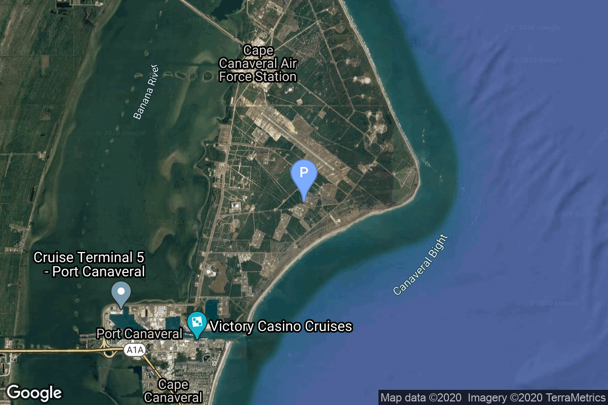
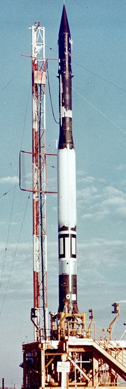
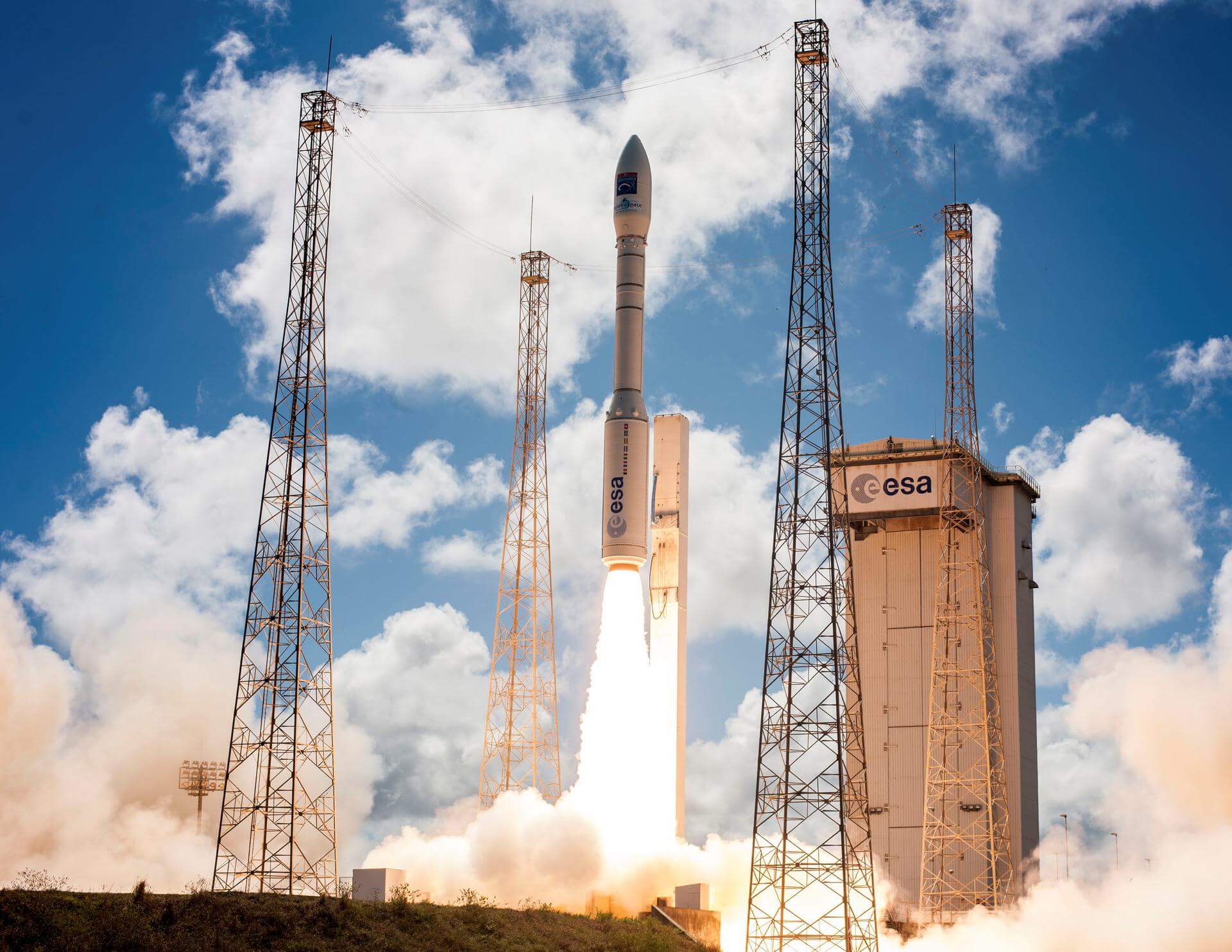
{ "count": 7503, "next": "https://ll.thespacedevs.com/2.0.0/launch/?format=api&limit=10&offset=6860&ordering=name", "previous": "https://ll.thespacedevs.com/2.0.0/launch/?format=api&limit=10&offset=6840&ordering=name", "results": [ { "id": "de282e74-e03b-411e-9633-2d1497629893", "url": "https://ll.thespacedevs.com/2.0.0/launch/de282e74-e03b-411e-9633-2d1497629893/?format=api", "launch_library_id": null, "slug": "vanguard-vanguard-4", "name": "Vanguard | Vanguard", "status": { "id": 4, "name": "Failure" }, "net": "1958-04-29T02:53:00Z", "window_end": "1958-04-29T02:53:00Z", "window_start": "1958-04-29T02:53:00Z", "inhold": false, "tbdtime": false, "tbddate": false, "probability": null, "holdreason": "", "failreason": null, "hashtag": null, "launch_service_provider": { "id": 166, "url": "https://ll.thespacedevs.com/2.0.0/agencies/166/?format=api", "name": "US Navy", "type": "Government" }, "rocket": { "id": 3012, "configuration": { "id": 449, "launch_library_id": null, "url": "https://ll.thespacedevs.com/2.0.0/config/launcher/449/?format=api", "name": "Vanguard", "family": "", "full_name": "Vanguard", "variant": "" } }, "mission": { "id": 1432, "launch_library_id": null, "name": "Vanguard", "description": "Small satellite used to test the Vanguard three-stage launch vehicle.", "launch_designator": null, "type": "Test Flight", "orbit": { "id": 8, "name": "Low Earth Orbit", "abbrev": "LEO" } }, "pad": { "id": 118, "url": "https://ll.thespacedevs.com/2.0.0/pad/118/?format=api", "agency_id": 166, "name": "Launch Complex 18A", "info_url": null, "wiki_url": "https://en.wikipedia.org/wiki/Cape_Canaveral_Launch_Complex_18", "map_url": "https://www.google.com/maps?q=28.4493,-80.564494", "latitude": "28.4493", "longitude": "-80.564494", "location": { "id": 12, "url": "https://ll.thespacedevs.com/2.0.0/location/12/?format=api", "name": "Cape Canaveral SFS, FL, USA", "country_code": "USA", "map_image": "https://thespacedevs-prod.nyc3.digitaloceanspaces.com/media/map_images/location_12_20200803142519.jpg", "total_launch_count": 1023, "total_landing_count": 64 }, "map_image": "https://thespacedevs-prod.nyc3.digitaloceanspaces.com/media/map_images/pad_118_20200803143338.jpg", "total_launch_count": 18 }, "webcast_live": false, "image": "https://thespacedevs-prod.nyc3.digitaloceanspaces.com/media/images/vanguard_1_on_p_image_20240411114304.jpeg", "infographic": null, "program": [] }, { "id": "597540d3-b6b1-44d8-b6e6-3b799dc6b1e4", "url": "https://ll.thespacedevs.com/2.0.0/launch/597540d3-b6b1-44d8-b6e6-3b799dc6b1e4/?format=api", "launch_library_id": null, "slug": "vanguard-vanguard-ii", "name": "Vanguard | Vanguard II", "status": { "id": 3, "name": "Success" }, "net": "1959-02-17T15:55:00Z", "window_end": "1959-02-17T15:55:00Z", "window_start": "1959-02-17T15:55:00Z", "inhold": false, "tbdtime": false, "tbddate": false, "probability": null, "holdreason": "", "failreason": null, "hashtag": null, "launch_service_provider": { "id": 166, "url": "https://ll.thespacedevs.com/2.0.0/agencies/166/?format=api", "name": "US Navy", "type": "Government" }, "rocket": { "id": 3035, "configuration": { "id": 449, "launch_library_id": null, "url": "https://ll.thespacedevs.com/2.0.0/config/launcher/449/?format=api", "name": "Vanguard", "family": "", "full_name": "Vanguard", "variant": "" } }, "mission": { "id": 1457, "launch_library_id": null, "name": "Vanguard II", "description": "Vanguard II is an Earth orbiting satellite and the first weather satellite. It was designed to measure cloud-cover distribution over the daylight portion of its orbit for a period of 19 days and to provide information on the density of the atmosphere.", "launch_designator": null, "type": "Earth Science", "orbit": { "id": 12, "name": "Medium Earth Orbit", "abbrev": "MEO" } }, "pad": { "id": 118, "url": "https://ll.thespacedevs.com/2.0.0/pad/118/?format=api", "agency_id": 166, "name": "Launch Complex 18A", "info_url": null, "wiki_url": "https://en.wikipedia.org/wiki/Cape_Canaveral_Launch_Complex_18", "map_url": "https://www.google.com/maps?q=28.4493,-80.564494", "latitude": "28.4493", "longitude": "-80.564494", "location": { "id": 12, "url": "https://ll.thespacedevs.com/2.0.0/location/12/?format=api", "name": "Cape Canaveral SFS, FL, USA", "country_code": "USA", "map_image": "https://thespacedevs-prod.nyc3.digitaloceanspaces.com/media/map_images/location_12_20200803142519.jpg", "total_launch_count": 1023, "total_landing_count": 64 }, "map_image": "https://thespacedevs-prod.nyc3.digitaloceanspaces.com/media/map_images/pad_118_20200803143338.jpg", "total_launch_count": 18 }, "webcast_live": false, "image": "https://thespacedevs-prod.nyc3.digitaloceanspaces.com/media/images/vanguard_1_on_p_image_20240411114304.jpeg", "infographic": null, "program": [] }, { "id": "614d577a-ac7c-4659-8fed-4b6a734469cd", "url": "https://ll.thespacedevs.com/2.0.0/launch/614d577a-ac7c-4659-8fed-4b6a734469cd/?format=api", "launch_library_id": null, "slug": "vanguard-vanguard-iii", "name": "Vanguard | Vanguard III", "status": { "id": 3, "name": "Success" }, "net": "1959-09-18T05:20:07Z", "window_end": "1959-09-18T05:20:07Z", "window_start": "1959-09-18T05:20:07Z", "inhold": false, "tbdtime": false, "tbddate": false, "probability": null, "holdreason": "", "failreason": null, "hashtag": null, "launch_service_provider": { "id": 166, "url": "https://ll.thespacedevs.com/2.0.0/agencies/166/?format=api", "name": "US Navy", "type": "Government" }, "rocket": { "id": 3051, "configuration": { "id": 449, "launch_library_id": null, "url": "https://ll.thespacedevs.com/2.0.0/config/launcher/449/?format=api", "name": "Vanguard", "family": "", "full_name": "Vanguard", "variant": "" } }, "mission": { "id": 1473, "launch_library_id": null, "name": "Vanguard III", "description": "Vanguard 3 is a scientific satellite to measure the Earth's magnetic field, solar X-ray radiation and its effects on the Earth's atmosphere and the near-Earth micrometeoroid environment.", "launch_designator": null, "type": "Earth Science", "orbit": { "id": 12, "name": "Medium Earth Orbit", "abbrev": "MEO" } }, "pad": { "id": 118, "url": "https://ll.thespacedevs.com/2.0.0/pad/118/?format=api", "agency_id": 166, "name": "Launch Complex 18A", "info_url": null, "wiki_url": "https://en.wikipedia.org/wiki/Cape_Canaveral_Launch_Complex_18", "map_url": "https://www.google.com/maps?q=28.4493,-80.564494", "latitude": "28.4493", "longitude": "-80.564494", "location": { "id": 12, "url": "https://ll.thespacedevs.com/2.0.0/location/12/?format=api", "name": "Cape Canaveral SFS, FL, USA", "country_code": "USA", "map_image": "https://thespacedevs-prod.nyc3.digitaloceanspaces.com/media/map_images/location_12_20200803142519.jpg", "total_launch_count": 1023, "total_landing_count": 64 }, "map_image": "https://thespacedevs-prod.nyc3.digitaloceanspaces.com/media/map_images/pad_118_20200803143338.jpg", "total_launch_count": 18 }, "webcast_live": false, "image": "https://thespacedevs-prod.nyc3.digitaloceanspaces.com/media/images/vanguard_1_on_p_image_20240411114304.jpeg", "infographic": null, "program": [] }, { "id": "68ab2654-f5ed-431f-a2cc-dbb392b4d7d8", "url": "https://ll.thespacedevs.com/2.0.0/launch/68ab2654-f5ed-431f-a2cc-dbb392b4d7d8/?format=api", "launch_library_id": 1071, "slug": "vega-adm-aeolus", "name": "Vega | ADM-Aeolus", "status": { "id": 3, "name": "Success" }, "net": "2018-08-22T21:20:09Z", "window_end": "2018-08-22T21:20:09Z", "window_start": "2018-08-22T21:20:09Z", "inhold": false, "tbdtime": false, "tbddate": false, "probability": -1, "holdreason": "", "failreason": null, "hashtag": "#Aeolus", "launch_service_provider": { "id": 115, "url": "https://ll.thespacedevs.com/2.0.0/agencies/115/?format=api", "name": "Arianespace", "type": "Commercial" }, "rocket": { "id": 1361, "configuration": { "id": 167, "launch_library_id": 18, "url": "https://ll.thespacedevs.com/2.0.0/config/launcher/167/?format=api", "name": "Vega", "family": "Vega", "full_name": "Vega", "variant": "" } }, "mission": { "id": 483, "launch_library_id": 640, "name": "ADM-Aeolus", "description": "ADM-Aeolus was an Earth observation satellite built by Airbus Defense and Space for ESA. Its goal was to directly observe wind profiles from space on a global scale and provide data that could improve weather forecasting and advance understanding of atmospherics dynamics and climate. The Aeolus satellite weighed around 1366 kg and flew in a low sun-synchronous orbit at about 400 km altitude. It was desorbited and reentered the Earth's atmosphere on July 28, 2023 at approximately 19:00 UTC.", "launch_designator": null, "type": "Earth Science", "orbit": { "id": 17, "name": "Sun-Synchronous Orbit", "abbrev": "SSO" } }, "pad": { "id": 34, "url": "https://ll.thespacedevs.com/2.0.0/pad/34/?format=api", "agency_id": 115, "name": "Ariane Launch Area 1 (ELV)", "info_url": null, "wiki_url": "https://en.wikipedia.org/wiki/ELA-1", "map_url": "https://www.google.com/maps?q=5.236,-52.775", "latitude": "5.236", "longitude": "-52.775", "location": { "id": 13, "url": "https://ll.thespacedevs.com/2.0.0/location/13/?format=api", "name": "Guiana Space Centre, French Guiana", "country_code": "GUF", "map_image": "https://thespacedevs-prod.nyc3.digitaloceanspaces.com/media/map_images/location_13_20200803142412.jpg", "total_launch_count": 325, "total_landing_count": 0 }, "map_image": "https://thespacedevs-prod.nyc3.digitaloceanspaces.com/media/map_images/pad_34_20200803143527.jpg", "total_launch_count": 52 }, "webcast_live": false, "image": "https://thespacedevs-prod.nyc3.digitaloceanspaces.com/media/images/vega_image_20201111143622.jpeg", "infographic": null, "program": [] }, { "id": "88651cb1-b8ee-47c6-88e9-69b759654e36", "url": "https://ll.thespacedevs.com/2.0.0/launch/88651cb1-b8ee-47c6-88e9-69b759654e36/?format=api", "launch_library_id": null, "slug": "vega-c-altius", "name": "Vega-C | Altius", "status": { "id": 2, "name": "TBD" }, "net": "2026-12-31T00:00:00Z", "window_end": "2026-12-31T00:00:00Z", "window_start": "2026-12-31T00:00:00Z", "inhold": false, "tbdtime": true, "tbddate": true, "probability": null, "holdreason": "", "failreason": "", "hashtag": null, "launch_service_provider": { "id": 115, "url": "https://ll.thespacedevs.com/2.0.0/agencies/115/?format=api", "name": "Arianespace", "type": "Commercial" }, "rocket": { "id": 7515, "configuration": { "id": 127, "launch_library_id": 163, "url": "https://ll.thespacedevs.com/2.0.0/config/launcher/127/?format=api", "name": "Vega-C", "family": "Vega", "full_name": "Vega-C", "variant": "" } }, "mission": { "id": 5925, "launch_library_id": null, "name": "Altius", "description": "ALTIUS is a satellite mission proposed by the Belgian Institute for Space Aeronomy to monitor the distribution and evolution of stratospheric ozone in the Earth's atmosphere.", "launch_designator": null, "type": "Earth Science", "orbit": { "id": 17, "name": "Sun-Synchronous Orbit", "abbrev": "SSO" } }, "pad": { "id": 34, "url": "https://ll.thespacedevs.com/2.0.0/pad/34/?format=api", "agency_id": 115, "name": "Ariane Launch Area 1 (ELV)", "info_url": null, "wiki_url": "https://en.wikipedia.org/wiki/ELA-1", "map_url": "https://www.google.com/maps?q=5.236,-52.775", "latitude": "5.236", "longitude": "-52.775", "location": { "id": 13, "url": "https://ll.thespacedevs.com/2.0.0/location/13/?format=api", "name": "Guiana Space Centre, French Guiana", "country_code": "GUF", "map_image": "https://thespacedevs-prod.nyc3.digitaloceanspaces.com/media/map_images/location_13_20200803142412.jpg", "total_launch_count": 325, "total_landing_count": 0 }, "map_image": "https://thespacedevs-prod.nyc3.digitaloceanspaces.com/media/map_images/pad_34_20200803143527.jpg", "total_launch_count": 52 }, "webcast_live": false, "image": "https://thespacedevs-prod.nyc3.digitaloceanspaces.com/media/images/vega-c_image_20220713154437.jpg", "infographic": null, "program": [] }, { "id": "ccbd07da-d3c7-4b22-a5ee-cb190f6e06b0", "url": "https://ll.thespacedevs.com/2.0.0/launch/ccbd07da-d3c7-4b22-a5ee-cb190f6e06b0/?format=api", "launch_library_id": 2001, "slug": "vega-c-biomass", "name": "Vega-C | Biomass", "status": { "id": 3, "name": "Success" }, "net": "2025-04-29T09:15:52Z", "window_end": "2025-04-29T09:15:52Z", "window_start": "2025-04-29T09:15:52Z", "inhold": false, "tbdtime": false, "tbddate": false, "probability": null, "holdreason": "", "failreason": "", "hashtag": null, "launch_service_provider": { "id": 115, "url": "https://ll.thespacedevs.com/2.0.0/agencies/115/?format=api", "name": "Arianespace", "type": "Commercial" }, "rocket": { "id": 2571, "configuration": { "id": 127, "launch_library_id": 163, "url": "https://ll.thespacedevs.com/2.0.0/config/launcher/127/?format=api", "name": "Vega-C", "family": "Vega", "full_name": "Vega-C", "variant": "" } }, "mission": { "id": 1054, "launch_library_id": 1252, "name": "Biomass", "description": "Biomass is an European Space Agency mission designed to measure the density of carbon stored in the world's forests. The spacecraft, built by Airbus Defence and Space, features the first civilian P-band synthetic aperture radar as well as a 12m-diameter deployable reflector from L3Harris made of over 900 km of gold-coated molybdenum 25µm wire.\r\nWith a minimum operational lifetime of 5 years in its 666km 6am/6pm sun-synchronous orbit, the global coverage achieved every 9 months allows to precisely monitor the evolution of forests over time.", "launch_designator": null, "type": "Earth Science", "orbit": { "id": 17, "name": "Sun-Synchronous Orbit", "abbrev": "SSO" } }, "pad": { "id": 34, "url": "https://ll.thespacedevs.com/2.0.0/pad/34/?format=api", "agency_id": 115, "name": "Ariane Launch Area 1 (ELV)", "info_url": null, "wiki_url": "https://en.wikipedia.org/wiki/ELA-1", "map_url": "https://www.google.com/maps?q=5.236,-52.775", "latitude": "5.236", "longitude": "-52.775", "location": { "id": 13, "url": "https://ll.thespacedevs.com/2.0.0/location/13/?format=api", "name": "Guiana Space Centre, French Guiana", "country_code": "GUF", "map_image": "https://thespacedevs-prod.nyc3.digitaloceanspaces.com/media/map_images/location_13_20200803142412.jpg", "total_launch_count": 325, "total_landing_count": 0 }, "map_image": "https://thespacedevs-prod.nyc3.digitaloceanspaces.com/media/map_images/pad_34_20200803143527.jpg", "total_launch_count": 52 }, "webcast_live": false, "image": "https://thespacedevs-prod.nyc3.digitaloceanspaces.com/media/images/vega-c_image_20220713154437.jpg", "infographic": "https://thespacedevs-prod.nyc3.digitaloceanspaces.com/media/infographic_images/vega-c2520257_infographic_20250211185656.png", "program": [] }, { "id": "b0634bea-4769-4846-8546-b7574d571bbc", "url": "https://ll.thespacedevs.com/2.0.0/launch/b0634bea-4769-4846-8546-b7574d571bbc/?format=api", "launch_library_id": null, "slug": "vega-c-clearspace-1", "name": "Vega-C | ClearSpace-1", "status": { "id": 2, "name": "TBD" }, "net": "2026-12-31T00:00:00Z", "window_end": "2026-12-31T00:00:00Z", "window_start": "2026-12-31T00:00:00Z", "inhold": false, "tbdtime": true, "tbddate": true, "probability": null, "holdreason": "", "failreason": "", "hashtag": null, "launch_service_provider": { "id": 115, "url": "https://ll.thespacedevs.com/2.0.0/agencies/115/?format=api", "name": "Arianespace", "type": "Commercial" }, "rocket": { "id": 7765, "configuration": { "id": 127, "launch_library_id": 163, "url": "https://ll.thespacedevs.com/2.0.0/config/launcher/127/?format=api", "name": "Vega-C", "family": "Vega", "full_name": "Vega-C", "variant": "" } }, "mission": { "id": 6283, "launch_library_id": null, "name": "ClearSpace-1", "description": "First debris removal mission by the Swiss startup ClearSpace. Contracted by the European Space Agency, it is designed to catch and de-orbit part of a Vega rocket from Low Earth Orbit using four articulated arms.", "launch_designator": null, "type": "Technology", "orbit": { "id": 8, "name": "Low Earth Orbit", "abbrev": "LEO" } }, "pad": { "id": 34, "url": "https://ll.thespacedevs.com/2.0.0/pad/34/?format=api", "agency_id": 115, "name": "Ariane Launch Area 1 (ELV)", "info_url": null, "wiki_url": "https://en.wikipedia.org/wiki/ELA-1", "map_url": "https://www.google.com/maps?q=5.236,-52.775", "latitude": "5.236", "longitude": "-52.775", "location": { "id": 13, "url": "https://ll.thespacedevs.com/2.0.0/location/13/?format=api", "name": "Guiana Space Centre, French Guiana", "country_code": "GUF", "map_image": "https://thespacedevs-prod.nyc3.digitaloceanspaces.com/media/map_images/location_13_20200803142412.jpg", "total_launch_count": 325, "total_landing_count": 0 }, "map_image": "https://thespacedevs-prod.nyc3.digitaloceanspaces.com/media/map_images/pad_34_20200803143527.jpg", "total_launch_count": 52 }, "webcast_live": false, "image": "https://thespacedevs-prod.nyc3.digitaloceanspaces.com/media/images/vega-c_image_20220713154437.jpg", "infographic": null, "program": [] }, { "id": "a2a87bed-7e8c-4680-a282-045c4ffe9917", "url": "https://ll.thespacedevs.com/2.0.0/launch/a2a87bed-7e8c-4680-a282-045c4ffe9917/?format=api", "launch_library_id": null, "slug": "vega-c-co3d-microcarb", "name": "Vega-C | CO3D & MicroCarb", "status": { "id": 2, "name": "TBD" }, "net": "2025-07-31T00:00:00Z", "window_end": "2025-07-31T00:00:00Z", "window_start": "2025-07-31T00:00:00Z", "inhold": false, "tbdtime": true, "tbddate": true, "probability": null, "holdreason": "", "failreason": "", "hashtag": null, "launch_service_provider": { "id": 115, "url": "https://ll.thespacedevs.com/2.0.0/agencies/115/?format=api", "name": "Arianespace", "type": "Commercial" }, "rocket": { "id": 8433, "configuration": { "id": 127, "launch_library_id": 163, "url": "https://ll.thespacedevs.com/2.0.0/config/launcher/127/?format=api", "name": "Vega-C", "family": "Vega", "full_name": "Vega-C", "variant": "" } }, "mission": { "id": 7022, "launch_library_id": null, "name": "CO3D & MicroCarb", "description": "CO3D is a CNES-Airbus Defence & Space constellation of four small satellites designed to map the globe in 3D from low Earth to serve public and private sector needs. Microcarb is a small satellite designed to map sources and sinks of carbon dioxide (CO2)—the most important greenhouse gas — on a global scale.", "launch_designator": null, "type": "Earth Science", "orbit": { "id": 17, "name": "Sun-Synchronous Orbit", "abbrev": "SSO" } }, "pad": { "id": 34, "url": "https://ll.thespacedevs.com/2.0.0/pad/34/?format=api", "agency_id": 115, "name": "Ariane Launch Area 1 (ELV)", "info_url": null, "wiki_url": "https://en.wikipedia.org/wiki/ELA-1", "map_url": "https://www.google.com/maps?q=5.236,-52.775", "latitude": "5.236", "longitude": "-52.775", "location": { "id": 13, "url": "https://ll.thespacedevs.com/2.0.0/location/13/?format=api", "name": "Guiana Space Centre, French Guiana", "country_code": "GUF", "map_image": "https://thespacedevs-prod.nyc3.digitaloceanspaces.com/media/map_images/location_13_20200803142412.jpg", "total_launch_count": 325, "total_landing_count": 0 }, "map_image": "https://thespacedevs-prod.nyc3.digitaloceanspaces.com/media/map_images/pad_34_20200803143527.jpg", "total_launch_count": 52 }, "webcast_live": false, "image": "https://thespacedevs-prod.nyc3.digitaloceanspaces.com/media/images/vega-c_image_20220713154437.jpg", "infographic": null, "program": [] }, { "id": "63ddb2d1-8369-4681-8a50-e95819150382", "url": "https://ll.thespacedevs.com/2.0.0/launch/63ddb2d1-8369-4681-8a50-e95819150382/?format=api", "launch_library_id": null, "slug": "vega-c-csg-3", "name": "Vega-C | CSG-3", "status": { "id": 2, "name": "TBD" }, "net": "2025-12-31T00:00:00Z", "window_end": "2025-12-31T00:00:00Z", "window_start": "2025-12-31T00:00:00Z", "inhold": false, "tbdtime": true, "tbddate": true, "probability": null, "holdreason": "", "failreason": "", "hashtag": null, "launch_service_provider": { "id": 115, "url": "https://ll.thespacedevs.com/2.0.0/agencies/115/?format=api", "name": "Arianespace", "type": "Commercial" }, "rocket": { "id": 7470, "configuration": { "id": 127, "launch_library_id": 163, "url": "https://ll.thespacedevs.com/2.0.0/config/launcher/127/?format=api", "name": "Vega-C", "family": "Vega", "full_name": "Vega-C", "variant": "" } }, "mission": { "id": 5871, "launch_library_id": null, "name": "CSG-3", "description": "CSG-3 is an Earth observation satellite for the Italian Space Agency, part of a reconnaissance constellation using synthetic aperture radars operating in the X-band.", "launch_designator": null, "type": "Earth Science", "orbit": { "id": 17, "name": "Sun-Synchronous Orbit", "abbrev": "SSO" } }, "pad": { "id": 34, "url": "https://ll.thespacedevs.com/2.0.0/pad/34/?format=api", "agency_id": 115, "name": "Ariane Launch Area 1 (ELV)", "info_url": null, "wiki_url": "https://en.wikipedia.org/wiki/ELA-1", "map_url": "https://www.google.com/maps?q=5.236,-52.775", "latitude": "5.236", "longitude": "-52.775", "location": { "id": 13, "url": "https://ll.thespacedevs.com/2.0.0/location/13/?format=api", "name": "Guiana Space Centre, French Guiana", "country_code": "GUF", "map_image": "https://thespacedevs-prod.nyc3.digitaloceanspaces.com/media/map_images/location_13_20200803142412.jpg", "total_launch_count": 325, "total_landing_count": 0 }, "map_image": "https://thespacedevs-prod.nyc3.digitaloceanspaces.com/media/map_images/pad_34_20200803143527.jpg", "total_launch_count": 52 }, "webcast_live": false, "image": "https://thespacedevs-prod.nyc3.digitaloceanspaces.com/media/images/vega-c_image_20220713154437.jpg", "infographic": null, "program": [] }, { "id": "846775f9-6a84-4a63-9077-660feffa4dab", "url": "https://ll.thespacedevs.com/2.0.0/launch/846775f9-6a84-4a63-9077-660feffa4dab/?format=api", "launch_library_id": null, "slug": "vega-c-csg-4", "name": "Vega-C | CSG-4", "status": { "id": 2, "name": "TBD" }, "net": "2026-12-31T00:00:00Z", "window_end": "2026-12-31T00:00:00Z", "window_start": "2026-12-31T00:00:00Z", "inhold": false, "tbdtime": true, "tbddate": true, "probability": null, "holdreason": "", "failreason": "", "hashtag": null, "launch_service_provider": { "id": 115, "url": "https://ll.thespacedevs.com/2.0.0/agencies/115/?format=api", "name": "Arianespace", "type": "Commercial" }, "rocket": { "id": 8177, "configuration": { "id": 127, "launch_library_id": 163, "url": "https://ll.thespacedevs.com/2.0.0/config/launcher/127/?format=api", "name": "Vega-C", "family": "Vega", "full_name": "Vega-C", "variant": "" } }, "mission": { "id": 6744, "launch_library_id": null, "name": "CSG-4", "description": "CSG-4 is an Earth observation satellite for the Italian Space Agency, part of a reconnaissance constellation using synthetic aperture radars operating in the X-band.", "launch_designator": null, "type": "Earth Science", "orbit": { "id": 17, "name": "Sun-Synchronous Orbit", "abbrev": "SSO" } }, "pad": { "id": 34, "url": "https://ll.thespacedevs.com/2.0.0/pad/34/?format=api", "agency_id": 115, "name": "Ariane Launch Area 1 (ELV)", "info_url": null, "wiki_url": "https://en.wikipedia.org/wiki/ELA-1", "map_url": "https://www.google.com/maps?q=5.236,-52.775", "latitude": "5.236", "longitude": "-52.775", "location": { "id": 13, "url": "https://ll.thespacedevs.com/2.0.0/location/13/?format=api", "name": "Guiana Space Centre, French Guiana", "country_code": "GUF", "map_image": "https://thespacedevs-prod.nyc3.digitaloceanspaces.com/media/map_images/location_13_20200803142412.jpg", "total_launch_count": 325, "total_landing_count": 0 }, "map_image": "https://thespacedevs-prod.nyc3.digitaloceanspaces.com/media/map_images/pad_34_20200803143527.jpg", "total_launch_count": 52 }, "webcast_live": false, "image": "https://thespacedevs-prod.nyc3.digitaloceanspaces.com/media/images/vega-c_image_20220713154437.jpg", "infographic": null, "program": [] } ] }