Launch List
API endpoint that returns all Launch objects or a single launch.
EXAMPLE - /launch/
GET: Return a list of all Launch objects.
FILTERS: Fields - 'name', 'id(s)', 'lsp_id', 'lsp_name', 'serial_number', 'launcher_config__id', 'rocket__spacecraftflight__spacecraft__name'
MODE: 'normal', 'list', 'detailed' EXAMPLE: ?mode=list
SEARCH: Searches through the launch name, rocket name, launch agency, mission name & spacecraft name. EXAMPLE - ?search=SpaceX
GET /2.0.0/launch/?format=api&offset=6800&ordering=id
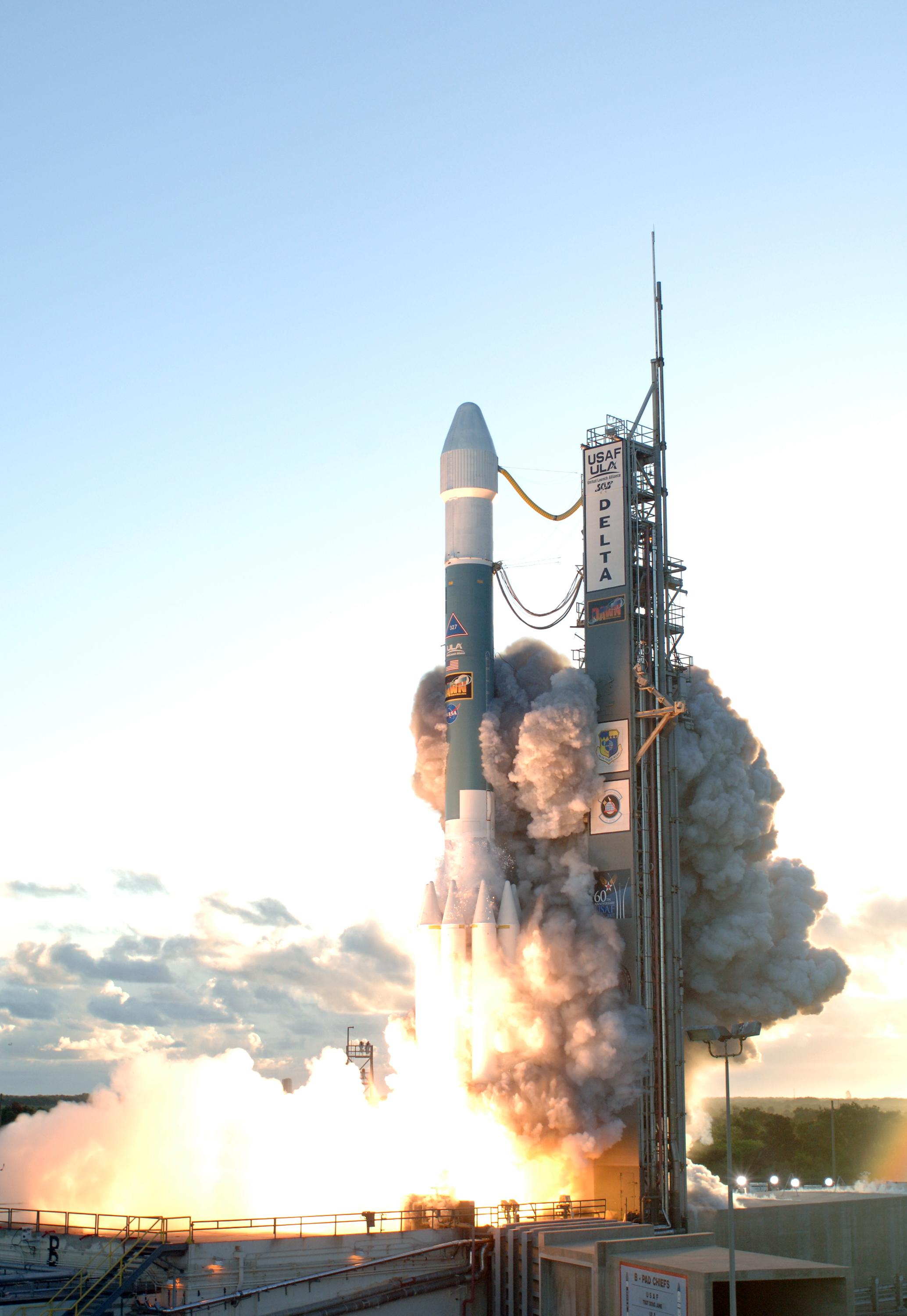
{ "count": 7736, "next": "https://ll.thespacedevs.com/2.0.0/launch/?format=api&limit=10&offset=6810&ordering=id", "previous": "https://ll.thespacedevs.com/2.0.0/launch/?format=api&limit=10&offset=6790&ordering=id", "results": [ { "id": "e02a5b5c-4a20-4b6a-afde-ae67cc928413", "url": "https://ll.thespacedevs.com/2.0.0/launch/e02a5b5c-4a20-4b6a-afde-ae67cc928413/?format=api", "launch_library_id": 1914, "slug": "soyuz-u-soyuz-t-1", "name": "Soyuz U | Soyuz T-1", "status": { "id": 3, "name": "Success" }, "net": "1979-12-16T12:29:50Z", "window_end": "1979-12-16T12:29:50Z", "window_start": "1979-12-16T12:29:50Z", "inhold": false, "tbdtime": false, "tbddate": false, "probability": 0, "holdreason": "", "failreason": "", "hashtag": null, "launch_service_provider": { "id": 66, "url": "https://ll.thespacedevs.com/2.0.0/agencies/66/?format=api", "name": "Soviet Space Program", "type": "Government" }, "rocket": { "id": 2461, "configuration": { "id": 37, "launch_library_id": 35, "url": "https://ll.thespacedevs.com/2.0.0/config/launcher/37/?format=api", "name": "Soyuz U", "family": "Soyuz", "full_name": "Soyuz U", "variant": "" } }, "mission": { "id": 5836, "launch_library_id": null, "name": "Soyuz T-1", "description": "Test flight of the Soyuz T spacecraft which docked to Salyut 6", "launch_designator": null, "type": "Test Flight", "orbit": { "id": 8, "name": "Low Earth Orbit", "abbrev": "LEO" } }, "pad": { "id": 20, "url": "https://ll.thespacedevs.com/2.0.0/pad/20/?format=api", "agency_id": null, "name": "31/6", "info_url": null, "wiki_url": "https://en.wikipedia.org/wiki/Baikonur_Cosmodrome_Site_31", "map_url": "https://www.google.com/maps?q=45.996034,63.564003", "latitude": "45.996034", "longitude": "63.564003", "location": { "id": 15, "url": "https://ll.thespacedevs.com/2.0.0/location/15/?format=api", "name": "Baikonur Cosmodrome, Republic of Kazakhstan", "country_code": "KAZ", "map_image": "https://thespacedevs-prod.nyc3.digitaloceanspaces.com/media/map_images/location_15_20200803142517.jpg", "total_launch_count": 1559, "total_landing_count": 0 }, "map_image": "https://thespacedevs-prod.nyc3.digitaloceanspaces.com/media/map_images/pad_20_20200803143516.jpg", "total_launch_count": 426 }, "webcast_live": false, "image": "https://thespacedevs-prod.nyc3.digitaloceanspaces.com/media/images/soyuz2520u_image_20190222031023.jpeg", "infographic": null, "program": [ { "id": 8, "url": "https://ll.thespacedevs.com/2.0.0/program/8/?format=api", "name": "Soyuz", "description": "The Soyuz programme is a human spaceflight programme initiated by the Soviet Union in the early 1960s. The Soyuz spacecraft was originally part of a Moon landing project intended to put a Soviet cosmonaut on the Moon. It was the third Soviet human spaceflight programme after the Vostok and Voskhod programmes.", "agencies": [ { "id": 63, "url": "https://ll.thespacedevs.com/2.0.0/agencies/63/?format=api", "name": "Russian Federal Space Agency (ROSCOSMOS)", "type": "Government" }, { "id": 66, "url": "https://ll.thespacedevs.com/2.0.0/agencies/66/?format=api", "name": "Soviet Space Program", "type": "Government" } ], "image_url": "https://thespacedevs-prod.nyc3.digitaloceanspaces.com/media/images/soyuz_program_20201129185543.png", "start_date": "1966-11-28T11:02:00Z", "end_date": null, "info_url": null, "wiki_url": "https://en.wikipedia.org/wiki/Soyuz_programme" }, { "id": 23, "url": "https://ll.thespacedevs.com/2.0.0/program/23/?format=api", "name": "Salyut", "description": "The Salyut programme was the first space station programme, undertaken by the Soviet Union. It involved a series of four crewed scientific research space stations and two crewed military reconnaissance space stations over a period of 15 years, from 1971 to 1986.", "agencies": [ { "id": 66, "url": "https://ll.thespacedevs.com/2.0.0/agencies/66/?format=api", "name": "Soviet Space Program", "type": "Government" } ], "image_url": "https://thespacedevs-prod.nyc3.digitaloceanspaces.com/media/images/salyut_program_20230506090532.png", "start_date": "1971-04-19T01:40:00Z", "end_date": "1986-07-16T12:34:05Z", "info_url": null, "wiki_url": "https://en.wikipedia.org/wiki/Salyut_programme" } ] }, { "id": "e02d9fdf-2479-46d8-b87a-44adbc350a16", "url": "https://ll.thespacedevs.com/2.0.0/launch/e02d9fdf-2479-46d8-b87a-44adbc350a16/?format=api", "launch_library_id": 1475, "slug": "ariane-5-eca-astra-1l-galaxy-17", "name": "Ariane 5 ECA | Astra 1L & Galaxy 17", "status": { "id": 3, "name": "Success" }, "net": "2007-05-04T22:29:00Z", "window_end": "2007-05-04T22:29:00Z", "window_start": "2007-05-04T22:29:00Z", "inhold": false, "tbdtime": false, "tbddate": false, "probability": null, "holdreason": "", "failreason": null, "hashtag": null, "launch_service_provider": { "id": 115, "url": "https://ll.thespacedevs.com/2.0.0/agencies/115/?format=api", "name": "Arianespace", "type": "Commercial" }, "rocket": { "id": 538, "configuration": { "id": 20, "launch_library_id": 27, "url": "https://ll.thespacedevs.com/2.0.0/config/launcher/20/?format=api", "name": "Ariane 5 ECA", "family": "Ariane", "full_name": "Ariane 5 ECA", "variant": "ECA" } }, "mission": { "id": 593, "launch_library_id": 784, "name": "Astra 1L & Galaxy 17", "description": "Astra 1L is an important DTH TV platform in Europe operating at 19.2 degrees East, for SES. Galaxy 17 is a communications satellite owned by Intelsat locating at 91 degrees West serving the North American market.", "launch_designator": null, "type": "Communications", "orbit": { "id": 2, "name": "Geostationary Transfer Orbit", "abbrev": "GTO" } }, "pad": { "id": 77, "url": "https://ll.thespacedevs.com/2.0.0/pad/77/?format=api", "agency_id": 115, "name": "Ariane Launch Area 3", "info_url": null, "wiki_url": "https://en.wikipedia.org/wiki/ELA-3", "map_url": "https://www.google.com/maps?q=5.239,-52.768", "latitude": "5.239", "longitude": "-52.768", "location": { "id": 13, "url": "https://ll.thespacedevs.com/2.0.0/location/13/?format=api", "name": "Guiana Space Centre, French Guiana", "country_code": "GUF", "map_image": "https://thespacedevs-prod.nyc3.digitaloceanspaces.com/media/map_images/location_13_20200803142412.jpg", "total_launch_count": 330, "total_landing_count": 0 }, "map_image": "https://thespacedevs-prod.nyc3.digitaloceanspaces.com/media/map_images/pad_77_20200803143458.jpg", "total_launch_count": 118 }, "webcast_live": false, "image": "https://thespacedevs-prod.nyc3.digitaloceanspaces.com/media/images/ariane252052520eca_image_20190224012333.jpeg", "infographic": null, "program": [] }, { "id": "e02e1b61-205b-4ea7-b3eb-2ce505b8c263", "url": "https://ll.thespacedevs.com/2.0.0/launch/e02e1b61-205b-4ea7-b3eb-2ce505b8c263/?format=api", "launch_library_id": 100, "slug": "soyuz-u-egyptsat-2-usus-a-3a", "name": "Soyuz-U | EgyptSat 2 / ايجيبت سات", "status": { "id": 3, "name": "Success" }, "net": "2014-04-16T16:20:00Z", "window_end": "2014-04-16T16:20:00Z", "window_start": "2014-04-16T16:20:00Z", "inhold": false, "tbdtime": false, "tbddate": false, "probability": null, "holdreason": "", "failreason": null, "hashtag": null, "launch_service_provider": { "id": 63, "url": "https://ll.thespacedevs.com/2.0.0/agencies/63/?format=api", "name": "Russian Federal Space Agency (ROSCOSMOS)", "type": "Government" }, "rocket": { "id": 1751, "configuration": { "id": 37, "launch_library_id": 35, "url": "https://ll.thespacedevs.com/2.0.0/config/launcher/37/?format=api", "name": "Soyuz U", "family": "Soyuz", "full_name": "Soyuz U", "variant": "" } }, "mission": { "id": 486, "launch_library_id": 85, "name": "EgyptSat 2", "description": "A Russian government Soyuz rocket will launch the EgyptSat 2 Earth observation satellite for Egypts National Authority for Remote Sensing and Space Sciences. ", "launch_designator": null, "type": "Earth Science", "orbit": { "id": 8, "name": "Low Earth Orbit", "abbrev": "LEO" } }, "pad": { "id": 20, "url": "https://ll.thespacedevs.com/2.0.0/pad/20/?format=api", "agency_id": null, "name": "31/6", "info_url": null, "wiki_url": "https://en.wikipedia.org/wiki/Baikonur_Cosmodrome_Site_31", "map_url": "https://www.google.com/maps?q=45.996034,63.564003", "latitude": "45.996034", "longitude": "63.564003", "location": { "id": 15, "url": "https://ll.thespacedevs.com/2.0.0/location/15/?format=api", "name": "Baikonur Cosmodrome, Republic of Kazakhstan", "country_code": "KAZ", "map_image": "https://thespacedevs-prod.nyc3.digitaloceanspaces.com/media/map_images/location_15_20200803142517.jpg", "total_launch_count": 1559, "total_landing_count": 0 }, "map_image": "https://thespacedevs-prod.nyc3.digitaloceanspaces.com/media/map_images/pad_20_20200803143516.jpg", "total_launch_count": 426 }, "webcast_live": false, "image": "https://thespacedevs-prod.nyc3.digitaloceanspaces.com/media/images/soyuz2520u_image_20190222031023.jpeg", "infographic": null, "program": [] }, { "id": "e0398747-5356-4ce8-862e-f54989643b05", "url": "https://ll.thespacedevs.com/2.0.0/launch/e0398747-5356-4ce8-862e-f54989643b05/?format=api", "launch_library_id": 1537, "slug": "delta-ii-7925h-95-dawn", "name": "Delta II 7925H-9.5 | Dawn", "status": { "id": 3, "name": "Success" }, "net": "2007-09-27T11:34:00Z", "window_end": "2007-09-27T11:34:00Z", "window_start": "2007-09-27T11:34:00Z", "inhold": false, "tbdtime": false, "tbddate": false, "probability": 0, "holdreason": "", "failreason": "", "hashtag": null, "launch_service_provider": { "id": 124, "url": "https://ll.thespacedevs.com/2.0.0/agencies/124/?format=api", "name": "United Launch Alliance", "type": "Commercial" }, "rocket": { "id": 547, "configuration": { "id": 155, "launch_library_id": 180, "url": "https://ll.thespacedevs.com/2.0.0/config/launcher/155/?format=api", "name": "Delta II", "family": "Delta", "full_name": "Delta II 7925H-9.5", "variant": "7925H-9.5" } }, "mission": { "id": 539, "launch_library_id": 694, "name": "Dawn", "description": "A space probe launch by NASA with the mission of studying known protoplanets of the asteroid belt, Vesta and Ceres.", "launch_designator": null, "type": "Planetary Science", "orbit": { "id": 6, "name": "Heliocentric N/A", "abbrev": "Helio-N/A" } }, "pad": { "id": 1, "url": "https://ll.thespacedevs.com/2.0.0/pad/1/?format=api", "agency_id": null, "name": "Space Launch Complex 17B", "info_url": null, "wiki_url": "https://en.wikipedia.org/wiki/Cape_Canaveral_Space_Launch_Complex_17", "map_url": "https://www.google.com/maps?q=28.4458,-80.5657", "latitude": "28.4458", "longitude": "-80.5657", "location": { "id": 12, "url": "https://ll.thespacedevs.com/2.0.0/location/12/?format=api", "name": "Cape Canaveral SFS, FL, USA", "country_code": "USA", "map_image": "https://thespacedevs-prod.nyc3.digitaloceanspaces.com/media/map_images/location_12_20200803142519.jpg", "total_launch_count": 1076, "total_landing_count": 70 }, "map_image": "https://thespacedevs-prod.nyc3.digitaloceanspaces.com/media/map_images/pad_1_20200803143208.jpg", "total_launch_count": 132 }, "webcast_live": false, "image": "https://thespacedevs-prod.nyc3.digitaloceanspaces.com/media/images/delta_ii_7925h-_image_20240922115412.jpg", "infographic": null, "program": [ { "id": 33, "url": "https://ll.thespacedevs.com/2.0.0/program/33/?format=api", "name": "Discovery Program", "description": "The Discovery Program is a series of Solar System exploration missions funded by the U.S. National Aeronautics and Space Administration (NASA) through its Planetary Missions Program Office. The cost of each mission is capped at a lower level than missions from NASA's New Frontiers or Flagship Programs. As a result, Discovery missions tend to be more focused on a specific scientific goal rather than serving a general purpose.", "agencies": [ { "id": 44, "url": "https://ll.thespacedevs.com/2.0.0/agencies/44/?format=api", "name": "National Aeronautics and Space Administration", "type": "Government" } ], "image_url": "https://thespacedevs-prod.nyc3.digitaloceanspaces.com/media/images/discovery2520p_program_20231231122246.jpeg", "start_date": "1990-01-01T00:00:00Z", "end_date": null, "info_url": "https://www.nasa.gov/planetarymissions/discovery-program/", "wiki_url": "https://en.wikipedia.org/wiki/Discovery_Program" } ] }, { "id": "e039ca31-4c26-4dd5-a828-ae8be06aec9e", "url": "https://ll.thespacedevs.com/2.0.0/launch/e039ca31-4c26-4dd5-a828-ae8be06aec9e/?format=api", "launch_library_id": null, "slug": "molniya-m-us-k-58", "name": "Molniya-M | US-K 58", "status": { "id": 3, "name": "Success" }, "net": "1988-10-03T22:23:39Z", "window_end": "1988-10-03T22:23:39Z", "window_start": "1988-10-03T22:23:39Z", "inhold": false, "tbdtime": false, "tbddate": false, "probability": null, "holdreason": "", "failreason": null, "hashtag": null, "launch_service_provider": { "id": 66, "url": "https://ll.thespacedevs.com/2.0.0/agencies/66/?format=api", "name": "Soviet Space Program", "type": "Government" }, "rocket": { "id": 6117, "configuration": { "id": 106, "launch_library_id": 126, "url": "https://ll.thespacedevs.com/2.0.0/config/launcher/106/?format=api", "name": "Molniya-M", "family": "R-7", "full_name": "Molniya-M 2BL", "variant": "2BL" } }, "mission": { "id": 4507, "launch_library_id": null, "name": "US-K 58", "description": "Early warning satellite", "launch_designator": null, "type": "Government/Top Secret", "orbit": { "id": 0, "name": "Elliptical Orbit", "abbrev": "Elliptical" } }, "pad": { "id": 168, "url": "https://ll.thespacedevs.com/2.0.0/pad/168/?format=api", "agency_id": null, "name": "41/1", "info_url": null, "wiki_url": "https://en.wikipedia.org/wiki/Plesetsk_Cosmodrome", "map_url": "https://www.google.com/maps?q=62.941,40.526806", "latitude": "62.941", "longitude": "40.526806", "location": { "id": 6, "url": "https://ll.thespacedevs.com/2.0.0/location/6/?format=api", "name": "Plesetsk Cosmodrome, Russian Federation", "country_code": "RUS", "map_image": "https://thespacedevs-prod.nyc3.digitaloceanspaces.com/media/map_images/location_6_20200803142434.jpg", "total_launch_count": 1679, "total_landing_count": 0 }, "map_image": "https://thespacedevs-prod.nyc3.digitaloceanspaces.com/media/map_images/pad_168_20200803143446.jpg", "total_launch_count": 310 }, "webcast_live": false, "image": "https://thespacedevs-prod.nyc3.digitaloceanspaces.com/media/images/molniya_m_image_20251102061752.jpg", "infographic": null, "program": [] }, { "id": "e03f0e3b-3712-4e28-9de7-8def0d94a947", "url": "https://ll.thespacedevs.com/2.0.0/launch/e03f0e3b-3712-4e28-9de7-8def0d94a947/?format=api", "launch_library_id": null, "slug": "thor-delta-e-essa-4", "name": "Thor Delta E | ESSA 4", "status": { "id": 3, "name": "Success" }, "net": "1967-01-26T17:31:00Z", "window_end": "1967-01-26T17:31:00Z", "window_start": "1967-01-26T17:31:00Z", "inhold": false, "tbdtime": false, "tbddate": false, "probability": null, "holdreason": "", "failreason": null, "hashtag": null, "launch_service_provider": { "id": 161, "url": "https://ll.thespacedevs.com/2.0.0/agencies/161/?format=api", "name": "United States Air Force", "type": "Government" }, "rocket": { "id": 3614, "configuration": { "id": 404, "launch_library_id": null, "url": "https://ll.thespacedevs.com/2.0.0/config/launcher/404/?format=api", "name": "Thor Delta E", "family": "Thor", "full_name": "Thor Delta E", "variant": "Delta E" } }, "mission": { "id": 2033, "launch_library_id": null, "name": "ESSA 4", "description": "The ESSA series was the second generation of US meterological satellites after the TIROS (Television & Infra-Red Observation Satellite) series. They were also called OT (Operational TIROS), TOS (TIROS Operational Satellite).", "launch_designator": null, "type": "Earth Science", "orbit": { "id": 17, "name": "Sun-Synchronous Orbit", "abbrev": "SSO" } }, "pad": { "id": 98, "url": "https://ll.thespacedevs.com/2.0.0/pad/98/?format=api", "agency_id": 161, "name": "Space Launch Complex 2E", "info_url": null, "wiki_url": "https://en.wikipedia.org/wiki/Vandenberg_Space_Launch_Complex_2", "map_url": "https://www.google.com/maps?q=34.7516,-120.6192", "latitude": "34.7516", "longitude": "-120.6192", "location": { "id": 11, "url": "https://ll.thespacedevs.com/2.0.0/location/11/?format=api", "name": "Vandenberg SFB, CA, USA", "country_code": "USA", "map_image": "https://thespacedevs-prod.nyc3.digitaloceanspaces.com/media/map_images/location_11_20200803142416.jpg", "total_launch_count": 852, "total_landing_count": 30 }, "map_image": "https://thespacedevs-prod.nyc3.digitaloceanspaces.com/media/map_images/pad_98_20200803143228.jpg", "total_launch_count": 47 }, "webcast_live": false, "image": "https://thespacedevs-prod.nyc3.digitaloceanspaces.com/media/images/thor_delta_e1_image_20251205041725.jpg", "infographic": null, "program": [] }, { "id": "e0427db4-5314-4766-9471-0c70859beb7a", "url": "https://ll.thespacedevs.com/2.0.0/launch/e0427db4-5314-4766-9471-0c70859beb7a/?format=api", "launch_library_id": null, "slug": "falcon-9-block-5-starlink-group-10-14", "name": "Falcon 9 Block 5 | Starlink Group 10-14", "status": { "id": 3, "name": "Success" }, "net": "2025-08-31T11:49:00Z", "window_end": "2025-08-31T15:15:00Z", "window_start": "2025-08-31T11:15:00Z", "inhold": false, "tbdtime": false, "tbddate": false, "probability": 85, "holdreason": "", "failreason": "", "hashtag": null, "launch_service_provider": { "id": 121, "url": "https://ll.thespacedevs.com/2.0.0/agencies/121/?format=api", "name": "SpaceX", "type": "Commercial" }, "rocket": { "id": 8688, "configuration": { "id": 164, "launch_library_id": 188, "url": "https://ll.thespacedevs.com/2.0.0/config/launcher/164/?format=api", "name": "Falcon 9", "family": "Falcon", "full_name": "Falcon 9 Block 5", "variant": "Block 5" } }, "mission": { "id": 7280, "launch_library_id": null, "name": "Starlink Group 10-14", "description": "A batch of 28 satellites for the Starlink mega-constellation - SpaceX's project for space-based Internet communication system.", "launch_designator": null, "type": "Communications", "orbit": { "id": 8, "name": "Low Earth Orbit", "abbrev": "LEO" } }, "pad": { "id": 80, "url": "https://ll.thespacedevs.com/2.0.0/pad/80/?format=api", "agency_id": 121, "name": "Space Launch Complex 40", "info_url": null, "wiki_url": "https://en.wikipedia.org/wiki/Cape_Canaveral_Air_Force_Station_Space_Launch_Complex_40", "map_url": "https://www.google.com/maps?q=28.56194122,-80.57735736", "latitude": "28.56194122", "longitude": "-80.57735736", "location": { "id": 12, "url": "https://ll.thespacedevs.com/2.0.0/location/12/?format=api", "name": "Cape Canaveral SFS, FL, USA", "country_code": "USA", "map_image": "https://thespacedevs-prod.nyc3.digitaloceanspaces.com/media/map_images/location_12_20200803142519.jpg", "total_launch_count": 1076, "total_landing_count": 70 }, "map_image": "https://thespacedevs-prod.nyc3.digitaloceanspaces.com/media/map_images/pad_80_20200803143323.jpg", "total_launch_count": 354 }, "webcast_live": false, "image": "https://thespacedevs-prod.nyc3.digitaloceanspaces.com/media/images/falcon2520925_image_20221009234147.png", "infographic": null, "program": [ { "id": 25, "url": "https://ll.thespacedevs.com/2.0.0/program/25/?format=api", "name": "Starlink", "description": "Starlink is a satellite internet constellation operated by American aerospace company SpaceX", "agencies": [ { "id": 121, "url": "https://ll.thespacedevs.com/2.0.0/agencies/121/?format=api", "name": "SpaceX", "type": "Commercial" } ], "image_url": "https://thespacedevs-prod.nyc3.digitaloceanspaces.com/media/images/starlink_program_20231228154508.jpeg", "start_date": "2018-02-22T14:17:00Z", "end_date": null, "info_url": "https://starlink.com", "wiki_url": "https://en.wikipedia.org/wiki/Starlink" } ] }, { "id": "e055ae69-537a-43ef-a2ef-741a5f4b6557", "url": "https://ll.thespacedevs.com/2.0.0/launch/e055ae69-537a-43ef-a2ef-741a5f4b6557/?format=api", "launch_library_id": null, "slug": "thor-delta-e1-isis-2", "name": "Thor Delta E1 | Isis 2", "status": { "id": 3, "name": "Success" }, "net": "1971-04-01T02:57:07Z", "window_end": "1971-04-01T02:57:07Z", "window_start": "1971-04-01T02:57:07Z", "inhold": false, "tbdtime": false, "tbddate": false, "probability": null, "holdreason": "", "failreason": null, "hashtag": null, "launch_service_provider": { "id": 161, "url": "https://ll.thespacedevs.com/2.0.0/agencies/161/?format=api", "name": "United States Air Force", "type": "Government" }, "rocket": { "id": 4116, "configuration": { "id": 405, "launch_library_id": null, "url": "https://ll.thespacedevs.com/2.0.0/config/launcher/405/?format=api", "name": "Thor Delta E1", "family": "Thor", "full_name": "Thor Delta E1", "variant": "Delta E1" } }, "mission": { "id": 2534, "launch_library_id": null, "name": "Isis 2", "description": "ISIS 2 was an ionospheric observatory instrumented with a sweep- and a fixed-frequency ionosonde, a VLF receiver, energetic and soft particle detectors, an ion mass spectrometer, an electrostatic probe, a retarding potential analyzer, a beacon transmitter, a cosmic noise experiment, and two photometers.", "launch_designator": null, "type": "Earth Science", "orbit": { "id": 8, "name": "Low Earth Orbit", "abbrev": "LEO" } }, "pad": { "id": 98, "url": "https://ll.thespacedevs.com/2.0.0/pad/98/?format=api", "agency_id": 161, "name": "Space Launch Complex 2E", "info_url": null, "wiki_url": "https://en.wikipedia.org/wiki/Vandenberg_Space_Launch_Complex_2", "map_url": "https://www.google.com/maps?q=34.7516,-120.6192", "latitude": "34.7516", "longitude": "-120.6192", "location": { "id": 11, "url": "https://ll.thespacedevs.com/2.0.0/location/11/?format=api", "name": "Vandenberg SFB, CA, USA", "country_code": "USA", "map_image": "https://thespacedevs-prod.nyc3.digitaloceanspaces.com/media/map_images/location_11_20200803142416.jpg", "total_launch_count": 852, "total_landing_count": 30 }, "map_image": "https://thespacedevs-prod.nyc3.digitaloceanspaces.com/media/map_images/pad_98_20200803143228.jpg", "total_launch_count": 47 }, "webcast_live": false, "image": "https://thespacedevs-prod.nyc3.digitaloceanspaces.com/media/images/delta-e1_2528i_image_20251205042339.png", "infographic": null, "program": [] }, { "id": "e06c9f00-0be5-42d5-89d4-b179e5ff21db", "url": "https://ll.thespacedevs.com/2.0.0/launch/e06c9f00-0be5-42d5-89d4-b179e5ff21db/?format=api", "launch_library_id": null, "slug": "kosmos-3m-tsikada-17", "name": "Kosmos-3M | Tsikada 17", "status": { "id": 3, "name": "Success" }, "net": "1991-02-05T02:36:45Z", "window_end": "1991-02-05T02:36:45Z", "window_start": "1991-02-05T02:36:45Z", "inhold": false, "tbdtime": false, "tbddate": false, "probability": null, "holdreason": "", "failreason": null, "hashtag": null, "launch_service_provider": { "id": 66, "url": "https://ll.thespacedevs.com/2.0.0/agencies/66/?format=api", "name": "Soviet Space Program", "type": "Government" }, "rocket": { "id": 6344, "configuration": { "id": 102, "launch_library_id": 122, "url": "https://ll.thespacedevs.com/2.0.0/config/launcher/102/?format=api", "name": "Kosmos-3M", "family": "Kosmos", "full_name": "Kosmos-3M (11K65M)", "variant": "-3M" } }, "mission": { "id": 4734, "launch_library_id": null, "name": "Tsikada 17", "description": "Civilian navigation satellite equivalent to the purely military Parus", "launch_designator": null, "type": "Navigation", "orbit": { "id": 8, "name": "Low Earth Orbit", "abbrev": "LEO" } }, "pad": { "id": 3, "url": "https://ll.thespacedevs.com/2.0.0/pad/3/?format=api", "agency_id": 163, "name": "133/3 (133L)", "info_url": null, "wiki_url": "", "map_url": "https://www.google.com/maps?q=62.886999,40.846984", "latitude": "62.886999", "longitude": "40.846984", "location": { "id": 6, "url": "https://ll.thespacedevs.com/2.0.0/location/6/?format=api", "name": "Plesetsk Cosmodrome, Russian Federation", "country_code": "RUS", "map_image": "https://thespacedevs-prod.nyc3.digitaloceanspaces.com/media/map_images/location_6_20200803142434.jpg", "total_launch_count": 1679, "total_landing_count": 0 }, "map_image": "https://thespacedevs-prod.nyc3.digitaloceanspaces.com/media/map_images/pad_3_20200803143438.jpg", "total_launch_count": 159 }, "webcast_live": false, "image": "https://thespacedevs-prod.nyc3.digitaloceanspaces.com/media/images/kosmos-3m_durin_image_20251101171325.jpg", "infographic": null, "program": [] }, { "id": "e0741415-6c63-4236-9736-24a6c04485bc", "url": "https://ll.thespacedevs.com/2.0.0/launch/e0741415-6c63-4236-9736-24a6c04485bc/?format=api", "launch_library_id": null, "slug": "nuri-neonsat-2-to-6", "name": "Nuri | NeonSat-2 to 6", "status": { "id": 2, "name": "TBD" }, "net": "2026-09-30T00:00:00Z", "window_end": "2026-09-30T00:00:00Z", "window_start": "2026-09-30T00:00:00Z", "inhold": false, "tbdtime": true, "tbddate": true, "probability": null, "holdreason": "", "failreason": "", "hashtag": null, "launch_service_provider": { "id": 41, "url": "https://ll.thespacedevs.com/2.0.0/agencies/41/?format=api", "name": "Korea Aerospace Research Institute", "type": "Government" }, "rocket": { "id": 8848, "configuration": { "id": 117, "launch_library_id": 169, "url": "https://ll.thespacedevs.com/2.0.0/config/launcher/117/?format=api", "name": "Nuri", "family": "KSLV", "full_name": "KSLV-2 Nuri", "variant": "2" } }, "mission": { "id": 7439, "launch_library_id": null, "name": "NeonSat-2 to 6", "description": "NeonSat-2 to 6 are part of the South Korean government's Earth observation micro-satellite constellation NeonSat (New-space Earth Observation Satellite). The NeonSat constellation is the first satellite system developed by the government using a mass-production approach for precise monitoring of the Korean Peninsula.", "launch_designator": null, "type": "Earth Science", "orbit": { "id": 17, "name": "Sun-Synchronous Orbit", "abbrev": "SSO" } }, "pad": { "id": 192, "url": "https://ll.thespacedevs.com/2.0.0/pad/192/?format=api", "agency_id": 41, "name": "LC-2", "info_url": null, "wiki_url": "https://en.wikipedia.org/wiki/Naro_Space_Center", "map_url": "https://www.google.com/maps?q=34.431867,127.535069", "latitude": "34.431867", "longitude": "127.535069", "location": { "id": 9, "url": "https://ll.thespacedevs.com/2.0.0/location/9/?format=api", "name": "Naro Space Center, South Korea", "country_code": "KOR", "map_image": "https://thespacedevs-prod.nyc3.digitaloceanspaces.com/media/map_images/location_9_20200803142441.jpg", "total_launch_count": 8, "total_landing_count": 0 }, "map_image": "https://thespacedevs-prod.nyc3.digitaloceanspaces.com/media/map_images/pad_lc-2_20210812070305.jpg", "total_launch_count": 5 }, "webcast_live": false, "image": "https://thespacedevs-prod.nyc3.digitaloceanspaces.com/media/images/nuri_liftoff_2_image_20240820080542.jpeg", "infographic": null, "program": [] } ] }