Launch List
API endpoint that returns all Launch objects or a single launch.
EXAMPLE - /launch/
GET: Return a list of all Launch objects.
FILTERS: Fields - 'name', 'id(s)', 'lsp_id', 'lsp_name', 'serial_number', 'launcher_config__id', 'rocket__spacecraftflight__spacecraft__name'
MODE: 'normal', 'list', 'detailed' EXAMPLE: ?mode=list
SEARCH: Searches through the launch name, rocket name, launch agency, mission name & spacecraft name. EXAMPLE - ?search=SpaceX
GET /2.0.0/launch/?format=api&offset=6790&ordering=-id
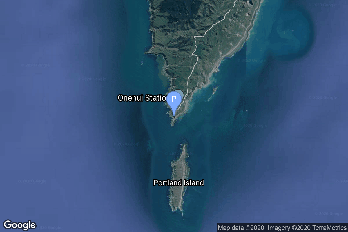
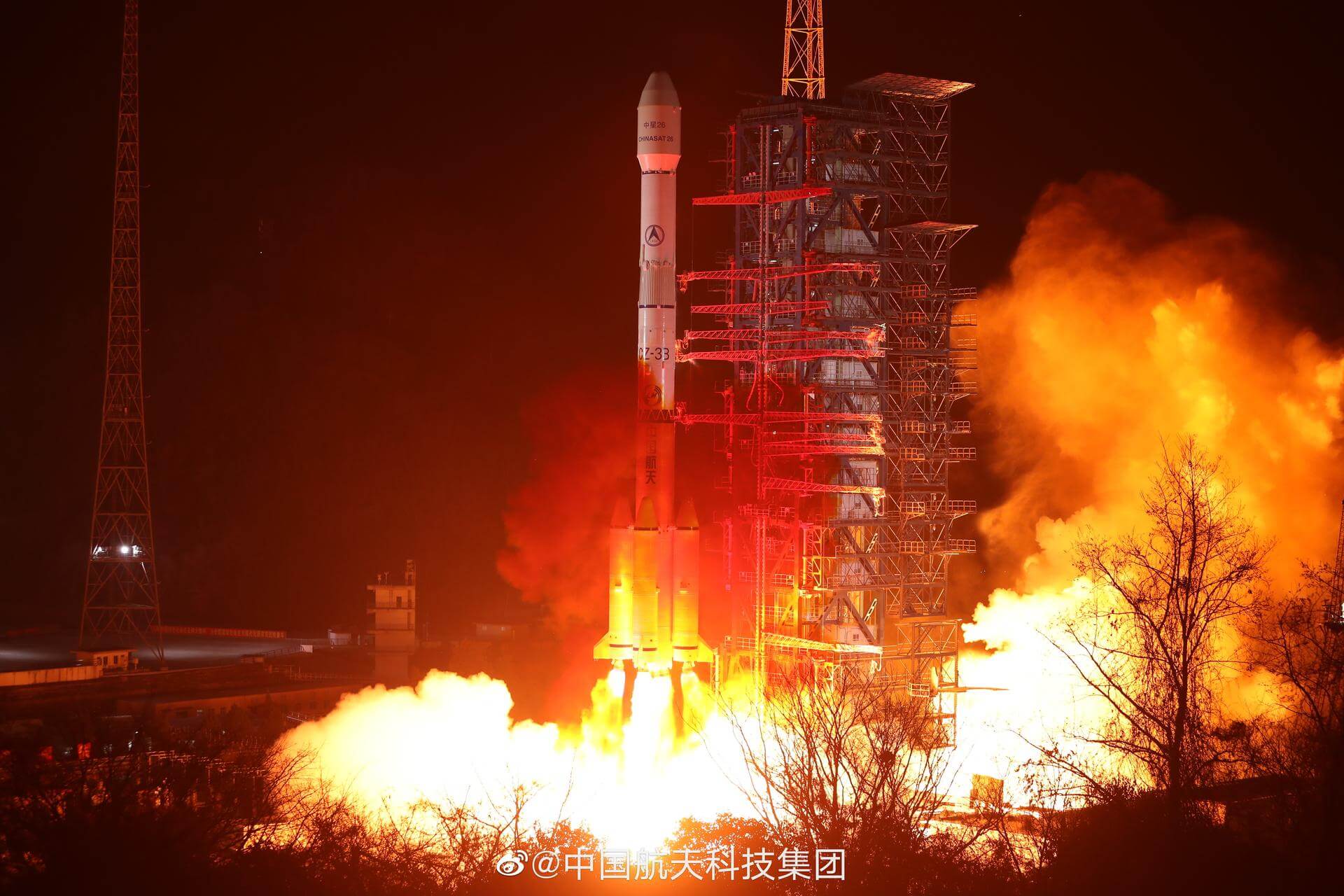
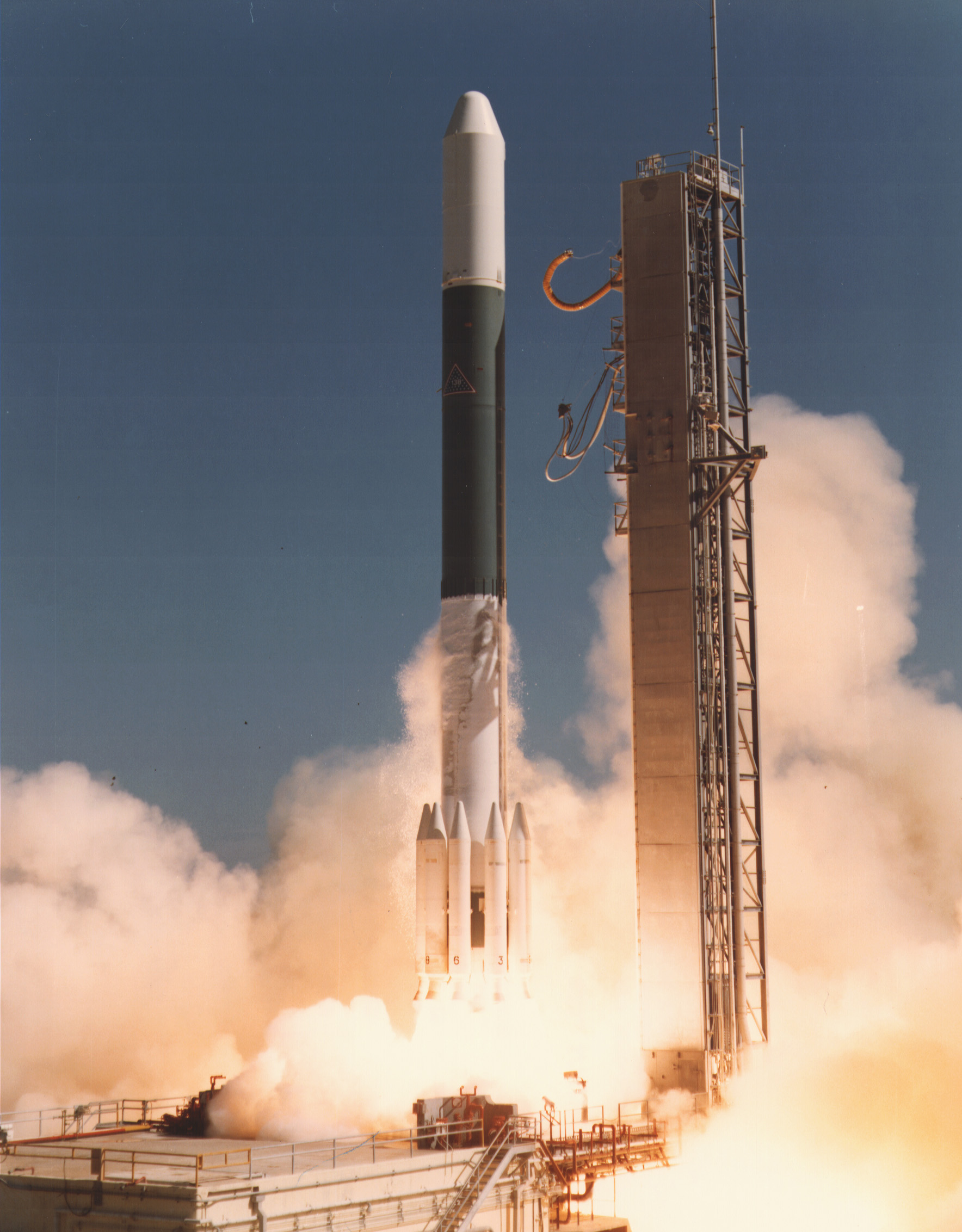
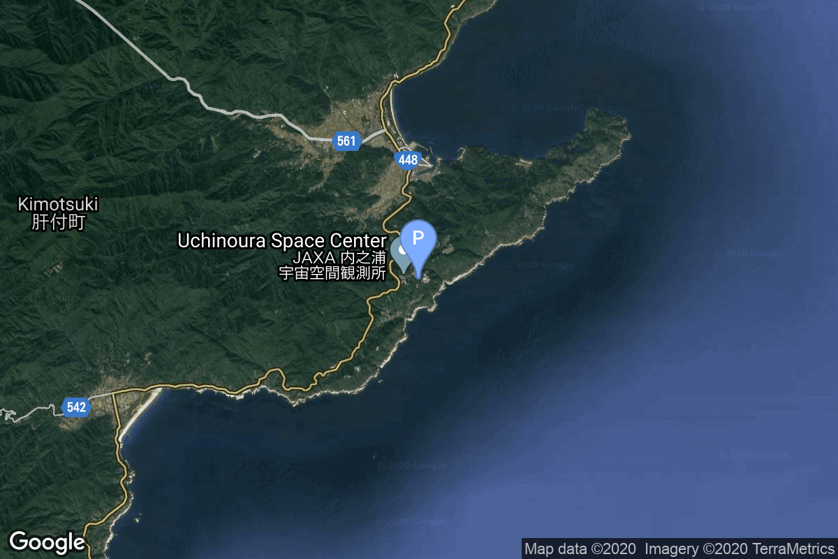
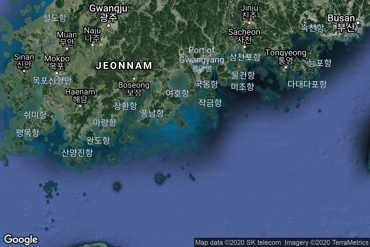
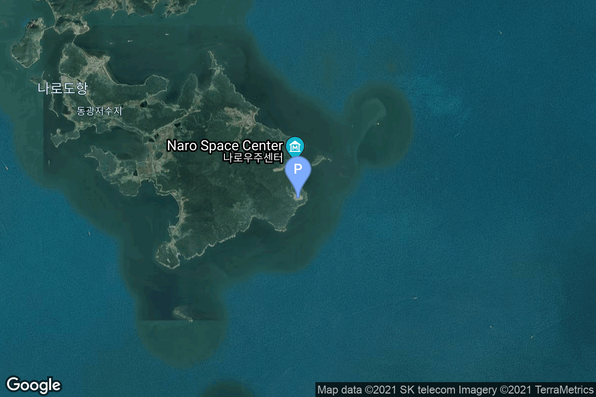
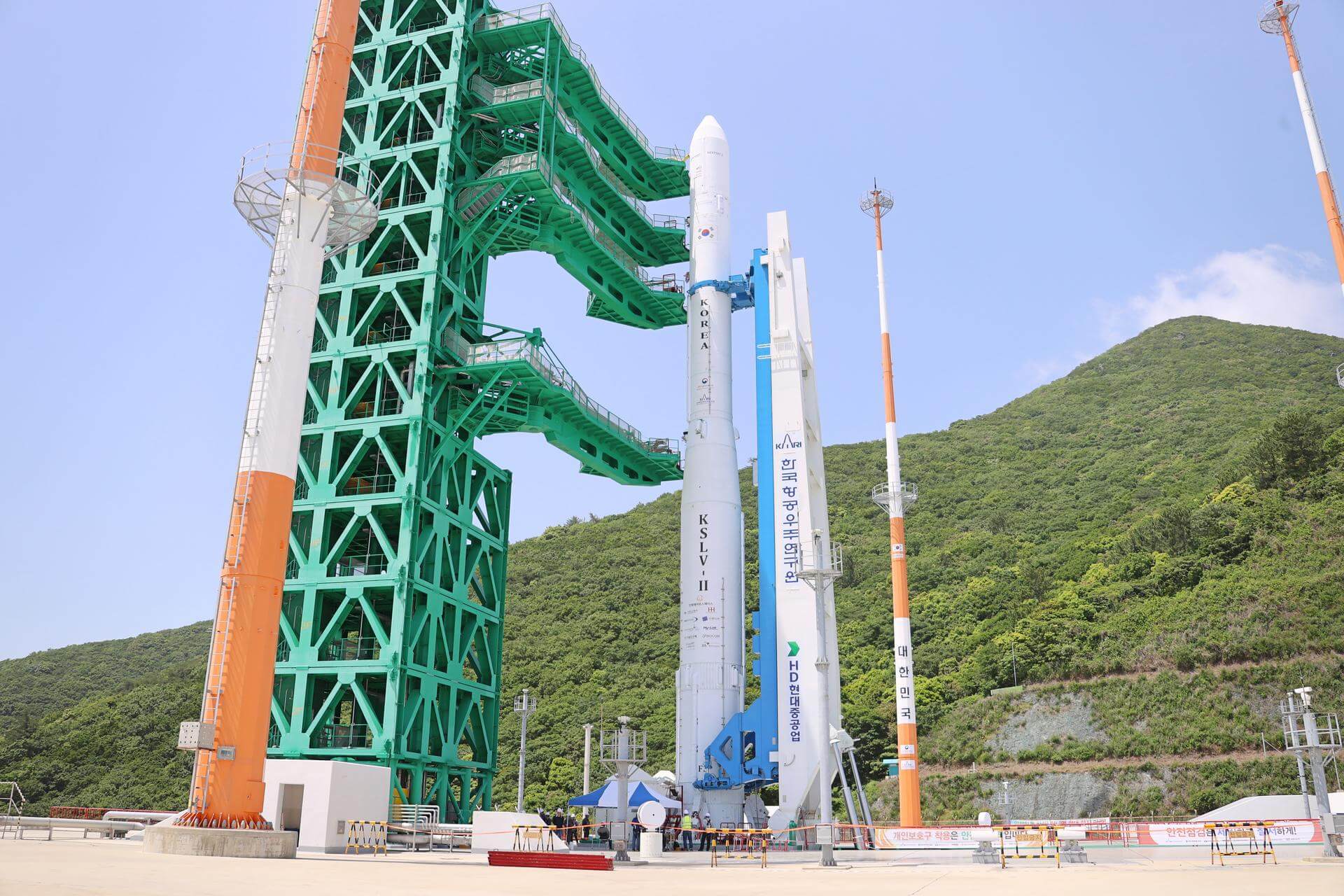
{ "count": 7736, "next": "https://ll.thespacedevs.com/2.0.0/launch/?format=api&limit=10&offset=6800&ordering=-id", "previous": "https://ll.thespacedevs.com/2.0.0/launch/?format=api&limit=10&offset=6780&ordering=-id", "results": [ { "id": "1fae2781-87aa-4a0a-a023-af689a9c5d79", "url": "https://ll.thespacedevs.com/2.0.0/launch/1fae2781-87aa-4a0a-a023-af689a9c5d79/?format=api", "launch_library_id": null, "slug": "electron-kineis-killed-the-radiot-star-kineis-6-10", "name": "Electron | Kinéis Killed the RadIoT Star (Kinéis 6-10)", "status": { "id": 3, "name": "Success" }, "net": "2024-09-20T23:01:00Z", "window_end": "2024-09-20T23:01:00Z", "window_start": "2024-09-20T23:01:00Z", "inhold": false, "tbdtime": false, "tbddate": false, "probability": 70, "holdreason": "", "failreason": "", "hashtag": null, "launch_service_provider": { "id": 147, "url": "https://ll.thespacedevs.com/2.0.0/agencies/147/?format=api", "name": "Rocket Lab", "type": "Commercial" }, "rocket": { "id": 7530, "configuration": { "id": 26, "launch_library_id": 148, "url": "https://ll.thespacedevs.com/2.0.0/config/launcher/26/?format=api", "name": "Electron", "family": "", "full_name": "Electron", "variant": "" } }, "mission": { "id": 5949, "launch_library_id": null, "name": "Kinéis Killed the RadIoT Star (Kinéis 6-10)", "description": "Second batch of five satellites for the French Kinéis IoT constellation designed to operate with 25 nanosatellites of 30 kg each.", "launch_designator": null, "type": "Communications", "orbit": { "id": 17, "name": "Sun-Synchronous Orbit", "abbrev": "SSO" } }, "pad": { "id": 65, "url": "https://ll.thespacedevs.com/2.0.0/pad/65/?format=api", "agency_id": 147, "name": "Rocket Lab Launch Complex 1A", "info_url": null, "wiki_url": "https://en.wikipedia.org/wiki/Rocket_Lab_Launch_Complex_1", "map_url": "https://www.google.com/maps?q=-39.262833,177.864469", "latitude": "-39.262833", "longitude": "177.864469", "location": { "id": 10, "url": "https://ll.thespacedevs.com/2.0.0/location/10/?format=api", "name": "Rocket Lab Launch Complex 1, Mahia Peninsula, New Zealand", "country_code": "NZL", "map_image": "https://thespacedevs-prod.nyc3.digitaloceanspaces.com/media/map_images/location_10_20200803142509.jpg", "total_launch_count": 69, "total_landing_count": 17 }, "map_image": "https://thespacedevs-prod.nyc3.digitaloceanspaces.com/media/map_images/pad_65_20200803143549.jpg", "total_launch_count": 35 }, "webcast_live": false, "image": "https://thespacedevs-prod.nyc3.digitaloceanspaces.com/media/images/electron_image_20190705175640.jpeg", "infographic": null, "program": [] }, { "id": "1fac2df2-b6a8-4e28-a7cd-fa4d6d76987d", "url": "https://ll.thespacedevs.com/2.0.0/launch/1fac2df2-b6a8-4e28-a7cd-fa4d6d76987d/?format=api", "launch_library_id": 731, "slug": "long-march-3be-eutelsat-w3c", "name": "Long March 3B/E | Eutelsat W3C", "status": { "id": 3, "name": "Success" }, "net": "2011-10-07T08:21:04Z", "window_end": "2011-10-07T08:21:04Z", "window_start": "2011-10-07T08:21:04Z", "inhold": false, "tbdtime": false, "tbddate": false, "probability": null, "holdreason": "", "failreason": "", "hashtag": null, "launch_service_provider": { "id": 88, "url": "https://ll.thespacedevs.com/2.0.0/agencies/88/?format=api", "name": "China Aerospace Science and Technology Corporation", "type": "Government" }, "rocket": { "id": 1560, "configuration": { "id": 50, "launch_library_id": 69, "url": "https://ll.thespacedevs.com/2.0.0/config/launcher/50/?format=api", "name": "Long March 3B/E", "family": "Long March", "full_name": "Long March 3B/E", "variant": "B/E" } }, "mission": null, "pad": { "id": 45, "url": "https://ll.thespacedevs.com/2.0.0/pad/45/?format=api", "agency_id": null, "name": "Launch Complex 2 (LC-2)", "info_url": null, "wiki_url": "https://en.wikipedia.org/wiki/Xichang_Satellite_Launch_Center", "map_url": "https://www.google.com/maps?q=28.245564,102.026751", "latitude": "28.245564", "longitude": "102.026751", "location": { "id": 16, "url": "https://ll.thespacedevs.com/2.0.0/location/16/?format=api", "name": "Xichang Satellite Launch Center, People's Republic of China", "country_code": "CHN", "map_image": "https://thespacedevs-prod.nyc3.digitaloceanspaces.com/media/map_images/location_16_20200803142513.jpg", "total_launch_count": 235, "total_landing_count": 0 }, "map_image": "https://thespacedevs-prod.nyc3.digitaloceanspaces.com/media/map_images/pad_45_20200803143520.jpg", "total_launch_count": 122 }, "webcast_live": false, "image": "https://thespacedevs-prod.nyc3.digitaloceanspaces.com/media/images/long2520march_image_20230907120240.jpeg", "infographic": null, "program": [] }, { "id": "1fa9d6c1-309e-4181-85e3-53833b9bc76c", "url": "https://ll.thespacedevs.com/2.0.0/launch/1fa9d6c1-309e-4181-85e3-53833b9bc76c/?format=api", "launch_library_id": null, "slug": "delta-2914-iue", "name": "Delta 2914 | IUE", "status": { "id": 3, "name": "Success" }, "net": "1978-01-26T17:36:00Z", "window_end": "1978-01-26T17:36:00Z", "window_start": "1978-01-26T17:36:00Z", "inhold": false, "tbdtime": false, "tbddate": false, "probability": null, "holdreason": "", "failreason": null, "hashtag": null, "launch_service_provider": { "id": 161, "url": "https://ll.thespacedevs.com/2.0.0/agencies/161/?format=api", "name": "United States Air Force", "type": "Government" }, "rocket": { "id": 4925, "configuration": { "id": 287, "launch_library_id": null, "url": "https://ll.thespacedevs.com/2.0.0/config/launcher/287/?format=api", "name": "Delta 2914", "family": "Delta", "full_name": "Delta 2914", "variant": "2914" } }, "mission": { "id": 3341, "launch_library_id": null, "name": "IUE", "description": "UV astronomical obsrvatory used as an international facility", "launch_designator": null, "type": "Astrophysics", "orbit": { "id": 12, "name": "Medium Earth Orbit", "abbrev": "MEO" } }, "pad": { "id": 14, "url": "https://ll.thespacedevs.com/2.0.0/pad/14/?format=api", "agency_id": null, "name": "Space Launch Complex 17A", "info_url": null, "wiki_url": "https://en.wikipedia.org/wiki/Cape_Canaveral_Space_Launch_Complex_17", "map_url": "https://www.google.com/maps?q=28.4472,-80.565", "latitude": "28.4472", "longitude": "-80.565", "location": { "id": 12, "url": "https://ll.thespacedevs.com/2.0.0/location/12/?format=api", "name": "Cape Canaveral SFS, FL, USA", "country_code": "USA", "map_image": "https://thespacedevs-prod.nyc3.digitaloceanspaces.com/media/map_images/location_12_20200803142519.jpg", "total_launch_count": 1076, "total_landing_count": 70 }, "map_image": "https://thespacedevs-prod.nyc3.digitaloceanspaces.com/media/map_images/pad_14_20200803143451.jpg", "total_launch_count": 145 }, "webcast_live": false, "image": "https://thespacedevs-prod.nyc3.digitaloceanspaces.com/media/images/delta_2910_image_20231231105214.jpeg", "infographic": null, "program": [] }, { "id": "1fa6e219-a2cc-414c-b323-4b20fa7e874f", "url": "https://ll.thespacedevs.com/2.0.0/launch/1fa6e219-a2cc-414c-b323-4b20fa7e874f/?format=api", "launch_library_id": null, "slug": "kinetica-1-7-satellites", "name": "Kinetica 1 | 7 satellites", "status": { "id": 3, "name": "Success" }, "net": "2025-08-19T07:33:00Z", "window_end": "2025-08-19T07:51:00Z", "window_start": "2025-08-19T07:25:00Z", "inhold": false, "tbdtime": false, "tbddate": false, "probability": null, "holdreason": "", "failreason": "", "hashtag": null, "launch_service_provider": { "id": 1040, "url": "https://ll.thespacedevs.com/2.0.0/agencies/1040/?format=api", "name": "CAS Space", "type": "Commercial" }, "rocket": { "id": 8680, "configuration": { "id": 483, "launch_library_id": null, "url": "https://ll.thespacedevs.com/2.0.0/config/launcher/483/?format=api", "name": "Kinetica 1", "family": "", "full_name": "Kinetica 1", "variant": "" } }, "mission": { "id": 7272, "launch_library_id": null, "name": "7 satellites", "description": "A share ride mission of 7 various Earth observation and technological demonstration satellites:\r\n\r\n* AIRSAT-05/Haishao-2\r\n* Tianyan 26\r\n* Duogongneng Shiyan-2 01-03\r\n* ThumbSat-1/2 (Mexico)", "launch_designator": null, "type": "Technology", "orbit": { "id": 17, "name": "Sun-Synchronous Orbit", "abbrev": "SSO" } }, "pad": { "id": 151, "url": "https://ll.thespacedevs.com/2.0.0/pad/151/?format=api", "agency_id": null, "name": "Launch Area 130", "info_url": null, "wiki_url": "https://en.wikipedia.org/wiki/Jiuquan_Satellite_Launch_Center", "map_url": "https://www.google.com/maps?q=40.8182,100.22514", "latitude": "40.8182", "longitude": "100.22514", "location": { "id": 17, "url": "https://ll.thespacedevs.com/2.0.0/location/17/?format=api", "name": "Jiuquan Satellite Launch Center, People's Republic of China", "country_code": "CHN", "map_image": "https://thespacedevs-prod.nyc3.digitaloceanspaces.com/media/map_images/location_17_20200803142429.jpg", "total_launch_count": 271, "total_landing_count": 1 }, "map_image": "https://thespacedevs-prod.nyc3.digitaloceanspaces.com/media/map_images/pad_151_20200803143425.jpg", "total_launch_count": 11 }, "webcast_live": false, "image": "https://thespacedevs-prod.nyc3.digitaloceanspaces.com/media/images/zhongke-1a_image_20220912002218.png", "infographic": null, "program": [] }, { "id": "1fa3741c-3339-4954-a026-2cd9d36161c0", "url": "https://ll.thespacedevs.com/2.0.0/launch/1fa3741c-3339-4954-a026-2cd9d36161c0/?format=api", "launch_library_id": null, "slug": "falcon-9-block-5-rivada-7", "name": "Falcon 9 Block 5 | Rivada 7", "status": { "id": 2, "name": "TBD" }, "net": "2026-06-30T00:00:00Z", "window_end": "2026-06-30T00:00:00Z", "window_start": "2026-06-30T00:00:00Z", "inhold": false, "tbdtime": true, "tbddate": true, "probability": null, "holdreason": "", "failreason": "", "hashtag": null, "launch_service_provider": { "id": 121, "url": "https://ll.thespacedevs.com/2.0.0/agencies/121/?format=api", "name": "SpaceX", "type": "Commercial" }, "rocket": { "id": 7805, "configuration": { "id": 164, "launch_library_id": 188, "url": "https://ll.thespacedevs.com/2.0.0/config/launcher/164/?format=api", "name": "Falcon 9", "family": "Falcon", "full_name": "Falcon 9 Block 5", "variant": "Block 5" } }, "mission": { "id": 6573, "launch_library_id": null, "name": "Rivada 7", "description": "24 satellites for Rivada's internet constellation.", "launch_designator": null, "type": "Communications", "orbit": { "id": 13, "name": "Polar Orbit", "abbrev": "PO" } }, "pad": { "id": 16, "url": "https://ll.thespacedevs.com/2.0.0/pad/16/?format=api", "agency_id": null, "name": "Space Launch Complex 4E", "info_url": null, "wiki_url": "https://en.wikipedia.org/wiki/Vandenberg_Space_Launch_Complex_4#SLC-4E", "map_url": "https://www.google.com/maps?q=34.632,-120.611", "latitude": "34.632", "longitude": "-120.611", "location": { "id": 11, "url": "https://ll.thespacedevs.com/2.0.0/location/11/?format=api", "name": "Vandenberg SFB, CA, USA", "country_code": "USA", "map_image": "https://thespacedevs-prod.nyc3.digitaloceanspaces.com/media/map_images/location_11_20200803142416.jpg", "total_launch_count": 852, "total_landing_count": 30 }, "map_image": "https://thespacedevs-prod.nyc3.digitaloceanspaces.com/media/map_images/pad_16_20200803143532.jpg", "total_launch_count": 238 }, "webcast_live": false, "image": "https://thespacedevs-prod.nyc3.digitaloceanspaces.com/media/images/falcon_9_image_20230807133459.jpeg", "infographic": null, "program": [] }, { "id": "1f9d512f-8222-4058-8444-13237d15dbde", "url": "https://ll.thespacedevs.com/2.0.0/launch/1f9d512f-8222-4058-8444-13237d15dbde/?format=api", "launch_library_id": null, "slug": "pslv-kalpana-1", "name": "PSLV | KALPANA-1", "status": { "id": 3, "name": "Success" }, "net": "2002-09-12T10:23:40Z", "window_end": "2002-09-12T10:23:40Z", "window_start": "2002-09-12T10:23:40Z", "inhold": false, "tbdtime": false, "tbddate": false, "probability": null, "holdreason": "", "failreason": null, "hashtag": null, "launch_service_provider": { "id": 31, "url": "https://ll.thespacedevs.com/2.0.0/agencies/31/?format=api", "name": "Indian Space Research Organization", "type": "Government" }, "rocket": { "id": 7103, "configuration": { "id": 7, "launch_library_id": 14, "url": "https://ll.thespacedevs.com/2.0.0/config/launcher/7/?format=api", "name": "PSLV", "family": "PSLV", "full_name": "PSLV", "variant": "" } }, "mission": { "id": 5492, "launch_library_id": null, "name": "KALPANA-1", "description": "Kalpana-1 was the first dedicated meteorological satellite launched by Indian Space Research Organisation using Polar Satellite Launch Vehicle on 12 September 2002. The satellite is three-axis stabilized and is powered by solar panels, getting up to 550 watts (0.74 hp) of power. The METSAT bus was used as the basis for the Chandrayaan lunar orbiter mission of 2008.", "launch_designator": null, "type": "Earth Science", "orbit": { "id": 1, "name": "Geostationary Orbit", "abbrev": "Direct-GEO" } }, "pad": { "id": 50, "url": "https://ll.thespacedevs.com/2.0.0/pad/50/?format=api", "agency_id": 31, "name": "Satish Dhawan Space Centre First Launch Pad", "info_url": null, "wiki_url": "https://en.wikipedia.org/wiki/Satish_Dhawan_Space_Centre_First_Launch_Pad", "map_url": "https://www.google.com/maps?q=13.733,80.235", "latitude": "13.733", "longitude": "80.235", "location": { "id": 14, "url": "https://ll.thespacedevs.com/2.0.0/location/14/?format=api", "name": "Satish Dhawan Space Centre, India", "country_code": "IND", "map_image": "https://thespacedevs-prod.nyc3.digitaloceanspaces.com/media/map_images/location_14_20200803142403.jpg", "total_launch_count": 101, "total_landing_count": 0 }, "map_image": "https://thespacedevs-prod.nyc3.digitaloceanspaces.com/media/map_images/pad_50_20200803143457.jpg", "total_launch_count": 62 }, "webcast_live": false, "image": "https://thespacedevs-prod.nyc3.digitaloceanspaces.com/media/images/pslv_image_20190508083736.jpeg", "infographic": null, "program": [] }, { "id": "1f9b76fc-41c4-418a-9ee3-ec5e882f012b", "url": "https://ll.thespacedevs.com/2.0.0/launch/1f9b76fc-41c4-418a-9ee3-ec5e882f012b/?format=api", "launch_library_id": null, "slug": "soyuz-u-yantar-4k2-40", "name": "Soyuz U | Yantar-4K2 40", "status": { "id": 3, "name": "Success" }, "net": "1988-08-16T13:00:00Z", "window_end": "1988-08-16T13:00:00Z", "window_start": "1988-08-16T13:00:00Z", "inhold": false, "tbdtime": false, "tbddate": false, "probability": null, "holdreason": "", "failreason": null, "hashtag": null, "launch_service_provider": { "id": 66, "url": "https://ll.thespacedevs.com/2.0.0/agencies/66/?format=api", "name": "Soviet Space Program", "type": "Government" }, "rocket": { "id": 6098, "configuration": { "id": 37, "launch_library_id": 35, "url": "https://ll.thespacedevs.com/2.0.0/config/launcher/37/?format=api", "name": "Soyuz U", "family": "Soyuz", "full_name": "Soyuz U", "variant": "" } }, "mission": { "id": 4488, "launch_library_id": null, "name": "Yantar-4K2 40", "description": "Film-return reconnaissance satellite", "launch_designator": null, "type": "Government/Top Secret", "orbit": { "id": 8, "name": "Low Earth Orbit", "abbrev": "LEO" } }, "pad": { "id": 32, "url": "https://ll.thespacedevs.com/2.0.0/pad/32/?format=api", "agency_id": null, "name": "1/5", "info_url": null, "wiki_url": "", "map_url": "https://www.google.com/maps?q=45.92,63.342", "latitude": "45.92", "longitude": "63.342", "location": { "id": 15, "url": "https://ll.thespacedevs.com/2.0.0/location/15/?format=api", "name": "Baikonur Cosmodrome, Republic of Kazakhstan", "country_code": "KAZ", "map_image": "https://thespacedevs-prod.nyc3.digitaloceanspaces.com/media/map_images/location_15_20200803142517.jpg", "total_launch_count": 1559, "total_landing_count": 0 }, "map_image": "https://thespacedevs-prod.nyc3.digitaloceanspaces.com/media/map_images/pad_32_20200803143513.jpg", "total_launch_count": 487 }, "webcast_live": false, "image": "https://thespacedevs-prod.nyc3.digitaloceanspaces.com/media/images/soyuz2520u_image_20190222031023.jpeg", "infographic": null, "program": [] }, { "id": "1f869b6f-13b7-4efa-ab48-cb25b3a3f65e", "url": "https://ll.thespacedevs.com/2.0.0/launch/1f869b6f-13b7-4efa-ab48-cb25b3a3f65e/?format=api", "launch_library_id": null, "slug": "blue-scout-jr-oar-22-5", "name": "Blue Scout Jr | OAR 22-5", "status": { "id": 3, "name": "Success" }, "net": "1965-06-09T16:26:15Z", "window_end": "1965-06-09T16:26:15Z", "window_start": "1965-06-09T16:26:15Z", "inhold": false, "tbdtime": false, "tbddate": false, "probability": null, "holdreason": "", "failreason": null, "hashtag": null, "launch_service_provider": { "id": 161, "url": "https://ll.thespacedevs.com/2.0.0/agencies/161/?format=api", "name": "United States Air Force", "type": "Government" }, "rocket": { "id": 3404, "configuration": { "id": 265, "launch_library_id": null, "url": "https://ll.thespacedevs.com/2.0.0/config/launcher/265/?format=api", "name": "Blue Scout Jr", "family": "Blue Scout", "full_name": "Blue Scout Jr", "variant": "Jr" } }, "mission": { "id": 1824, "launch_library_id": null, "name": "OAR 22-5", "description": "Mission to study the magnetosphere", "launch_designator": null, "type": "Earth Science", "orbit": { "id": 15, "name": "Suborbital", "abbrev": "Sub" } }, "pad": { "id": 118, "url": "https://ll.thespacedevs.com/2.0.0/pad/118/?format=api", "agency_id": 166, "name": "Launch Complex 18A", "info_url": null, "wiki_url": "https://en.wikipedia.org/wiki/Cape_Canaveral_Launch_Complex_18", "map_url": "https://www.google.com/maps?q=28.4493,-80.564494", "latitude": "28.4493", "longitude": "-80.564494", "location": { "id": 12, "url": "https://ll.thespacedevs.com/2.0.0/location/12/?format=api", "name": "Cape Canaveral SFS, FL, USA", "country_code": "USA", "map_image": "https://thespacedevs-prod.nyc3.digitaloceanspaces.com/media/map_images/location_12_20200803142519.jpg", "total_launch_count": 1076, "total_landing_count": 70 }, "map_image": "https://thespacedevs-prod.nyc3.digitaloceanspaces.com/media/map_images/pad_118_20200803143338.jpg", "total_launch_count": 18 }, "webcast_live": false, "image": "https://thespacedevs-prod.nyc3.digitaloceanspaces.com/media/images/blue_scout_juni_image_20240411084702.png", "infographic": null, "program": [] }, { "id": "1f8005cf-c667-476b-96a9-cdd18057508c", "url": "https://ll.thespacedevs.com/2.0.0/launch/1f8005cf-c667-476b-96a9-cdd18057508c/?format=api", "launch_library_id": null, "slug": "voskhod-zenit-4mk-41", "name": "Voskhod | Zenit-4MK 41", "status": { "id": 3, "name": "Success" }, "net": "1975-04-24T08:04:59Z", "window_end": "1975-04-24T08:04:59Z", "window_start": "1975-04-24T08:04:59Z", "inhold": false, "tbdtime": false, "tbddate": false, "probability": null, "holdreason": "", "failreason": null, "hashtag": null, "launch_service_provider": { "id": 66, "url": "https://ll.thespacedevs.com/2.0.0/agencies/66/?format=api", "name": "Soviet Space Program", "type": "Government" }, "rocket": { "id": 4576, "configuration": { "id": 104, "launch_library_id": 138, "url": "https://ll.thespacedevs.com/2.0.0/config/launcher/104/?format=api", "name": "Voskhod", "family": "R-7", "full_name": "Voskhod", "variant": "Voskhod" } }, "mission": { "id": 2994, "launch_library_id": null, "name": "Zenit-4MK 41", "description": "High resolution optical reconnaissance satellite of the Vostok-based Zenit family.", "launch_designator": null, "type": "Government/Top Secret", "orbit": { "id": 8, "name": "Low Earth Orbit", "abbrev": "LEO" } }, "pad": { "id": 36, "url": "https://ll.thespacedevs.com/2.0.0/pad/36/?format=api", "agency_id": 163, "name": "43/3 (43L)", "info_url": null, "wiki_url": null, "map_url": "https://www.google.com/maps?q=62.9273,40.45", "latitude": "62.9273", "longitude": "40.45", "location": { "id": 6, "url": "https://ll.thespacedevs.com/2.0.0/location/6/?format=api", "name": "Plesetsk Cosmodrome, Russian Federation", "country_code": "RUS", "map_image": "https://thespacedevs-prod.nyc3.digitaloceanspaces.com/media/map_images/location_6_20200803142434.jpg", "total_launch_count": 1679, "total_landing_count": 0 }, "map_image": "https://thespacedevs-prod.nyc3.digitaloceanspaces.com/media/map_images/pad_36_20200803143534.jpg", "total_launch_count": 231 }, "webcast_live": false, "image": "https://thespacedevs-prod.nyc3.digitaloceanspaces.com/media/images/voskhod_during__image_20251102062248.jpg", "infographic": null, "program": [] }, { "id": "1f79ce8e-dabc-4287-bb59-2a40f567c4e4", "url": "https://ll.thespacedevs.com/2.0.0/launch/1f79ce8e-dabc-4287-bb59-2a40f567c4e4/?format=api", "launch_library_id": null, "slug": "nuri-flight-test", "name": "Nuri | Flight Test", "status": { "id": 4, "name": "Failure" }, "net": "2021-10-21T08:00:00Z", "window_end": "2021-10-21T10:20:00Z", "window_start": "2021-10-21T06:05:00Z", "inhold": false, "tbdtime": false, "tbddate": false, "probability": null, "holdreason": "", "failreason": "Third stage failed to place the payload simulator into orbit, for unknown reason.", "hashtag": null, "launch_service_provider": { "id": 41, "url": "https://ll.thespacedevs.com/2.0.0/agencies/41/?format=api", "name": "Korea Aerospace Research Institute", "type": "Government" }, "rocket": { "id": 2994, "configuration": { "id": 117, "launch_library_id": 169, "url": "https://ll.thespacedevs.com/2.0.0/config/launcher/117/?format=api", "name": "Nuri", "family": "KSLV", "full_name": "KSLV-2 Nuri", "variant": "2" } }, "mission": { "id": 1419, "launch_library_id": null, "name": "Flight Test", "description": "Maiden flight of the KSLV-II \"Nuri\" launch vehicle, carrying a dummy Payload of 1500 kg to sun-synchronous orbit.", "launch_designator": null, "type": "Test Flight", "orbit": { "id": 17, "name": "Sun-Synchronous Orbit", "abbrev": "SSO" } }, "pad": { "id": 192, "url": "https://ll.thespacedevs.com/2.0.0/pad/192/?format=api", "agency_id": 41, "name": "LC-2", "info_url": null, "wiki_url": "https://en.wikipedia.org/wiki/Naro_Space_Center", "map_url": "https://www.google.com/maps?q=34.431867,127.535069", "latitude": "34.431867", "longitude": "127.535069", "location": { "id": 9, "url": "https://ll.thespacedevs.com/2.0.0/location/9/?format=api", "name": "Naro Space Center, South Korea", "country_code": "KOR", "map_image": "https://thespacedevs-prod.nyc3.digitaloceanspaces.com/media/map_images/location_9_20200803142441.jpg", "total_launch_count": 8, "total_landing_count": 0 }, "map_image": "https://thespacedevs-prod.nyc3.digitaloceanspaces.com/media/map_images/pad_lc-2_20210812070305.jpg", "total_launch_count": 5 }, "webcast_live": false, "image": "https://thespacedevs-prod.nyc3.digitaloceanspaces.com/media/images/nuri_on_the_lau_image_20240307163812.jpeg", "infographic": null, "program": [] } ] }