Launch List
API endpoint that returns all Launch objects or a single launch.
EXAMPLE - /launch/
GET: Return a list of all Launch objects.
FILTERS: Fields - 'name', 'id(s)', 'lsp_id', 'lsp_name', 'serial_number', 'launcher_config__id', 'rocket__spacecraftflight__spacecraft__name'
MODE: 'normal', 'list', 'detailed' EXAMPLE: ?mode=list
SEARCH: Searches through the launch name, rocket name, launch agency, mission name & spacecraft name. EXAMPLE - ?search=SpaceX
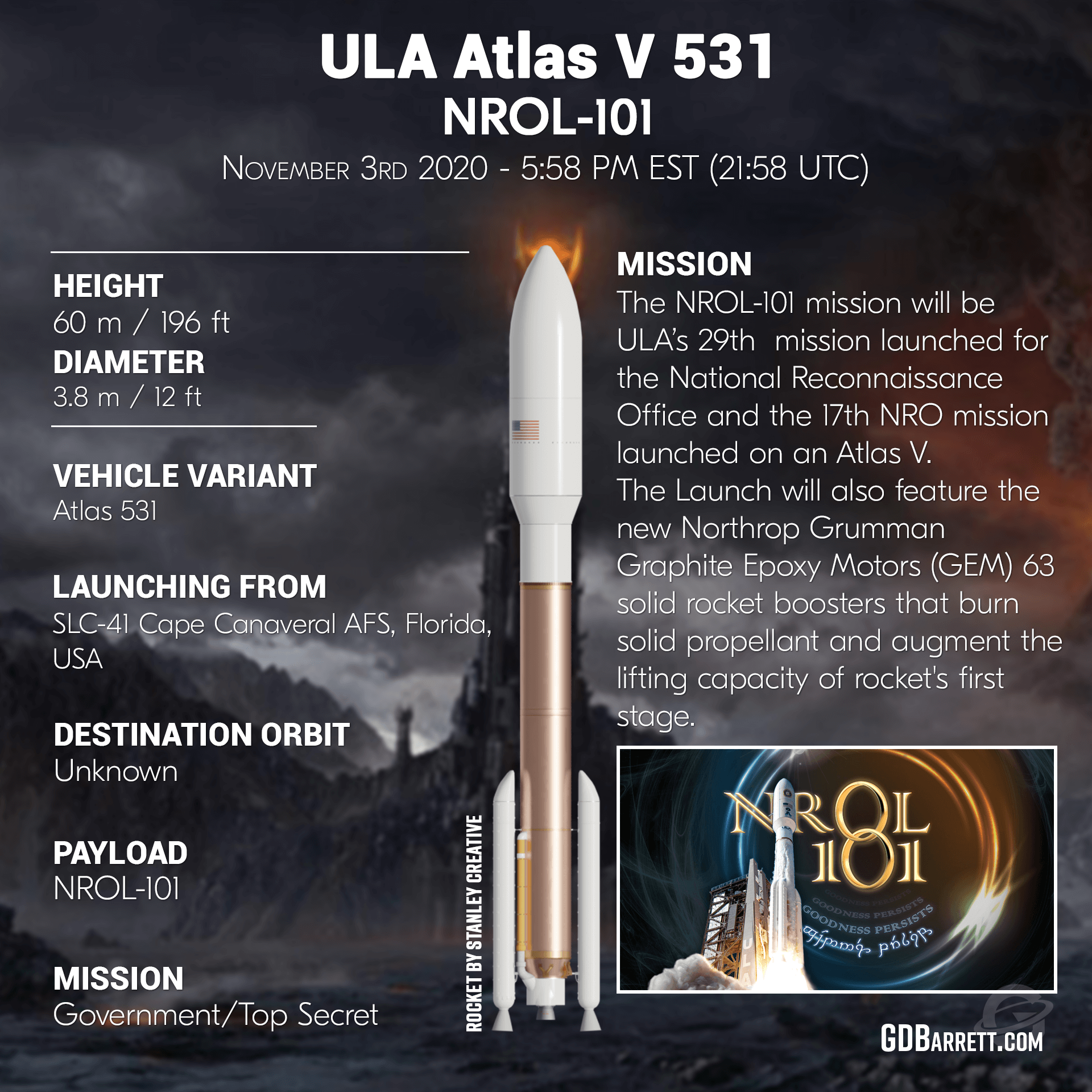
GET /2.0.0/launch/?format=api&offset=6750&ordering=-name
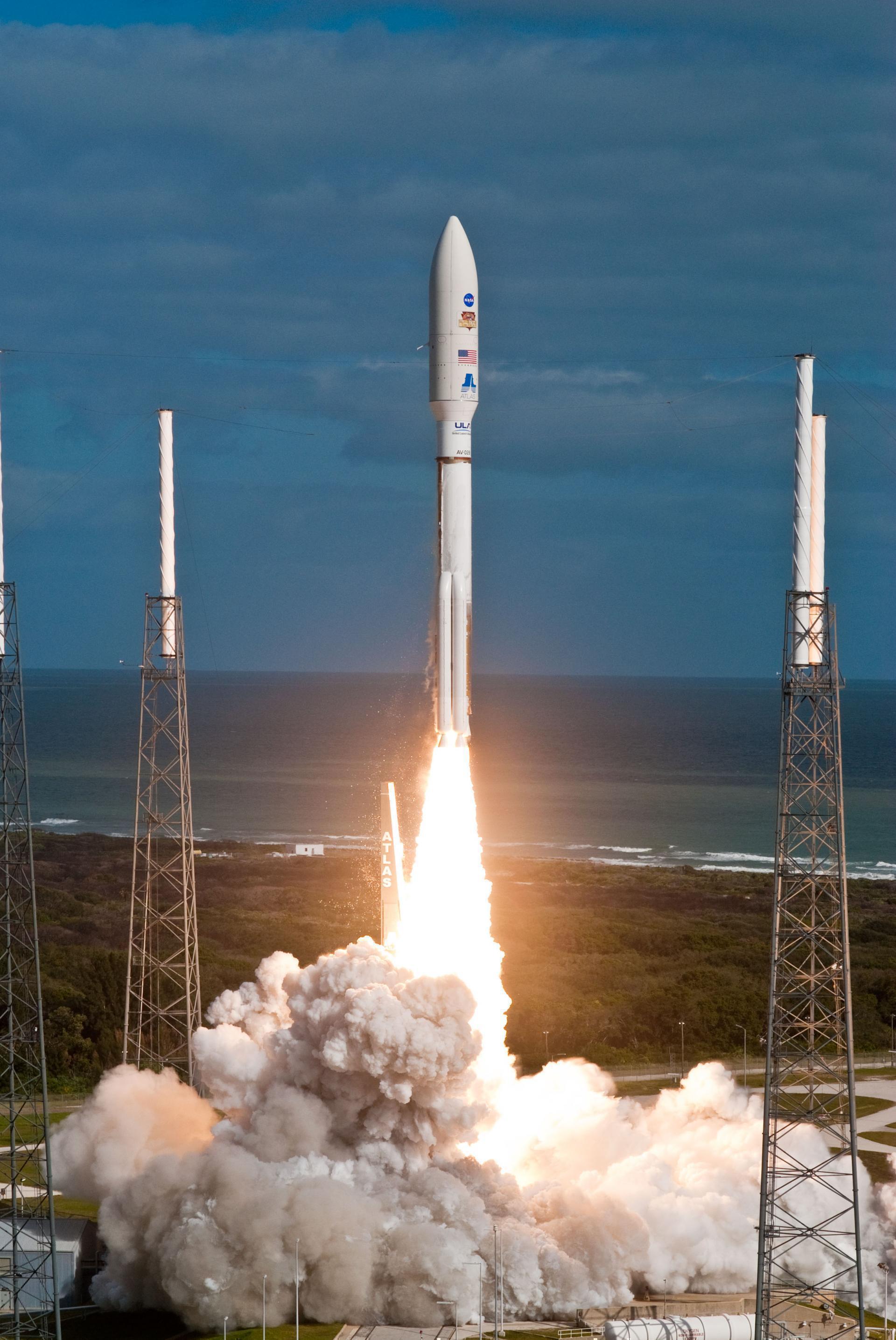
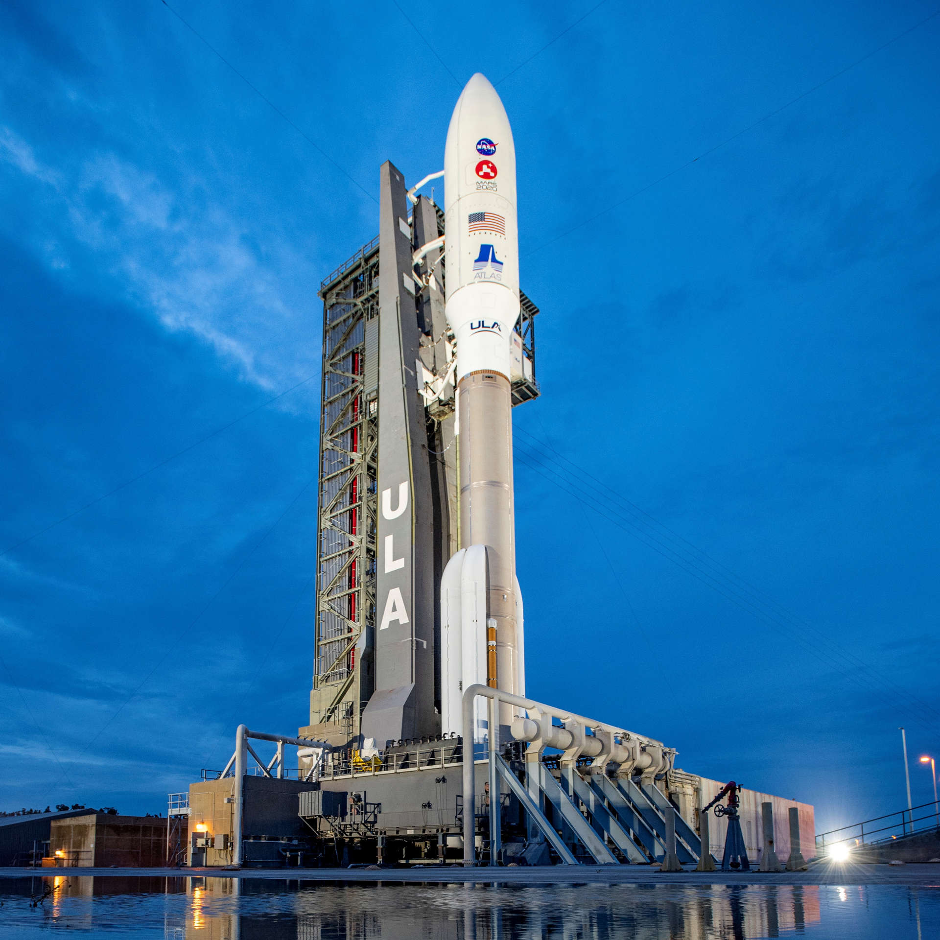
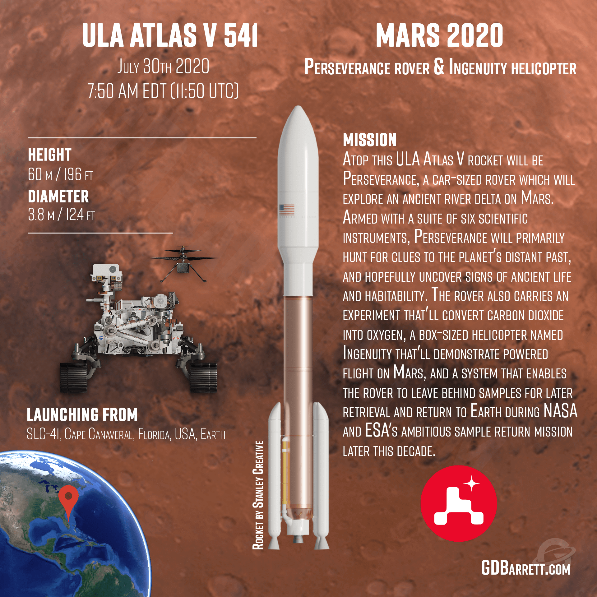
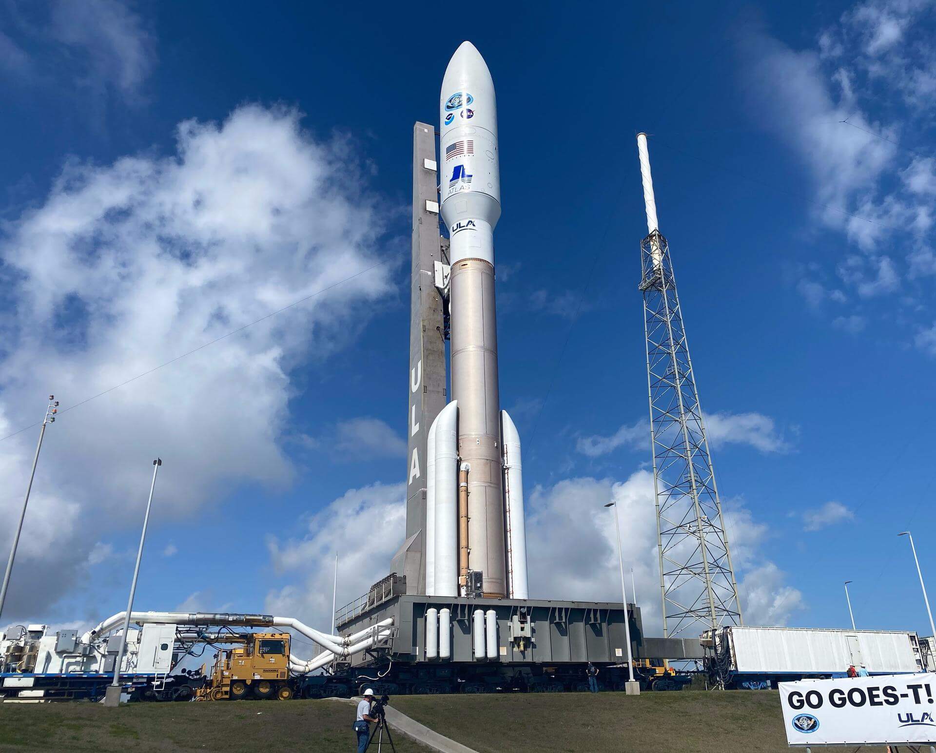
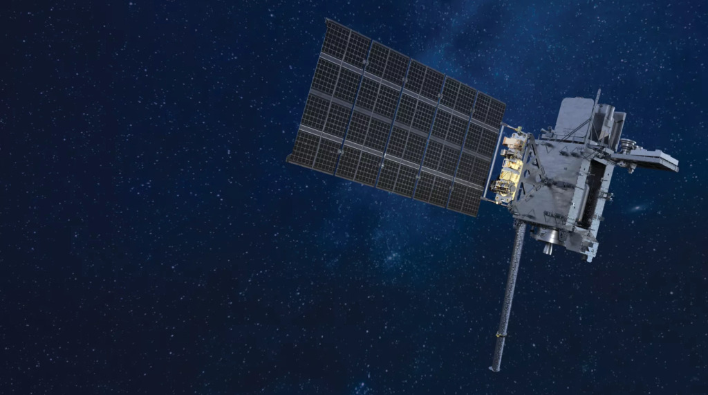
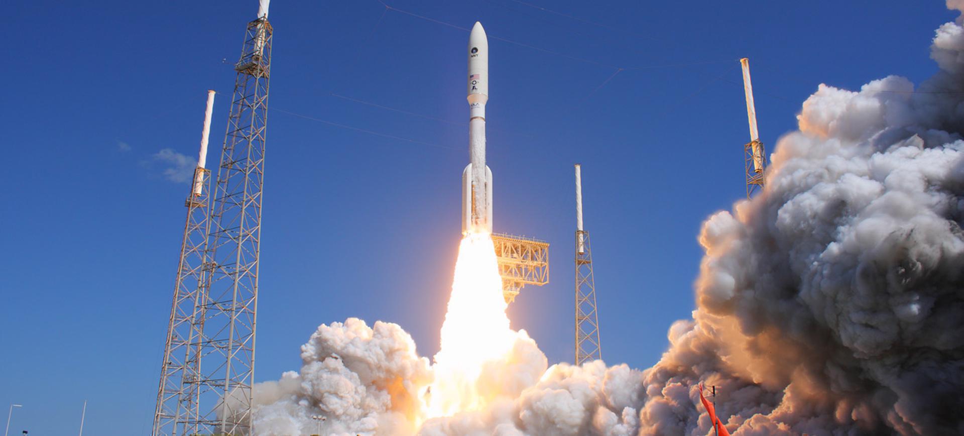
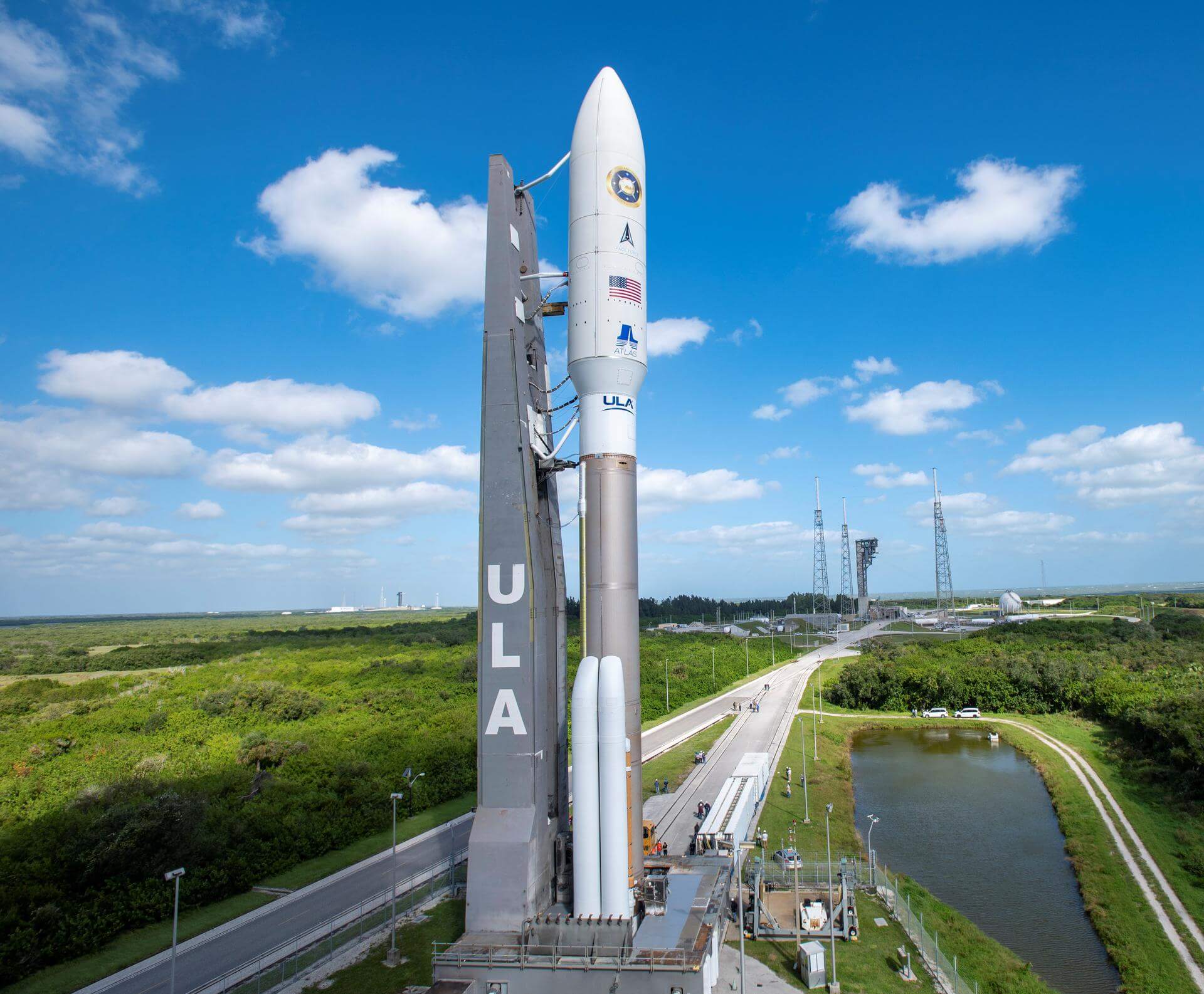
{ "count": 7503, "next": "https://ll.thespacedevs.com/2.0.0/launch/?format=api&limit=10&offset=6760&ordering=-name", "previous": "https://ll.thespacedevs.com/2.0.0/launch/?format=api&limit=10&offset=6740&ordering=-name", "results": [ { "id": "df8d4fdb-9add-4ce9-9f0e-aae1c61df212", "url": "https://ll.thespacedevs.com/2.0.0/launch/df8d4fdb-9add-4ce9-9f0e-aae1c61df212/?format=api", "launch_library_id": 744, "slug": "atlas-v-541-msl-curiosity", "name": "Atlas V 541 | MSL (Curiosity)", "status": { "id": 3, "name": "Success" }, "net": "2011-11-26T15:02:00Z", "window_end": "2011-11-26T15:02:00Z", "window_start": "2011-11-26T15:02:00Z", "inhold": false, "tbdtime": false, "tbddate": false, "probability": null, "holdreason": "", "failreason": "", "hashtag": null, "launch_service_provider": { "id": 124, "url": "https://ll.thespacedevs.com/2.0.0/agencies/124/?format=api", "name": "United Launch Alliance", "type": "Commercial" }, "rocket": { "id": 1569, "configuration": { "id": 1, "launch_library_id": 2, "url": "https://ll.thespacedevs.com/2.0.0/config/launcher/1/?format=api", "name": "Atlas V 541", "family": "Atlas", "full_name": "Atlas V 541", "variant": "541" } }, "mission": { "id": 6649, "launch_library_id": null, "name": "MSL (Curiosity)", "description": "The Mars Science Laboratory (MSL) mission, featuring the renowned Curiosity rover, was designed to assess the planet's past and present habitability. Equipped with an array of advanced scientific instruments, including a drill and a sample analysis unit, Curiosity explored the Gale Crater, a site believed to contain evidence of ancient Martian environments. It delivered groundbreaking discoveries, including the detection of organic molecules and the confirmation of an ancient, potentially habitable lake bed.", "launch_designator": null, "type": "Robotic Exploration", "orbit": { "id": 19, "name": "Mars Orbit", "abbrev": "Mars" } }, "pad": { "id": 29, "url": "https://ll.thespacedevs.com/2.0.0/pad/29/?format=api", "agency_id": null, "name": "Space Launch Complex 41", "info_url": null, "wiki_url": "https://en.wikipedia.org/wiki/Cape_Canaveral_Air_Force_Station_Space_Launch_Complex_41", "map_url": "https://www.google.com/maps?q=28.58341025,-80.58303644", "latitude": "28.58341025", "longitude": "-80.58303644", "location": { "id": 12, "url": "https://ll.thespacedevs.com/2.0.0/location/12/?format=api", "name": "Cape Canaveral SFS, FL, USA", "country_code": "USA", "map_image": "https://thespacedevs-prod.nyc3.digitaloceanspaces.com/media/map_images/location_12_20200803142519.jpg", "total_launch_count": 1023, "total_landing_count": 64 }, "map_image": "https://thespacedevs-prod.nyc3.digitaloceanspaces.com/media/map_images/pad_29_20200803143528.jpg", "total_launch_count": 115 }, "webcast_live": false, "image": "https://thespacedevs-prod.nyc3.digitaloceanspaces.com/media/images/atlas2520v2520541_image_20190224012314.jpeg", "infographic": null, "program": [ { "id": 36, "url": "https://ll.thespacedevs.com/2.0.0/program/36/?format=api", "name": "NASA Large Strategic Science Missions", "description": "NASA's large strategic science missions or large strategic missions, formerly known as Flagship missions or Flagship-class missions, are the costliest and most capable NASA science spacecraft. Flagship missions exist within all four divisions of NASA's Science Mission Directorate (SMD): the astrophysics, Earth science, heliophysics and planetary science divisions.", "agencies": [ { "id": 44, "url": "https://ll.thespacedevs.com/2.0.0/agencies/44/?format=api", "name": "National Aeronautics and Space Administration", "type": "Government" } ], "image_url": "https://thespacedevs-prod.nyc3.digitaloceanspaces.com/media/images/nasa2520large_program_20240205122003.jpeg", "start_date": "1975-08-22T00:00:00Z", "end_date": null, "info_url": null, "wiki_url": "https://en.wikipedia.org/wiki/Large_strategic_science_missions" } ] }, { "id": "c4db6995-f25f-4608-8eb9-ce95d5226af2", "url": "https://ll.thespacedevs.com/2.0.0/launch/c4db6995-f25f-4608-8eb9-ce95d5226af2/?format=api", "launch_library_id": 1081, "slug": "atlas-v-541-mars-2020-perseverance-rover-ingenuity", "name": "Atlas V 541 | Mars 2020 (Perseverance rover & Ingenuity helicopter)", "status": { "id": 3, "name": "Success" }, "net": "2020-07-30T11:50:00Z", "window_end": "2020-07-30T13:50:00Z", "window_start": "2020-07-30T11:50:00Z", "inhold": false, "tbdtime": false, "tbddate": false, "probability": 90, "holdreason": "", "failreason": null, "hashtag": null, "launch_service_provider": { "id": 124, "url": "https://ll.thespacedevs.com/2.0.0/agencies/124/?format=api", "name": "United Launch Alliance", "type": "Commercial" }, "rocket": { "id": 157, "configuration": { "id": 1, "launch_library_id": 2, "url": "https://ll.thespacedevs.com/2.0.0/config/launcher/1/?format=api", "name": "Atlas V 541", "family": "Atlas", "full_name": "Atlas V 541", "variant": "541" } }, "mission": { "id": 1126, "launch_library_id": 1323, "name": "Mars 2020 (Perseverance rover & Ingenuity helicopter)", "description": "Atop this ULA Atlas V rocket will be Perseverance, a car-sized rover which will explore an ancient river delta on Mars. Armed with a suite of six scientific instruments, Perseverance will primarily hunt for clues to the planet's distant past, and hopefully uncover signs of ancient life and habitability. The rover also carries an experiment that'll convert carbon dioxide into oxygen, a box-sized helicopter named Ingenuity that'll demonstrate powered flight on Mars, and a system that enables the rover to leave behind samples for later retrieval and return to Earth during NASA and ESA's ambitious sample return mission later this decade.", "launch_designator": null, "type": "Robotic Exploration", "orbit": { "id": 6, "name": "Heliocentric N/A", "abbrev": "Helio-N/A" } }, "pad": { "id": 29, "url": "https://ll.thespacedevs.com/2.0.0/pad/29/?format=api", "agency_id": null, "name": "Space Launch Complex 41", "info_url": null, "wiki_url": "https://en.wikipedia.org/wiki/Cape_Canaveral_Air_Force_Station_Space_Launch_Complex_41", "map_url": "https://www.google.com/maps?q=28.58341025,-80.58303644", "latitude": "28.58341025", "longitude": "-80.58303644", "location": { "id": 12, "url": "https://ll.thespacedevs.com/2.0.0/location/12/?format=api", "name": "Cape Canaveral SFS, FL, USA", "country_code": "USA", "map_image": "https://thespacedevs-prod.nyc3.digitaloceanspaces.com/media/map_images/location_12_20200803142519.jpg", "total_launch_count": 1023, "total_landing_count": 64 }, "map_image": "https://thespacedevs-prod.nyc3.digitaloceanspaces.com/media/map_images/pad_29_20200803143528.jpg", "total_launch_count": 115 }, "webcast_live": false, "image": "https://thespacedevs-prod.nyc3.digitaloceanspaces.com/media/images/atlas2520v252_image_20200729144937.jpg", "infographic": "https://thespacedevs-prod.nyc3.digitaloceanspaces.com/media/infographic_images/atlas2520v252_infographic_20200806042150.png", "program": [ { "id": 36, "url": "https://ll.thespacedevs.com/2.0.0/program/36/?format=api", "name": "NASA Large Strategic Science Missions", "description": "NASA's large strategic science missions or large strategic missions, formerly known as Flagship missions or Flagship-class missions, are the costliest and most capable NASA science spacecraft. Flagship missions exist within all four divisions of NASA's Science Mission Directorate (SMD): the astrophysics, Earth science, heliophysics and planetary science divisions.", "agencies": [ { "id": 44, "url": "https://ll.thespacedevs.com/2.0.0/agencies/44/?format=api", "name": "National Aeronautics and Space Administration", "type": "Government" } ], "image_url": "https://thespacedevs-prod.nyc3.digitaloceanspaces.com/media/images/nasa2520large_program_20240205122003.jpeg", "start_date": "1975-08-22T00:00:00Z", "end_date": null, "info_url": null, "wiki_url": "https://en.wikipedia.org/wiki/Large_strategic_science_missions" } ] }, { "id": "9ec0e690-09dd-4fa7-83aa-249c05700165", "url": "https://ll.thespacedevs.com/2.0.0/launch/9ec0e690-09dd-4fa7-83aa-249c05700165/?format=api", "launch_library_id": 2022, "slug": "atlas-v-541-goes-t", "name": "Atlas V 541 | GOES-T", "status": { "id": 3, "name": "Success" }, "net": "2022-03-01T21:38:00Z", "window_end": "2022-03-01T23:38:00Z", "window_start": "2022-03-01T21:38:00Z", "inhold": false, "tbdtime": false, "tbddate": false, "probability": 80, "holdreason": "", "failreason": "", "hashtag": null, "launch_service_provider": { "id": 124, "url": "https://ll.thespacedevs.com/2.0.0/agencies/124/?format=api", "name": "United Launch Alliance", "type": "Commercial" }, "rocket": { "id": 2607, "configuration": { "id": 1, "launch_library_id": 2, "url": "https://ll.thespacedevs.com/2.0.0/config/launcher/1/?format=api", "name": "Atlas V 541", "family": "Atlas", "full_name": "Atlas V 541", "variant": "541" } }, "mission": { "id": 5868, "launch_library_id": null, "name": "GOES-T", "description": "The Geostationary Operational Environmental Satellite T (GOES-T) is the third satellite in NOAA’s advanced GOES-R series. It is meant to operate as GOES West and work in tandem with GOES-16, which operates in the GOES East position", "launch_designator": null, "type": "Earth Science", "orbit": { "id": 2, "name": "Geostationary Transfer Orbit", "abbrev": "GTO" } }, "pad": { "id": 29, "url": "https://ll.thespacedevs.com/2.0.0/pad/29/?format=api", "agency_id": null, "name": "Space Launch Complex 41", "info_url": null, "wiki_url": "https://en.wikipedia.org/wiki/Cape_Canaveral_Air_Force_Station_Space_Launch_Complex_41", "map_url": "https://www.google.com/maps?q=28.58341025,-80.58303644", "latitude": "28.58341025", "longitude": "-80.58303644", "location": { "id": 12, "url": "https://ll.thespacedevs.com/2.0.0/location/12/?format=api", "name": "Cape Canaveral SFS, FL, USA", "country_code": "USA", "map_image": "https://thespacedevs-prod.nyc3.digitaloceanspaces.com/media/map_images/location_12_20200803142519.jpg", "total_launch_count": 1023, "total_landing_count": 64 }, "map_image": "https://thespacedevs-prod.nyc3.digitaloceanspaces.com/media/map_images/pad_29_20200803143528.jpg", "total_launch_count": 115 }, "webcast_live": false, "image": "https://thespacedevs-prod.nyc3.digitaloceanspaces.com/media/images/atlas2520v252_image_20220228154837.jpeg", "infographic": null, "program": [ { "id": 37, "url": "https://ll.thespacedevs.com/2.0.0/program/37/?format=api", "name": "Geostationary Operational Environmental Satellite", "description": "The Geostationary Operational Environmental Satellite (GOES), operated by the United States' National Oceanic and Atmospheric Administration (NOAA)'s National Environmental Satellite, Data, and Information Service division, supports weather forecasting, severe storm tracking, and meteorology research", "agencies": [ { "id": 44, "url": "https://ll.thespacedevs.com/2.0.0/agencies/44/?format=api", "name": "National Aeronautics and Space Administration", "type": "Government" }, { "id": 210, "url": "https://ll.thespacedevs.com/2.0.0/agencies/210/?format=api", "name": "National Oceanic and Atmospheric Administration", "type": "Government" } ], "image_url": "https://thespacedevs-prod.nyc3.digitaloceanspaces.com/media/images/goes-u_render_image_20240623151909.jpg", "start_date": "1975-10-16T22:40:00Z", "end_date": null, "info_url": null, "wiki_url": "https://en.wikipedia.org/wiki/Geostationary_Operational_Environmental_Satellite" } ] }, { "id": "adfcb90a-1b57-4aa2-9d96-47c2a233f37e", "url": "https://ll.thespacedevs.com/2.0.0/launch/adfcb90a-1b57-4aa2-9d96-47c2a233f37e/?format=api", "launch_library_id": 1129, "slug": "atlas-v-541-goes-s", "name": "Atlas V 541 | GOES-S", "status": { "id": 3, "name": "Success" }, "net": "2018-03-01T22:02:00Z", "window_end": "2018-03-02T00:02:00Z", "window_start": "2018-03-01T22:02:00Z", "inhold": false, "tbdtime": false, "tbddate": false, "probability": 90, "holdreason": "", "failreason": null, "hashtag": "#GOESS", "launch_service_provider": { "id": 124, "url": "https://ll.thespacedevs.com/2.0.0/agencies/124/?format=api", "name": "United Launch Alliance", "type": "Commercial" }, "rocket": { "id": 2081, "configuration": { "id": 1, "launch_library_id": 2, "url": "https://ll.thespacedevs.com/2.0.0/config/launcher/1/?format=api", "name": "Atlas V 541", "family": "Atlas", "full_name": "Atlas V 541", "variant": "541" } }, "mission": { "id": 905, "launch_library_id": 650, "name": "GOES-S", "description": "The Geostationary Operational Environmental Satellite-S Series (GOES-S) is the second of the next generation of geostationary weather satellites. The four satellites of the series will provide advanced imaging with increased spatial resolution and faster coverage for more accurate forecasts, real-time mapping of lightning activity, and improved monitoring of solar activity. GOES-S will provide continuous imagery and atmospheric measurements of the Western Hemisphere. GOES-S will be the primary tool for the detection and tracking of hurricanes and severe weather. Once operational as GOES-17, the satellite wil replace GOES-15 satellite.", "launch_designator": null, "type": "Earth Science", "orbit": { "id": 2, "name": "Geostationary Transfer Orbit", "abbrev": "GTO" } }, "pad": { "id": 29, "url": "https://ll.thespacedevs.com/2.0.0/pad/29/?format=api", "agency_id": null, "name": "Space Launch Complex 41", "info_url": null, "wiki_url": "https://en.wikipedia.org/wiki/Cape_Canaveral_Air_Force_Station_Space_Launch_Complex_41", "map_url": "https://www.google.com/maps?q=28.58341025,-80.58303644", "latitude": "28.58341025", "longitude": "-80.58303644", "location": { "id": 12, "url": "https://ll.thespacedevs.com/2.0.0/location/12/?format=api", "name": "Cape Canaveral SFS, FL, USA", "country_code": "USA", "map_image": "https://thespacedevs-prod.nyc3.digitaloceanspaces.com/media/map_images/location_12_20200803142519.jpg", "total_launch_count": 1023, "total_landing_count": 64 }, "map_image": "https://thespacedevs-prod.nyc3.digitaloceanspaces.com/media/map_images/pad_29_20200803143528.jpg", "total_launch_count": 115 }, "webcast_live": false, "image": "https://thespacedevs-prod.nyc3.digitaloceanspaces.com/media/images/atlas2520v2520541_image_20190224012314.jpeg", "infographic": null, "program": [ { "id": 37, "url": "https://ll.thespacedevs.com/2.0.0/program/37/?format=api", "name": "Geostationary Operational Environmental Satellite", "description": "The Geostationary Operational Environmental Satellite (GOES), operated by the United States' National Oceanic and Atmospheric Administration (NOAA)'s National Environmental Satellite, Data, and Information Service division, supports weather forecasting, severe storm tracking, and meteorology research", "agencies": [ { "id": 44, "url": "https://ll.thespacedevs.com/2.0.0/agencies/44/?format=api", "name": "National Aeronautics and Space Administration", "type": "Government" }, { "id": 210, "url": "https://ll.thespacedevs.com/2.0.0/agencies/210/?format=api", "name": "National Oceanic and Atmospheric Administration", "type": "Government" } ], "image_url": "https://thespacedevs-prod.nyc3.digitaloceanspaces.com/media/images/goes-u_render_image_20240623151909.jpg", "start_date": "1975-10-16T22:40:00Z", "end_date": null, "info_url": null, "wiki_url": "https://en.wikipedia.org/wiki/Geostationary_Operational_Environmental_Satellite" } ] }, { "id": "8e2d9e38-577b-4acb-bc01-f83385cf31bd", "url": "https://ll.thespacedevs.com/2.0.0/launch/8e2d9e38-577b-4acb-bc01-f83385cf31bd/?format=api", "launch_library_id": 765, "slug": "atlas-v-541-goes-r", "name": "Atlas V 541 | GOES-R", "status": { "id": 3, "name": "Success" }, "net": "2016-11-19T23:42:00Z", "window_end": "2016-11-19T23:42:00Z", "window_start": "2016-11-19T22:42:00Z", "inhold": false, "tbdtime": false, "tbddate": false, "probability": 100, "holdreason": "", "failreason": null, "hashtag": null, "launch_service_provider": { "id": 124, "url": "https://ll.thespacedevs.com/2.0.0/agencies/124/?format=api", "name": "United Launch Alliance", "type": "Commercial" }, "rocket": { "id": 1966, "configuration": { "id": 1, "launch_library_id": 2, "url": "https://ll.thespacedevs.com/2.0.0/config/launcher/1/?format=api", "name": "Atlas V 541", "family": "Atlas", "full_name": "Atlas V 541", "variant": "541" } }, "mission": { "id": 261, "launch_library_id": 353, "name": "GOES-R", "description": "The Geostationary Operational Environmental Satellite-R Series (GOES-R) is the next generation of geostationary weather satellites. The four satellites of the series will provide advanced imaging with increased spatial resolution and faster coverage for more accurate forecasts, real-time mapping of lightning activity, and improved monitoring of solar activity. GOES-R is the first satellite of the series, and it will provide continuous imagery and atmospheric measurements of Earth’s Western Hemisphere and space weather monitoring. It will be the primary tool for the detection and tracking of hurricanes and severe weather.", "launch_designator": null, "type": "Earth Science", "orbit": { "id": 2, "name": "Geostationary Transfer Orbit", "abbrev": "GTO" } }, "pad": { "id": 29, "url": "https://ll.thespacedevs.com/2.0.0/pad/29/?format=api", "agency_id": null, "name": "Space Launch Complex 41", "info_url": null, "wiki_url": "https://en.wikipedia.org/wiki/Cape_Canaveral_Air_Force_Station_Space_Launch_Complex_41", "map_url": "https://www.google.com/maps?q=28.58341025,-80.58303644", "latitude": "28.58341025", "longitude": "-80.58303644", "location": { "id": 12, "url": "https://ll.thespacedevs.com/2.0.0/location/12/?format=api", "name": "Cape Canaveral SFS, FL, USA", "country_code": "USA", "map_image": "https://thespacedevs-prod.nyc3.digitaloceanspaces.com/media/map_images/location_12_20200803142519.jpg", "total_launch_count": 1023, "total_landing_count": 64 }, "map_image": "https://thespacedevs-prod.nyc3.digitaloceanspaces.com/media/map_images/pad_29_20200803143528.jpg", "total_launch_count": 115 }, "webcast_live": false, "image": "https://thespacedevs-prod.nyc3.digitaloceanspaces.com/media/images/atlas2520v2520541_image_20190224012314.jpeg", "infographic": null, "program": [ { "id": 37, "url": "https://ll.thespacedevs.com/2.0.0/program/37/?format=api", "name": "Geostationary Operational Environmental Satellite", "description": "The Geostationary Operational Environmental Satellite (GOES), operated by the United States' National Oceanic and Atmospheric Administration (NOAA)'s National Environmental Satellite, Data, and Information Service division, supports weather forecasting, severe storm tracking, and meteorology research", "agencies": [ { "id": 44, "url": "https://ll.thespacedevs.com/2.0.0/agencies/44/?format=api", "name": "National Aeronautics and Space Administration", "type": "Government" }, { "id": 210, "url": "https://ll.thespacedevs.com/2.0.0/agencies/210/?format=api", "name": "National Oceanic and Atmospheric Administration", "type": "Government" } ], "image_url": "https://thespacedevs-prod.nyc3.digitaloceanspaces.com/media/images/goes-u_render_image_20240623151909.jpg", "start_date": "1975-10-16T22:40:00Z", "end_date": null, "info_url": null, "wiki_url": "https://en.wikipedia.org/wiki/Geostationary_Operational_Environmental_Satellite" } ] }, { "id": "ae6f284f-20be-43db-8af1-c6981c1cdcbd", "url": "https://ll.thespacedevs.com/2.0.0/launch/ae6f284f-20be-43db-8af1-c6981c1cdcbd/?format=api", "launch_library_id": 2081, "slug": "atlas-v-531-ses-20-ses-21", "name": "Atlas V 531 | SES-20 & SES-21", "status": { "id": 3, "name": "Success" }, "net": "2022-10-04T21:36:00Z", "window_end": "2022-10-04T22:21:00Z", "window_start": "2022-10-04T21:36:00Z", "inhold": false, "tbdtime": false, "tbddate": false, "probability": 90, "holdreason": "", "failreason": "", "hashtag": null, "launch_service_provider": { "id": 124, "url": "https://ll.thespacedevs.com/2.0.0/agencies/124/?format=api", "name": "United Launch Alliance", "type": "Commercial" }, "rocket": { "id": 2737, "configuration": { "id": 8, "launch_library_id": 10, "url": "https://ll.thespacedevs.com/2.0.0/config/launcher/8/?format=api", "name": "Atlas V 531", "family": "Atlas", "full_name": "Atlas V 531", "variant": "531" } }, "mission": { "id": 6140, "launch_library_id": null, "name": "SES-20 & SES-21", "description": "SES-20 & SES-21 are a pair of C-band communication satellites built by Boeing, using the highly efficient all-electric propulsion BSS-702SP satellite bus.\r\n\r\nThese satellites will enable SES to clear 280MHz of mid-band spectrum for 5G use while seamlessly migrating SES’s existing C-band customers and ensuring the continued delivery of digital television to nearly 120 million American TV homes and other critical data services.", "launch_designator": null, "type": "Communications", "orbit": { "id": 1, "name": "Geostationary Orbit", "abbrev": "Direct-GEO" } }, "pad": { "id": 29, "url": "https://ll.thespacedevs.com/2.0.0/pad/29/?format=api", "agency_id": null, "name": "Space Launch Complex 41", "info_url": null, "wiki_url": "https://en.wikipedia.org/wiki/Cape_Canaveral_Air_Force_Station_Space_Launch_Complex_41", "map_url": "https://www.google.com/maps?q=28.58341025,-80.58303644", "latitude": "28.58341025", "longitude": "-80.58303644", "location": { "id": 12, "url": "https://ll.thespacedevs.com/2.0.0/location/12/?format=api", "name": "Cape Canaveral SFS, FL, USA", "country_code": "USA", "map_image": "https://thespacedevs-prod.nyc3.digitaloceanspaces.com/media/map_images/location_12_20200803142519.jpg", "total_launch_count": 1023, "total_landing_count": 64 }, "map_image": "https://thespacedevs-prod.nyc3.digitaloceanspaces.com/media/map_images/pad_29_20200803143528.jpg", "total_launch_count": 115 }, "webcast_live": false, "image": "https://thespacedevs-prod.nyc3.digitaloceanspaces.com/media/images/atlas2520v2520531_image_20190222030726.jpeg", "infographic": null, "program": [] }, { "id": "c5a9ba01-d03f-4fd7-940a-8a10d535809a", "url": "https://ll.thespacedevs.com/2.0.0/launch/c5a9ba01-d03f-4fd7-940a-8a10d535809a/?format=api", "launch_library_id": 1312, "slug": "atlas-v-531-nrol-101", "name": "Atlas V 531 | NROL-101", "status": { "id": 3, "name": "Success" }, "net": "2020-11-13T22:32:00Z", "window_end": "2020-11-14T01:05:00Z", "window_start": "2020-11-13T22:13:00Z", "inhold": false, "tbdtime": false, "tbddate": false, "probability": 90, "holdreason": "", "failreason": "", "hashtag": "#NROL101", "launch_service_provider": { "id": 124, "url": "https://ll.thespacedevs.com/2.0.0/agencies/124/?format=api", "name": "United Launch Alliance", "type": "Commercial" }, "rocket": { "id": 2622, "configuration": { "id": 8, "launch_library_id": 10, "url": "https://ll.thespacedevs.com/2.0.0/config/launcher/8/?format=api", "name": "Atlas V 531", "family": "Atlas", "full_name": "Atlas V 531", "variant": "531" } }, "mission": { "id": 433, "launch_library_id": 569, "name": "NROL-101", "description": "Classified payload for the U.S. National Reconnaissance Office.", "launch_designator": null, "type": "Government/Top Secret", "orbit": { "id": 12, "name": "Medium Earth Orbit", "abbrev": "MEO" } }, "pad": { "id": 29, "url": "https://ll.thespacedevs.com/2.0.0/pad/29/?format=api", "agency_id": null, "name": "Space Launch Complex 41", "info_url": null, "wiki_url": "https://en.wikipedia.org/wiki/Cape_Canaveral_Air_Force_Station_Space_Launch_Complex_41", "map_url": "https://www.google.com/maps?q=28.58341025,-80.58303644", "latitude": "28.58341025", "longitude": "-80.58303644", "location": { "id": 12, "url": "https://ll.thespacedevs.com/2.0.0/location/12/?format=api", "name": "Cape Canaveral SFS, FL, USA", "country_code": "USA", "map_image": "https://thespacedevs-prod.nyc3.digitaloceanspaces.com/media/map_images/location_12_20200803142519.jpg", "total_launch_count": 1023, "total_landing_count": 64 }, "map_image": "https://thespacedevs-prod.nyc3.digitaloceanspaces.com/media/map_images/pad_29_20200803143528.jpg", "total_launch_count": 115 }, "webcast_live": false, "image": "https://thespacedevs-prod.nyc3.digitaloceanspaces.com/media/images/atlas2520v252_image_20201110095715.jpeg", "infographic": "https://thespacedevs-prod.nyc3.digitaloceanspaces.com/media/infographic_images/atlas2520v252_infographic_20201101011525.png", "program": [] }, { "id": "682c07ca-8f04-4a38-bfea-7272a9714cad", "url": "https://ll.thespacedevs.com/2.0.0/launch/682c07ca-8f04-4a38-bfea-7272a9714cad/?format=api", "launch_library_id": 566, "slug": "atlas-v-531-aehf-3-usa-246", "name": "Atlas V 531 | AEHF-3 (USA-246)", "status": { "id": 3, "name": "Success" }, "net": "2013-09-18T08:10:00Z", "window_end": "2013-09-18T08:10:00Z", "window_start": "2013-09-18T08:10:00Z", "inhold": false, "tbdtime": false, "tbddate": false, "probability": -1, "holdreason": "", "failreason": null, "hashtag": null, "launch_service_provider": { "id": 124, "url": "https://ll.thespacedevs.com/2.0.0/agencies/124/?format=api", "name": "United Launch Alliance", "type": "Commercial" }, "rocket": { "id": 1702, "configuration": { "id": 8, "launch_library_id": 10, "url": "https://ll.thespacedevs.com/2.0.0/config/launcher/8/?format=api", "name": "Atlas V 531", "family": "Atlas", "full_name": "Atlas V 531", "variant": "531" } }, "mission": { "id": 312, "launch_library_id": 403, "name": "AEHF-3 (USA-246)", "description": "This is the third satellite in the Advanced Extremely High Frequency (AEHF) system, which is a series of communications satellites operated by the United States Air Force Space Command. It provides global, survivable, protected communications capabilities for strategic command and tactical warfighters operating on ground, sea and air platforms.", "launch_designator": null, "type": "Communications", "orbit": { "id": 2, "name": "Geostationary Transfer Orbit", "abbrev": "GTO" } }, "pad": { "id": 29, "url": "https://ll.thespacedevs.com/2.0.0/pad/29/?format=api", "agency_id": null, "name": "Space Launch Complex 41", "info_url": null, "wiki_url": "https://en.wikipedia.org/wiki/Cape_Canaveral_Air_Force_Station_Space_Launch_Complex_41", "map_url": "https://www.google.com/maps?q=28.58341025,-80.58303644", "latitude": "28.58341025", "longitude": "-80.58303644", "location": { "id": 12, "url": "https://ll.thespacedevs.com/2.0.0/location/12/?format=api", "name": "Cape Canaveral SFS, FL, USA", "country_code": "USA", "map_image": "https://thespacedevs-prod.nyc3.digitaloceanspaces.com/media/map_images/location_12_20200803142519.jpg", "total_launch_count": 1023, "total_landing_count": 64 }, "map_image": "https://thespacedevs-prod.nyc3.digitaloceanspaces.com/media/map_images/pad_29_20200803143528.jpg", "total_launch_count": 115 }, "webcast_live": false, "image": "https://thespacedevs-prod.nyc3.digitaloceanspaces.com/media/images/atlas2520v2520531_image_20190222030726.jpeg", "infographic": null, "program": [] }, { "id": "456d849d-afbe-4455-a786-9b7010cc6c1b", "url": "https://ll.thespacedevs.com/2.0.0/launch/456d849d-afbe-4455-a786-9b7010cc6c1b/?format=api", "launch_library_id": 615, "slug": "atlas-v-531-aehf-2-usa-235", "name": "Atlas V 531 | AEHF-2 (USA-235)", "status": { "id": 3, "name": "Success" }, "net": "2012-05-04T18:42:00Z", "window_end": "2012-05-04T18:42:00Z", "window_start": "2012-05-04T18:42:00Z", "inhold": false, "tbdtime": false, "tbddate": false, "probability": -1, "holdreason": "", "failreason": null, "hashtag": null, "launch_service_provider": { "id": 124, "url": "https://ll.thespacedevs.com/2.0.0/agencies/124/?format=api", "name": "United Launch Alliance", "type": "Commercial" }, "rocket": { "id": 1603, "configuration": { "id": 8, "launch_library_id": 10, "url": "https://ll.thespacedevs.com/2.0.0/config/launcher/8/?format=api", "name": "Atlas V 531", "family": "Atlas", "full_name": "Atlas V 531", "variant": "531" } }, "mission": { "id": 885, "launch_library_id": 56, "name": "AEHF-1 (USA-214)", "description": "This is the first satellite of the Advanced Extremely High Frequency (AEHF) system, which is a series of communications satellites operated by the United States Air Force Space Command. It provides global, survivable, protected communications capabilities for strategic command and tactical warfighters operating on ground, sea and air platforms.", "launch_designator": null, "type": "Communications", "orbit": { "id": 2, "name": "Geostationary Transfer Orbit", "abbrev": "GTO" } }, "pad": { "id": 29, "url": "https://ll.thespacedevs.com/2.0.0/pad/29/?format=api", "agency_id": null, "name": "Space Launch Complex 41", "info_url": null, "wiki_url": "https://en.wikipedia.org/wiki/Cape_Canaveral_Air_Force_Station_Space_Launch_Complex_41", "map_url": "https://www.google.com/maps?q=28.58341025,-80.58303644", "latitude": "28.58341025", "longitude": "-80.58303644", "location": { "id": 12, "url": "https://ll.thespacedevs.com/2.0.0/location/12/?format=api", "name": "Cape Canaveral SFS, FL, USA", "country_code": "USA", "map_image": "https://thespacedevs-prod.nyc3.digitaloceanspaces.com/media/map_images/location_12_20200803142519.jpg", "total_launch_count": 1023, "total_landing_count": 64 }, "map_image": "https://thespacedevs-prod.nyc3.digitaloceanspaces.com/media/map_images/pad_29_20200803143528.jpg", "total_launch_count": 115 }, "webcast_live": false, "image": "https://thespacedevs-prod.nyc3.digitaloceanspaces.com/media/images/atlas2520v2520531_image_20190222030726.jpeg", "infographic": null, "program": [] }, { "id": "c6b50ea5-0465-482f-873f-cb5f9120286e", "url": "https://ll.thespacedevs.com/2.0.0/launch/c6b50ea5-0465-482f-873f-cb5f9120286e/?format=api", "launch_library_id": 827, "slug": "atlas-v-531-aehf-1-usa-214", "name": "Atlas V 531 | AEHF-1 (USA-214)", "status": { "id": 3, "name": "Success" }, "net": "2010-08-14T11:07:00Z", "window_end": "2010-08-14T11:07:00Z", "window_start": "2010-08-14T11:07:00Z", "inhold": false, "tbdtime": false, "tbddate": false, "probability": -1, "holdreason": "", "failreason": null, "hashtag": null, "launch_service_provider": { "id": 124, "url": "https://ll.thespacedevs.com/2.0.0/agencies/124/?format=api", "name": "United Launch Alliance", "type": "Commercial" }, "rocket": { "id": 1475, "configuration": { "id": 8, "launch_library_id": 10, "url": "https://ll.thespacedevs.com/2.0.0/config/launcher/8/?format=api", "name": "Atlas V 531", "family": "Atlas", "full_name": "Atlas V 531", "variant": "531" } }, "mission": null, "pad": { "id": 29, "url": "https://ll.thespacedevs.com/2.0.0/pad/29/?format=api", "agency_id": null, "name": "Space Launch Complex 41", "info_url": null, "wiki_url": "https://en.wikipedia.org/wiki/Cape_Canaveral_Air_Force_Station_Space_Launch_Complex_41", "map_url": "https://www.google.com/maps?q=28.58341025,-80.58303644", "latitude": "28.58341025", "longitude": "-80.58303644", "location": { "id": 12, "url": "https://ll.thespacedevs.com/2.0.0/location/12/?format=api", "name": "Cape Canaveral SFS, FL, USA", "country_code": "USA", "map_image": "https://thespacedevs-prod.nyc3.digitaloceanspaces.com/media/map_images/location_12_20200803142519.jpg", "total_launch_count": 1023, "total_landing_count": 64 }, "map_image": "https://thespacedevs-prod.nyc3.digitaloceanspaces.com/media/map_images/pad_29_20200803143528.jpg", "total_launch_count": 115 }, "webcast_live": false, "image": "https://thespacedevs-prod.nyc3.digitaloceanspaces.com/media/images/atlas2520v2520531_image_20190222030726.jpeg", "infographic": null, "program": [] } ] }