Launch List
API endpoint that returns all Launch objects or a single launch.
EXAMPLE - /launch/
GET: Return a list of all Launch objects.
FILTERS: Fields - 'name', 'id(s)', 'lsp_id', 'lsp_name', 'serial_number', 'launcher_config__id', 'rocket__spacecraftflight__spacecraft__name'
MODE: 'normal', 'list', 'detailed' EXAMPLE: ?mode=list
SEARCH: Searches through the launch name, rocket name, launch agency, mission name & spacecraft name. EXAMPLE - ?search=SpaceX
GET /2.0.0/launch/?format=api&offset=6660&ordering=-net
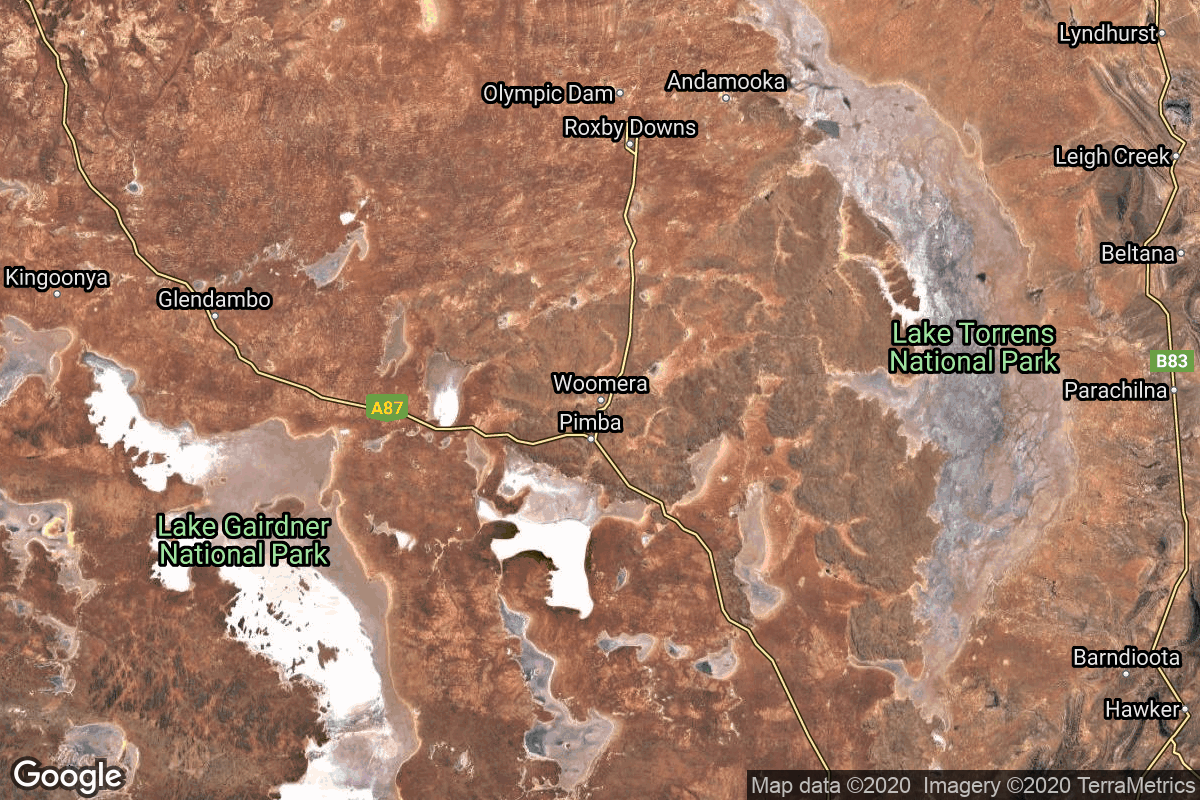
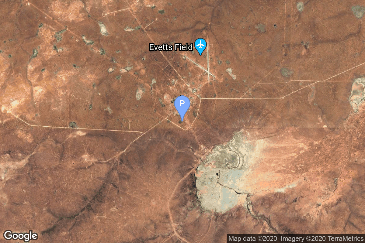
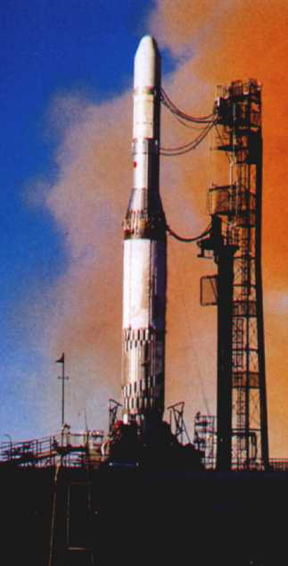
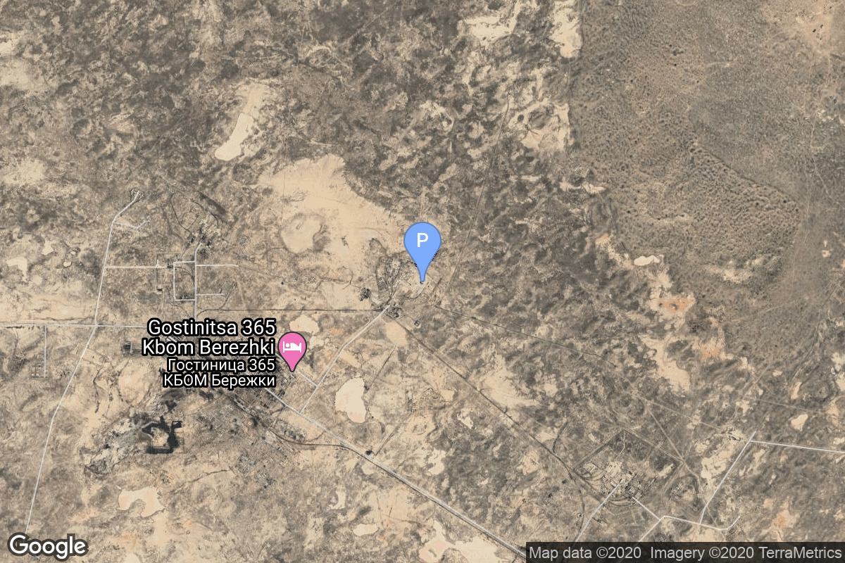
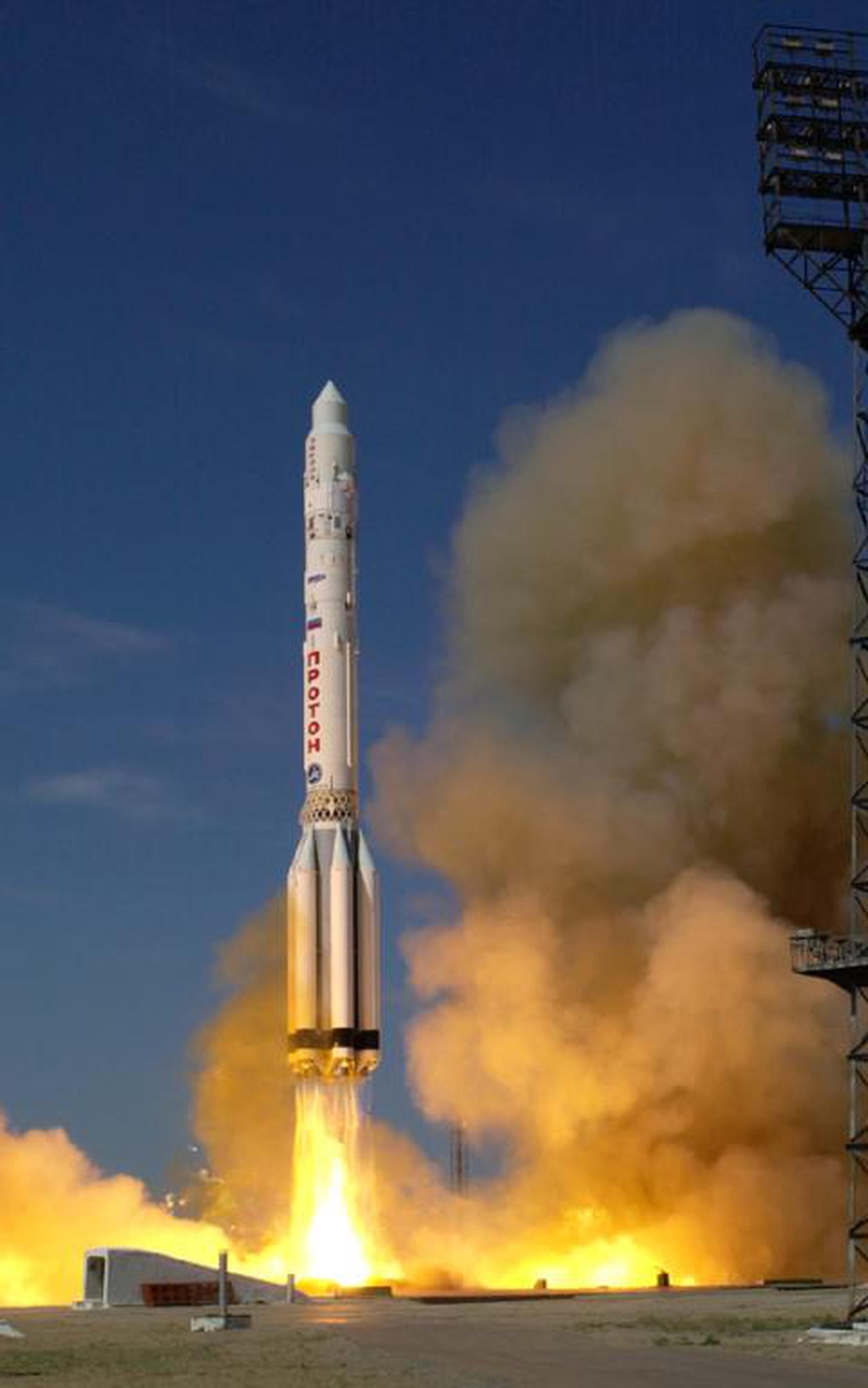
{ "count": 7639, "next": "https://ll.thespacedevs.com/2.0.0/launch/?format=api&limit=10&offset=6670&ordering=-net", "previous": "https://ll.thespacedevs.com/2.0.0/launch/?format=api&limit=10&offset=6650&ordering=-net", "results": [ { "id": "ba66f540-2ab0-4448-bb30-956d97aa04f9", "url": "https://ll.thespacedevs.com/2.0.0/launch/ba66f540-2ab0-4448-bb30-956d97aa04f9/?format=api", "launch_library_id": null, "slug": "kosmos-3m-sfera-3", "name": "Kosmos-3M | Sfera 3", "status": { "id": 3, "name": "Success" }, "net": "1968-11-30T12:00:01Z", "window_end": "1968-11-30T12:00:01Z", "window_start": "1968-11-30T12:00:01Z", "inhold": false, "tbdtime": false, "tbddate": false, "probability": null, "holdreason": "", "failreason": null, "hashtag": null, "launch_service_provider": { "id": 66, "url": "https://ll.thespacedevs.com/2.0.0/agencies/66/?format=api", "name": "Soviet Space Program", "type": "Government" }, "rocket": { "id": 3848, "configuration": { "id": 102, "launch_library_id": 122, "url": "https://ll.thespacedevs.com/2.0.0/config/launcher/102/?format=api", "name": "Kosmos-3M", "family": "Kosmos", "full_name": "Kosmos-3M (11K65M)", "variant": "-3M" } }, "mission": { "id": 2266, "launch_library_id": null, "name": "Sfera 3", "description": "The Sfera or Geoid series were the first soviet geodetic satellites to improve the accuracy of maps. The development of the satellites started in 1965 at NPO-PM.", "launch_designator": null, "type": "Earth Science", "orbit": { "id": 8, "name": "Low Earth Orbit", "abbrev": "LEO" } }, "pad": { "id": 167, "url": "https://ll.thespacedevs.com/2.0.0/pad/167/?format=api", "agency_id": null, "name": "132/2", "info_url": null, "wiki_url": "https://en.wikipedia.org/wiki/Plesetsk_Cosmodrome", "map_url": "https://www.google.com/maps?q=62.883,40.869806", "latitude": "62.883", "longitude": "40.869806", "location": { "id": 6, "url": "https://ll.thespacedevs.com/2.0.0/location/6/?format=api", "name": "Plesetsk Cosmodrome, Russian Federation", "country_code": "RUS", "map_image": "https://thespacedevs-prod.nyc3.digitaloceanspaces.com/media/map_images/location_6_20200803142434.jpg", "total_launch_count": 1678, "total_landing_count": 0 }, "map_image": "https://thespacedevs-prod.nyc3.digitaloceanspaces.com/media/map_images/pad_167_20200803143417.jpg", "total_launch_count": 172 }, "webcast_live": false, "image": null, "infographic": null, "program": [] }, { "id": "92a2c8e9-8b56-4abd-8fe9-e67bef355a64", "url": "https://ll.thespacedevs.com/2.0.0/launch/92a2c8e9-8b56-4abd-8fe9-e67bef355a64/?format=api", "launch_library_id": null, "slug": "europa-i-stv-1", "name": "Europa I | STV 1", "status": { "id": 4, "name": "Failure" }, "net": "1968-11-29T23:12:02Z", "window_end": "1968-11-29T23:12:02Z", "window_start": "1968-11-29T23:12:02Z", "inhold": false, "tbdtime": false, "tbddate": false, "probability": null, "holdreason": "", "failreason": null, "hashtag": null, "launch_service_provider": { "id": 1015, "url": "https://ll.thespacedevs.com/2.0.0/agencies/1015/?format=api", "name": "European Launcher Development Organisation", "type": "Government" }, "rocket": { "id": 3847, "configuration": { "id": 316, "launch_library_id": null, "url": "https://ll.thespacedevs.com/2.0.0/config/launcher/316/?format=api", "name": "Europa I", "family": "Europa", "full_name": "Europa I", "variant": "I" } }, "mission": { "id": 2265, "launch_library_id": null, "name": "STV 1", "description": "STV (Satellite Test Vehicle) was a series of vehicle evaluation payloads built for the test flights of the Europa-1 rocket.", "launch_designator": null, "type": "Test Flight", "orbit": { "id": 8, "name": "Low Earth Orbit", "abbrev": "LEO" } }, "pad": { "id": 180, "url": "https://ll.thespacedevs.com/2.0.0/pad/180/?format=api", "agency_id": null, "name": "Launch Area 6A", "info_url": null, "wiki_url": "https://en.wikipedia.org/wiki/RAAF_Woomera_Range_Complex", "map_url": "https://www.google.com/maps?q=-30.9552778,136.5300282", "latitude": "-30.9552778", "longitude": "136.5300282", "location": { "id": 152, "url": "https://ll.thespacedevs.com/2.0.0/location/152/?format=api", "name": "RAAF Woomera Range Complex", "country_code": "AUS", "map_image": "https://thespacedevs-prod.nyc3.digitaloceanspaces.com/media/map_images/location_152_20200803142502.jpg", "total_launch_count": 6, "total_landing_count": 0 }, "map_image": "https://thespacedevs-prod.nyc3.digitaloceanspaces.com/media/map_images/pad_180_20200803143508.jpg", "total_launch_count": 3 }, "webcast_live": false, "image": "https://thespacedevs-prod.nyc3.digitaloceanspaces.com/media/images/europa_1_on_the_image_20240411115405.jpg", "infographic": null, "program": [] }, { "id": "616ee72b-d00f-45b3-884e-b6edb0548e36", "url": "https://ll.thespacedevs.com/2.0.0/launch/616ee72b-d00f-45b3-884e-b6edb0548e36/?format=api", "launch_library_id": null, "slug": "voskhod-zenit-2-68", "name": "Voskhod | Zenit-2 68", "status": { "id": 3, "name": "Success" }, "net": "1968-11-29T12:40:34Z", "window_end": "1968-11-29T12:40:34Z", "window_start": "1968-11-29T12:40:34Z", "inhold": false, "tbdtime": false, "tbddate": false, "probability": null, "holdreason": "", "failreason": null, "hashtag": null, "launch_service_provider": { "id": 66, "url": "https://ll.thespacedevs.com/2.0.0/agencies/66/?format=api", "name": "Soviet Space Program", "type": "Government" }, "rocket": { "id": 3846, "configuration": { "id": 104, "launch_library_id": 138, "url": "https://ll.thespacedevs.com/2.0.0/config/launcher/104/?format=api", "name": "Voskhod", "family": "R-7", "full_name": "Voskhod", "variant": "Voskhod" } }, "mission": { "id": 2264, "launch_library_id": null, "name": "Zenit-2 68", "description": "Zenit-2 film-return and ELINT reconnaissance satellite.", "launch_designator": null, "type": "Government/Top Secret", "orbit": { "id": 8, "name": "Low Earth Orbit", "abbrev": "LEO" } }, "pad": { "id": 168, "url": "https://ll.thespacedevs.com/2.0.0/pad/168/?format=api", "agency_id": null, "name": "41/1", "info_url": null, "wiki_url": "https://en.wikipedia.org/wiki/Plesetsk_Cosmodrome", "map_url": "https://www.google.com/maps?q=62.941,40.526806", "latitude": "62.941", "longitude": "40.526806", "location": { "id": 6, "url": "https://ll.thespacedevs.com/2.0.0/location/6/?format=api", "name": "Plesetsk Cosmodrome, Russian Federation", "country_code": "RUS", "map_image": "https://thespacedevs-prod.nyc3.digitaloceanspaces.com/media/map_images/location_6_20200803142434.jpg", "total_launch_count": 1678, "total_landing_count": 0 }, "map_image": "https://thespacedevs-prod.nyc3.digitaloceanspaces.com/media/map_images/pad_168_20200803143446.jpg", "total_launch_count": 310 }, "webcast_live": false, "image": null, "infographic": null, "program": [] }, { "id": "1c1b54ab-afdc-47fb-91e1-2867d5d79d8c", "url": "https://ll.thespacedevs.com/2.0.0/launch/1c1b54ab-afdc-47fb-91e1-2867d5d79d8c/?format=api", "launch_library_id": null, "slug": "voskhod-zenit-4-50", "name": "Voskhod | Zenit-4 50", "status": { "id": 3, "name": "Success" }, "net": "1968-11-21T12:10:01Z", "window_end": "1968-11-21T12:10:01Z", "window_start": "1968-11-21T12:10:01Z", "inhold": false, "tbdtime": false, "tbddate": false, "probability": null, "holdreason": "", "failreason": null, "hashtag": null, "launch_service_provider": { "id": 66, "url": "https://ll.thespacedevs.com/2.0.0/agencies/66/?format=api", "name": "Soviet Space Program", "type": "Government" }, "rocket": { "id": 3845, "configuration": { "id": 104, "launch_library_id": 138, "url": "https://ll.thespacedevs.com/2.0.0/config/launcher/104/?format=api", "name": "Voskhod", "family": "R-7", "full_name": "Voskhod", "variant": "Voskhod" } }, "mission": { "id": 2263, "launch_library_id": null, "name": "Zenit-4 50", "description": "Zenit-4 film-return reconnaissance satellite.", "launch_designator": null, "type": "Government/Top Secret", "orbit": { "id": 8, "name": "Low Earth Orbit", "abbrev": "LEO" } }, "pad": { "id": 168, "url": "https://ll.thespacedevs.com/2.0.0/pad/168/?format=api", "agency_id": null, "name": "41/1", "info_url": null, "wiki_url": "https://en.wikipedia.org/wiki/Plesetsk_Cosmodrome", "map_url": "https://www.google.com/maps?q=62.941,40.526806", "latitude": "62.941", "longitude": "40.526806", "location": { "id": 6, "url": "https://ll.thespacedevs.com/2.0.0/location/6/?format=api", "name": "Plesetsk Cosmodrome, Russian Federation", "country_code": "RUS", "map_image": "https://thespacedevs-prod.nyc3.digitaloceanspaces.com/media/map_images/location_6_20200803142434.jpg", "total_launch_count": 1678, "total_landing_count": 0 }, "map_image": "https://thespacedevs-prod.nyc3.digitaloceanspaces.com/media/map_images/pad_168_20200803143446.jpg", "total_launch_count": 310 }, "webcast_live": false, "image": null, "infographic": null, "program": [] }, { "id": "1b7edc50-3e5d-4949-819b-83b331405c5f", "url": "https://ll.thespacedevs.com/2.0.0/launch/1b7edc50-3e5d-4949-819b-83b331405c5f/?format=api", "launch_library_id": null, "slug": "proton-proton-4", "name": "Proton | Proton-4", "status": { "id": 3, "name": "Success" }, "net": "1968-11-16T11:40:00Z", "window_end": "1968-11-16T11:40:00Z", "window_start": "1968-11-16T11:40:00Z", "inhold": false, "tbdtime": false, "tbddate": false, "probability": null, "holdreason": "", "failreason": null, "hashtag": null, "launch_service_provider": { "id": 66, "url": "https://ll.thespacedevs.com/2.0.0/agencies/66/?format=api", "name": "Soviet Space Program", "type": "Government" }, "rocket": { "id": 3844, "configuration": { "id": 95, "launch_library_id": 131, "url": "https://ll.thespacedevs.com/2.0.0/config/launcher/95/?format=api", "name": "Proton", "family": "Proton / UR-500", "full_name": "Proton-K", "variant": "K" } }, "mission": { "id": 2262, "launch_library_id": null, "name": "Proton-4", "description": "Satellite designed to study the interaction of elementary particles with energies in excess of 1012 eV up to 1015 eV.", "launch_designator": null, "type": "Earth Science", "orbit": { "id": 8, "name": "Low Earth Orbit", "abbrev": "LEO" } }, "pad": { "id": 7, "url": "https://ll.thespacedevs.com/2.0.0/pad/7/?format=api", "agency_id": null, "name": "81/24 (81P)", "info_url": null, "wiki_url": "", "map_url": "https://www.google.com/maps?q=46.071001,62.984999", "latitude": "46.071001", "longitude": "62.984999", "location": { "id": 15, "url": "https://ll.thespacedevs.com/2.0.0/location/15/?format=api", "name": "Baikonur Cosmodrome, Republic of Kazakhstan", "country_code": "KAZ", "map_image": "https://thespacedevs-prod.nyc3.digitaloceanspaces.com/media/map_images/location_15_20200803142517.jpg", "total_launch_count": 1558, "total_landing_count": 0 }, "map_image": "https://thespacedevs-prod.nyc3.digitaloceanspaces.com/media/map_images/pad_7_20200803143454.jpg", "total_launch_count": 92 }, "webcast_live": false, "image": "https://thespacedevs-prod.nyc3.digitaloceanspaces.com/media/images/proton_image_20190207032625.jpeg", "infographic": null, "program": [] }, { "id": "775a7360-ed08-4cd0-9cf3-b47476d2a7f4", "url": "https://ll.thespacedevs.com/2.0.0/launch/775a7360-ed08-4cd0-9cf3-b47476d2a7f4/?format=api", "launch_library_id": null, "slug": "voskhod-zenit-2-67", "name": "Voskhod | Zenit-2 67", "status": { "id": 3, "name": "Success" }, "net": "1968-11-13T12:00:01Z", "window_end": "1968-11-13T12:00:01Z", "window_start": "1968-11-13T12:00:01Z", "inhold": false, "tbdtime": false, "tbddate": false, "probability": null, "holdreason": "", "failreason": null, "hashtag": null, "launch_service_provider": { "id": 66, "url": "https://ll.thespacedevs.com/2.0.0/agencies/66/?format=api", "name": "Soviet Space Program", "type": "Government" }, "rocket": { "id": 3843, "configuration": { "id": 104, "launch_library_id": 138, "url": "https://ll.thespacedevs.com/2.0.0/config/launcher/104/?format=api", "name": "Voskhod", "family": "R-7", "full_name": "Voskhod", "variant": "Voskhod" } }, "mission": { "id": 2261, "launch_library_id": null, "name": "Zenit-2 67", "description": "Zenit-2 film-return and ELINT reconnaissance satellite.", "launch_designator": null, "type": "Government/Top Secret", "orbit": { "id": 8, "name": "Low Earth Orbit", "abbrev": "LEO" } }, "pad": { "id": 168, "url": "https://ll.thespacedevs.com/2.0.0/pad/168/?format=api", "agency_id": null, "name": "41/1", "info_url": null, "wiki_url": "https://en.wikipedia.org/wiki/Plesetsk_Cosmodrome", "map_url": "https://www.google.com/maps?q=62.941,40.526806", "latitude": "62.941", "longitude": "40.526806", "location": { "id": 6, "url": "https://ll.thespacedevs.com/2.0.0/location/6/?format=api", "name": "Plesetsk Cosmodrome, Russian Federation", "country_code": "RUS", "map_image": "https://thespacedevs-prod.nyc3.digitaloceanspaces.com/media/map_images/location_6_20200803142434.jpg", "total_launch_count": 1678, "total_landing_count": 0 }, "map_image": "https://thespacedevs-prod.nyc3.digitaloceanspaces.com/media/map_images/pad_168_20200803143446.jpg", "total_launch_count": 310 }, "webcast_live": false, "image": null, "infographic": null, "program": [] }, { "id": "de16a700-65bb-4bf7-a9b3-6145f0da295d", "url": "https://ll.thespacedevs.com/2.0.0/launch/de16a700-65bb-4bf7-a9b3-6145f0da295d/?format=api", "launch_library_id": 1900, "slug": "proton-ur-500-kd-zond-6", "name": "Proton / UR-500 K/D | Zond 6", "status": { "id": 3, "name": "Success" }, "net": "1968-11-10T19:11:31Z", "window_end": "1968-11-10T19:11:31Z", "window_start": "1968-11-10T19:11:31Z", "inhold": false, "tbdtime": false, "tbddate": false, "probability": 0, "holdreason": "", "failreason": "", "hashtag": "", "launch_service_provider": { "id": 66, "url": "https://ll.thespacedevs.com/2.0.0/agencies/66/?format=api", "name": "Soviet Space Program", "type": "Government" }, "rocket": { "id": 2441, "configuration": { "id": 191, "launch_library_id": 220, "url": "https://ll.thespacedevs.com/2.0.0/config/launcher/191/?format=api", "name": "Proton", "family": "Proton / UR-500", "full_name": "Proton / UR-500 K/D", "variant": "K/D" } }, "mission": null, "pad": { "id": 31, "url": "https://ll.thespacedevs.com/2.0.0/pad/31/?format=api", "agency_id": null, "name": "81/23 (81L)", "info_url": null, "wiki_url": "", "map_url": "https://www.google.com/maps?q=46.073997,62.977999", "latitude": "46.073997", "longitude": "62.977999", "location": { "id": 15, "url": "https://ll.thespacedevs.com/2.0.0/location/15/?format=api", "name": "Baikonur Cosmodrome, Republic of Kazakhstan", "country_code": "KAZ", "map_image": "https://thespacedevs-prod.nyc3.digitaloceanspaces.com/media/map_images/location_15_20200803142517.jpg", "total_launch_count": 1558, "total_landing_count": 0 }, "map_image": "https://thespacedevs-prod.nyc3.digitaloceanspaces.com/media/map_images/pad_31_20200803143402.jpg", "total_launch_count": 104 }, "webcast_live": false, "image": "https://thespacedevs-prod.nyc3.digitaloceanspaces.com/media/images/proton_image_20231231095535.jpg", "infographic": null, "program": [ { "id": 8, "url": "https://ll.thespacedevs.com/2.0.0/program/8/?format=api", "name": "Soyuz", "description": "The Soyuz programme is a human spaceflight programme initiated by the Soviet Union in the early 1960s. The Soyuz spacecraft was originally part of a Moon landing project intended to put a Soviet cosmonaut on the Moon. It was the third Soviet human spaceflight programme after the Vostok and Voskhod programmes.", "agencies": [ { "id": 63, "url": "https://ll.thespacedevs.com/2.0.0/agencies/63/?format=api", "name": "Russian Federal Space Agency (ROSCOSMOS)", "type": "Government" }, { "id": 66, "url": "https://ll.thespacedevs.com/2.0.0/agencies/66/?format=api", "name": "Soviet Space Program", "type": "Government" } ], "image_url": "https://thespacedevs-prod.nyc3.digitaloceanspaces.com/media/images/soyuz_program_20201129185543.png", "start_date": "1966-11-28T11:02:00Z", "end_date": null, "info_url": null, "wiki_url": "https://en.wikipedia.org/wiki/Soyuz_programme" } ] }, { "id": "d1d8d518-bf99-4e64-833d-701777b176d2", "url": "https://ll.thespacedevs.com/2.0.0/launch/d1d8d518-bf99-4e64-833d-701777b176d2/?format=api", "launch_library_id": null, "slug": "thor-delta-e1-pioneer-9", "name": "Thor Delta E1 | Pioneer 9", "status": { "id": 3, "name": "Success" }, "net": "1968-11-08T09:46:29Z", "window_end": "1968-11-08T09:46:29Z", "window_start": "1968-11-08T09:46:29Z", "inhold": false, "tbdtime": false, "tbddate": false, "probability": null, "holdreason": "", "failreason": null, "hashtag": null, "launch_service_provider": { "id": 161, "url": "https://ll.thespacedevs.com/2.0.0/agencies/161/?format=api", "name": "United States Air Force", "type": "Government" }, "rocket": { "id": 3842, "configuration": { "id": 405, "launch_library_id": null, "url": "https://ll.thespacedevs.com/2.0.0/config/launcher/405/?format=api", "name": "Thor Delta E1", "family": "Thor", "full_name": "Thor Delta E1", "variant": "Delta E1" } }, "mission": { "id": 2260, "launch_library_id": null, "name": "Pioneer 9", "description": "Pioneer A to E (Pioneer 6 to 9 after launch) were a series of five solar-orbiting, spin-stabilized, solar-cell and battery-powered satellites designed to obtain measurements of interplanetary phenomena from widely separated points in space on a continuing basis.", "launch_designator": null, "type": "Astrophysics", "orbit": { "id": 6, "name": "Heliocentric N/A", "abbrev": "Helio-N/A" } }, "pad": { "id": 1, "url": "https://ll.thespacedevs.com/2.0.0/pad/1/?format=api", "agency_id": null, "name": "Space Launch Complex 17B", "info_url": null, "wiki_url": "https://en.wikipedia.org/wiki/Cape_Canaveral_Space_Launch_Complex_17", "map_url": "https://www.google.com/maps?q=28.4458,-80.5657", "latitude": "28.4458", "longitude": "-80.5657", "location": { "id": 12, "url": "https://ll.thespacedevs.com/2.0.0/location/12/?format=api", "name": "Cape Canaveral SFS, FL, USA", "country_code": "USA", "map_image": "https://thespacedevs-prod.nyc3.digitaloceanspaces.com/media/map_images/location_12_20200803142519.jpg", "total_launch_count": 1056, "total_landing_count": 68 }, "map_image": "https://thespacedevs-prod.nyc3.digitaloceanspaces.com/media/map_images/pad_1_20200803143208.jpg", "total_launch_count": 132 }, "webcast_live": false, "image": null, "infographic": null, "program": [] }, { "id": "bce85e9f-bde0-43c1-9602-387db876da4c", "url": "https://ll.thespacedevs.com/2.0.0/launch/bce85e9f-bde0-43c1-9602-387db876da4c/?format=api", "launch_library_id": null, "slug": "titan-iiib-kh-8-17", "name": "Titan IIIB | KH-8 17", "status": { "id": 3, "name": "Success" }, "net": "1968-11-06T19:10:00Z", "window_end": "1968-11-06T19:10:00Z", "window_start": "1968-11-06T19:10:00Z", "inhold": false, "tbdtime": false, "tbddate": false, "probability": null, "holdreason": "", "failreason": null, "hashtag": null, "launch_service_provider": { "id": 161, "url": "https://ll.thespacedevs.com/2.0.0/agencies/161/?format=api", "name": "United States Air Force", "type": "Government" }, "rocket": { "id": 3841, "configuration": { "id": 438, "launch_library_id": null, "url": "https://ll.thespacedevs.com/2.0.0/config/launcher/438/?format=api", "name": "Titan IIIB", "family": "Titan", "full_name": "Titan IIIB", "variant": "IIIB" } }, "mission": { "id": 2259, "launch_library_id": null, "name": "KH-8 17", "description": "KH-8 or Gambit-3 was the second generation of Gambit high resolution reconnaissance satellites.", "launch_designator": null, "type": "Government/Top Secret", "orbit": { "id": 8, "name": "Low Earth Orbit", "abbrev": "LEO" } }, "pad": { "id": 156, "url": "https://ll.thespacedevs.com/2.0.0/pad/156/?format=api", "agency_id": null, "name": "Space Launch Complex 4W", "info_url": "https://www.astronautix.com/v/vandenbergslc4w.html", "wiki_url": "https://en.wikipedia.org/wiki/Vandenberg_Air_Force_Base_Space_Launch_Complex_4#SLC-4W", "map_url": "https://www.google.com/maps?q=34.63312,-120.61584", "latitude": "34.63312", "longitude": "-120.61584", "location": { "id": 11, "url": "https://ll.thespacedevs.com/2.0.0/location/11/?format=api", "name": "Vandenberg SFB, CA, USA", "country_code": "USA", "map_image": "https://thespacedevs-prod.nyc3.digitaloceanspaces.com/media/map_images/location_11_20200803142416.jpg", "total_launch_count": 835, "total_landing_count": 29 }, "map_image": "https://thespacedevs-prod.nyc3.digitaloceanspaces.com/media/map_images/pad_156_20200803143351.jpg", "total_launch_count": 93 }, "webcast_live": false, "image": null, "infographic": null, "program": [] }, { "id": "a061aa50-e943-4676-aff2-54d565157dc0", "url": "https://ll.thespacedevs.com/2.0.0/launch/a061aa50-e943-4676-aff2-54d565157dc0/?format=api", "launch_library_id": null, "slug": "thorad-slv-2g-agena-d-kh-4b-5", "name": "Thorad SLV-2G Agena D | KH-4B 5", "status": { "id": 3, "name": "Success" }, "net": "1968-11-03T21:30:00Z", "window_end": "1968-11-03T21:30:00Z", "window_start": "1968-11-03T21:30:00Z", "inhold": false, "tbdtime": false, "tbddate": false, "probability": null, "holdreason": "", "failreason": null, "hashtag": null, "launch_service_provider": { "id": 161, "url": "https://ll.thespacedevs.com/2.0.0/agencies/161/?format=api", "name": "United States Air Force", "type": "Government" }, "rocket": { "id": 3840, "configuration": { "id": 418, "launch_library_id": null, "url": "https://ll.thespacedevs.com/2.0.0/config/launcher/418/?format=api", "name": "Thorad SLV-2G Agena D", "family": "Thor", "full_name": "Thorad SLV-2G Agena D", "variant": "SLV-2G Agena D" } }, "mission": { "id": 2258, "launch_library_id": null, "name": "KH-4B 5", "description": "The KH-4B (Keyhole-4B) was sixth optical reconnaissance satellite version in the Corona-program.", "launch_designator": null, "type": "Government/Top Secret", "orbit": { "id": 8, "name": "Low Earth Orbit", "abbrev": "LEO" } }, "pad": { "id": 93, "url": "https://ll.thespacedevs.com/2.0.0/pad/93/?format=api", "agency_id": 161, "name": "Space Launch Complex 3W", "info_url": null, "wiki_url": "https://en.wikipedia.org/wiki/Vandenberg_Space_Launch_Complex_3#SLC-3W", "map_url": "https://www.google.com/maps?q=34.644,-120.593", "latitude": "34.644", "longitude": "-120.593", "location": { "id": 11, "url": "https://ll.thespacedevs.com/2.0.0/location/11/?format=api", "name": "Vandenberg SFB, CA, USA", "country_code": "USA", "map_image": "https://thespacedevs-prod.nyc3.digitaloceanspaces.com/media/map_images/location_11_20200803142416.jpg", "total_launch_count": 835, "total_landing_count": 29 }, "map_image": "https://thespacedevs-prod.nyc3.digitaloceanspaces.com/media/map_images/pad_93_20200803143225.jpg", "total_launch_count": 81 }, "webcast_live": false, "image": null, "infographic": null, "program": [] } ] }