Launch List
API endpoint that returns all Launch objects or a single launch.
EXAMPLE - /launch/
GET: Return a list of all Launch objects.
FILTERS: Fields - 'name', 'id(s)', 'lsp_id', 'lsp_name', 'serial_number', 'launcher_config__id', 'rocket__spacecraftflight__spacecraft__name'
MODE: 'normal', 'list', 'detailed' EXAMPLE: ?mode=list
SEARCH: Searches through the launch name, rocket name, launch agency, mission name & spacecraft name. EXAMPLE - ?search=SpaceX
GET /2.0.0/launch/?format=api&offset=6650&ordering=-name
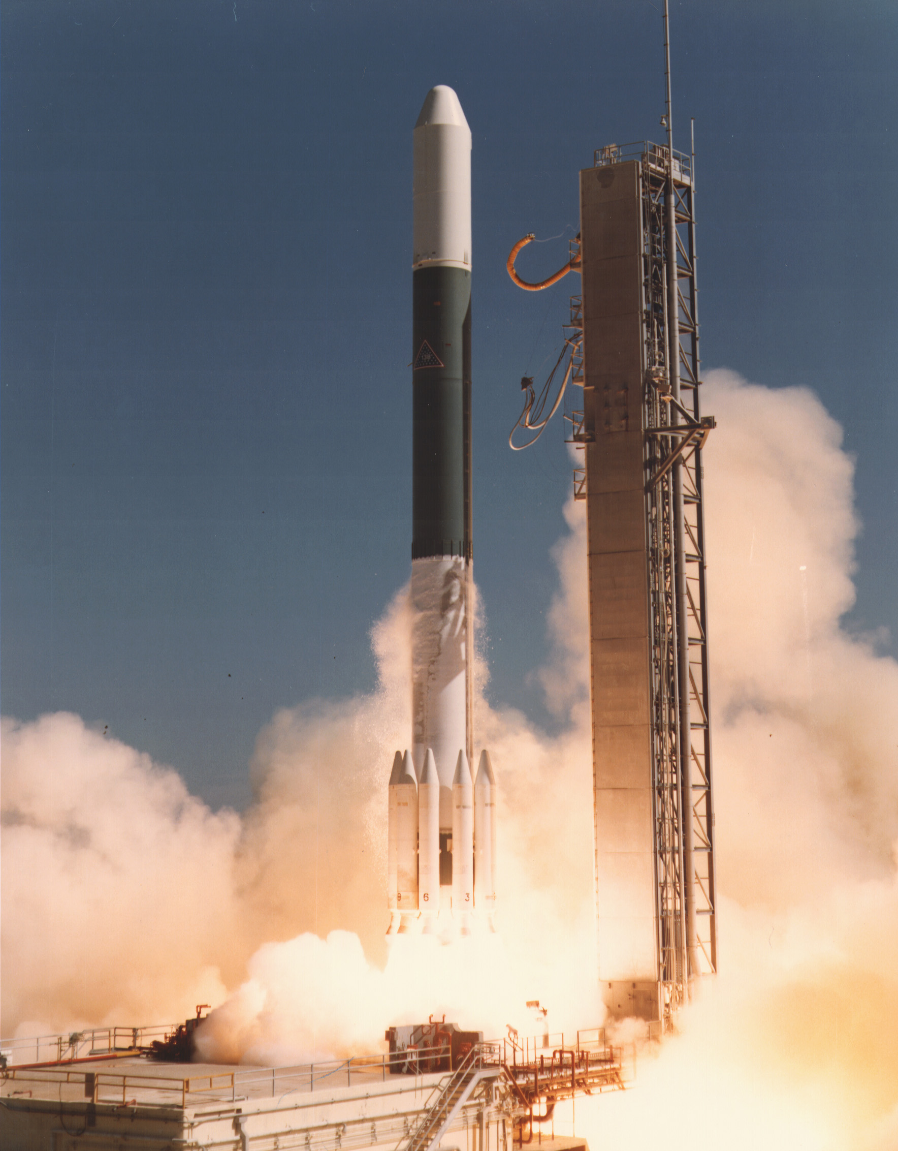
{ "count": 7505, "next": "https://ll.thespacedevs.com/2.0.0/launch/?format=api&limit=10&offset=6660&ordering=-name", "previous": "https://ll.thespacedevs.com/2.0.0/launch/?format=api&limit=10&offset=6640&ordering=-name", "results": [ { "id": "9000e50e-c94b-410c-946b-82867f56f49f", "url": "https://ll.thespacedevs.com/2.0.0/launch/9000e50e-c94b-410c-946b-82867f56f49f/?format=api", "launch_library_id": null, "slug": "delta-2910-landsat-3", "name": "Delta 2910 | Landsat 3", "status": { "id": 3, "name": "Success" }, "net": "1978-03-05T17:54:00Z", "window_end": "1978-03-05T17:54:00Z", "window_start": "1978-03-05T17:54:00Z", "inhold": false, "tbdtime": false, "tbddate": false, "probability": null, "holdreason": "", "failreason": "", "hashtag": null, "launch_service_provider": { "id": 161, "url": "https://ll.thespacedevs.com/2.0.0/agencies/161/?format=api", "name": "United States Air Force", "type": "Government" }, "rocket": { "id": 4938, "configuration": { "id": 285, "launch_library_id": null, "url": "https://ll.thespacedevs.com/2.0.0/config/launcher/285/?format=api", "name": "Delta 2910", "family": "Delta", "full_name": "Delta 2910", "variant": "2910" } }, "mission": { "id": 3354, "launch_library_id": null, "name": "Landsat 3", "description": "Earth observation satellite", "launch_designator": null, "type": "Earth Science", "orbit": { "id": 17, "name": "Sun-Synchronous Orbit", "abbrev": "SSO" } }, "pad": { "id": 39, "url": "https://ll.thespacedevs.com/2.0.0/pad/39/?format=api", "agency_id": null, "name": "Space Launch Complex 2W", "info_url": null, "wiki_url": "https://en.wikipedia.org/wiki/Vandenberg_Space_Launch_Complex_2", "map_url": "https://www.google.com/maps?q=34.7556,-120.6224", "latitude": "34.7556", "longitude": "-120.6224", "location": { "id": 11, "url": "https://ll.thespacedevs.com/2.0.0/location/11/?format=api", "name": "Vandenberg SFB, CA, USA", "country_code": "USA", "map_image": "https://thespacedevs-prod.nyc3.digitaloceanspaces.com/media/map_images/location_11_20200803142416.jpg", "total_launch_count": 807, "total_landing_count": 26 }, "map_image": "https://thespacedevs-prod.nyc3.digitaloceanspaces.com/media/map_images/pad_39_20200803143542.jpg", "total_launch_count": 98 }, "webcast_live": false, "image": "https://thespacedevs-prod.nyc3.digitaloceanspaces.com/media/images/delta_2910_image_20231231105214.jpeg", "infographic": null, "program": [ { "id": 31, "url": "https://ll.thespacedevs.com/2.0.0/program/31/?format=api", "name": "Landsat", "description": "The Landsat program is the longest-running enterprise for acquisition of satellite imagery of Earth. It is a joint NASA / USGS program.", "agencies": [ { "id": 44, "url": "https://ll.thespacedevs.com/2.0.0/agencies/44/?format=api", "name": "National Aeronautics and Space Administration", "type": "Government" } ], "image_url": "https://thespacedevs-prod.nyc3.digitaloceanspaces.com/media/images/landsat_program_20231230154736.jpeg", "start_date": "1972-07-23T00:00:00Z", "end_date": null, "info_url": null, "wiki_url": "https://en.wikipedia.org/wiki/Landsat_program" } ] }, { "id": "e4a8265f-3348-451a-b24f-747259e58f7f", "url": "https://ll.thespacedevs.com/2.0.0/launch/e4a8265f-3348-451a-b24f-747259e58f7f/?format=api", "launch_library_id": null, "slug": "delta-2910-landsat-2", "name": "Delta 2910 | Landsat 2", "status": { "id": 3, "name": "Success" }, "net": "1975-01-22T17:55:52Z", "window_end": "1975-01-22T17:55:52Z", "window_start": "1975-01-22T17:55:52Z", "inhold": false, "tbdtime": false, "tbddate": false, "probability": null, "holdreason": "", "failreason": "", "hashtag": null, "launch_service_provider": { "id": 161, "url": "https://ll.thespacedevs.com/2.0.0/agencies/161/?format=api", "name": "United States Air Force", "type": "Government" }, "rocket": { "id": 4543, "configuration": { "id": 285, "launch_library_id": null, "url": "https://ll.thespacedevs.com/2.0.0/config/launcher/285/?format=api", "name": "Delta 2910", "family": "Delta", "full_name": "Delta 2910", "variant": "2910" } }, "mission": { "id": 2961, "launch_library_id": null, "name": "Landsat 2", "description": "Earth observation satellite", "launch_designator": null, "type": "Earth Science", "orbit": { "id": 17, "name": "Sun-Synchronous Orbit", "abbrev": "SSO" } }, "pad": { "id": 39, "url": "https://ll.thespacedevs.com/2.0.0/pad/39/?format=api", "agency_id": null, "name": "Space Launch Complex 2W", "info_url": null, "wiki_url": "https://en.wikipedia.org/wiki/Vandenberg_Space_Launch_Complex_2", "map_url": "https://www.google.com/maps?q=34.7556,-120.6224", "latitude": "34.7556", "longitude": "-120.6224", "location": { "id": 11, "url": "https://ll.thespacedevs.com/2.0.0/location/11/?format=api", "name": "Vandenberg SFB, CA, USA", "country_code": "USA", "map_image": "https://thespacedevs-prod.nyc3.digitaloceanspaces.com/media/map_images/location_11_20200803142416.jpg", "total_launch_count": 807, "total_landing_count": 26 }, "map_image": "https://thespacedevs-prod.nyc3.digitaloceanspaces.com/media/map_images/pad_39_20200803143542.jpg", "total_launch_count": 98 }, "webcast_live": false, "image": "https://thespacedevs-prod.nyc3.digitaloceanspaces.com/media/images/delta_2910_image_20231231105214.jpeg", "infographic": null, "program": [ { "id": 31, "url": "https://ll.thespacedevs.com/2.0.0/program/31/?format=api", "name": "Landsat", "description": "The Landsat program is the longest-running enterprise for acquisition of satellite imagery of Earth. It is a joint NASA / USGS program.", "agencies": [ { "id": 44, "url": "https://ll.thespacedevs.com/2.0.0/agencies/44/?format=api", "name": "National Aeronautics and Space Administration", "type": "Government" } ], "image_url": "https://thespacedevs-prod.nyc3.digitaloceanspaces.com/media/images/landsat_program_20231230154736.jpeg", "start_date": "1972-07-23T00:00:00Z", "end_date": null, "info_url": null, "wiki_url": "https://en.wikipedia.org/wiki/Landsat_program" } ] }, { "id": "5b333326-5f52-4312-8ae2-dc087ba64d0c", "url": "https://ll.thespacedevs.com/2.0.0/launch/5b333326-5f52-4312-8ae2-dc087ba64d0c/?format=api", "launch_library_id": null, "slug": "delta-2910-ae-e", "name": "Delta 2910 | AE-E", "status": { "id": 3, "name": "Success" }, "net": "1975-11-20T02:06:48Z", "window_end": "1975-11-20T02:06:48Z", "window_start": "1975-11-20T02:06:48Z", "inhold": false, "tbdtime": false, "tbddate": false, "probability": null, "holdreason": "", "failreason": null, "hashtag": null, "launch_service_provider": { "id": 161, "url": "https://ll.thespacedevs.com/2.0.0/agencies/161/?format=api", "name": "United States Air Force", "type": "Government" }, "rocket": { "id": 4643, "configuration": { "id": 285, "launch_library_id": null, "url": "https://ll.thespacedevs.com/2.0.0/config/launcher/285/?format=api", "name": "Delta 2910", "family": "Delta", "full_name": "Delta 2910", "variant": "2910" } }, "mission": { "id": 3061, "launch_library_id": null, "name": "AE-E", "description": "Scientific satellite dedicated to photochemical processes in the Earth's atmosphere", "launch_designator": null, "type": "Earth Science", "orbit": { "id": 0, "name": "Elliptical Orbit", "abbrev": "Elliptical" } }, "pad": { "id": 1, "url": "https://ll.thespacedevs.com/2.0.0/pad/1/?format=api", "agency_id": null, "name": "Space Launch Complex 17B", "info_url": null, "wiki_url": "https://en.wikipedia.org/wiki/Cape_Canaveral_Space_Launch_Complex_17", "map_url": "https://www.google.com/maps?q=28.4458,-80.5657", "latitude": "28.4458", "longitude": "-80.5657", "location": { "id": 12, "url": "https://ll.thespacedevs.com/2.0.0/location/12/?format=api", "name": "Cape Canaveral SFS, FL, USA", "country_code": "USA", "map_image": "https://thespacedevs-prod.nyc3.digitaloceanspaces.com/media/map_images/location_12_20200803142519.jpg", "total_launch_count": 1024, "total_landing_count": 64 }, "map_image": "https://thespacedevs-prod.nyc3.digitaloceanspaces.com/media/map_images/pad_1_20200803143208.jpg", "total_launch_count": 132 }, "webcast_live": false, "image": "https://thespacedevs-prod.nyc3.digitaloceanspaces.com/media/images/delta_2910_image_20231231105214.jpeg", "infographic": null, "program": [] }, { "id": "c072793b-4822-4a5f-a9f7-53fc0b32d3b3", "url": "https://ll.thespacedevs.com/2.0.0/launch/c072793b-4822-4a5f-a9f7-53fc0b32d3b3/?format=api", "launch_library_id": null, "slug": "delta-2910-ae-d", "name": "Delta 2910 | AE-D", "status": { "id": 3, "name": "Success" }, "net": "1975-10-06T09:00:50Z", "window_end": "1975-10-06T09:00:50Z", "window_start": "1975-10-06T09:00:50Z", "inhold": false, "tbdtime": false, "tbddate": false, "probability": null, "holdreason": "", "failreason": null, "hashtag": null, "launch_service_provider": { "id": 161, "url": "https://ll.thespacedevs.com/2.0.0/agencies/161/?format=api", "name": "United States Air Force", "type": "Government" }, "rocket": { "id": 4632, "configuration": { "id": 285, "launch_library_id": null, "url": "https://ll.thespacedevs.com/2.0.0/config/launcher/285/?format=api", "name": "Delta 2910", "family": "Delta", "full_name": "Delta 2910", "variant": "2910" } }, "mission": { "id": 3050, "launch_library_id": null, "name": "AE-D", "description": "Scientific satellite dedicated to photochemical processes in the Earth's atmosphere", "launch_designator": null, "type": "Earth Science", "orbit": { "id": 0, "name": "Elliptical Orbit", "abbrev": "Elliptical" } }, "pad": { "id": 39, "url": "https://ll.thespacedevs.com/2.0.0/pad/39/?format=api", "agency_id": null, "name": "Space Launch Complex 2W", "info_url": null, "wiki_url": "https://en.wikipedia.org/wiki/Vandenberg_Space_Launch_Complex_2", "map_url": "https://www.google.com/maps?q=34.7556,-120.6224", "latitude": "34.7556", "longitude": "-120.6224", "location": { "id": 11, "url": "https://ll.thespacedevs.com/2.0.0/location/11/?format=api", "name": "Vandenberg SFB, CA, USA", "country_code": "USA", "map_image": "https://thespacedevs-prod.nyc3.digitaloceanspaces.com/media/map_images/location_11_20200803142416.jpg", "total_launch_count": 807, "total_landing_count": 26 }, "map_image": "https://thespacedevs-prod.nyc3.digitaloceanspaces.com/media/map_images/pad_39_20200803143542.jpg", "total_launch_count": 98 }, "webcast_live": false, "image": "https://thespacedevs-prod.nyc3.digitaloceanspaces.com/media/images/delta_2910_image_20231231105214.jpeg", "infographic": null, "program": [] }, { "id": "3b526b92-0321-4c55-a9c1-317d4a032fbe", "url": "https://ll.thespacedevs.com/2.0.0/launch/3b526b92-0321-4c55-a9c1-317d4a032fbe/?format=api", "launch_library_id": null, "slug": "delta-2313-skynet-iib", "name": "Delta 2313 | Skynet IIB", "status": { "id": 3, "name": "Success" }, "net": "1974-11-23T00:28:01Z", "window_end": "1974-11-23T00:28:01Z", "window_start": "1974-11-23T00:28:01Z", "inhold": false, "tbdtime": false, "tbddate": false, "probability": null, "holdreason": "", "failreason": null, "hashtag": null, "launch_service_provider": { "id": 161, "url": "https://ll.thespacedevs.com/2.0.0/agencies/161/?format=api", "name": "United States Air Force", "type": "Government" }, "rocket": { "id": 4530, "configuration": { "id": 284, "launch_library_id": null, "url": "https://ll.thespacedevs.com/2.0.0/config/launcher/284/?format=api", "name": "Delta 2313", "family": "Delta", "full_name": "Delta 2313", "variant": "2313" } }, "mission": { "id": 2948, "launch_library_id": null, "name": "Skynet IIB", "description": "British military communications satellite", "launch_designator": null, "type": "Government/Top Secret", "orbit": { "id": 1, "name": "Geostationary Orbit", "abbrev": "Direct-GEO" } }, "pad": { "id": 1, "url": "https://ll.thespacedevs.com/2.0.0/pad/1/?format=api", "agency_id": null, "name": "Space Launch Complex 17B", "info_url": null, "wiki_url": "https://en.wikipedia.org/wiki/Cape_Canaveral_Space_Launch_Complex_17", "map_url": "https://www.google.com/maps?q=28.4458,-80.5657", "latitude": "28.4458", "longitude": "-80.5657", "location": { "id": 12, "url": "https://ll.thespacedevs.com/2.0.0/location/12/?format=api", "name": "Cape Canaveral SFS, FL, USA", "country_code": "USA", "map_image": "https://thespacedevs-prod.nyc3.digitaloceanspaces.com/media/map_images/location_12_20200803142519.jpg", "total_launch_count": 1024, "total_landing_count": 64 }, "map_image": "https://thespacedevs-prod.nyc3.digitaloceanspaces.com/media/map_images/pad_1_20200803143208.jpg", "total_launch_count": 132 }, "webcast_live": false, "image": null, "infographic": null, "program": [] }, { "id": "ab946a3c-9453-4d3a-9c84-905b7d9ae98a", "url": "https://ll.thespacedevs.com/2.0.0/launch/ab946a3c-9453-4d3a-9c84-905b7d9ae98a/?format=api", "launch_library_id": null, "slug": "delta-2313-skynet-iia", "name": "Delta 2313 | Skynet IIA", "status": { "id": 4, "name": "Failure" }, "net": "1974-01-19T01:38:47Z", "window_end": "1974-01-19T01:38:47Z", "window_start": "1974-01-19T01:38:47Z", "inhold": false, "tbdtime": false, "tbddate": false, "probability": null, "holdreason": "", "failreason": null, "hashtag": null, "launch_service_provider": { "id": 161, "url": "https://ll.thespacedevs.com/2.0.0/agencies/161/?format=api", "name": "United States Air Force", "type": "Government" }, "rocket": { "id": 4438, "configuration": { "id": 284, "launch_library_id": null, "url": "https://ll.thespacedevs.com/2.0.0/config/launcher/284/?format=api", "name": "Delta 2313", "family": "Delta", "full_name": "Delta 2313", "variant": "2313" } }, "mission": { "id": 2856, "launch_library_id": null, "name": "Skynet IIA", "description": "British military communications satellite", "launch_designator": null, "type": "Government/Top Secret", "orbit": { "id": 1, "name": "Geostationary Orbit", "abbrev": "Direct-GEO" } }, "pad": { "id": 1, "url": "https://ll.thespacedevs.com/2.0.0/pad/1/?format=api", "agency_id": null, "name": "Space Launch Complex 17B", "info_url": null, "wiki_url": "https://en.wikipedia.org/wiki/Cape_Canaveral_Space_Launch_Complex_17", "map_url": "https://www.google.com/maps?q=28.4458,-80.5657", "latitude": "28.4458", "longitude": "-80.5657", "location": { "id": 12, "url": "https://ll.thespacedevs.com/2.0.0/location/12/?format=api", "name": "Cape Canaveral SFS, FL, USA", "country_code": "USA", "map_image": "https://thespacedevs-prod.nyc3.digitaloceanspaces.com/media/map_images/location_12_20200803142519.jpg", "total_launch_count": 1024, "total_landing_count": 64 }, "map_image": "https://thespacedevs-prod.nyc3.digitaloceanspaces.com/media/map_images/pad_1_20200803143208.jpg", "total_launch_count": 132 }, "webcast_live": false, "image": null, "infographic": null, "program": [] }, { "id": "4a3f1a08-69a1-40f3-a9cc-29c44b44db4a", "url": "https://ll.thespacedevs.com/2.0.0/launch/4a3f1a08-69a1-40f3-a9cc-29c44b44db4a/?format=api", "launch_library_id": null, "slug": "delta-2313-sirio-1", "name": "Delta 2313 | Sirio 1", "status": { "id": 3, "name": "Success" }, "net": "1977-08-25T23:49:59Z", "window_end": "1977-08-25T23:49:59Z", "window_start": "1977-08-25T23:49:59Z", "inhold": false, "tbdtime": false, "tbddate": false, "probability": null, "holdreason": "", "failreason": null, "hashtag": null, "launch_service_provider": { "id": 161, "url": "https://ll.thespacedevs.com/2.0.0/agencies/161/?format=api", "name": "United States Air Force", "type": "Government" }, "rocket": { "id": 4871, "configuration": { "id": 284, "launch_library_id": null, "url": "https://ll.thespacedevs.com/2.0.0/config/launcher/284/?format=api", "name": "Delta 2313", "family": "Delta", "full_name": "Delta 2313", "variant": "2313" } }, "mission": { "id": 3288, "launch_library_id": null, "name": "Sirio 1", "description": "The SIRIO satellite is an experimental geostationary artificial telecommunications satellite, the first to be designed and built in Italy.", "launch_designator": null, "type": "Communications", "orbit": { "id": 1, "name": "Geostationary Orbit", "abbrev": "Direct-GEO" } }, "pad": { "id": 1, "url": "https://ll.thespacedevs.com/2.0.0/pad/1/?format=api", "agency_id": null, "name": "Space Launch Complex 17B", "info_url": null, "wiki_url": "https://en.wikipedia.org/wiki/Cape_Canaveral_Space_Launch_Complex_17", "map_url": "https://www.google.com/maps?q=28.4458,-80.5657", "latitude": "28.4458", "longitude": "-80.5657", "location": { "id": 12, "url": "https://ll.thespacedevs.com/2.0.0/location/12/?format=api", "name": "Cape Canaveral SFS, FL, USA", "country_code": "USA", "map_image": "https://thespacedevs-prod.nyc3.digitaloceanspaces.com/media/map_images/location_12_20200803142519.jpg", "total_launch_count": 1024, "total_landing_count": 64 }, "map_image": "https://thespacedevs-prod.nyc3.digitaloceanspaces.com/media/map_images/pad_1_20200803143208.jpg", "total_launch_count": 132 }, "webcast_live": false, "image": null, "infographic": null, "program": [] }, { "id": "9d75c97f-3e54-4dd2-b550-1e276f6ebf41", "url": "https://ll.thespacedevs.com/2.0.0/launch/9d75c97f-3e54-4dd2-b550-1e276f6ebf41/?format=api", "launch_library_id": null, "slug": "delta-2310-solar-mesosphere-explorer", "name": "Delta 2310 | Solar Mesosphere Explorer", "status": { "id": 3, "name": "Success" }, "net": "1981-10-06T11:27:00Z", "window_end": "1981-10-06T11:27:00Z", "window_start": "1981-10-06T11:27:00Z", "inhold": false, "tbdtime": false, "tbddate": false, "probability": null, "holdreason": "", "failreason": null, "hashtag": null, "launch_service_provider": { "id": 161, "url": "https://ll.thespacedevs.com/2.0.0/agencies/161/?format=api", "name": "United States Air Force", "type": "Government" }, "rocket": { "id": 5331, "configuration": { "id": 283, "launch_library_id": null, "url": "https://ll.thespacedevs.com/2.0.0/config/launcher/283/?format=api", "name": "Delta 2310", "family": "Delta", "full_name": "Delta 2310", "variant": "2310" } }, "mission": { "id": 3739, "launch_library_id": null, "name": "Solar Mesosphere Explorer", "description": "Scientific satellite dedicated to research related to the Earth's ozone layer", "launch_designator": null, "type": "Earth Science", "orbit": { "id": 8, "name": "Low Earth Orbit", "abbrev": "LEO" } }, "pad": { "id": 39, "url": "https://ll.thespacedevs.com/2.0.0/pad/39/?format=api", "agency_id": null, "name": "Space Launch Complex 2W", "info_url": null, "wiki_url": "https://en.wikipedia.org/wiki/Vandenberg_Space_Launch_Complex_2", "map_url": "https://www.google.com/maps?q=34.7556,-120.6224", "latitude": "34.7556", "longitude": "-120.6224", "location": { "id": 11, "url": "https://ll.thespacedevs.com/2.0.0/location/11/?format=api", "name": "Vandenberg SFB, CA, USA", "country_code": "USA", "map_image": "https://thespacedevs-prod.nyc3.digitaloceanspaces.com/media/map_images/location_11_20200803142416.jpg", "total_launch_count": 807, "total_landing_count": 26 }, "map_image": "https://thespacedevs-prod.nyc3.digitaloceanspaces.com/media/map_images/pad_39_20200803143542.jpg", "total_launch_count": 98 }, "webcast_live": false, "image": null, "infographic": null, "program": [] }, { "id": "753edd58-6b33-448c-997d-04b0ac8f8cc8", "url": "https://ll.thespacedevs.com/2.0.0/launch/753edd58-6b33-448c-997d-04b0ac8f8cc8/?format=api", "launch_library_id": null, "slug": "delta-2310-noaa-5", "name": "Delta 2310 | NOAA 5", "status": { "id": 3, "name": "Success" }, "net": "1976-07-29T17:07:00Z", "window_end": "1976-07-29T17:07:00Z", "window_start": "1976-07-29T17:07:00Z", "inhold": false, "tbdtime": false, "tbddate": false, "probability": null, "holdreason": "", "failreason": null, "hashtag": null, "launch_service_provider": { "id": 161, "url": "https://ll.thespacedevs.com/2.0.0/agencies/161/?format=api", "name": "United States Air Force", "type": "Government" }, "rocket": { "id": 4740, "configuration": { "id": 283, "launch_library_id": null, "url": "https://ll.thespacedevs.com/2.0.0/config/launcher/283/?format=api", "name": "Delta 2310", "family": "Delta", "full_name": "Delta 2310", "variant": "2310" } }, "mission": { "id": 3158, "launch_library_id": null, "name": "NOAA 5", "description": "Meteorological satellite using radiometric imaging", "launch_designator": null, "type": "Earth Science", "orbit": { "id": 17, "name": "Sun-Synchronous Orbit", "abbrev": "SSO" } }, "pad": { "id": 39, "url": "https://ll.thespacedevs.com/2.0.0/pad/39/?format=api", "agency_id": null, "name": "Space Launch Complex 2W", "info_url": null, "wiki_url": "https://en.wikipedia.org/wiki/Vandenberg_Space_Launch_Complex_2", "map_url": "https://www.google.com/maps?q=34.7556,-120.6224", "latitude": "34.7556", "longitude": "-120.6224", "location": { "id": 11, "url": "https://ll.thespacedevs.com/2.0.0/location/11/?format=api", "name": "Vandenberg SFB, CA, USA", "country_code": "USA", "map_image": "https://thespacedevs-prod.nyc3.digitaloceanspaces.com/media/map_images/location_11_20200803142416.jpg", "total_launch_count": 807, "total_landing_count": 26 }, "map_image": "https://thespacedevs-prod.nyc3.digitaloceanspaces.com/media/map_images/pad_39_20200803143542.jpg", "total_launch_count": 98 }, "webcast_live": false, "image": null, "infographic": null, "program": [] }, { "id": "987b478f-9fc5-4fbc-8bcd-2a8a5aaa0b91", "url": "https://ll.thespacedevs.com/2.0.0/launch/987b478f-9fc5-4fbc-8bcd-2a8a5aaa0b91/?format=api", "launch_library_id": null, "slug": "delta-2310-noaa-4", "name": "Delta 2310 | NOAA 4", "status": { "id": 3, "name": "Success" }, "net": "1974-11-15T17:11:00Z", "window_end": "1974-11-15T17:11:00Z", "window_start": "1974-11-15T17:11:00Z", "inhold": false, "tbdtime": false, "tbddate": false, "probability": null, "holdreason": "", "failreason": null, "hashtag": null, "launch_service_provider": { "id": 161, "url": "https://ll.thespacedevs.com/2.0.0/agencies/161/?format=api", "name": "United States Air Force", "type": "Government" }, "rocket": { "id": 4525, "configuration": { "id": 283, "launch_library_id": null, "url": "https://ll.thespacedevs.com/2.0.0/config/launcher/283/?format=api", "name": "Delta 2310", "family": "Delta", "full_name": "Delta 2310", "variant": "2310" } }, "mission": { "id": 2943, "launch_library_id": null, "name": "NOAA 4", "description": "Meteorological satellite using radiometric imaging", "launch_designator": null, "type": "Earth Science", "orbit": { "id": 17, "name": "Sun-Synchronous Orbit", "abbrev": "SSO" } }, "pad": { "id": 39, "url": "https://ll.thespacedevs.com/2.0.0/pad/39/?format=api", "agency_id": null, "name": "Space Launch Complex 2W", "info_url": null, "wiki_url": "https://en.wikipedia.org/wiki/Vandenberg_Space_Launch_Complex_2", "map_url": "https://www.google.com/maps?q=34.7556,-120.6224", "latitude": "34.7556", "longitude": "-120.6224", "location": { "id": 11, "url": "https://ll.thespacedevs.com/2.0.0/location/11/?format=api", "name": "Vandenberg SFB, CA, USA", "country_code": "USA", "map_image": "https://thespacedevs-prod.nyc3.digitaloceanspaces.com/media/map_images/location_11_20200803142416.jpg", "total_launch_count": 807, "total_landing_count": 26 }, "map_image": "https://thespacedevs-prod.nyc3.digitaloceanspaces.com/media/map_images/pad_39_20200803143542.jpg", "total_launch_count": 98 }, "webcast_live": false, "image": null, "infographic": null, "program": [] } ] }