Launch List
API endpoint that returns all Launch objects or a single launch.
EXAMPLE - /launch/
GET: Return a list of all Launch objects.
FILTERS: Fields - 'name', 'id(s)', 'lsp_id', 'lsp_name', 'serial_number', 'launcher_config__id', 'rocket__spacecraftflight__spacecraft__name'
MODE: 'normal', 'list', 'detailed' EXAMPLE: ?mode=list
SEARCH: Searches through the launch name, rocket name, launch agency, mission name & spacecraft name. EXAMPLE - ?search=SpaceX
GET /2.0.0/launch/?format=api&offset=6590&ordering=id
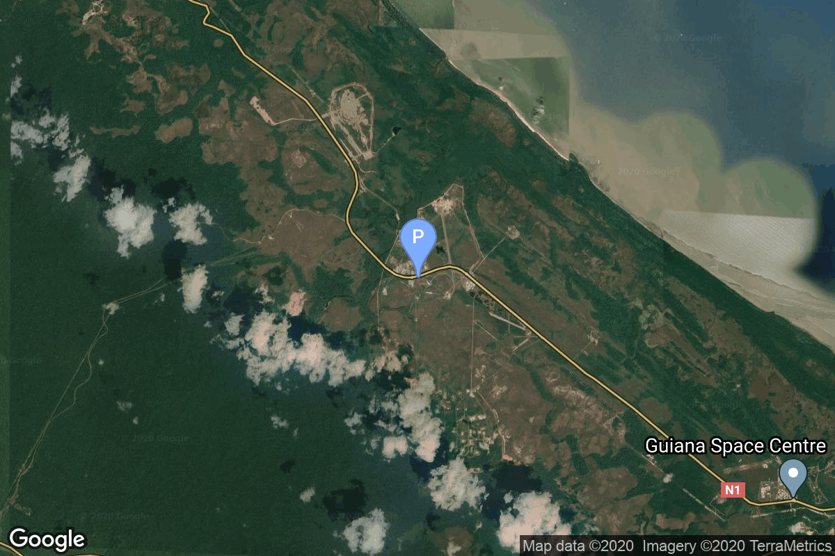
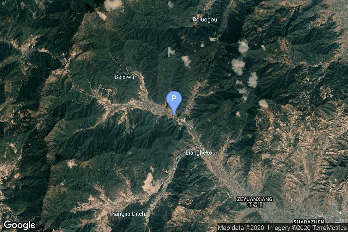
{ "count": 7827, "next": "https://ll.thespacedevs.com/2.0.0/launch/?format=api&limit=10&offset=6600&ordering=id", "previous": "https://ll.thespacedevs.com/2.0.0/launch/?format=api&limit=10&offset=6580&ordering=id", "results": [ { "id": "d6ca3a23-71f9-485c-a70d-911705ddff9c", "url": "https://ll.thespacedevs.com/2.0.0/launch/d6ca3a23-71f9-485c-a70d-911705ddff9c/?format=api", "launch_library_id": null, "slug": "voskhod-zenit-2-39", "name": "Voskhod | Zenit-2 39", "status": { "id": 3, "name": "Success" }, "net": "1966-06-08T11:00:00Z", "window_end": "1966-06-08T11:00:00Z", "window_start": "1966-06-08T11:00:00Z", "inhold": false, "tbdtime": false, "tbddate": false, "probability": null, "holdreason": "", "failreason": null, "hashtag": null, "launch_service_provider": { "id": 66, "url": "https://ll.thespacedevs.com/2.0.0/agencies/66/?format=api", "name": "Soviet Space Program", "type": "Government" }, "rocket": { "id": 3536, "configuration": { "id": 104, "launch_library_id": 138, "url": "https://ll.thespacedevs.com/2.0.0/config/launcher/104/?format=api", "name": "Voskhod", "family": "R-7", "full_name": "Voskhod", "variant": "Voskhod" } }, "mission": { "id": 1956, "launch_library_id": null, "name": "Zenit-2 39", "description": "Zenit-2 film-return and ELINT reconnaissance satellite.", "launch_designator": null, "type": "Government/Top Secret", "orbit": { "id": 8, "name": "Low Earth Orbit", "abbrev": "LEO" } }, "pad": { "id": 20, "url": "https://ll.thespacedevs.com/2.0.0/pad/20/?format=api", "agency_id": null, "name": "31/6", "info_url": null, "wiki_url": "https://en.wikipedia.org/wiki/Baikonur_Cosmodrome_Site_31", "map_url": "https://www.google.com/maps?q=45.996034,63.564003", "latitude": "45.996034", "longitude": "63.564003", "location": { "id": 15, "url": "https://ll.thespacedevs.com/2.0.0/location/15/?format=api", "name": "Baikonur Cosmodrome, Republic of Kazakhstan", "country_code": "KAZ", "map_image": "https://thespacedevs-prod.nyc3.digitaloceanspaces.com/media/map_images/location_15_20200803142517.jpg", "total_launch_count": 1561, "total_landing_count": 0 }, "map_image": "https://thespacedevs-prod.nyc3.digitaloceanspaces.com/media/map_images/pad_20_20200803143516.jpg", "total_launch_count": 427 }, "webcast_live": false, "image": "https://thespacedevs-prod.nyc3.digitaloceanspaces.com/media/images/voskhod_during__image_20251102062248.jpg", "infographic": null, "program": [] }, { "id": "d6cc6817-411a-4802-9a29-1f43e7011ba8", "url": "https://ll.thespacedevs.com/2.0.0/launch/d6cc6817-411a-4802-9a29-1f43e7011ba8/?format=api", "launch_library_id": null, "slug": "diamant-b-tournesol", "name": "Diamant B | Tournesol", "status": { "id": 3, "name": "Success" }, "net": "1971-04-15T09:19:37Z", "window_end": "1971-04-15T09:19:37Z", "window_start": "1971-04-15T09:19:37Z", "inhold": false, "tbdtime": false, "tbddate": false, "probability": null, "holdreason": "", "failreason": null, "hashtag": null, "launch_service_provider": { "id": 46, "url": "https://ll.thespacedevs.com/2.0.0/agencies/46/?format=api", "name": "National Center of Space Research", "type": "Government" }, "rocket": { "id": 4122, "configuration": { "id": 312, "launch_library_id": null, "url": "https://ll.thespacedevs.com/2.0.0/config/launcher/312/?format=api", "name": "Diamant B", "family": "Diamant", "full_name": "Diamant B", "variant": "B" } }, "mission": { "id": 2540, "launch_library_id": null, "name": "Tournesol", "description": "French satellite designed to detect the presence of hydrogen in several directions of the celestial sphere.", "launch_designator": null, "type": "Astrophysics", "orbit": { "id": 8, "name": "Low Earth Orbit", "abbrev": "LEO" } }, "pad": { "id": 125, "url": "https://ll.thespacedevs.com/2.0.0/pad/125/?format=api", "agency_id": 46, "name": "Diamant Launch Area", "info_url": null, "wiki_url": null, "map_url": "https://www.google.com/maps?q=5.2222222,-52.7758051", "latitude": "5.2222222", "longitude": "-52.7758051", "location": { "id": 13, "url": "https://ll.thespacedevs.com/2.0.0/location/13/?format=api", "name": "Guiana Space Centre, French Guiana", "country_code": "GUF", "map_image": "https://thespacedevs-prod.nyc3.digitaloceanspaces.com/media/map_images/location_13_20200803142412.jpg", "total_launch_count": 331, "total_landing_count": 0 }, "map_image": "https://thespacedevs-prod.nyc3.digitaloceanspaces.com/media/map_images/pad_125_20200803143236.jpg", "total_launch_count": 8 }, "webcast_live": false, "image": "https://thespacedevs-prod.nyc3.digitaloceanspaces.com/media/images/diamant_b_lifto_image_20240411170212.jpg", "infographic": null, "program": [] }, { "id": "d6cdf365-f3db-430d-b8a4-d09cfac0106c", "url": "https://ll.thespacedevs.com/2.0.0/launch/d6cdf365-f3db-430d-b8a4-d09cfac0106c/?format=api", "launch_library_id": null, "slug": "delta-6925-gps-2-9", "name": "Delta 6925 | GPS-2 9", "status": { "id": 3, "name": "Success" }, "net": "1990-10-01T21:56:00Z", "window_end": "1990-10-01T21:56:00Z", "window_start": "1990-10-01T21:56:00Z", "inhold": false, "tbdtime": false, "tbddate": false, "probability": null, "holdreason": "", "failreason": "", "hashtag": null, "launch_service_provider": { "id": 161, "url": "https://ll.thespacedevs.com/2.0.0/agencies/161/?format=api", "name": "United States Air Force", "type": "Government" }, "rocket": { "id": 6313, "configuration": { "id": 300, "launch_library_id": null, "url": "https://ll.thespacedevs.com/2.0.0/config/launcher/300/?format=api", "name": "Delta II", "family": "Delta", "full_name": "Delta II 6925", "variant": "6925" } }, "mission": { "id": 4703, "launch_library_id": null, "name": "GPS-2 9", "description": "Second generation GPS navigation satellite", "launch_designator": null, "type": "Navigation", "orbit": { "id": 12, "name": "Medium Earth Orbit", "abbrev": "MEO" } }, "pad": { "id": 14, "url": "https://ll.thespacedevs.com/2.0.0/pad/14/?format=api", "agency_id": null, "name": "Space Launch Complex 17A", "info_url": null, "wiki_url": "https://en.wikipedia.org/wiki/Cape_Canaveral_Space_Launch_Complex_17", "map_url": "https://www.google.com/maps?q=28.4472,-80.565", "latitude": "28.4472", "longitude": "-80.565", "location": { "id": 12, "url": "https://ll.thespacedevs.com/2.0.0/location/12/?format=api", "name": "Cape Canaveral SFS, FL, USA", "country_code": "USA", "map_image": "https://thespacedevs-prod.nyc3.digitaloceanspaces.com/media/map_images/location_12_20200803142519.jpg", "total_launch_count": 1098, "total_landing_count": 71 }, "map_image": "https://thespacedevs-prod.nyc3.digitaloceanspaces.com/media/map_images/pad_14_20200803143451.jpg", "total_launch_count": 145 }, "webcast_live": false, "image": null, "infographic": null, "program": [ { "id": 29, "url": "https://ll.thespacedevs.com/2.0.0/program/29/?format=api", "name": "Global Positioning System", "description": "The Global Positioning System (GPS), originally Navstar GPS, is a satellite-based radio navigation system owned by the United States government and operated by the United States Space Force. It is one of the global navigation satellite systems (GNSS) that provide geolocation and time information to a GPS receiver anywhere on or near the Earth where there is an unobstructed line of sight to four or more GPS satellites.", "agencies": [ { "id": 1041, "url": "https://ll.thespacedevs.com/2.0.0/agencies/1041/?format=api", "name": "United States Space Force", "type": "Government" } ], "image_url": "https://thespacedevs-prod.nyc3.digitaloceanspaces.com/media/images/global2520posi_program_20231229182501.png", "start_date": "1978-02-22T00:00:00Z", "end_date": null, "info_url": "https://www.gps.gov/", "wiki_url": "https://en.wikipedia.org/wiki/Global_Positioning_System" } ] }, { "id": "d6dd6900-332e-4e9e-89b8-dfa4ba285822", "url": "https://ll.thespacedevs.com/2.0.0/launch/d6dd6900-332e-4e9e-89b8-dfa4ba285822/?format=api", "launch_library_id": null, "slug": "firefly-alpha-flta006-message-in-a-booster", "name": "Firefly Alpha | FLTA006 (Message in a Booster)", "status": { "id": 4, "name": "Failure" }, "net": "2025-04-29T13:37:00Z", "window_end": "2025-04-29T14:29:00Z", "window_start": "2025-04-29T13:37:00Z", "inhold": false, "tbdtime": false, "tbddate": false, "probability": 90, "holdreason": "", "failreason": "Problem during stage separation and second stage ignition caused disintegration of the separated 1st stage and the loss of the Lightning engine nozzle extension on the 2nd stage, substantially reducing the engine’s thrust. 2nd stage reached 320 km in altitude but did not reach orbital velocity, eventually impacted the Pacific Ocean north of Antarctica.", "hashtag": null, "launch_service_provider": { "id": 265, "url": "https://ll.thespacedevs.com/2.0.0/agencies/265/?format=api", "name": "Firefly Aerospace", "type": "Commercial" }, "rocket": { "id": 8418, "configuration": { "id": 179, "launch_library_id": 216, "url": "https://ll.thespacedevs.com/2.0.0/config/launcher/179/?format=api", "name": "Firefly Alpha", "family": "Firefly Alpha", "full_name": "Firefly Alpha", "variant": "" } }, "mission": { "id": 7007, "launch_library_id": null, "name": "FLTA006 (Message in a Booster)", "description": "Sixth flight of the Firefly Alpha small satellite launcher, launching the demonstration mission for Lockheed Martin's new LM400 satellite bus, which will carry a communications payload. The satellite bus is customizable to support different missions, including remote sensing, communications, imagery and radar Earth observations. It can also support different kinds of orbits and launch configurations.", "launch_designator": null, "type": "Technology", "orbit": { "id": 8, "name": "Low Earth Orbit", "abbrev": "LEO" } }, "pad": { "id": 39, "url": "https://ll.thespacedevs.com/2.0.0/pad/39/?format=api", "agency_id": null, "name": "Space Launch Complex 2W", "info_url": null, "wiki_url": "https://en.wikipedia.org/wiki/Vandenberg_Space_Launch_Complex_2", "map_url": "https://www.google.com/maps?q=34.7556,-120.6224", "latitude": "34.7556", "longitude": "-120.6224", "location": { "id": 11, "url": "https://ll.thespacedevs.com/2.0.0/location/11/?format=api", "name": "Vandenberg SFB, CA, USA", "country_code": "USA", "map_image": "https://thespacedevs-prod.nyc3.digitaloceanspaces.com/media/map_images/location_11_20200803142416.jpg", "total_launch_count": 872, "total_landing_count": 33 }, "map_image": "https://thespacedevs-prod.nyc3.digitaloceanspaces.com/media/map_images/pad_39_20200803143542.jpg", "total_launch_count": 99 }, "webcast_live": false, "image": "https://thespacedevs-prod.nyc3.digitaloceanspaces.com/media/images/firefly_alpha_l_image_20240605174156.jpeg", "infographic": null, "program": [] }, { "id": "d6e5241f-c55d-4469-ab80-1a1f59ec6064", "url": "https://ll.thespacedevs.com/2.0.0/launch/d6e5241f-c55d-4469-ab80-1a1f59ec6064/?format=api", "launch_library_id": null, "slug": "kuaizhou-1a-tianmu-1-19-22", "name": "Kuaizhou 1A | Tianmu-1 19-22", "status": { "id": 3, "name": "Success" }, "net": "2023-12-27T06:50:00Z", "window_end": "2023-12-27T07:26:00Z", "window_start": "2023-12-27T06:49:00Z", "inhold": false, "tbdtime": false, "tbddate": false, "probability": null, "holdreason": "", "failreason": "", "hashtag": null, "launch_service_provider": { "id": 194, "url": "https://ll.thespacedevs.com/2.0.0/agencies/194/?format=api", "name": "ExPace", "type": "Commercial" }, "rocket": { "id": 8153, "configuration": { "id": 135, "launch_library_id": 155, "url": "https://ll.thespacedevs.com/2.0.0/config/launcher/135/?format=api", "name": "Kuaizhou 1A", "family": "Kuaizhou", "full_name": "Kuaizhou 1A", "variant": "1A" } }, "mission": { "id": 6714, "launch_library_id": null, "name": "Tianmu-1 19-22", "description": "Small meteorology research satellites using GNSS radio occultation by CASIC subsidiary Xiyong Microelectronics Park.", "launch_designator": null, "type": "Earth Science", "orbit": { "id": 17, "name": "Sun-Synchronous Orbit", "abbrev": "SSO" } }, "pad": { "id": 21, "url": "https://ll.thespacedevs.com/2.0.0/pad/21/?format=api", "agency_id": null, "name": "Launch Area 95A", "info_url": null, "wiki_url": "https://en.wikipedia.org/wiki/Jiuquan_Satellite_Launch_Center", "map_url": "https://www.google.com/maps?q=40.969117,100.343333", "latitude": "40.969117", "longitude": "100.343333", "location": { "id": 17, "url": "https://ll.thespacedevs.com/2.0.0/location/17/?format=api", "name": "Jiuquan Satellite Launch Center, People's Republic of China", "country_code": "CHN", "map_image": "https://thespacedevs-prod.nyc3.digitaloceanspaces.com/media/map_images/location_17_20200803142429.jpg", "total_launch_count": 280, "total_landing_count": 2 }, "map_image": "https://thespacedevs-prod.nyc3.digitaloceanspaces.com/media/map_images/pad_21_20200803143253.jpg", "total_launch_count": 66 }, "webcast_live": false, "image": "https://thespacedevs-prod.nyc3.digitaloceanspaces.com/media/images/kuaizhou-1a252_image_20231227075024.jpg", "infographic": null, "program": [] }, { "id": "d6e60f3b-21d0-44f9-be02-fe0c00289b6a", "url": "https://ll.thespacedevs.com/2.0.0/launch/d6e60f3b-21d0-44f9-be02-fe0c00289b6a/?format=api", "launch_library_id": null, "slug": "falcon-9-block-5-inmarsat-6-f2", "name": "Falcon 9 Block 5 | Inmarsat-6 F2", "status": { "id": 3, "name": "Success" }, "net": "2023-02-18T03:59:00Z", "window_end": "2023-02-18T05:28:00Z", "window_start": "2023-02-18T03:59:00Z", "inhold": false, "tbdtime": false, "tbddate": false, "probability": 75, "holdreason": "", "failreason": "", "hashtag": null, "launch_service_provider": { "id": 121, "url": "https://ll.thespacedevs.com/2.0.0/agencies/121/?format=api", "name": "SpaceX", "type": "Commercial" }, "rocket": { "id": 7703, "configuration": { "id": 164, "launch_library_id": 188, "url": "https://ll.thespacedevs.com/2.0.0/config/launcher/164/?format=api", "name": "Falcon 9", "family": "Falcon", "full_name": "Falcon 9 Block 5", "variant": "Block 5" } }, "mission": { "id": 6221, "launch_library_id": null, "name": "Inmarsat-6 F2", "description": "Inmarsat-6 is the sixth generation of satellites for the London-based global mobile satellite communications operator Inmarsat. It consists of a dual mission to augment both L-band and Ka-band Global Xpress services.\r\n\r\nAirbus Defence and Space has been awarded a contract by Inmarsat to design and develop the first two Inmarsat-6 (I-6) mobile communications satellites, creating the most versatile mobile services satellites in its fleet.\r\n\r\nThe two I-6 satellites are based on Airbus Defence and Space's Eurostar platform in its E3000e variant, which exclusively uses electric propulsion for orbit raising. The satellites take advantage of the reduction in mass that this electric propulsion technology enables for a dual payload mission, with an exceptionally large next generation digitally processed payload.\r\n\r\nI-6 F1 and F2 both carry a large 9 m aperture L-band antenna and nine multibeam Ka-band antennas, and feature a high level of flexibility and connectivity. A new generation modular digital processor provides full routing flexibility over up to 8000 channels and dynamic power allocation to over 200 spot beams in L-band. Ka-band spot beams are steerable over the full Earth disk, with flexible channel to beam allocation.", "launch_designator": null, "type": "Communications", "orbit": { "id": 2, "name": "Geostationary Transfer Orbit", "abbrev": "GTO" } }, "pad": { "id": 80, "url": "https://ll.thespacedevs.com/2.0.0/pad/80/?format=api", "agency_id": 121, "name": "Space Launch Complex 40", "info_url": null, "wiki_url": "https://en.wikipedia.org/wiki/Cape_Canaveral_Air_Force_Station_Space_Launch_Complex_40", "map_url": "https://www.google.com/maps?q=28.56194122,-80.57735736", "latitude": "28.56194122", "longitude": "-80.57735736", "location": { "id": 12, "url": "https://ll.thespacedevs.com/2.0.0/location/12/?format=api", "name": "Cape Canaveral SFS, FL, USA", "country_code": "USA", "map_image": "https://thespacedevs-prod.nyc3.digitaloceanspaces.com/media/map_images/location_12_20200803142519.jpg", "total_launch_count": 1098, "total_landing_count": 71 }, "map_image": "https://thespacedevs-prod.nyc3.digitaloceanspaces.com/media/map_images/pad_80_20200803143323.jpg", "total_launch_count": 375 }, "webcast_live": false, "image": "https://thespacedevs-prod.nyc3.digitaloceanspaces.com/media/images/falcon2520925_image_20240101101051.jpeg", "infographic": null, "program": [] }, { "id": "d6e7ef65-c122-4fbf-ace5-76431c557673", "url": "https://ll.thespacedevs.com/2.0.0/launch/d6e7ef65-c122-4fbf-ace5-76431c557673/?format=api", "launch_library_id": null, "slug": "saturn-i-saturn-sa-4", "name": "Saturn I | Saturn SA-4", "status": { "id": 3, "name": "Success" }, "net": "1963-03-28T20:11:55Z", "window_end": "1963-03-28T20:11:55Z", "window_start": "1963-03-28T20:11:55Z", "inhold": false, "tbdtime": false, "tbddate": false, "probability": null, "holdreason": "", "failreason": "", "hashtag": null, "launch_service_provider": { "id": 44, "url": "https://ll.thespacedevs.com/2.0.0/agencies/44/?format=api", "name": "National Aeronautics and Space Administration", "type": "Government" }, "rocket": { "id": 7421, "configuration": { "id": 355, "launch_library_id": null, "url": "https://ll.thespacedevs.com/2.0.0/config/launcher/355/?format=api", "name": "Saturn I", "family": "Saturn", "full_name": "Saturn I", "variant": "I" } }, "mission": { "id": 5810, "launch_library_id": null, "name": "Saturn SA-4", "description": "Fourth and last suborbital test flight of the Saturn I launch vehicle.", "launch_designator": null, "type": "Test Flight", "orbit": { "id": 15, "name": "Suborbital", "abbrev": "Sub" } }, "pad": { "id": 19, "url": "https://ll.thespacedevs.com/2.0.0/pad/19/?format=api", "agency_id": null, "name": "Launch Complex 34", "info_url": null, "wiki_url": "https://en.wikipedia.org/wiki/Cape_Canaveral_Air_Force_Station_Launch_Complex_34", "map_url": "https://www.google.com/maps?q=28.521811,-80.56113", "latitude": "28.521811", "longitude": "-80.56113", "location": { "id": 12, "url": "https://ll.thespacedevs.com/2.0.0/location/12/?format=api", "name": "Cape Canaveral SFS, FL, USA", "country_code": "USA", "map_image": "https://thespacedevs-prod.nyc3.digitaloceanspaces.com/media/map_images/location_12_20200803142519.jpg", "total_launch_count": 1098, "total_landing_count": 71 }, "map_image": "https://thespacedevs-prod.nyc3.digitaloceanspaces.com/media/map_images/pad_19_20200803143428.jpg", "total_launch_count": 9 }, "webcast_live": false, "image": "https://thespacedevs-prod.nyc3.digitaloceanspaces.com/media/images/saturn_1_on_lc-_image_20240411095856.jpeg", "infographic": null, "program": [ { "id": 4, "url": "https://ll.thespacedevs.com/2.0.0/program/4/?format=api", "name": "Apollo", "description": "The Apollo program was the third United States human spaceflight program carried out by the National Aeronautics and Space Administration (NASA), which succeeded in landing the first humans on the Moon from 1969 to 1972.", "agencies": [ { "id": 44, "url": "https://ll.thespacedevs.com/2.0.0/agencies/44/?format=api", "name": "National Aeronautics and Space Administration", "type": "Government" } ], "image_url": "https://thespacedevs-prod.nyc3.digitaloceanspaces.com/media/images/apollo_program_20200820200202.png", "start_date": "1966-11-16T00:00:00Z", "end_date": "1972-12-19T19:24:59Z", "info_url": "https://www.nasa.gov/mission_pages/apollo/index.html", "wiki_url": "https://en.wikipedia.org/wiki/Apollo_program" } ] }, { "id": "d6ebccda-9537-40b3-8d1c-f1e1bded54c2", "url": "https://ll.thespacedevs.com/2.0.0/launch/d6ebccda-9537-40b3-8d1c-f1e1bded54c2/?format=api", "launch_library_id": null, "slug": "thorad-slv-2g-agena-d-kh-4a-50", "name": "Thorad SLV-2G Agena D | KH-4A 50", "status": { "id": 3, "name": "Success" }, "net": "1969-03-19T21:38:00Z", "window_end": "1969-03-19T21:38:00Z", "window_start": "1969-03-19T21:38:00Z", "inhold": false, "tbdtime": false, "tbddate": false, "probability": null, "holdreason": "", "failreason": null, "hashtag": null, "launch_service_provider": { "id": 161, "url": "https://ll.thespacedevs.com/2.0.0/agencies/161/?format=api", "name": "United States Air Force", "type": "Government" }, "rocket": { "id": 3886, "configuration": { "id": 418, "launch_library_id": null, "url": "https://ll.thespacedevs.com/2.0.0/config/launcher/418/?format=api", "name": "Thorad SLV-2G Agena D", "family": "Thor", "full_name": "Thorad SLV-2G Agena D", "variant": "SLV-2G Agena D" } }, "mission": { "id": 2304, "launch_library_id": null, "name": "KH-4A 50", "description": "The KH-4A (Keyhole-4A) was the fifth optical reconnaissance satellite version in the Corona-program.", "launch_designator": null, "type": "Government/Top Secret", "orbit": { "id": 8, "name": "Low Earth Orbit", "abbrev": "LEO" } }, "pad": { "id": 93, "url": "https://ll.thespacedevs.com/2.0.0/pad/93/?format=api", "agency_id": 161, "name": "Space Launch Complex 3W", "info_url": null, "wiki_url": "https://en.wikipedia.org/wiki/Vandenberg_Space_Launch_Complex_3#SLC-3W", "map_url": "https://www.google.com/maps?q=34.644,-120.593", "latitude": "34.644", "longitude": "-120.593", "location": { "id": 11, "url": "https://ll.thespacedevs.com/2.0.0/location/11/?format=api", "name": "Vandenberg SFB, CA, USA", "country_code": "USA", "map_image": "https://thespacedevs-prod.nyc3.digitaloceanspaces.com/media/map_images/location_11_20200803142416.jpg", "total_launch_count": 872, "total_landing_count": 33 }, "map_image": "https://thespacedevs-prod.nyc3.digitaloceanspaces.com/media/map_images/pad_93_20200803143225.jpg", "total_launch_count": 81 }, "webcast_live": false, "image": "https://thespacedevs-prod.nyc3.digitaloceanspaces.com/media/images/thorad-slv2g_ag_image_20251102061406.jpg", "infographic": null, "program": [] }, { "id": "d6fc45b4-8775-48cd-8007-55e82706eb86", "url": "https://ll.thespacedevs.com/2.0.0/launch/d6fc45b4-8775-48cd-8007-55e82706eb86/?format=api", "launch_library_id": null, "slug": "voskhod-zenit-4m-25", "name": "Voskhod | Zenit-4M 25", "status": { "id": 3, "name": "Success" }, "net": "1971-11-02T14:25:02Z", "window_end": "1971-11-02T14:25:02Z", "window_start": "1971-11-02T14:25:02Z", "inhold": false, "tbdtime": false, "tbddate": false, "probability": null, "holdreason": "", "failreason": null, "hashtag": null, "launch_service_provider": { "id": 66, "url": "https://ll.thespacedevs.com/2.0.0/agencies/66/?format=api", "name": "Soviet Space Program", "type": "Government" }, "rocket": { "id": 4189, "configuration": { "id": 104, "launch_library_id": 138, "url": "https://ll.thespacedevs.com/2.0.0/config/launcher/104/?format=api", "name": "Voskhod", "family": "R-7", "full_name": "Voskhod", "variant": "Voskhod" } }, "mission": { "id": 2607, "launch_library_id": null, "name": "Zenit-4M 25", "description": "The soviet Zenit-4M (Rotor, 11F691) was an improved version of the Zenit-4 high resolution reconnaissance satellite and was part of the Vostok-based Zenit-family.", "launch_designator": null, "type": "Government/Top Secret", "orbit": { "id": 8, "name": "Low Earth Orbit", "abbrev": "LEO" } }, "pad": { "id": 168, "url": "https://ll.thespacedevs.com/2.0.0/pad/168/?format=api", "agency_id": null, "name": "41/1", "info_url": null, "wiki_url": "https://en.wikipedia.org/wiki/Plesetsk_Cosmodrome", "map_url": "https://www.google.com/maps?q=62.941,40.526806", "latitude": "62.941", "longitude": "40.526806", "location": { "id": 6, "url": "https://ll.thespacedevs.com/2.0.0/location/6/?format=api", "name": "Plesetsk Cosmodrome, Russian Federation", "country_code": "RUS", "map_image": "https://thespacedevs-prod.nyc3.digitaloceanspaces.com/media/map_images/location_6_20200803142434.jpg", "total_launch_count": 1682, "total_landing_count": 0 }, "map_image": "https://thespacedevs-prod.nyc3.digitaloceanspaces.com/media/map_images/pad_168_20200803143446.jpg", "total_launch_count": 310 }, "webcast_live": false, "image": "https://thespacedevs-prod.nyc3.digitaloceanspaces.com/media/images/voskhod_during__image_20251102062248.jpg", "infographic": null, "program": [] }, { "id": "d6fd5085-8665-4b6c-a886-edd41c21aa73", "url": "https://ll.thespacedevs.com/2.0.0/launch/d6fd5085-8665-4b6c-a886-edd41c21aa73/?format=api", "launch_library_id": 943, "slug": "soyuz-u-soyuz-t-9", "name": "Soyuz-U | Soyuz T-9", "status": { "id": 3, "name": "Success" }, "net": "1983-06-27T09:12:18Z", "window_end": "1983-06-27T09:12:18Z", "window_start": "1983-06-27T09:12:18Z", "inhold": false, "tbdtime": false, "tbddate": false, "probability": null, "holdreason": "", "failreason": "", "hashtag": null, "launch_service_provider": { "id": 66, "url": "https://ll.thespacedevs.com/2.0.0/agencies/66/?format=api", "name": "Soviet Space Program", "type": "Government" }, "rocket": { "id": 291, "configuration": { "id": 37, "launch_library_id": 35, "url": "https://ll.thespacedevs.com/2.0.0/config/launcher/37/?format=api", "name": "Soyuz U", "family": "Soyuz", "full_name": "Soyuz U", "variant": "" } }, "mission": { "id": 322, "launch_library_id": 436, "name": "Soyuz T-9", "description": "Soyuz T-5 was the second long-duration expedition to the Salyut 7 space station. The mission began on June 27, 1983, 09:12:00 UTC, launching Commander Vladimir Lyakhov and Flight Engineer Aleksandr Aleksandrov into orbit. They docked with the station the next day. During their 150-day stay on the station, crew carried outd various scientific and medical experiments, performed two EVAs to install additional solar panels on the station, and were visited by 2 uncrewed cargo Progress vehicles.\nThe mission concluded with a safe landing back on Earth on November 23, 1983, 19:58:00 UTC.", "launch_designator": null, "type": "Human Exploration", "orbit": { "id": 8, "name": "Low Earth Orbit", "abbrev": "LEO" } }, "pad": { "id": 32, "url": "https://ll.thespacedevs.com/2.0.0/pad/32/?format=api", "agency_id": null, "name": "1/5", "info_url": null, "wiki_url": "", "map_url": "https://www.google.com/maps?q=45.92,63.342", "latitude": "45.92", "longitude": "63.342", "location": { "id": 15, "url": "https://ll.thespacedevs.com/2.0.0/location/15/?format=api", "name": "Baikonur Cosmodrome, Republic of Kazakhstan", "country_code": "KAZ", "map_image": "https://thespacedevs-prod.nyc3.digitaloceanspaces.com/media/map_images/location_15_20200803142517.jpg", "total_launch_count": 1561, "total_landing_count": 0 }, "map_image": "https://thespacedevs-prod.nyc3.digitaloceanspaces.com/media/map_images/pad_32_20200803143513.jpg", "total_launch_count": 487 }, "webcast_live": false, "image": "https://thespacedevs-prod.nyc3.digitaloceanspaces.com/media/images/soyuz2520u_image_20190222031023.jpeg", "infographic": null, "program": [ { "id": 8, "url": "https://ll.thespacedevs.com/2.0.0/program/8/?format=api", "name": "Soyuz", "description": "The Soyuz programme is a human spaceflight programme initiated by the Soviet Union in the early 1960s. The Soyuz spacecraft was originally part of a Moon landing project intended to put a Soviet cosmonaut on the Moon. It was the third Soviet human spaceflight programme after the Vostok and Voskhod programmes.", "agencies": [ { "id": 63, "url": "https://ll.thespacedevs.com/2.0.0/agencies/63/?format=api", "name": "Russian Federal Space Agency (ROSCOSMOS)", "type": "Government" }, { "id": 66, "url": "https://ll.thespacedevs.com/2.0.0/agencies/66/?format=api", "name": "Soviet Space Program", "type": "Government" } ], "image_url": "https://thespacedevs-prod.nyc3.digitaloceanspaces.com/media/images/soyuz_program_20201129185543.png", "start_date": "1966-11-28T11:02:00Z", "end_date": null, "info_url": null, "wiki_url": "https://en.wikipedia.org/wiki/Soyuz_programme" }, { "id": 23, "url": "https://ll.thespacedevs.com/2.0.0/program/23/?format=api", "name": "Salyut", "description": "The Salyut programme was the first space station programme, undertaken by the Soviet Union. It involved a series of four crewed scientific research space stations and two crewed military reconnaissance space stations over a period of 15 years, from 1971 to 1986.", "agencies": [ { "id": 66, "url": "https://ll.thespacedevs.com/2.0.0/agencies/66/?format=api", "name": "Soviet Space Program", "type": "Government" } ], "image_url": "https://thespacedevs-prod.nyc3.digitaloceanspaces.com/media/images/salyut_program_20230506090532.png", "start_date": "1971-04-19T01:40:00Z", "end_date": "1986-07-16T12:34:05Z", "info_url": null, "wiki_url": "https://en.wikipedia.org/wiki/Salyut_programme" } ] } ] }