Launch List
API endpoint that returns all Launch objects or a single launch.
EXAMPLE - /launch/
GET: Return a list of all Launch objects.
FILTERS: Fields - 'name', 'id(s)', 'lsp_id', 'lsp_name', 'serial_number', 'launcher_config__id', 'rocket__spacecraftflight__spacecraft__name'
MODE: 'normal', 'list', 'detailed' EXAMPLE: ?mode=list
SEARCH: Searches through the launch name, rocket name, launch agency, mission name & spacecraft name. EXAMPLE - ?search=SpaceX
GET /2.0.0/launch/?format=api&offset=6570&ordering=-name
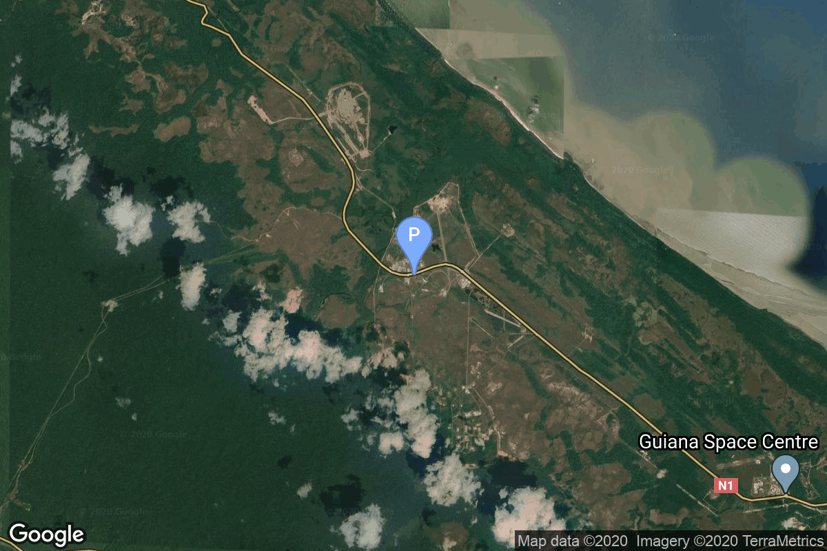
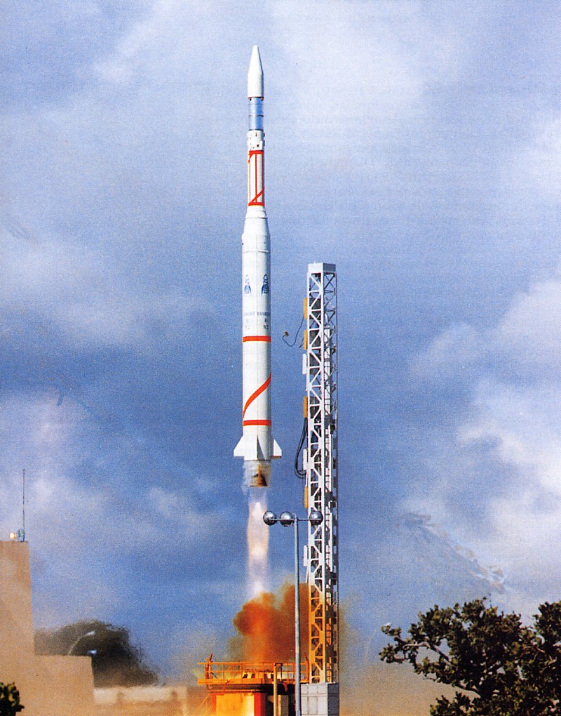
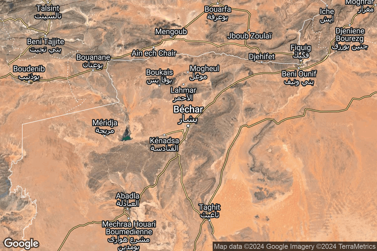
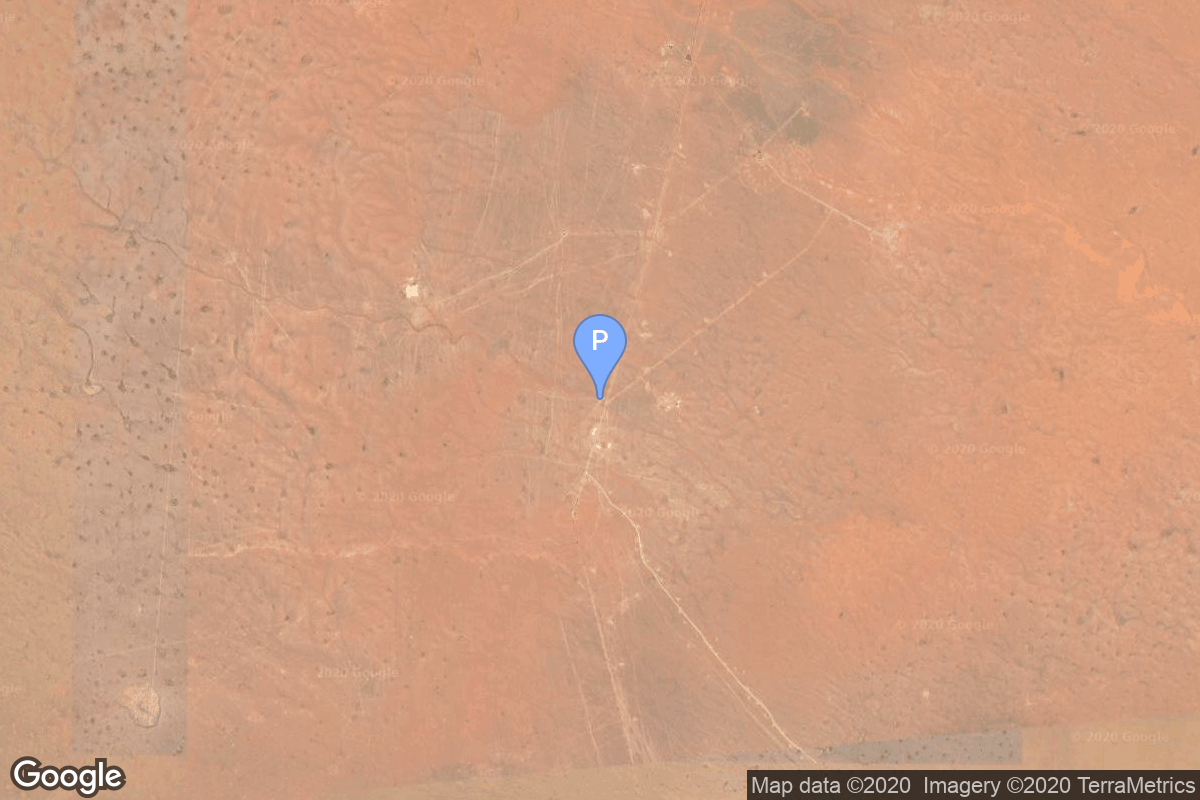
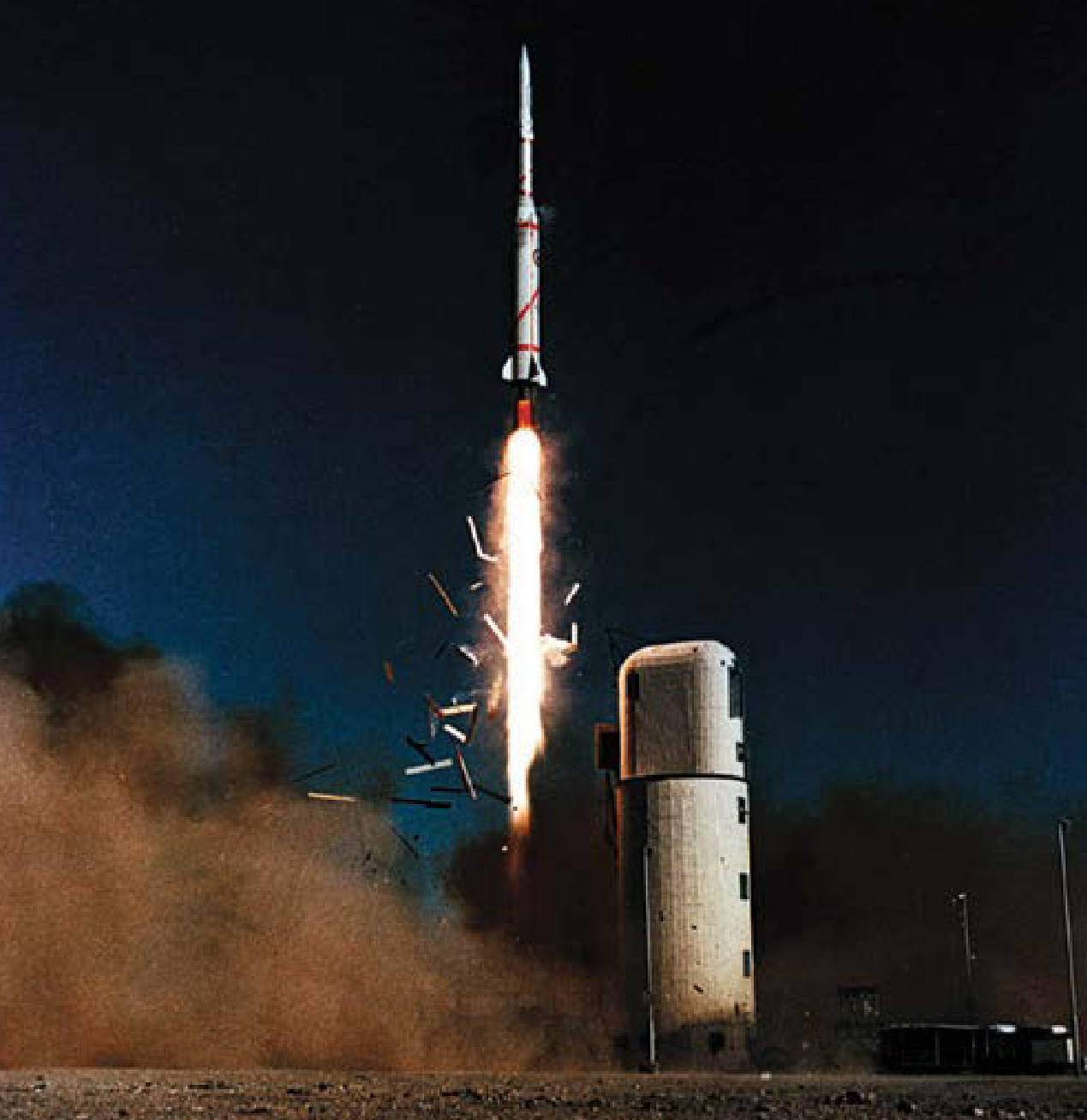
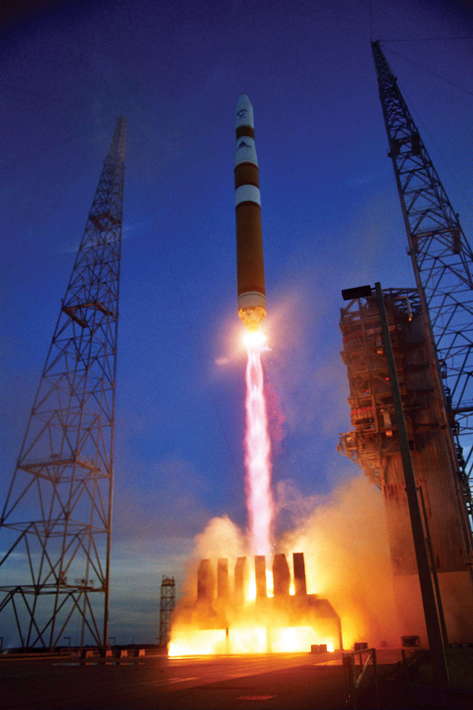
{ "count": 7723, "next": "https://ll.thespacedevs.com/2.0.0/launch/?format=api&limit=10&offset=6580&ordering=-name", "previous": "https://ll.thespacedevs.com/2.0.0/launch/?format=api&limit=10&offset=6560&ordering=-name", "results": [ { "id": "d3234425-8b9c-4761-b62c-de9468ee4ff1", "url": "https://ll.thespacedevs.com/2.0.0/launch/d3234425-8b9c-4761-b62c-de9468ee4ff1/?format=api", "launch_library_id": null, "slug": "diamant-bp4-castor-pollux", "name": "Diamant BP4 | Castor & Pollux", "status": { "id": 3, "name": "Success" }, "net": "1975-05-17T10:32:00Z", "window_end": "1975-05-17T10:32:00Z", "window_start": "1975-05-17T10:32:00Z", "inhold": false, "tbdtime": false, "tbddate": false, "probability": null, "holdreason": "", "failreason": null, "hashtag": null, "launch_service_provider": { "id": 46, "url": "https://ll.thespacedevs.com/2.0.0/agencies/46/?format=api", "name": "National Center of Space Research", "type": "Government" }, "rocket": { "id": 4580, "configuration": { "id": 313, "launch_library_id": null, "url": "https://ll.thespacedevs.com/2.0.0/config/launcher/313/?format=api", "name": "Diamant BP4", "family": "Diamant", "full_name": "Diamant BP4", "variant": "BP4" } }, "mission": { "id": 2998, "launch_library_id": null, "name": "Castor & Pollux", "description": "Dual French scientific satellites", "launch_designator": null, "type": "Earth Science", "orbit": { "id": 8, "name": "Low Earth Orbit", "abbrev": "LEO" } }, "pad": { "id": 125, "url": "https://ll.thespacedevs.com/2.0.0/pad/125/?format=api", "agency_id": 46, "name": "Diamant Launch Area", "info_url": null, "wiki_url": null, "map_url": "https://www.google.com/maps?q=5.2222222,-52.7758051", "latitude": "5.2222222", "longitude": "-52.7758051", "location": { "id": 13, "url": "https://ll.thespacedevs.com/2.0.0/location/13/?format=api", "name": "Guiana Space Centre, French Guiana", "country_code": "GUF", "map_image": "https://thespacedevs-prod.nyc3.digitaloceanspaces.com/media/map_images/location_13_20200803142412.jpg", "total_launch_count": 329, "total_landing_count": 0 }, "map_image": "https://thespacedevs-prod.nyc3.digitaloceanspaces.com/media/map_images/pad_125_20200803143236.jpg", "total_launch_count": 8 }, "webcast_live": false, "image": null, "infographic": null, "program": [] }, { "id": "0c9d8810-8a3a-4e75-93cf-a33d50b1afce", "url": "https://ll.thespacedevs.com/2.0.0/launch/0c9d8810-8a3a-4e75-93cf-a33d50b1afce/?format=api", "launch_library_id": null, "slug": "diamant-bp4-aura", "name": "Diamant BP4 | Aura", "status": { "id": 3, "name": "Success" }, "net": "1975-09-27T08:37:00Z", "window_end": "1975-09-27T08:37:00Z", "window_start": "1975-09-27T08:37:00Z", "inhold": false, "tbdtime": false, "tbddate": false, "probability": null, "holdreason": "", "failreason": null, "hashtag": null, "launch_service_provider": { "id": 46, "url": "https://ll.thespacedevs.com/2.0.0/agencies/46/?format=api", "name": "National Center of Space Research", "type": "Government" }, "rocket": { "id": 4629, "configuration": { "id": 313, "launch_library_id": null, "url": "https://ll.thespacedevs.com/2.0.0/config/launcher/313/?format=api", "name": "Diamant BP4", "family": "Diamant", "full_name": "Diamant BP4", "variant": "BP4" } }, "mission": { "id": 3047, "launch_library_id": null, "name": "Aura", "description": "French scientific satellite dedicated to solar and atmospheric investigations", "launch_designator": null, "type": "Earth Science", "orbit": { "id": 8, "name": "Low Earth Orbit", "abbrev": "LEO" } }, "pad": { "id": 125, "url": "https://ll.thespacedevs.com/2.0.0/pad/125/?format=api", "agency_id": 46, "name": "Diamant Launch Area", "info_url": null, "wiki_url": null, "map_url": "https://www.google.com/maps?q=5.2222222,-52.7758051", "latitude": "5.2222222", "longitude": "-52.7758051", "location": { "id": 13, "url": "https://ll.thespacedevs.com/2.0.0/location/13/?format=api", "name": "Guiana Space Centre, French Guiana", "country_code": "GUF", "map_image": "https://thespacedevs-prod.nyc3.digitaloceanspaces.com/media/map_images/location_13_20200803142412.jpg", "total_launch_count": 329, "total_landing_count": 0 }, "map_image": "https://thespacedevs-prod.nyc3.digitaloceanspaces.com/media/map_images/pad_125_20200803143236.jpg", "total_launch_count": 8 }, "webcast_live": false, "image": null, "infographic": null, "program": [] }, { "id": "15887d4c-2c56-46bb-b8a1-3420176073a7", "url": "https://ll.thespacedevs.com/2.0.0/launch/15887d4c-2c56-46bb-b8a1-3420176073a7/?format=api", "launch_library_id": null, "slug": "diamant-b-dial-wika", "name": "Diamant B | Dial Wika", "status": { "id": 3, "name": "Success" }, "net": "1970-03-10T12:20:00Z", "window_end": "1970-03-10T12:20:00Z", "window_start": "1970-03-10T12:20:00Z", "inhold": false, "tbdtime": false, "tbddate": false, "probability": null, "holdreason": "", "failreason": null, "hashtag": null, "launch_service_provider": { "id": 46, "url": "https://ll.thespacedevs.com/2.0.0/agencies/46/?format=api", "name": "National Center of Space Research", "type": "Government" }, "rocket": { "id": 3990, "configuration": { "id": 312, "launch_library_id": null, "url": "https://ll.thespacedevs.com/2.0.0/config/launcher/312/?format=api", "name": "Diamant B", "family": "Diamant", "full_name": "Diamant B", "variant": "B" } }, "mission": { "id": 2408, "launch_library_id": null, "name": "Dial Wika", "description": "French-German scientific satellite with four experiments aboard.", "launch_designator": null, "type": "Earth Science", "orbit": { "id": 8, "name": "Low Earth Orbit", "abbrev": "LEO" } }, "pad": { "id": 125, "url": "https://ll.thespacedevs.com/2.0.0/pad/125/?format=api", "agency_id": 46, "name": "Diamant Launch Area", "info_url": null, "wiki_url": null, "map_url": "https://www.google.com/maps?q=5.2222222,-52.7758051", "latitude": "5.2222222", "longitude": "-52.7758051", "location": { "id": 13, "url": "https://ll.thespacedevs.com/2.0.0/location/13/?format=api", "name": "Guiana Space Centre, French Guiana", "country_code": "GUF", "map_image": "https://thespacedevs-prod.nyc3.digitaloceanspaces.com/media/map_images/location_13_20200803142412.jpg", "total_launch_count": 329, "total_landing_count": 0 }, "map_image": "https://thespacedevs-prod.nyc3.digitaloceanspaces.com/media/map_images/pad_125_20200803143236.jpg", "total_launch_count": 8 }, "webcast_live": false, "image": "https://thespacedevs-prod.nyc3.digitaloceanspaces.com/media/images/diamant_b_lifto_image_20240411170212.jpg", "infographic": null, "program": [] }, { "id": "1abc0ed7-c195-4896-8955-475ac5c1b207", "url": "https://ll.thespacedevs.com/2.0.0/launch/1abc0ed7-c195-4896-8955-475ac5c1b207/?format=api", "launch_library_id": null, "slug": "diamant-b-castor-pollux", "name": "Diamant B | Castor & Pollux", "status": { "id": 4, "name": "Failure" }, "net": "1973-05-21T08:47:00Z", "window_end": "1973-05-21T08:47:00Z", "window_start": "1973-05-21T08:47:00Z", "inhold": false, "tbdtime": false, "tbddate": false, "probability": null, "holdreason": "", "failreason": null, "hashtag": null, "launch_service_provider": { "id": 46, "url": "https://ll.thespacedevs.com/2.0.0/agencies/46/?format=api", "name": "National Center of Space Research", "type": "Government" }, "rocket": { "id": 4359, "configuration": { "id": 312, "launch_library_id": null, "url": "https://ll.thespacedevs.com/2.0.0/config/launcher/312/?format=api", "name": "Diamant B", "family": "Diamant", "full_name": "Diamant B", "variant": "B" } }, "mission": { "id": 2777, "launch_library_id": null, "name": "Castor & Pollux", "description": "Dual French scientific satellites. Lost due to launch vehicle failure.", "launch_designator": null, "type": "Earth Science", "orbit": { "id": 8, "name": "Low Earth Orbit", "abbrev": "LEO" } }, "pad": { "id": 125, "url": "https://ll.thespacedevs.com/2.0.0/pad/125/?format=api", "agency_id": 46, "name": "Diamant Launch Area", "info_url": null, "wiki_url": null, "map_url": "https://www.google.com/maps?q=5.2222222,-52.7758051", "latitude": "5.2222222", "longitude": "-52.7758051", "location": { "id": 13, "url": "https://ll.thespacedevs.com/2.0.0/location/13/?format=api", "name": "Guiana Space Centre, French Guiana", "country_code": "GUF", "map_image": "https://thespacedevs-prod.nyc3.digitaloceanspaces.com/media/map_images/location_13_20200803142412.jpg", "total_launch_count": 329, "total_landing_count": 0 }, "map_image": "https://thespacedevs-prod.nyc3.digitaloceanspaces.com/media/map_images/pad_125_20200803143236.jpg", "total_launch_count": 8 }, "webcast_live": false, "image": "https://thespacedevs-prod.nyc3.digitaloceanspaces.com/media/images/diamant_b_lifto_image_20240411170212.jpg", "infographic": null, "program": [] }, { "id": "3795303e-8662-4def-aaec-05144cee34af", "url": "https://ll.thespacedevs.com/2.0.0/launch/3795303e-8662-4def-aaec-05144cee34af/?format=api", "launch_library_id": null, "slug": "diamant-a-diapason-d-1a", "name": "Diamant A | Diapason D-1A", "status": { "id": 3, "name": "Success" }, "net": "1966-02-17T08:33:36Z", "window_end": "1966-02-17T08:33:36Z", "window_start": "1966-02-17T08:33:36Z", "inhold": false, "tbdtime": false, "tbddate": false, "probability": null, "holdreason": "", "failreason": null, "hashtag": null, "launch_service_provider": { "id": 46, "url": "https://ll.thespacedevs.com/2.0.0/agencies/46/?format=api", "name": "National Center of Space Research", "type": "Government" }, "rocket": { "id": 3492, "configuration": { "id": 311, "launch_library_id": null, "url": "https://ll.thespacedevs.com/2.0.0/config/launcher/311/?format=api", "name": "Diamant A", "family": "Diamant", "full_name": "Diamant A", "variant": "A" } }, "mission": { "id": 1912, "launch_library_id": null, "name": "Diapason D-1A", "description": "Diapason was a small cylindrical satellite, 20 cm long and 50 cm in diameter which was used for making geodetic measurements.", "launch_designator": null, "type": "Earth Science", "orbit": { "id": 8, "name": "Low Earth Orbit", "abbrev": "LEO" } }, "pad": { "id": 141, "url": "https://ll.thespacedevs.com/2.0.0/pad/141/?format=api", "agency_id": null, "name": "Brigitte", "info_url": null, "wiki_url": "https://en.wikipedia.org/wiki/Hammaguir", "map_url": "https://www.google.com/maps?q=30.7787318,-3.0669721", "latitude": "30.7787318", "longitude": "-3.0669721", "location": { "id": 147, "url": "https://ll.thespacedevs.com/2.0.0/location/147/?format=api", "name": "Interarmy Special Vehicles Test Centre, French Algeria", "country_code": "FRA", "map_image": "https://thespacedevs-prod.nyc3.digitaloceanspaces.com/media/map_images/location_147_20240808092142.jpg", "total_launch_count": 4, "total_landing_count": 0 }, "map_image": "https://thespacedevs-prod.nyc3.digitaloceanspaces.com/media/map_images/pad_141_20200803143211.jpg", "total_launch_count": 4 }, "webcast_live": false, "image": "https://thespacedevs-prod.nyc3.digitaloceanspaces.com/media/images/diamant_a_lifto_image_20240411170731.png", "infographic": null, "program": [] }, { "id": "c5cd3db6-4b32-4cd9-a178-f3e04a9ed47f", "url": "https://ll.thespacedevs.com/2.0.0/launch/c5cd3db6-4b32-4cd9-a178-f3e04a9ed47f/?format=api", "launch_library_id": null, "slug": "diamant-a-diademe-d-1d", "name": "Diamant A | Diademe D-1D", "status": { "id": 3, "name": "Success" }, "net": "1967-02-15T10:06:57Z", "window_end": "1967-02-15T10:06:57Z", "window_start": "1967-02-15T10:06:57Z", "inhold": false, "tbdtime": false, "tbddate": false, "probability": null, "holdreason": "", "failreason": null, "hashtag": null, "launch_service_provider": { "id": 46, "url": "https://ll.thespacedevs.com/2.0.0/agencies/46/?format=api", "name": "National Center of Space Research", "type": "Government" }, "rocket": { "id": 3623, "configuration": { "id": 311, "launch_library_id": null, "url": "https://ll.thespacedevs.com/2.0.0/config/launcher/311/?format=api", "name": "Diamant A", "family": "Diamant", "full_name": "Diamant A", "variant": "A" } }, "mission": { "id": 2041, "launch_library_id": null, "name": "Diademe D-1D", "description": "French geodetic study satellite.", "launch_designator": null, "type": "Earth Science", "orbit": { "id": 8, "name": "Low Earth Orbit", "abbrev": "LEO" } }, "pad": { "id": 141, "url": "https://ll.thespacedevs.com/2.0.0/pad/141/?format=api", "agency_id": null, "name": "Brigitte", "info_url": null, "wiki_url": "https://en.wikipedia.org/wiki/Hammaguir", "map_url": "https://www.google.com/maps?q=30.7787318,-3.0669721", "latitude": "30.7787318", "longitude": "-3.0669721", "location": { "id": 147, "url": "https://ll.thespacedevs.com/2.0.0/location/147/?format=api", "name": "Interarmy Special Vehicles Test Centre, French Algeria", "country_code": "FRA", "map_image": "https://thespacedevs-prod.nyc3.digitaloceanspaces.com/media/map_images/location_147_20240808092142.jpg", "total_launch_count": 4, "total_landing_count": 0 }, "map_image": "https://thespacedevs-prod.nyc3.digitaloceanspaces.com/media/map_images/pad_141_20200803143211.jpg", "total_launch_count": 4 }, "webcast_live": false, "image": "https://thespacedevs-prod.nyc3.digitaloceanspaces.com/media/images/diamant_a_lifto_image_20240411170731.png", "infographic": null, "program": [] }, { "id": "c29dfe71-9741-4902-9fcd-4ccbf3741408", "url": "https://ll.thespacedevs.com/2.0.0/launch/c29dfe71-9741-4902-9fcd-4ccbf3741408/?format=api", "launch_library_id": null, "slug": "diamant-a-diademe-d-1c", "name": "Diamant A | Diademe D-1C", "status": { "id": 3, "name": "Success" }, "net": "1967-02-08T09:39:39Z", "window_end": "1967-02-08T09:39:39Z", "window_start": "1967-02-08T09:39:39Z", "inhold": false, "tbdtime": false, "tbddate": false, "probability": null, "holdreason": "", "failreason": null, "hashtag": null, "launch_service_provider": { "id": 46, "url": "https://ll.thespacedevs.com/2.0.0/agencies/46/?format=api", "name": "National Center of Space Research", "type": "Government" }, "rocket": { "id": 3619, "configuration": { "id": 311, "launch_library_id": null, "url": "https://ll.thespacedevs.com/2.0.0/config/launcher/311/?format=api", "name": "Diamant A", "family": "Diamant", "full_name": "Diamant A", "variant": "A" } }, "mission": { "id": 2038, "launch_library_id": null, "name": "Diademe D-1C", "description": "French geodetic study satellite.", "launch_designator": null, "type": "Earth Science", "orbit": { "id": 8, "name": "Low Earth Orbit", "abbrev": "LEO" } }, "pad": { "id": 141, "url": "https://ll.thespacedevs.com/2.0.0/pad/141/?format=api", "agency_id": null, "name": "Brigitte", "info_url": null, "wiki_url": "https://en.wikipedia.org/wiki/Hammaguir", "map_url": "https://www.google.com/maps?q=30.7787318,-3.0669721", "latitude": "30.7787318", "longitude": "-3.0669721", "location": { "id": 147, "url": "https://ll.thespacedevs.com/2.0.0/location/147/?format=api", "name": "Interarmy Special Vehicles Test Centre, French Algeria", "country_code": "FRA", "map_image": "https://thespacedevs-prod.nyc3.digitaloceanspaces.com/media/map_images/location_147_20240808092142.jpg", "total_launch_count": 4, "total_landing_count": 0 }, "map_image": "https://thespacedevs-prod.nyc3.digitaloceanspaces.com/media/map_images/pad_141_20200803143211.jpg", "total_launch_count": 4 }, "webcast_live": false, "image": "https://thespacedevs-prod.nyc3.digitaloceanspaces.com/media/images/diamant_a_lifto_image_20240411170731.png", "infographic": null, "program": [] }, { "id": "e7434c5e-3660-4135-9f91-46b1bfbd01fc", "url": "https://ll.thespacedevs.com/2.0.0/launch/e7434c5e-3660-4135-9f91-46b1bfbd01fc/?format=api", "launch_library_id": null, "slug": "diamant-a-asterix", "name": "Diamant A | Asterix", "status": { "id": 3, "name": "Success" }, "net": "1965-11-26T14:47:21Z", "window_end": "1965-11-26T14:47:21Z", "window_start": "1965-11-26T14:47:21Z", "inhold": false, "tbdtime": false, "tbddate": false, "probability": null, "holdreason": "", "failreason": null, "hashtag": null, "launch_service_provider": { "id": 46, "url": "https://ll.thespacedevs.com/2.0.0/agencies/46/?format=api", "name": "National Center of Space Research", "type": "Government" }, "rocket": { "id": 3460, "configuration": { "id": 311, "launch_library_id": null, "url": "https://ll.thespacedevs.com/2.0.0/config/launcher/311/?format=api", "name": "Diamant A", "family": "Diamant", "full_name": "Diamant A", "variant": "A" } }, "mission": { "id": 1880, "launch_library_id": null, "name": "Asterix", "description": "First french satellite", "launch_designator": null, "type": "Test Flight", "orbit": { "id": 8, "name": "Low Earth Orbit", "abbrev": "LEO" } }, "pad": { "id": 141, "url": "https://ll.thespacedevs.com/2.0.0/pad/141/?format=api", "agency_id": null, "name": "Brigitte", "info_url": null, "wiki_url": "https://en.wikipedia.org/wiki/Hammaguir", "map_url": "https://www.google.com/maps?q=30.7787318,-3.0669721", "latitude": "30.7787318", "longitude": "-3.0669721", "location": { "id": 147, "url": "https://ll.thespacedevs.com/2.0.0/location/147/?format=api", "name": "Interarmy Special Vehicles Test Centre, French Algeria", "country_code": "FRA", "map_image": "https://thespacedevs-prod.nyc3.digitaloceanspaces.com/media/map_images/location_147_20240808092142.jpg", "total_launch_count": 4, "total_landing_count": 0 }, "map_image": "https://thespacedevs-prod.nyc3.digitaloceanspaces.com/media/map_images/pad_141_20200803143211.jpg", "total_launch_count": 4 }, "webcast_live": false, "image": "https://thespacedevs-prod.nyc3.digitaloceanspaces.com/media/images/diamant_a_lifto_image_20240411170731.png", "infographic": null, "program": [] }, { "id": "44e5f5fa-efc9-4b6a-9253-e84676de9af0", "url": "https://ll.thespacedevs.com/2.0.0/launch/44e5f5fa-efc9-4b6a-9253-e84676de9af0/?format=api", "launch_library_id": null, "slug": "delta-iv-m-dscs-iii-b-6", "name": "Delta IV M | DSCS III B-6", "status": { "id": 3, "name": "Success" }, "net": "2003-08-29T23:13:00Z", "window_end": "2003-08-29T23:13:00Z", "window_start": "2003-08-29T23:13:00Z", "inhold": false, "tbdtime": false, "tbddate": false, "probability": null, "holdreason": "", "failreason": null, "hashtag": null, "launch_service_provider": { "id": 161, "url": "https://ll.thespacedevs.com/2.0.0/agencies/161/?format=api", "name": "United States Air Force", "type": "Government" }, "rocket": { "id": 7147, "configuration": { "id": 458, "launch_library_id": null, "url": "https://ll.thespacedevs.com/2.0.0/config/launcher/458/?format=api", "name": "Delta IV M", "family": "Delta", "full_name": "Delta IV M", "variant": "M" } }, "mission": { "id": 5536, "launch_library_id": null, "name": "DSCS III B-6", "description": "Defense Satellite Communications System (DSCS) constellation provides long haul communications to users worldwide through contested environments.", "launch_designator": null, "type": "Communications", "orbit": { "id": 8, "name": "Low Earth Orbit", "abbrev": "LEO" } }, "pad": { "id": 38, "url": "https://ll.thespacedevs.com/2.0.0/pad/38/?format=api", "agency_id": null, "name": "Space Launch Complex 37B", "info_url": null, "wiki_url": "https://en.wikipedia.org/wiki/Cape_Canaveral_Air_Force_Station_Space_Launch_Complex_37", "map_url": "https://www.google.com/maps?q=28.5317,-80.56495", "latitude": "28.5317", "longitude": "-80.56495", "location": { "id": 12, "url": "https://ll.thespacedevs.com/2.0.0/location/12/?format=api", "name": "Cape Canaveral SFS, FL, USA", "country_code": "USA", "map_image": "https://thespacedevs-prod.nyc3.digitaloceanspaces.com/media/map_images/location_12_20200803142519.jpg", "total_launch_count": 1072, "total_landing_count": 69 }, "map_image": "https://thespacedevs-prod.nyc3.digitaloceanspaces.com/media/map_images/pad_38_20200803143515.jpg", "total_launch_count": 40 }, "webcast_live": false, "image": "https://thespacedevs-prod.nyc3.digitaloceanspaces.com/media/images/delta_iv_m_image_20200605211709.jpg", "infographic": null, "program": [] }, { "id": "70c55dea-fd71-4879-9a98-9e2cebd51bd3", "url": "https://ll.thespacedevs.com/2.0.0/launch/70c55dea-fd71-4879-9a98-9e2cebd51bd3/?format=api", "launch_library_id": null, "slug": "delta-iv-m-dscs-iii-a-3", "name": "Delta IV M | DSCS III A-3", "status": { "id": 3, "name": "Success" }, "net": "2003-03-11T00:59:00Z", "window_end": "2003-03-11T00:59:00Z", "window_start": "2003-03-11T00:59:00Z", "inhold": false, "tbdtime": false, "tbddate": false, "probability": null, "holdreason": "", "failreason": null, "hashtag": null, "launch_service_provider": { "id": 161, "url": "https://ll.thespacedevs.com/2.0.0/agencies/161/?format=api", "name": "United States Air Force", "type": "Government" }, "rocket": { "id": 7124, "configuration": { "id": 458, "launch_library_id": null, "url": "https://ll.thespacedevs.com/2.0.0/config/launcher/458/?format=api", "name": "Delta IV M", "family": "Delta", "full_name": "Delta IV M", "variant": "M" } }, "mission": { "id": 5513, "launch_library_id": null, "name": "DSCS III A-3", "description": "The U.S. Air Force Space Command operates 10 Phase III DSCS satellites providing defense officials and battlefield commanders secure voice and high rate data communications. The DSCS III system also transmits space operations and early warning data to various systems and users.", "launch_designator": null, "type": "Communications", "orbit": { "id": 2, "name": "Geostationary Transfer Orbit", "abbrev": "GTO" } }, "pad": { "id": 38, "url": "https://ll.thespacedevs.com/2.0.0/pad/38/?format=api", "agency_id": null, "name": "Space Launch Complex 37B", "info_url": null, "wiki_url": "https://en.wikipedia.org/wiki/Cape_Canaveral_Air_Force_Station_Space_Launch_Complex_37", "map_url": "https://www.google.com/maps?q=28.5317,-80.56495", "latitude": "28.5317", "longitude": "-80.56495", "location": { "id": 12, "url": "https://ll.thespacedevs.com/2.0.0/location/12/?format=api", "name": "Cape Canaveral SFS, FL, USA", "country_code": "USA", "map_image": "https://thespacedevs-prod.nyc3.digitaloceanspaces.com/media/map_images/location_12_20200803142519.jpg", "total_launch_count": 1072, "total_landing_count": 69 }, "map_image": "https://thespacedevs-prod.nyc3.digitaloceanspaces.com/media/map_images/pad_38_20200803143515.jpg", "total_launch_count": 40 }, "webcast_live": false, "image": "https://thespacedevs-prod.nyc3.digitaloceanspaces.com/media/images/delta_iv_m_image_20200605211709.jpg", "infographic": null, "program": [] } ] }