Launch List
API endpoint that returns all Launch objects or a single launch.
EXAMPLE - /launch/
GET: Return a list of all Launch objects.
FILTERS: Fields - 'name', 'id(s)', 'lsp_id', 'lsp_name', 'serial_number', 'launcher_config__id', 'rocket__spacecraftflight__spacecraft__name'
MODE: 'normal', 'list', 'detailed' EXAMPLE: ?mode=list
SEARCH: Searches through the launch name, rocket name, launch agency, mission name & spacecraft name. EXAMPLE - ?search=SpaceX
GET /2.0.0/launch/?format=api&offset=6560&ordering=-name
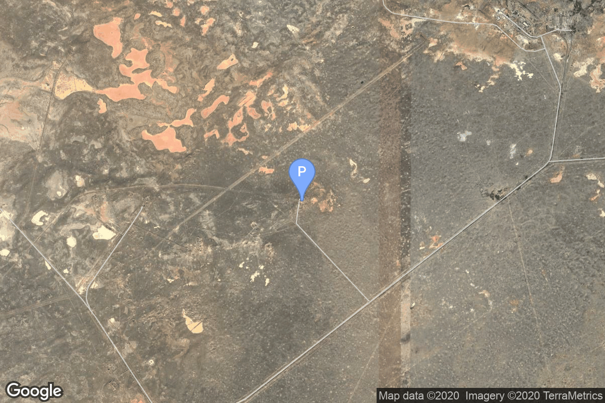
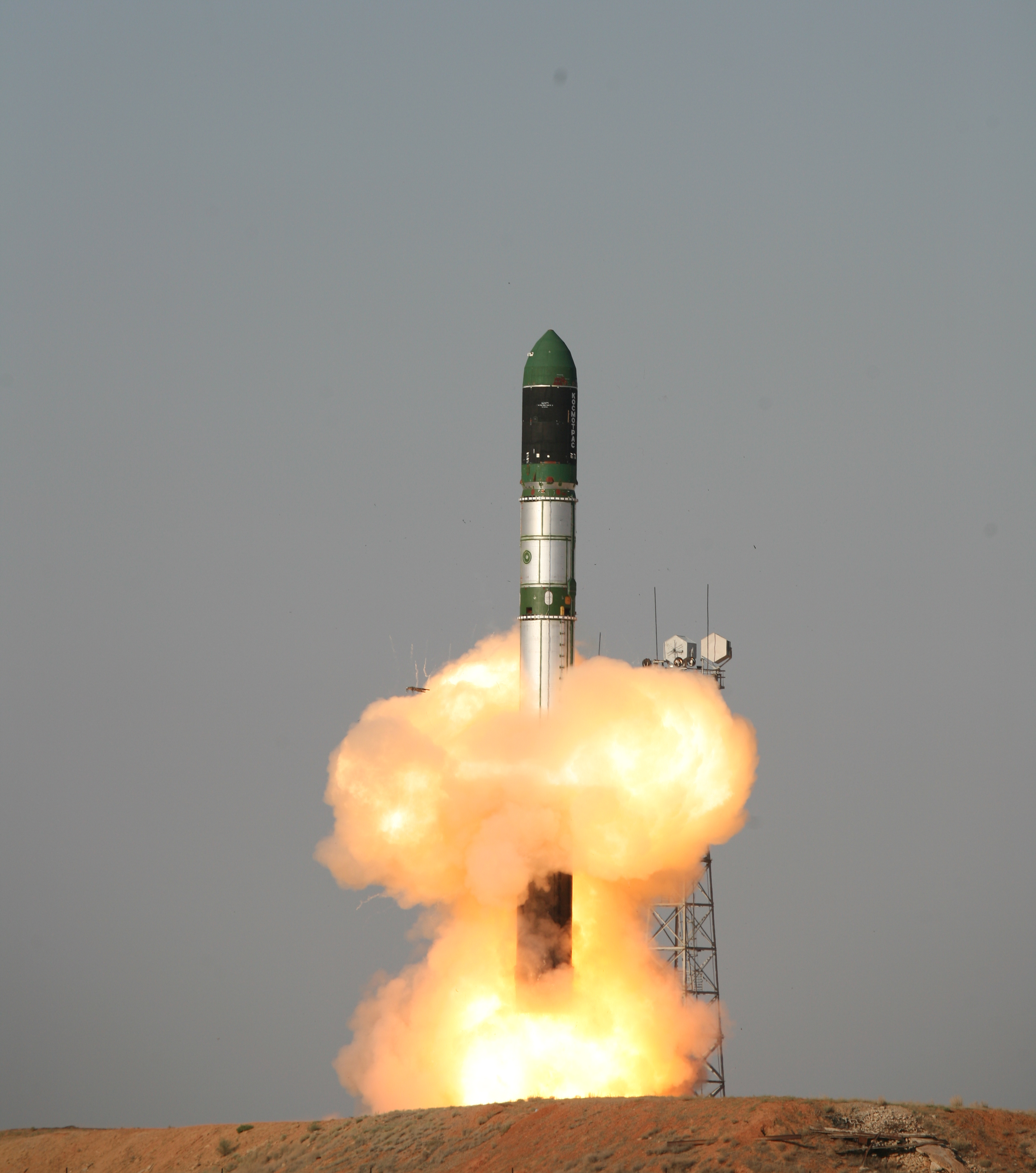
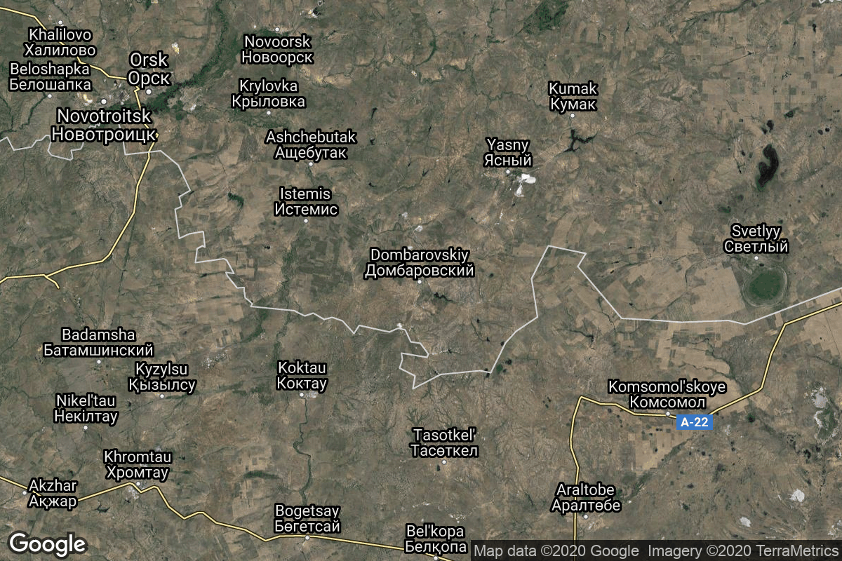
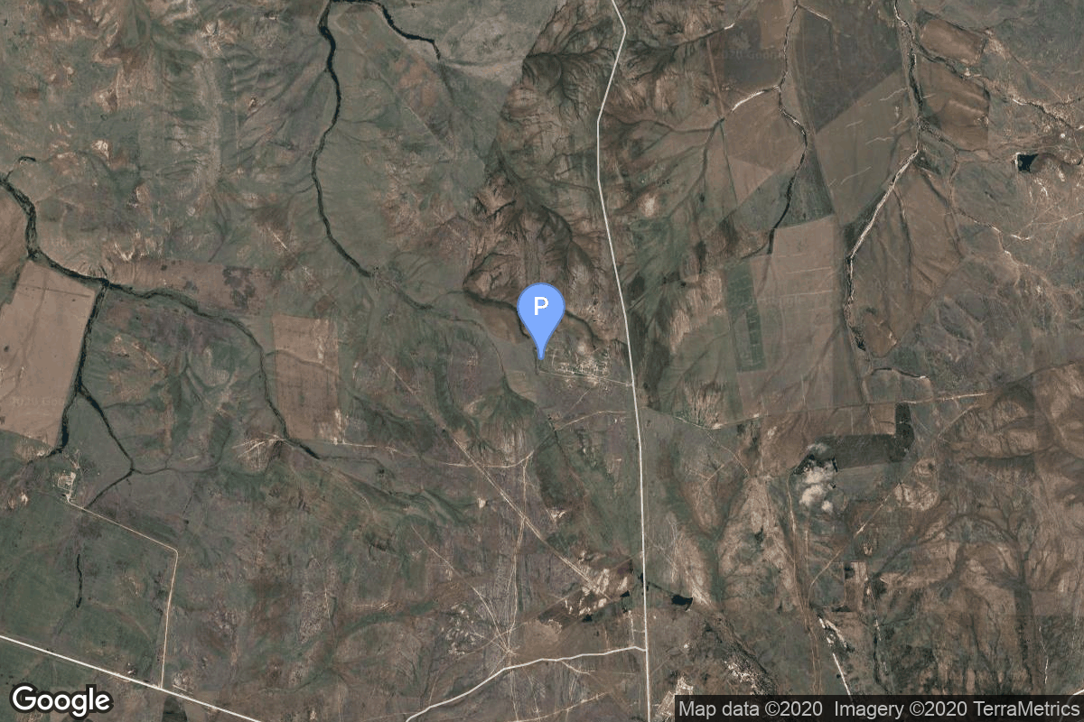
{ "count": 7730, "next": "https://ll.thespacedevs.com/2.0.0/launch/?format=api&limit=10&offset=6570&ordering=-name", "previous": "https://ll.thespacedevs.com/2.0.0/launch/?format=api&limit=10&offset=6550&ordering=-name", "results": [ { "id": "5aec8f39-0432-443e-905d-d45db3ba28aa", "url": "https://ll.thespacedevs.com/2.0.0/launch/5aec8f39-0432-443e-905d-d45db3ba28aa/?format=api", "launch_library_id": null, "slug": "dnepr-dubaisat-1", "name": "Dnepr | DubaiSat 1", "status": { "id": 3, "name": "Success" }, "net": "2009-07-29T18:46:29Z", "window_end": "2009-07-29T18:46:29Z", "window_start": "2009-07-29T18:46:29Z", "inhold": false, "tbdtime": false, "tbddate": false, "probability": null, "holdreason": "", "failreason": null, "hashtag": null, "launch_service_provider": { "id": 119, "url": "https://ll.thespacedevs.com/2.0.0/agencies/119/?format=api", "name": "ISC Kosmotras", "type": "Commercial" }, "rocket": { "id": 7400, "configuration": { "id": 31, "launch_library_id": 54, "url": "https://ll.thespacedevs.com/2.0.0/config/launcher/31/?format=api", "name": "Dnepr", "family": "", "full_name": "Dnepr 1", "variant": "1" } }, "mission": { "id": 5789, "launch_library_id": null, "name": "DubaiSat 1", "description": "Emirati Earth observation satellite. Launched with 5 secondary payloads.", "launch_designator": null, "type": "Earth Science", "orbit": { "id": 17, "name": "Sun-Synchronous Orbit", "abbrev": "SSO" } }, "pad": { "id": 12, "url": "https://ll.thespacedevs.com/2.0.0/pad/12/?format=api", "agency_id": null, "name": "109/95", "info_url": null, "wiki_url": "", "map_url": "https://www.google.com/maps?q=45.95112,63.497095", "latitude": "45.95112", "longitude": "63.497095", "location": { "id": 15, "url": "https://ll.thespacedevs.com/2.0.0/location/15/?format=api", "name": "Baikonur Cosmodrome, Republic of Kazakhstan", "country_code": "KAZ", "map_image": "https://thespacedevs-prod.nyc3.digitaloceanspaces.com/media/map_images/location_15_20200803142517.jpg", "total_launch_count": 1559, "total_landing_count": 0 }, "map_image": "https://thespacedevs-prod.nyc3.digitaloceanspaces.com/media/map_images/pad_12_20200803143322.jpg", "total_launch_count": 12 }, "webcast_live": false, "image": "https://thespacedevs-prod.nyc3.digitaloceanspaces.com/media/images/dnepr-1_liftoff_image_20240411092543.jpeg", "infographic": null, "program": [] }, { "id": "2e986328-5529-4a13-a4c6-44cdc0994c48", "url": "https://ll.thespacedevs.com/2.0.0/launch/2e986328-5529-4a13-a4c6-44cdc0994c48/?format=api", "launch_library_id": null, "slug": "dnepr-belka", "name": "Dnepr | BelKA", "status": { "id": 4, "name": "Failure" }, "net": "2006-07-26T19:43:05Z", "window_end": "2006-07-26T19:43:05Z", "window_start": "2006-07-26T19:43:05Z", "inhold": false, "tbdtime": false, "tbddate": false, "probability": null, "holdreason": "", "failreason": null, "hashtag": null, "launch_service_provider": { "id": 119, "url": "https://ll.thespacedevs.com/2.0.0/agencies/119/?format=api", "name": "ISC Kosmotras", "type": "Commercial" }, "rocket": { "id": 7277, "configuration": { "id": 31, "launch_library_id": 54, "url": "https://ll.thespacedevs.com/2.0.0/config/launcher/31/?format=api", "name": "Dnepr", "family": "", "full_name": "Dnepr 1", "variant": "1" } }, "mission": { "id": 5666, "launch_library_id": null, "name": "BelKA", "description": "BelKa 1 is a remote sensing satellite that utilizes the Victoria universal satellite bus. Developed by Rocket and Space Corporation Energiya, Russia, under a contract with TSNIIMASH-Export, Russia, for National Academy of Sciences of Republic of Belarus as the final customer of the satellite.", "launch_designator": null, "type": "Earth Science", "orbit": { "id": 17, "name": "Sun-Synchronous Orbit", "abbrev": "SSO" } }, "pad": { "id": 12, "url": "https://ll.thespacedevs.com/2.0.0/pad/12/?format=api", "agency_id": null, "name": "109/95", "info_url": null, "wiki_url": "", "map_url": "https://www.google.com/maps?q=45.95112,63.497095", "latitude": "45.95112", "longitude": "63.497095", "location": { "id": 15, "url": "https://ll.thespacedevs.com/2.0.0/location/15/?format=api", "name": "Baikonur Cosmodrome, Republic of Kazakhstan", "country_code": "KAZ", "map_image": "https://thespacedevs-prod.nyc3.digitaloceanspaces.com/media/map_images/location_15_20200803142517.jpg", "total_launch_count": 1559, "total_landing_count": 0 }, "map_image": "https://thespacedevs-prod.nyc3.digitaloceanspaces.com/media/map_images/pad_12_20200803143322.jpg", "total_launch_count": 12 }, "webcast_live": false, "image": "https://thespacedevs-prod.nyc3.digitaloceanspaces.com/media/images/dnepr-1_liftoff_image_20240411092543.jpeg", "infographic": null, "program": [] }, { "id": "821d8bf0-bb65-4db6-bfcf-35429a24c8cc", "url": "https://ll.thespacedevs.com/2.0.0/launch/821d8bf0-bb65-4db6-bfcf-35429a24c8cc/?format=api", "launch_library_id": null, "slug": "dnepr-aprizesat-2", "name": "Dnepr | Aprizesat-2", "status": { "id": 3, "name": "Success" }, "net": "2004-06-29T06:30:06Z", "window_end": "2004-06-29T06:30:06Z", "window_start": "2004-06-29T06:30:06Z", "inhold": false, "tbdtime": false, "tbddate": false, "probability": null, "holdreason": "", "failreason": null, "hashtag": null, "launch_service_provider": { "id": 119, "url": "https://ll.thespacedevs.com/2.0.0/agencies/119/?format=api", "name": "ISC Kosmotras", "type": "Commercial" }, "rocket": { "id": 7188, "configuration": { "id": 31, "launch_library_id": 54, "url": "https://ll.thespacedevs.com/2.0.0/config/launcher/31/?format=api", "name": "Dnepr", "family": "", "full_name": "Dnepr 1", "variant": "1" } }, "mission": { "id": 5577, "launch_library_id": null, "name": "Aprizesat-2", "description": "AprizeSat, is a constellation of small Low-Earth-Orbit satellites (64 satellites planned) to achieve a global communication system of data transmission and fixed and mobile asset tracking and monitoring (GMPCS).", "launch_designator": null, "type": "Communications", "orbit": { "id": 8, "name": "Low Earth Orbit", "abbrev": "LEO" } }, "pad": { "id": 12, "url": "https://ll.thespacedevs.com/2.0.0/pad/12/?format=api", "agency_id": null, "name": "109/95", "info_url": null, "wiki_url": "", "map_url": "https://www.google.com/maps?q=45.95112,63.497095", "latitude": "45.95112", "longitude": "63.497095", "location": { "id": 15, "url": "https://ll.thespacedevs.com/2.0.0/location/15/?format=api", "name": "Baikonur Cosmodrome, Republic of Kazakhstan", "country_code": "KAZ", "map_image": "https://thespacedevs-prod.nyc3.digitaloceanspaces.com/media/map_images/location_15_20200803142517.jpg", "total_launch_count": 1559, "total_landing_count": 0 }, "map_image": "https://thespacedevs-prod.nyc3.digitaloceanspaces.com/media/map_images/pad_12_20200803143322.jpg", "total_launch_count": 12 }, "webcast_live": false, "image": "https://thespacedevs-prod.nyc3.digitaloceanspaces.com/media/images/dnepr-1_liftoff_image_20240411092543.jpeg", "infographic": null, "program": [] }, { "id": "45c6bdef-7a83-4f07-86a1-b6913dfdf739", "url": "https://ll.thespacedevs.com/2.0.0/launch/45c6bdef-7a83-4f07-86a1-b6913dfdf739/?format=api", "launch_library_id": null, "slug": "dnepr-aatis-oscar-49", "name": "Dnepr | AATiS-OSCAR-49", "status": { "id": 3, "name": "Success" }, "net": "2002-12-20T17:00:00Z", "window_end": "2002-12-20T17:00:00Z", "window_start": "2002-12-20T17:00:00Z", "inhold": false, "tbdtime": false, "tbddate": false, "probability": null, "holdreason": "", "failreason": null, "hashtag": null, "launch_service_provider": { "id": 119, "url": "https://ll.thespacedevs.com/2.0.0/agencies/119/?format=api", "name": "ISC Kosmotras", "type": "Commercial" }, "rocket": { "id": 7116, "configuration": { "id": 31, "launch_library_id": 54, "url": "https://ll.thespacedevs.com/2.0.0/config/launcher/31/?format=api", "name": "Dnepr", "family": "", "full_name": "Dnepr 1", "variant": "1" } }, "mission": { "id": 5505, "launch_library_id": null, "name": "AATiS-OSCAR-49", "description": "Technology satellite for OHB-System, Germany.", "launch_designator": null, "type": "Communications", "orbit": { "id": 8, "name": "Low Earth Orbit", "abbrev": "LEO" } }, "pad": { "id": 12, "url": "https://ll.thespacedevs.com/2.0.0/pad/12/?format=api", "agency_id": null, "name": "109/95", "info_url": null, "wiki_url": "", "map_url": "https://www.google.com/maps?q=45.95112,63.497095", "latitude": "45.95112", "longitude": "63.497095", "location": { "id": 15, "url": "https://ll.thespacedevs.com/2.0.0/location/15/?format=api", "name": "Baikonur Cosmodrome, Republic of Kazakhstan", "country_code": "KAZ", "map_image": "https://thespacedevs-prod.nyc3.digitaloceanspaces.com/media/map_images/location_15_20200803142517.jpg", "total_launch_count": 1559, "total_landing_count": 0 }, "map_image": "https://thespacedevs-prod.nyc3.digitaloceanspaces.com/media/map_images/pad_12_20200803143322.jpg", "total_launch_count": 12 }, "webcast_live": false, "image": "https://thespacedevs-prod.nyc3.digitaloceanspaces.com/media/images/dnepr-1_liftoff_image_20240411092543.jpeg", "infographic": null, "program": [] }, { "id": "8b6412cb-e04f-4ed1-8072-3f4368b9054b", "url": "https://ll.thespacedevs.com/2.0.0/launch/8b6412cb-e04f-4ed1-8072-3f4368b9054b/?format=api", "launch_library_id": 818, "slug": "dnepr-1-tandem-x", "name": "Dnepr 1 | TanDEM-X", "status": { "id": 3, "name": "Success" }, "net": "2010-06-21T02:14:08Z", "window_end": "2010-06-21T02:14:08Z", "window_start": "2010-06-21T02:14:08Z", "inhold": false, "tbdtime": false, "tbddate": false, "probability": null, "holdreason": "", "failreason": "", "hashtag": null, "launch_service_provider": { "id": 119, "url": "https://ll.thespacedevs.com/2.0.0/agencies/119/?format=api", "name": "ISC Kosmotras", "type": "Commercial" }, "rocket": { "id": 1468, "configuration": { "id": 31, "launch_library_id": 54, "url": "https://ll.thespacedevs.com/2.0.0/config/launcher/31/?format=api", "name": "Dnepr", "family": "", "full_name": "Dnepr 1", "variant": "1" } }, "mission": null, "pad": { "id": 12, "url": "https://ll.thespacedevs.com/2.0.0/pad/12/?format=api", "agency_id": null, "name": "109/95", "info_url": null, "wiki_url": "", "map_url": "https://www.google.com/maps?q=45.95112,63.497095", "latitude": "45.95112", "longitude": "63.497095", "location": { "id": 15, "url": "https://ll.thespacedevs.com/2.0.0/location/15/?format=api", "name": "Baikonur Cosmodrome, Republic of Kazakhstan", "country_code": "KAZ", "map_image": "https://thespacedevs-prod.nyc3.digitaloceanspaces.com/media/map_images/location_15_20200803142517.jpg", "total_launch_count": 1559, "total_landing_count": 0 }, "map_image": "https://thespacedevs-prod.nyc3.digitaloceanspaces.com/media/map_images/pad_12_20200803143322.jpg", "total_launch_count": 12 }, "webcast_live": false, "image": "https://thespacedevs-prod.nyc3.digitaloceanspaces.com/media/images/dnepr-1_liftoff_image_20240411092543.jpeg", "infographic": null, "program": [] }, { "id": "1561bf9d-84f9-45ee-a629-b1c0f0832186", "url": "https://ll.thespacedevs.com/2.0.0/launch/1561bf9d-84f9-45ee-a629-b1c0f0832186/?format=api", "launch_library_id": 716, "slug": "dnepr-1-sich-2", "name": "Dnepr 1 | Sich-2", "status": { "id": 3, "name": "Success" }, "net": "2011-08-17T07:12:20Z", "window_end": "2011-08-17T07:12:20Z", "window_start": "2011-08-17T07:12:20Z", "inhold": false, "tbdtime": false, "tbddate": false, "probability": null, "holdreason": "", "failreason": "", "hashtag": null, "launch_service_provider": { "id": 119, "url": "https://ll.thespacedevs.com/2.0.0/agencies/119/?format=api", "name": "ISC Kosmotras", "type": "Commercial" }, "rocket": { "id": 1546, "configuration": { "id": 31, "launch_library_id": 54, "url": "https://ll.thespacedevs.com/2.0.0/config/launcher/31/?format=api", "name": "Dnepr", "family": "", "full_name": "Dnepr 1", "variant": "1" } }, "mission": null, "pad": { "id": 183, "url": "https://ll.thespacedevs.com/2.0.0/pad/183/?format=api", "agency_id": null, "name": "370/13", "info_url": null, "wiki_url": "https://en.wikipedia.org/wiki/Dombarovsky_Air_Base", "map_url": "https://www.google.com/maps?q=51.0938889,59.8400282", "latitude": "51.0938889", "longitude": "59.8400282", "location": { "id": 5, "url": "https://ll.thespacedevs.com/2.0.0/location/5/?format=api", "name": "Dombarovskiy, Russian Federation", "country_code": "RUS", "map_image": "https://thespacedevs-prod.nyc3.digitaloceanspaces.com/media/map_images/location_5_20200803142425.jpg", "total_launch_count": 10, "total_landing_count": 0 }, "map_image": "https://thespacedevs-prod.nyc3.digitaloceanspaces.com/media/map_images/pad_183_20200803143512.jpg", "total_launch_count": 8 }, "webcast_live": false, "image": "https://thespacedevs-prod.nyc3.digitaloceanspaces.com/media/images/dnepr-1_liftoff_image_20240411092543.jpeg", "infographic": null, "program": [] }, { "id": "adc49e04-2f21-4125-9823-4b9af05a85fc", "url": "https://ll.thespacedevs.com/2.0.0/launch/adc49e04-2f21-4125-9823-4b9af05a85fc/?format=api", "launch_library_id": 816, "slug": "dnepr-1-prisma-mango-prisma-tango-picard-bpa-1", "name": "Dnepr 1 | Prisma-Mango, Prisma-Tango, Picard, BPA-1", "status": { "id": 3, "name": "Success" }, "net": "2010-06-15T14:42:21Z", "window_end": "2010-06-15T14:42:21Z", "window_start": "2010-06-15T14:42:21Z", "inhold": false, "tbdtime": false, "tbddate": false, "probability": null, "holdreason": "", "failreason": "", "hashtag": null, "launch_service_provider": { "id": 119, "url": "https://ll.thespacedevs.com/2.0.0/agencies/119/?format=api", "name": "ISC Kosmotras", "type": "Commercial" }, "rocket": { "id": 1466, "configuration": { "id": 31, "launch_library_id": 54, "url": "https://ll.thespacedevs.com/2.0.0/config/launcher/31/?format=api", "name": "Dnepr", "family": "", "full_name": "Dnepr 1", "variant": "1" } }, "mission": null, "pad": { "id": 183, "url": "https://ll.thespacedevs.com/2.0.0/pad/183/?format=api", "agency_id": null, "name": "370/13", "info_url": null, "wiki_url": "https://en.wikipedia.org/wiki/Dombarovsky_Air_Base", "map_url": "https://www.google.com/maps?q=51.0938889,59.8400282", "latitude": "51.0938889", "longitude": "59.8400282", "location": { "id": 5, "url": "https://ll.thespacedevs.com/2.0.0/location/5/?format=api", "name": "Dombarovskiy, Russian Federation", "country_code": "RUS", "map_image": "https://thespacedevs-prod.nyc3.digitaloceanspaces.com/media/map_images/location_5_20200803142425.jpg", "total_launch_count": 10, "total_landing_count": 0 }, "map_image": "https://thespacedevs-prod.nyc3.digitaloceanspaces.com/media/map_images/pad_183_20200803143512.jpg", "total_launch_count": 8 }, "webcast_live": false, "image": "https://thespacedevs-prod.nyc3.digitaloceanspaces.com/media/images/dnepr-1_liftoff_image_20240411092543.jpeg", "infographic": null, "program": [] }, { "id": "5fb584f7-b2cd-44ed-812c-f3681c9d17f7", "url": "https://ll.thespacedevs.com/2.0.0/launch/5fb584f7-b2cd-44ed-812c-f3681c9d17f7/?format=api", "launch_library_id": 582, "slug": "dnepr-1-multipayload-mission-33-satellites", "name": "Dnepr 1 | Multipayload mission, 33 satellites", "status": { "id": 3, "name": "Success" }, "net": "2013-11-21T07:10:11Z", "window_end": "2013-11-21T07:10:11Z", "window_start": "2013-11-21T07:10:11Z", "inhold": false, "tbdtime": false, "tbddate": false, "probability": null, "holdreason": "", "failreason": "", "hashtag": null, "launch_service_provider": { "id": 119, "url": "https://ll.thespacedevs.com/2.0.0/agencies/119/?format=api", "name": "ISC Kosmotras", "type": "Commercial" }, "rocket": { "id": 1718, "configuration": { "id": 31, "launch_library_id": 54, "url": "https://ll.thespacedevs.com/2.0.0/config/launcher/31/?format=api", "name": "Dnepr", "family": "", "full_name": "Dnepr 1", "variant": "1" } }, "mission": null, "pad": { "id": 183, "url": "https://ll.thespacedevs.com/2.0.0/pad/183/?format=api", "agency_id": null, "name": "370/13", "info_url": null, "wiki_url": "https://en.wikipedia.org/wiki/Dombarovsky_Air_Base", "map_url": "https://www.google.com/maps?q=51.0938889,59.8400282", "latitude": "51.0938889", "longitude": "59.8400282", "location": { "id": 5, "url": "https://ll.thespacedevs.com/2.0.0/location/5/?format=api", "name": "Dombarovskiy, Russian Federation", "country_code": "RUS", "map_image": "https://thespacedevs-prod.nyc3.digitaloceanspaces.com/media/map_images/location_5_20200803142425.jpg", "total_launch_count": 10, "total_landing_count": 0 }, "map_image": "https://thespacedevs-prod.nyc3.digitaloceanspaces.com/media/map_images/pad_183_20200803143512.jpg", "total_launch_count": 8 }, "webcast_live": false, "image": "https://thespacedevs-prod.nyc3.digitaloceanspaces.com/media/images/dnepr-1_liftoff_image_20240411092543.jpeg", "infographic": null, "program": [] }, { "id": "95c3d55b-6c8a-462e-8422-a202e64087f9", "url": "https://ll.thespacedevs.com/2.0.0/launch/95c3d55b-6c8a-462e-8422-a202e64087f9/?format=api", "launch_library_id": 288, "slug": "dnepr-1-multipayload-37-satellites", "name": "Dnepr 1 | Multipayload, 37 satellites.", "status": { "id": 3, "name": "Success" }, "net": "2014-06-19T19:11:17Z", "window_end": "2014-06-19T19:11:17Z", "window_start": "2014-06-19T19:11:17Z", "inhold": false, "tbdtime": false, "tbddate": false, "probability": null, "holdreason": "", "failreason": "", "hashtag": null, "launch_service_provider": { "id": 119, "url": "https://ll.thespacedevs.com/2.0.0/agencies/119/?format=api", "name": "ISC Kosmotras", "type": "Commercial" }, "rocket": { "id": 1763, "configuration": { "id": 31, "launch_library_id": 54, "url": "https://ll.thespacedevs.com/2.0.0/config/launcher/31/?format=api", "name": "Dnepr", "family": "", "full_name": "Dnepr 1", "variant": "1" } }, "mission": null, "pad": { "id": 183, "url": "https://ll.thespacedevs.com/2.0.0/pad/183/?format=api", "agency_id": null, "name": "370/13", "info_url": null, "wiki_url": "https://en.wikipedia.org/wiki/Dombarovsky_Air_Base", "map_url": "https://www.google.com/maps?q=51.0938889,59.8400282", "latitude": "51.0938889", "longitude": "59.8400282", "location": { "id": 5, "url": "https://ll.thespacedevs.com/2.0.0/location/5/?format=api", "name": "Dombarovskiy, Russian Federation", "country_code": "RUS", "map_image": "https://thespacedevs-prod.nyc3.digitaloceanspaces.com/media/map_images/location_5_20200803142425.jpg", "total_launch_count": 10, "total_landing_count": 0 }, "map_image": "https://thespacedevs-prod.nyc3.digitaloceanspaces.com/media/map_images/pad_183_20200803143512.jpg", "total_launch_count": 8 }, "webcast_live": false, "image": "https://thespacedevs-prod.nyc3.digitaloceanspaces.com/media/images/dnepr-1_liftoff_image_20240411092543.jpeg", "infographic": null, "program": [] }, { "id": "d66cda59-131e-4d51-a3cd-df42b9b703d4", "url": "https://ll.thespacedevs.com/2.0.0/launch/d66cda59-131e-4d51-a3cd-df42b9b703d4/?format=api", "launch_library_id": 558, "slug": "dnepr-1-kompsat-5-arirang-5", "name": "Dnepr 1 | KOMPSat-5 (Arirang-5)", "status": { "id": 3, "name": "Success" }, "net": "2013-08-22T14:39:13Z", "window_end": "2013-08-22T14:39:13Z", "window_start": "2013-08-22T14:39:13Z", "inhold": false, "tbdtime": false, "tbddate": false, "probability": null, "holdreason": "", "failreason": "", "hashtag": null, "launch_service_provider": { "id": 119, "url": "https://ll.thespacedevs.com/2.0.0/agencies/119/?format=api", "name": "ISC Kosmotras", "type": "Commercial" }, "rocket": { "id": 1695, "configuration": { "id": 31, "launch_library_id": 54, "url": "https://ll.thespacedevs.com/2.0.0/config/launcher/31/?format=api", "name": "Dnepr", "family": "", "full_name": "Dnepr 1", "variant": "1" } }, "mission": null, "pad": { "id": 183, "url": "https://ll.thespacedevs.com/2.0.0/pad/183/?format=api", "agency_id": null, "name": "370/13", "info_url": null, "wiki_url": "https://en.wikipedia.org/wiki/Dombarovsky_Air_Base", "map_url": "https://www.google.com/maps?q=51.0938889,59.8400282", "latitude": "51.0938889", "longitude": "59.8400282", "location": { "id": 5, "url": "https://ll.thespacedevs.com/2.0.0/location/5/?format=api", "name": "Dombarovskiy, Russian Federation", "country_code": "RUS", "map_image": "https://thespacedevs-prod.nyc3.digitaloceanspaces.com/media/map_images/location_5_20200803142425.jpg", "total_launch_count": 10, "total_landing_count": 0 }, "map_image": "https://thespacedevs-prod.nyc3.digitaloceanspaces.com/media/map_images/pad_183_20200803143512.jpg", "total_launch_count": 8 }, "webcast_live": false, "image": "https://thespacedevs-prod.nyc3.digitaloceanspaces.com/media/images/dnepr-1_liftoff_image_20240411092543.jpeg", "infographic": null, "program": [] } ] }