Launch List
API endpoint that returns all Launch objects or a single launch.
EXAMPLE - /launch/
GET: Return a list of all Launch objects.
FILTERS: Fields - 'name', 'id(s)', 'lsp_id', 'lsp_name', 'serial_number', 'launcher_config__id', 'rocket__spacecraftflight__spacecraft__name'
MODE: 'normal', 'list', 'detailed' EXAMPLE: ?mode=list
SEARCH: Searches through the launch name, rocket name, launch agency, mission name & spacecraft name. EXAMPLE - ?search=SpaceX
GET /2.0.0/launch/?format=api&offset=6450&ordering=-id
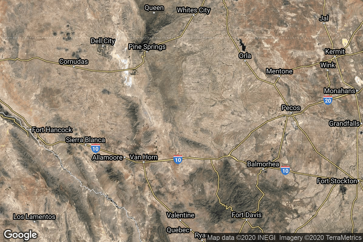
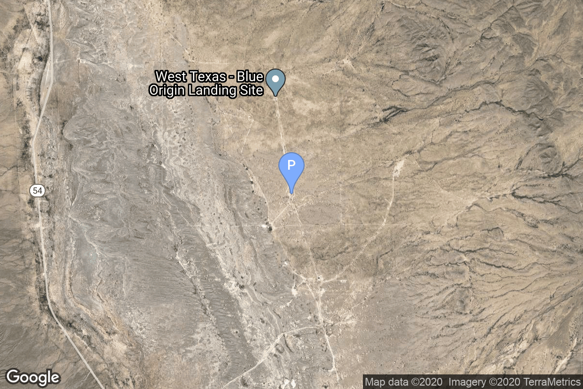
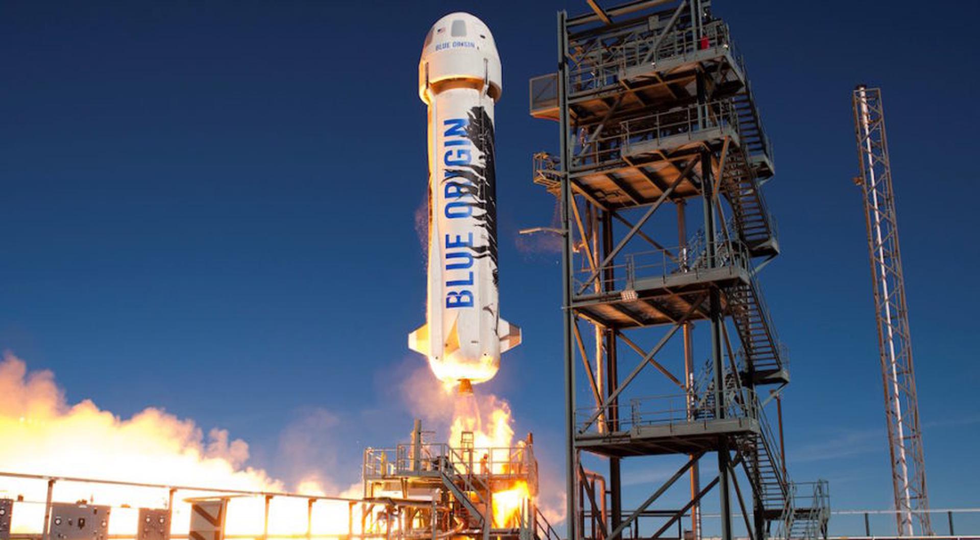
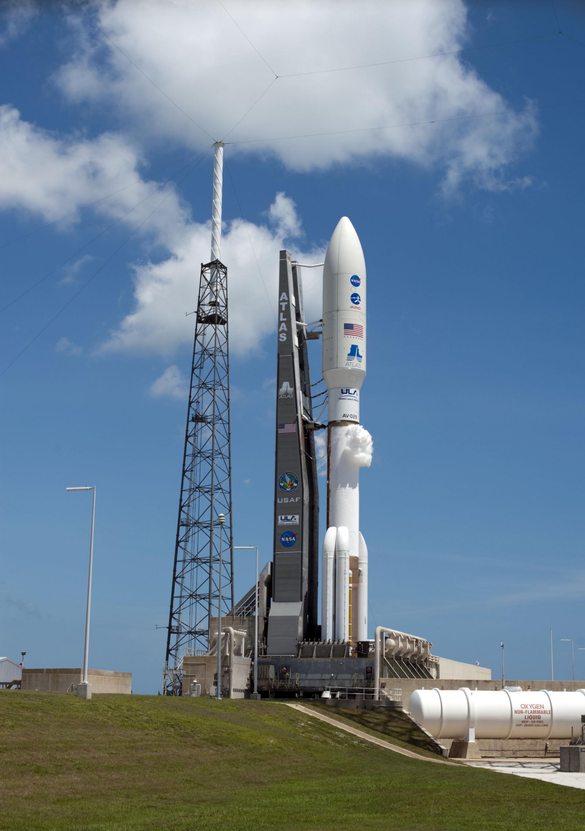
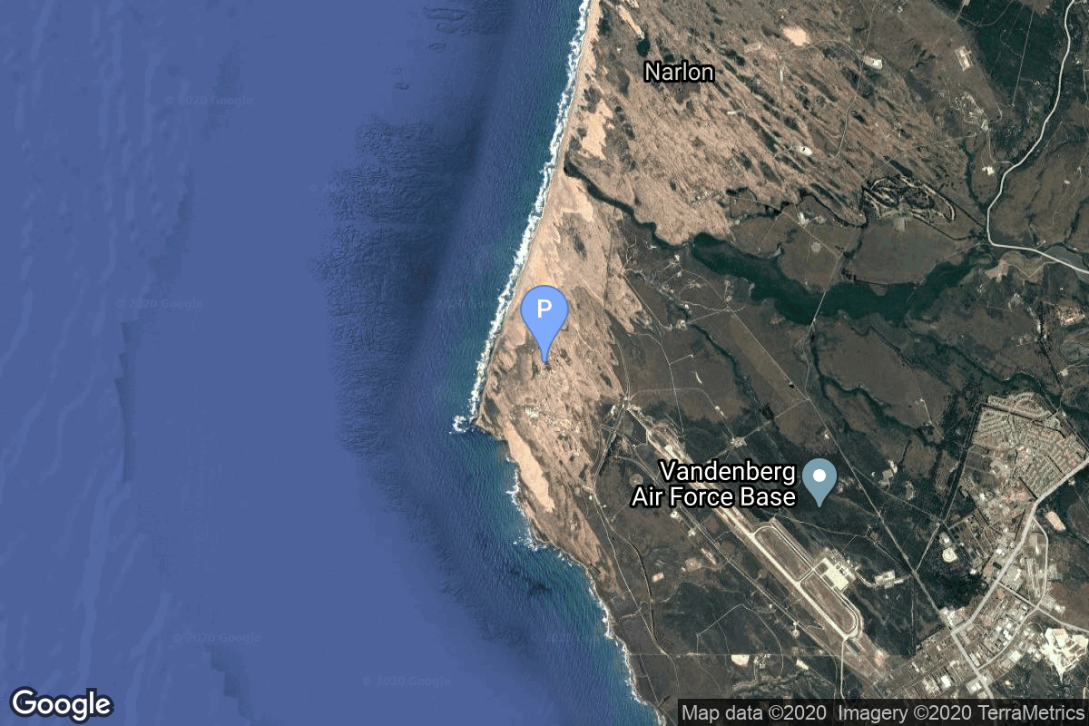
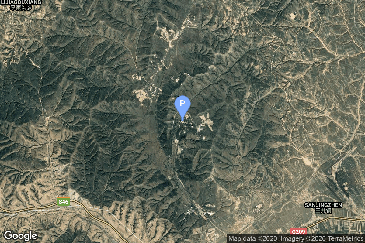
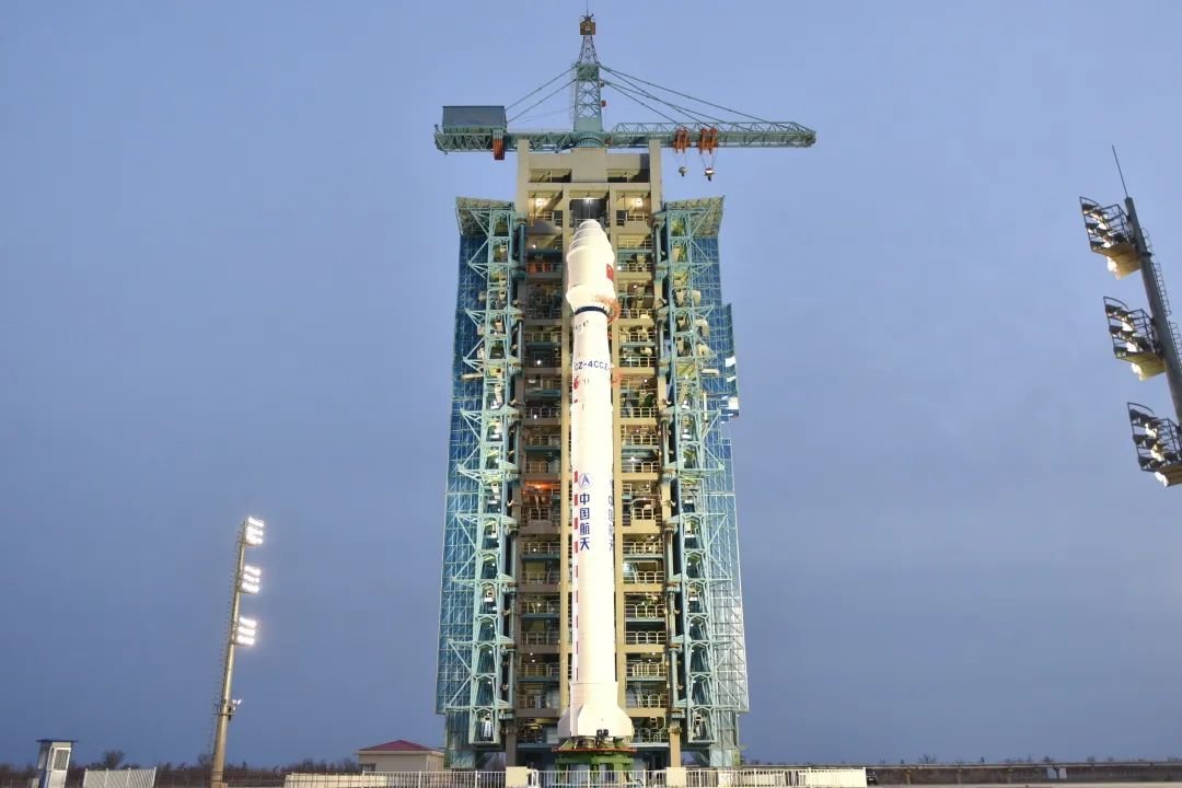
{ "count": 7507, "next": "https://ll.thespacedevs.com/2.0.0/launch/?format=api&limit=10&offset=6460&ordering=-id", "previous": "https://ll.thespacedevs.com/2.0.0/launch/?format=api&limit=10&offset=6440&ordering=-id", "results": [ { "id": "2589c15c-ebc4-4ab1-91cb-f244babd64b6", "url": "https://ll.thespacedevs.com/2.0.0/launch/2589c15c-ebc4-4ab1-91cb-f244babd64b6/?format=api", "launch_library_id": null, "slug": "soyuz-u-zenit-8-95", "name": "Soyuz U | Zenit-8 95", "status": { "id": 3, "name": "Success" }, "net": "1990-11-16T16:30:00Z", "window_end": "1990-11-16T16:30:00Z", "window_start": "1990-11-16T16:30:00Z", "inhold": false, "tbdtime": false, "tbddate": false, "probability": null, "holdreason": "", "failreason": null, "hashtag": null, "launch_service_provider": { "id": 66, "url": "https://ll.thespacedevs.com/2.0.0/agencies/66/?format=api", "name": "Soviet Space Program", "type": "Government" }, "rocket": { "id": 6322, "configuration": { "id": 37, "launch_library_id": 35, "url": "https://ll.thespacedevs.com/2.0.0/config/launcher/37/?format=api", "name": "Soyuz U", "family": "Soyuz", "full_name": "Soyuz U", "variant": "" } }, "mission": { "id": 4712, "launch_library_id": null, "name": "Zenit-8 95", "description": "Film-return reconnaissance satellite", "launch_designator": null, "type": "Government/Top Secret", "orbit": { "id": 8, "name": "Low Earth Orbit", "abbrev": "LEO" } }, "pad": { "id": 85, "url": "https://ll.thespacedevs.com/2.0.0/pad/85/?format=api", "agency_id": 163, "name": "43/4 (43R)", "info_url": null, "wiki_url": null, "map_url": "https://www.google.com/maps?q=62.92883,40.457098", "latitude": "62.92883", "longitude": "40.457098", "location": { "id": 6, "url": "https://ll.thespacedevs.com/2.0.0/location/6/?format=api", "name": "Plesetsk Cosmodrome, Russian Federation", "country_code": "RUS", "map_image": "https://thespacedevs-prod.nyc3.digitaloceanspaces.com/media/map_images/location_6_20200803142434.jpg", "total_launch_count": 1675, "total_landing_count": 0 }, "map_image": "https://thespacedevs-prod.nyc3.digitaloceanspaces.com/media/map_images/pad_85_20200803143554.jpg", "total_launch_count": 324 }, "webcast_live": false, "image": "https://thespacedevs-prod.nyc3.digitaloceanspaces.com/media/images/soyuz2520u_image_20190222031023.jpeg", "infographic": null, "program": [] }, { "id": "25748679-226b-4d5c-949e-f76e97caf6fe", "url": "https://ll.thespacedevs.com/2.0.0/launch/25748679-226b-4d5c-949e-f76e97caf6fe/?format=api", "launch_library_id": null, "slug": "new-shepard-ns-6", "name": "New Shepard | NS-6", "status": { "id": 3, "name": "Success" }, "net": "2016-10-05T16:36:00Z", "window_end": "2016-10-05T16:36:00Z", "window_start": "2016-10-05T16:36:00Z", "inhold": false, "tbdtime": false, "tbddate": false, "probability": null, "holdreason": "", "failreason": "", "hashtag": null, "launch_service_provider": { "id": 141, "url": "https://ll.thespacedevs.com/2.0.0/agencies/141/?format=api", "name": "Blue Origin", "type": "Commercial" }, "rocket": { "id": 2185, "configuration": { "id": 137, "launch_library_id": 9999, "url": "https://ll.thespacedevs.com/2.0.0/config/launcher/137/?format=api", "name": "New Shepard", "family": "", "full_name": "New Shepard", "variant": "" } }, "mission": { "id": 948, "launch_library_id": null, "name": "NS-6", "description": "The 6th flight for Blue Origin, NS-6 will test an in-flight abort scenario for the capsule.", "launch_designator": null, "type": "Test Flight", "orbit": { "id": 15, "name": "Suborbital", "abbrev": "Sub" } }, "pad": { "id": 90, "url": "https://ll.thespacedevs.com/2.0.0/pad/90/?format=api", "agency_id": 141, "name": "West Texas Suborbital Launch Site/ Corn Ranch", "info_url": "http://www.blueorigin.com", "wiki_url": "https://en.wikipedia.org/wiki/Corn_Ranch", "map_url": "https://www.google.com/maps?q=31.422878000000000,-104.757121000000000", "latitude": "31.422878", "longitude": "-104.757121", "location": { "id": 29, "url": "https://ll.thespacedevs.com/2.0.0/location/29/?format=api", "name": "Corn Ranch, Van Horn, TX, USA", "country_code": "USA", "map_image": "https://thespacedevs-prod.nyc3.digitaloceanspaces.com/media/map_images/location_29_20200803142436.jpg", "total_launch_count": 31, "total_landing_count": 31 }, "map_image": "https://thespacedevs-prod.nyc3.digitaloceanspaces.com/media/map_images/pad_90_20200803143233.jpg", "total_launch_count": 31 }, "webcast_live": false, "image": "https://thespacedevs-prod.nyc3.digitaloceanspaces.com/media/images/new2520shepard_image_20190207032624.jpeg", "infographic": null, "program": [] }, { "id": "25658233-1099-46b6-b57e-c4d46745abf8", "url": "https://ll.thespacedevs.com/2.0.0/launch/25658233-1099-46b6-b57e-c4d46745abf8/?format=api", "launch_library_id": null, "slug": "zenit-directv-7s", "name": "Zenit | DirecTV 7S", "status": { "id": 3, "name": "Success" }, "net": "2004-05-04T12:42:00Z", "window_end": "2004-05-04T12:42:00Z", "window_start": "2004-05-04T12:42:00Z", "inhold": false, "tbdtime": false, "tbddate": false, "probability": null, "holdreason": "", "failreason": null, "hashtag": null, "launch_service_provider": { "id": 122, "url": "https://ll.thespacedevs.com/2.0.0/agencies/122/?format=api", "name": "Sea Launch", "type": "Commercial" }, "rocket": { "id": 7180, "configuration": { "id": 11, "launch_library_id": 12, "url": "https://ll.thespacedevs.com/2.0.0/config/launcher/11/?format=api", "name": "Zenit", "family": "Zenith", "full_name": "Zenit 3SL", "variant": "3SL" } }, "mission": { "id": 5569, "launch_library_id": null, "name": "DirecTV 7S", "description": "54 Ku-band transponders for Direct-to-home TV services", "launch_designator": null, "type": "Communications", "orbit": { "id": 1, "name": "Geostationary Orbit", "abbrev": "Direct-GEO" } }, "pad": { "id": 13, "url": "https://ll.thespacedevs.com/2.0.0/pad/13/?format=api", "agency_id": 80, "name": "Launch Platform Odyssey", "info_url": null, "wiki_url": "https://en.wikipedia.org/wiki/Odyssey_(launch_platform)", "map_url": "https://www.google.com/maps?q=0.0,-154", "latitude": "0.0", "longitude": "-154.0", "location": { "id": 3, "url": "https://ll.thespacedevs.com/2.0.0/location/3/?format=api", "name": "Sea Launch", "country_code": "???", "map_image": "https://thespacedevs-prod.nyc3.digitaloceanspaces.com/media/map_images/location_3_20200803142448.jpg", "total_launch_count": 56, "total_landing_count": 0 }, "map_image": "https://thespacedevs-prod.nyc3.digitaloceanspaces.com/media/map_images/pad_13_20200803143257.jpg", "total_launch_count": 36 }, "webcast_live": false, "image": null, "infographic": null, "program": [] }, { "id": "2557d79e-ec3e-4012-a1b2-3cf6ae463dc0", "url": "https://ll.thespacedevs.com/2.0.0/launch/2557d79e-ec3e-4012-a1b2-3cf6ae463dc0/?format=api", "launch_library_id": null, "slug": "delta-ii-gps-iir-7", "name": "Delta II | GPS IIR-7", "status": { "id": 3, "name": "Success" }, "net": "2001-01-30T07:55:01Z", "window_end": "2001-01-30T07:55:01Z", "window_start": "2001-01-30T07:55:01Z", "inhold": false, "tbdtime": false, "tbddate": false, "probability": null, "holdreason": "", "failreason": "", "hashtag": null, "launch_service_provider": { "id": 161, "url": "https://ll.thespacedevs.com/2.0.0/agencies/161/?format=api", "name": "United States Air Force", "type": "Government" }, "rocket": { "id": 7032, "configuration": { "id": 140, "launch_library_id": 181, "url": "https://ll.thespacedevs.com/2.0.0/config/launcher/140/?format=api", "name": "Delta II", "family": "Delta", "full_name": "Delta II 7925-9.5", "variant": "7925-9.5" } }, "mission": { "id": 5421, "launch_library_id": null, "name": "GPS IIR-7", "description": "GPS IIR-7 was the seventh Block IIR GPS satellite to be launched as part of the United States Air Force Global Positioning System.", "launch_designator": null, "type": "Navigation", "orbit": { "id": 12, "name": "Medium Earth Orbit", "abbrev": "MEO" } }, "pad": { "id": 14, "url": "https://ll.thespacedevs.com/2.0.0/pad/14/?format=api", "agency_id": null, "name": "Space Launch Complex 17A", "info_url": null, "wiki_url": "https://en.wikipedia.org/wiki/Cape_Canaveral_Space_Launch_Complex_17", "map_url": "https://www.google.com/maps?q=28.4472,-80.565", "latitude": "28.4472", "longitude": "-80.565", "location": { "id": 12, "url": "https://ll.thespacedevs.com/2.0.0/location/12/?format=api", "name": "Cape Canaveral SFS, FL, USA", "country_code": "USA", "map_image": "https://thespacedevs-prod.nyc3.digitaloceanspaces.com/media/map_images/location_12_20200803142519.jpg", "total_launch_count": 1025, "total_landing_count": 64 }, "map_image": "https://thespacedevs-prod.nyc3.digitaloceanspaces.com/media/map_images/pad_14_20200803143451.jpg", "total_launch_count": 145 }, "webcast_live": false, "image": "https://thespacedevs-prod.nyc3.digitaloceanspaces.com/media/images/delta_ii_7925-9_image_20240312090356.jpeg", "infographic": null, "program": [ { "id": 29, "url": "https://ll.thespacedevs.com/2.0.0/program/29/?format=api", "name": "Global Positioning System", "description": "The Global Positioning System (GPS), originally Navstar GPS, is a satellite-based radio navigation system owned by the United States government and operated by the United States Space Force. It is one of the global navigation satellite systems (GNSS) that provide geolocation and time information to a GPS receiver anywhere on or near the Earth where there is an unobstructed line of sight to four or more GPS satellites.", "agencies": [ { "id": 1041, "url": "https://ll.thespacedevs.com/2.0.0/agencies/1041/?format=api", "name": "United States Space Force", "type": "Government" } ], "image_url": "https://thespacedevs-prod.nyc3.digitaloceanspaces.com/media/images/global2520posi_program_20231229182501.png", "start_date": "1978-02-22T00:00:00Z", "end_date": null, "info_url": "https://www.gps.gov/", "wiki_url": "https://en.wikipedia.org/wiki/Global_Positioning_System" } ] }, { "id": "2552cd6b-358d-4887-b032-cec8976011a7", "url": "https://ll.thespacedevs.com/2.0.0/launch/2552cd6b-358d-4887-b032-cec8976011a7/?format=api", "launch_library_id": null, "slug": "kosmos-3m-parus-52", "name": "Kosmos-3M | Parus 52", "status": { "id": 3, "name": "Success" }, "net": "1985-12-19T08:46:55Z", "window_end": "1985-12-19T08:46:55Z", "window_start": "1985-12-19T08:46:55Z", "inhold": false, "tbdtime": false, "tbddate": false, "probability": null, "holdreason": "", "failreason": null, "hashtag": null, "launch_service_provider": { "id": 66, "url": "https://ll.thespacedevs.com/2.0.0/agencies/66/?format=api", "name": "Soviet Space Program", "type": "Government" }, "rocket": { "id": 5816, "configuration": { "id": 102, "launch_library_id": 122, "url": "https://ll.thespacedevs.com/2.0.0/config/launcher/102/?format=api", "name": "Kosmos-3M", "family": "Kosmos", "full_name": "Kosmos-3M (11K65M)", "variant": "-3M" } }, "mission": { "id": 4214, "launch_library_id": null, "name": "Parus 52", "description": "Navigation satellite providing location information for the Tsiklon-B navigation system", "launch_designator": null, "type": "Navigation", "orbit": { "id": 8, "name": "Low Earth Orbit", "abbrev": "LEO" } }, "pad": { "id": 28, "url": "https://ll.thespacedevs.com/2.0.0/pad/28/?format=api", "agency_id": 163, "name": "132/1 (132L)", "info_url": null, "wiki_url": "", "map_url": "https://www.google.com/maps?q=62.883229,40.868549", "latitude": "62.883229", "longitude": "40.868549", "location": { "id": 6, "url": "https://ll.thespacedevs.com/2.0.0/location/6/?format=api", "name": "Plesetsk Cosmodrome, Russian Federation", "country_code": "RUS", "map_image": "https://thespacedevs-prod.nyc3.digitaloceanspaces.com/media/map_images/location_6_20200803142434.jpg", "total_launch_count": 1675, "total_landing_count": 0 }, "map_image": "https://thespacedevs-prod.nyc3.digitaloceanspaces.com/media/map_images/pad_28_20200803143254.jpg", "total_launch_count": 212 }, "webcast_live": false, "image": null, "infographic": null, "program": [] }, { "id": "254b64df-aaae-4c33-9914-619e859f6ef1", "url": "https://ll.thespacedevs.com/2.0.0/launch/254b64df-aaae-4c33-9914-619e859f6ef1/?format=api", "launch_library_id": 99, "slug": "soyuz-u-progress-m-23m-55p", "name": "Soyuz-U | Progress M-23M (55P)", "status": { "id": 3, "name": "Success" }, "net": "2014-04-09T15:26:27Z", "window_end": "2014-04-09T15:26:27Z", "window_start": "2014-04-09T15:26:27Z", "inhold": false, "tbdtime": false, "tbddate": false, "probability": -1, "holdreason": "", "failreason": null, "hashtag": null, "launch_service_provider": { "id": 63, "url": "https://ll.thespacedevs.com/2.0.0/agencies/63/?format=api", "name": "Russian Federal Space Agency (ROSCOSMOS)", "type": "Government" }, "rocket": { "id": 1748, "configuration": { "id": 37, "launch_library_id": 35, "url": "https://ll.thespacedevs.com/2.0.0/config/launcher/37/?format=api", "name": "Soyuz U", "family": "Soyuz", "full_name": "Soyuz U", "variant": "" } }, "mission": { "id": 70, "launch_library_id": 84, "name": "Progress M-23M (55P)", "description": "Progress 55 will deliver cargo and crew supplies to the International Space Station.", "launch_designator": null, "type": "Resupply", "orbit": { "id": 8, "name": "Low Earth Orbit", "abbrev": "LEO" } }, "pad": { "id": 32, "url": "https://ll.thespacedevs.com/2.0.0/pad/32/?format=api", "agency_id": null, "name": "1/5", "info_url": null, "wiki_url": "", "map_url": "https://www.google.com/maps?q=45.92,63.342", "latitude": "45.92", "longitude": "63.342", "location": { "id": 15, "url": "https://ll.thespacedevs.com/2.0.0/location/15/?format=api", "name": "Baikonur Cosmodrome, Republic of Kazakhstan", "country_code": "KAZ", "map_image": "https://thespacedevs-prod.nyc3.digitaloceanspaces.com/media/map_images/location_15_20200803142517.jpg", "total_launch_count": 1555, "total_landing_count": 0 }, "map_image": "https://thespacedevs-prod.nyc3.digitaloceanspaces.com/media/map_images/pad_32_20200803143513.jpg", "total_launch_count": 487 }, "webcast_live": false, "image": "https://thespacedevs-prod.nyc3.digitaloceanspaces.com/media/images/soyuz2520u_image_20190222031023.jpeg", "infographic": null, "program": [ { "id": 17, "url": "https://ll.thespacedevs.com/2.0.0/program/17/?format=api", "name": "International Space Station", "description": "The International Space Station programme is tied together by a complex set of legal, political and financial agreements between the sixteen nations involved in the project, governing ownership of the various components, rights to crewing and utilization, and responsibilities for crew rotation and resupply of the International Space Station. It was conceived in 1984 by President Ronald Reagan, during the Space Station Freedom project as it was originally called.", "agencies": [ { "id": 16, "url": "https://ll.thespacedevs.com/2.0.0/agencies/16/?format=api", "name": "Canadian Space Agency", "type": "Government" }, { "id": 27, "url": "https://ll.thespacedevs.com/2.0.0/agencies/27/?format=api", "name": "European Space Agency", "type": "Multinational" }, { "id": 37, "url": "https://ll.thespacedevs.com/2.0.0/agencies/37/?format=api", "name": "Japan Aerospace Exploration Agency", "type": "Government" }, { "id": 44, "url": "https://ll.thespacedevs.com/2.0.0/agencies/44/?format=api", "name": "National Aeronautics and Space Administration", "type": "Government" }, { "id": 63, "url": "https://ll.thespacedevs.com/2.0.0/agencies/63/?format=api", "name": "Russian Federal Space Agency (ROSCOSMOS)", "type": "Government" } ], "image_url": "https://thespacedevs-prod.nyc3.digitaloceanspaces.com/media/images/international2_program_20201129184745.png", "start_date": "1998-11-20T06:40:00Z", "end_date": null, "info_url": "https://www.nasa.gov/mission_pages/station/main/index.html", "wiki_url": "https://en.wikipedia.org/wiki/International_Space_Station_programme" } ] }, { "id": "251a9e17-c754-4ced-abbb-41b20c26aa2f", "url": "https://ll.thespacedevs.com/2.0.0/launch/251a9e17-c754-4ced-abbb-41b20c26aa2f/?format=api", "launch_library_id": 768, "slug": "atlas-v-551-aehf-4-usa-288", "name": "Atlas V 551 | AEHF-4 (USA 288)", "status": { "id": 3, "name": "Success" }, "net": "2018-10-17T04:15:00Z", "window_end": "2018-10-17T06:15:00Z", "window_start": "2018-10-17T04:15:00Z", "inhold": false, "tbdtime": false, "tbddate": false, "probability": 90, "holdreason": "", "failreason": null, "hashtag": "#AEHF4", "launch_service_provider": { "id": 124, "url": "https://ll.thespacedevs.com/2.0.0/agencies/124/?format=api", "name": "United Launch Alliance", "type": "Commercial" }, "rocket": { "id": 13, "configuration": { "id": 27, "launch_library_id": 37, "url": "https://ll.thespacedevs.com/2.0.0/config/launcher/27/?format=api", "name": "Atlas V 551", "family": "Atlas", "full_name": "Atlas V 551", "variant": "551" } }, "mission": { "id": 298, "launch_library_id": 404, "name": "AEHF-4", "description": "This is the fourth satellite in the Advanced Extremely High Frequency (AEHF) system, which is a series of communications satellites operated by the United States Air Force Space Command. It provides global, survivable, protected communications capabilities for strategic command and tactical warfighters operating on ground, sea and air platforms.", "launch_designator": null, "type": "Communications", "orbit": { "id": 2, "name": "Geostationary Transfer Orbit", "abbrev": "GTO" } }, "pad": { "id": 29, "url": "https://ll.thespacedevs.com/2.0.0/pad/29/?format=api", "agency_id": null, "name": "Space Launch Complex 41", "info_url": null, "wiki_url": "https://en.wikipedia.org/wiki/Cape_Canaveral_Air_Force_Station_Space_Launch_Complex_41", "map_url": "https://www.google.com/maps?q=28.58341025,-80.58303644", "latitude": "28.58341025", "longitude": "-80.58303644", "location": { "id": 12, "url": "https://ll.thespacedevs.com/2.0.0/location/12/?format=api", "name": "Cape Canaveral SFS, FL, USA", "country_code": "USA", "map_image": "https://thespacedevs-prod.nyc3.digitaloceanspaces.com/media/map_images/location_12_20200803142519.jpg", "total_launch_count": 1025, "total_landing_count": 64 }, "map_image": "https://thespacedevs-prod.nyc3.digitaloceanspaces.com/media/map_images/pad_29_20200803143528.jpg", "total_launch_count": 115 }, "webcast_live": false, "image": "https://thespacedevs-prod.nyc3.digitaloceanspaces.com/media/images/atlas2520v2520551_image_20190224012316.jpeg", "infographic": null, "program": [] }, { "id": "2516339f-dc98-4953-bb3d-cdec01671933", "url": "https://ll.thespacedevs.com/2.0.0/launch/2516339f-dc98-4953-bb3d-cdec01671933/?format=api", "launch_library_id": null, "slug": "thor-burner-2-dsap-5a-f3", "name": "Thor Burner 2 | DSAP-5A F3", "status": { "id": 3, "name": "Success" }, "net": "1971-02-17T03:52:05Z", "window_end": "1971-02-17T03:52:05Z", "window_start": "1971-02-17T03:52:05Z", "inhold": false, "tbdtime": false, "tbddate": false, "probability": null, "holdreason": "", "failreason": null, "hashtag": null, "launch_service_provider": { "id": 161, "url": "https://ll.thespacedevs.com/2.0.0/agencies/161/?format=api", "name": "United States Air Force", "type": "Government" }, "rocket": { "id": 4102, "configuration": { "id": 395, "launch_library_id": null, "url": "https://ll.thespacedevs.com/2.0.0/config/launcher/395/?format=api", "name": "Thor Burner 2", "family": "Thor", "full_name": "Thor Burner 2", "variant": "Burner 2" } }, "mission": { "id": 2520, "launch_library_id": null, "name": "DSAP-5A F3", "description": "Military meteorological satellite", "launch_designator": null, "type": "Government/Top Secret", "orbit": { "id": 17, "name": "Sun-Synchronous Orbit", "abbrev": "SSO" } }, "pad": { "id": 171, "url": "https://ll.thespacedevs.com/2.0.0/pad/171/?format=api", "agency_id": null, "name": "Space Launch Complex 10W", "info_url": null, "wiki_url": "https://en.wikipedia.org/wiki/Vandenberg_Air_Force_Base_Space_Launch_Complex_10", "map_url": "https://www.google.com/maps?q=34.7652778,-120.6244162", "latitude": "34.7652778", "longitude": "-120.6244162", "location": { "id": 11, "url": "https://ll.thespacedevs.com/2.0.0/location/11/?format=api", "name": "Vandenberg SFB, CA, USA", "country_code": "USA", "map_image": "https://thespacedevs-prod.nyc3.digitaloceanspaces.com/media/map_images/location_11_20200803142416.jpg", "total_launch_count": 808, "total_landing_count": 26 }, "map_image": "https://thespacedevs-prod.nyc3.digitaloceanspaces.com/media/map_images/pad_171_20200803143449.jpg", "total_launch_count": 31 }, "webcast_live": false, "image": null, "infographic": null, "program": [] }, { "id": "25161436-122b-46bc-86fb-b72d33c29378", "url": "https://ll.thespacedevs.com/2.0.0/launch/25161436-122b-46bc-86fb-b72d33c29378/?format=api", "launch_library_id": null, "slug": "atlas-iias-echostar-iii", "name": "Atlas IIAS | Echostar III", "status": { "id": 3, "name": "Success" }, "net": "1997-10-05T21:01:01Z", "window_end": "1997-10-05T21:01:01Z", "window_start": "1997-10-05T21:01:01Z", "inhold": false, "tbdtime": false, "tbddate": false, "probability": null, "holdreason": "", "failreason": null, "hashtag": null, "launch_service_provider": { "id": 82, "url": "https://ll.thespacedevs.com/2.0.0/agencies/82/?format=api", "name": "Lockheed Martin", "type": "Commercial" }, "rocket": { "id": 6809, "configuration": { "id": 255, "launch_library_id": null, "url": "https://ll.thespacedevs.com/2.0.0/config/launcher/255/?format=api", "name": "Atlas IIAS", "family": "Atlas", "full_name": "Atlas IIAS", "variant": "IIAS" } }, "mission": { "id": 5199, "launch_library_id": null, "name": "Echostar III", "description": "EchoStar 3 was originaly ordered as DBSC 1 by DBSC (Direct Broadcast Satellite Corporation) which merged with a subsidiary of EchoStar in late 1995. The merger was approved by the FCC in August 1996. EchoStar is only authorized to operate 11 transponders from 61.5°W but was granted in Mar 1998 a special authorization to use the full frequency space at that location.", "launch_designator": null, "type": "Communications", "orbit": { "id": 1, "name": "Geostationary Orbit", "abbrev": "Direct-GEO" } }, "pad": { "id": 122, "url": "https://ll.thespacedevs.com/2.0.0/pad/122/?format=api", "agency_id": 161, "name": "Launch Complex 36B", "info_url": null, "wiki_url": "https://en.wikipedia.org/wiki/Cape_Canaveral_Launch_Complex_36", "map_url": "https://www.google.com/maps?q=28.4705556,-80.542194", "latitude": "28.4705556", "longitude": "-80.542194", "location": { "id": 12, "url": "https://ll.thespacedevs.com/2.0.0/location/12/?format=api", "name": "Cape Canaveral SFS, FL, USA", "country_code": "USA", "map_image": "https://thespacedevs-prod.nyc3.digitaloceanspaces.com/media/map_images/location_12_20200803142519.jpg", "total_launch_count": 1025, "total_landing_count": 64 }, "map_image": "https://thespacedevs-prod.nyc3.digitaloceanspaces.com/media/map_images/pad_122_20200803143232.jpg", "total_launch_count": 76 }, "webcast_live": false, "image": null, "infographic": null, "program": [] }, { "id": "2510cf5e-458d-4f8f-abdd-e71186aeed21", "url": "https://ll.thespacedevs.com/2.0.0/launch/2510cf5e-458d-4f8f-abdd-e71186aeed21/?format=api", "launch_library_id": 826, "slug": "long-march-4c-yaogan-10", "name": "Long March 4C | Yaogan-10", "status": { "id": 3, "name": "Success" }, "net": "2010-08-09T22:49:05Z", "window_end": "2010-08-09T22:49:05Z", "window_start": "2010-08-09T22:49:05Z", "inhold": false, "tbdtime": false, "tbddate": false, "probability": null, "holdreason": "", "failreason": "", "hashtag": null, "launch_service_provider": { "id": 88, "url": "https://ll.thespacedevs.com/2.0.0/agencies/88/?format=api", "name": "China Aerospace Science and Technology Corporation", "type": "Government" }, "rocket": { "id": 1474, "configuration": { "id": 64, "launch_library_id": 70, "url": "https://ll.thespacedevs.com/2.0.0/config/launcher/64/?format=api", "name": "Long March 4C", "family": "Long March", "full_name": "Long March 4C", "variant": "C" } }, "mission": null, "pad": { "id": 25, "url": "https://ll.thespacedevs.com/2.0.0/pad/25/?format=api", "agency_id": null, "name": "Launch Complex 9", "info_url": null, "wiki_url": null, "map_url": "https://www.google.com/maps?q=38.863128,111.589567", "latitude": "38.863128", "longitude": "111.589567", "location": { "id": 19, "url": "https://ll.thespacedevs.com/2.0.0/location/19/?format=api", "name": "Taiyuan Satellite Launch Center, People's Republic of China", "country_code": "CHN", "map_image": "https://thespacedevs-prod.nyc3.digitaloceanspaces.com/media/map_images/location_19_20200803142421.jpg", "total_launch_count": 141, "total_landing_count": 0 }, "map_image": "https://thespacedevs-prod.nyc3.digitaloceanspaces.com/media/map_images/pad_25_20200803143501.jpg", "total_launch_count": 76 }, "webcast_live": false, "image": "https://thespacedevs-prod.nyc3.digitaloceanspaces.com/media/images/long_march_4c_image_20230801172338.jpeg", "infographic": null, "program": [] } ] }