Launch List
API endpoint that returns all Launch objects or a single launch.
EXAMPLE - /launch/
GET: Return a list of all Launch objects.
FILTERS: Fields - 'name', 'id(s)', 'lsp_id', 'lsp_name', 'serial_number', 'launcher_config__id', 'rocket__spacecraftflight__spacecraft__name'
MODE: 'normal', 'list', 'detailed' EXAMPLE: ?mode=list
SEARCH: Searches through the launch name, rocket name, launch agency, mission name & spacecraft name. EXAMPLE - ?search=SpaceX
GET /2.0.0/launch/?format=api&offset=6420&ordering=id
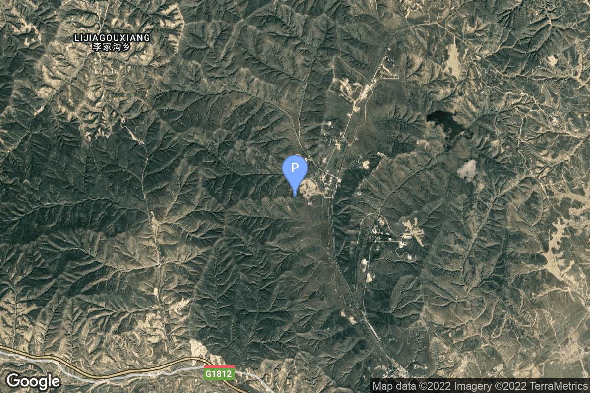
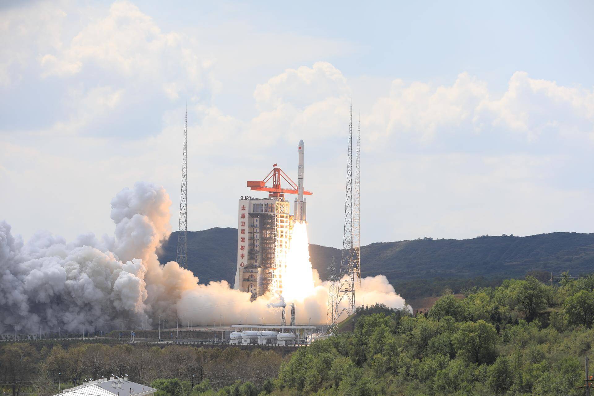
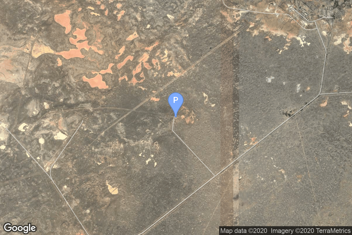
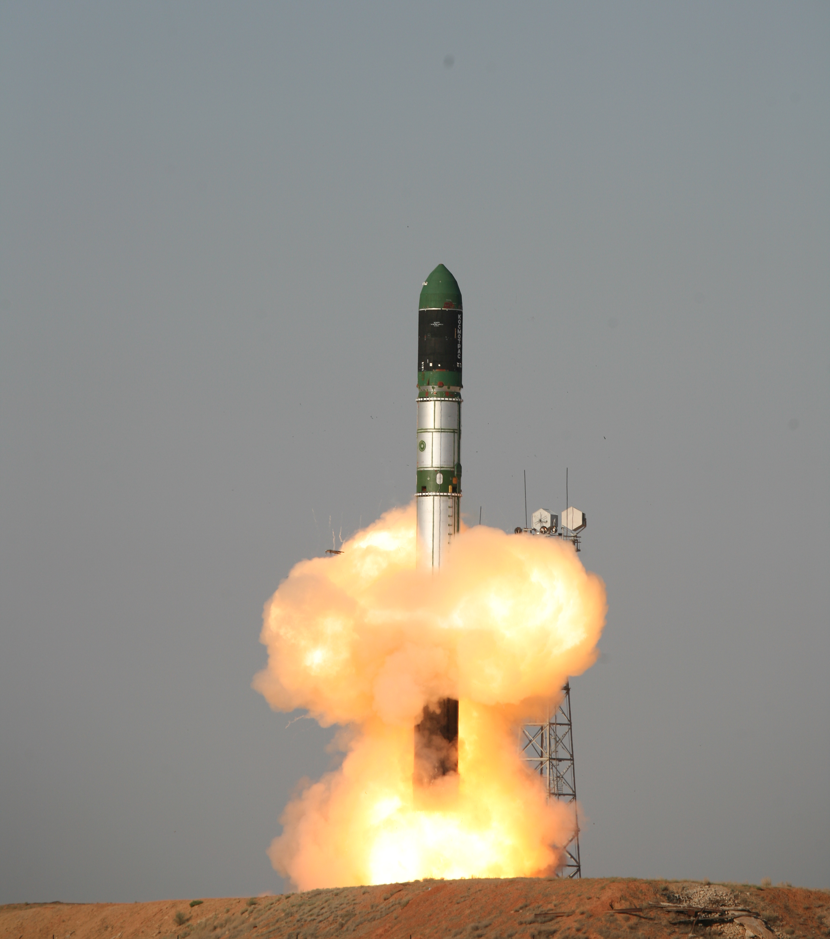
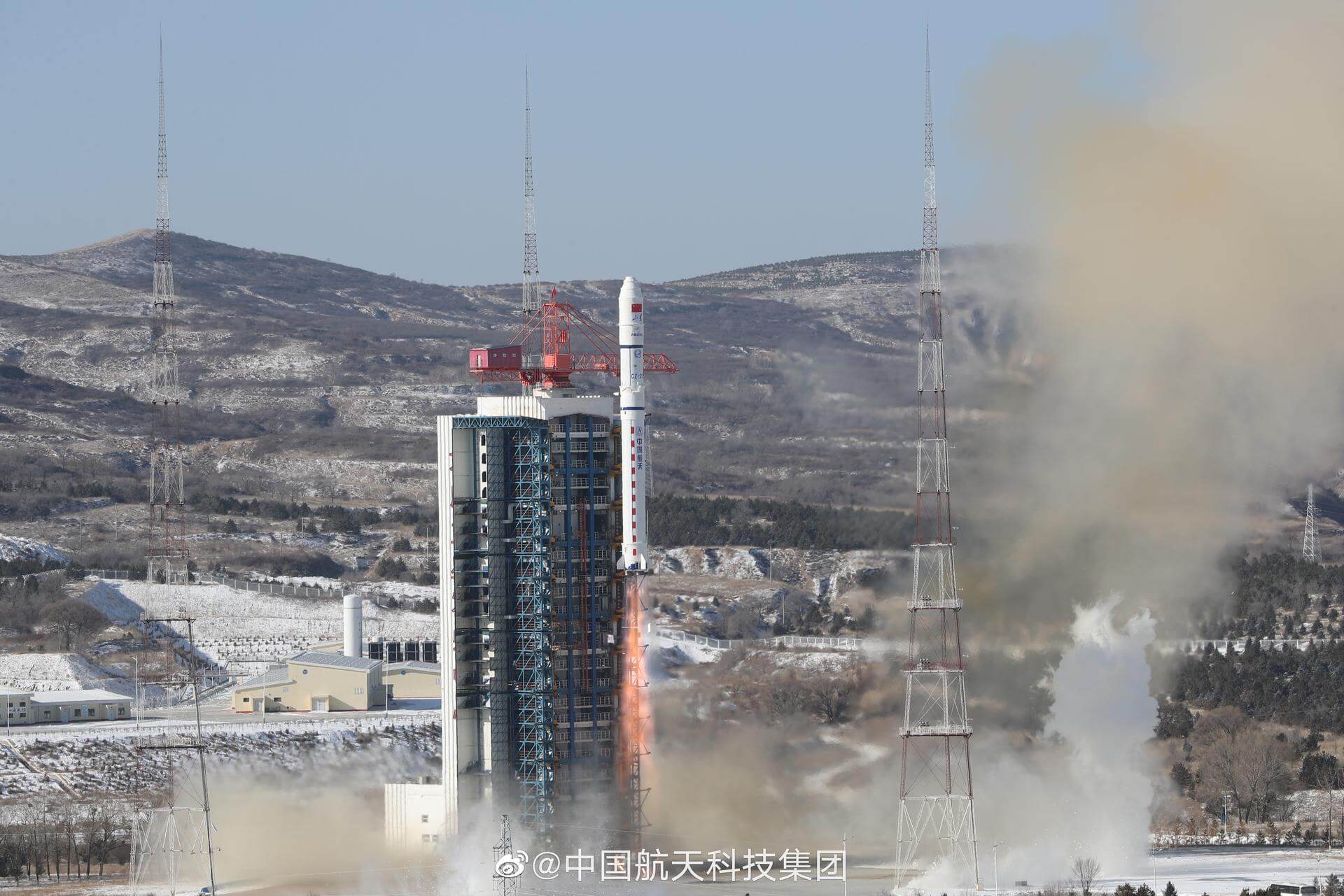
{ "count": 7507, "next": "https://ll.thespacedevs.com/2.0.0/launch/?format=api&limit=10&offset=6430&ordering=id", "previous": "https://ll.thespacedevs.com/2.0.0/launch/?format=api&limit=10&offset=6410&ordering=id", "results": [ { "id": "da7dd4f0-82d3-419e-ab14-2a02789b473a", "url": "https://ll.thespacedevs.com/2.0.0/launch/da7dd4f0-82d3-419e-ab14-2a02789b473a/?format=api", "launch_library_id": null, "slug": "long-march-6a-yaogan-40", "name": "Long March 6A | Yaogan 40", "status": { "id": 3, "name": "Success" }, "net": "2023-09-10T04:30:00Z", "window_end": "2023-09-10T04:59:00Z", "window_start": "2023-09-10T04:21:00Z", "inhold": false, "tbdtime": false, "tbddate": false, "probability": null, "holdreason": "", "failreason": "", "hashtag": null, "launch_service_provider": { "id": 88, "url": "https://ll.thespacedevs.com/2.0.0/agencies/88/?format=api", "name": "China Aerospace Science and Technology Corporation", "type": "Government" }, "rocket": { "id": 7999, "configuration": { "id": 478, "launch_library_id": null, "url": "https://ll.thespacedevs.com/2.0.0/config/launcher/478/?format=api", "name": "Long March 6A", "family": "Long March", "full_name": "Long March 6A", "variant": "" } }, "mission": { "id": 6539, "launch_library_id": null, "name": "Yaogan 40", "description": "3 Chinese reconnaissance satellites of unknown purposes, officially reported as for \"Electromagnetic environment probing\" purposes.", "launch_designator": null, "type": "Government/Top Secret", "orbit": { "id": 13, "name": "Polar Orbit", "abbrev": "PO" } }, "pad": { "id": 200, "url": "https://ll.thespacedevs.com/2.0.0/pad/200/?format=api", "agency_id": null, "name": "Launch Complex 9A", "info_url": null, "wiki_url": null, "map_url": "https://www.google.com/maps?q=38.8583,111.5802", "latitude": "38.8583", "longitude": "111.5802", "location": { "id": 19, "url": "https://ll.thespacedevs.com/2.0.0/location/19/?format=api", "name": "Taiyuan Satellite Launch Center, People's Republic of China", "country_code": "CHN", "map_image": "https://thespacedevs-prod.nyc3.digitaloceanspaces.com/media/map_images/location_19_20200803142421.jpg", "total_launch_count": 141, "total_landing_count": 0 }, "map_image": "https://thespacedevs-prod.nyc3.digitaloceanspaces.com/media/map_images/pad_launch_complex_9a_20220330003717.jpg", "total_launch_count": 13 }, "webcast_live": false, "image": "https://thespacedevs-prod.nyc3.digitaloceanspaces.com/media/images/long2520march_image_20230910165557.jpeg", "infographic": null, "program": [] }, { "id": "da7e050c-a1fc-43ca-8596-578b30b499f5", "url": "https://ll.thespacedevs.com/2.0.0/launch/da7e050c-a1fc-43ca-8596-578b30b499f5/?format=api", "launch_library_id": null, "slug": "dnepr-rapideye-1-to-5", "name": "Dnepr | RapidEye 1 to 5", "status": { "id": 3, "name": "Success" }, "net": "2008-08-29T07:15:58Z", "window_end": "2008-08-29T07:15:58Z", "window_start": "2008-08-29T07:15:58Z", "inhold": false, "tbdtime": false, "tbddate": false, "probability": null, "holdreason": "", "failreason": null, "hashtag": null, "launch_service_provider": { "id": 119, "url": "https://ll.thespacedevs.com/2.0.0/agencies/119/?format=api", "name": "ISC Kosmotras", "type": "Commercial" }, "rocket": { "id": 7363, "configuration": { "id": 31, "launch_library_id": 54, "url": "https://ll.thespacedevs.com/2.0.0/config/launcher/31/?format=api", "name": "Dnepr", "family": "", "full_name": "Dnepr 1", "variant": "1" } }, "mission": { "id": 5752, "launch_library_id": null, "name": "RapidEye 1 to 5", "description": "German Earth observation satellites", "launch_designator": null, "type": "Earth Science", "orbit": { "id": 17, "name": "Sun-Synchronous Orbit", "abbrev": "SSO" } }, "pad": { "id": 12, "url": "https://ll.thespacedevs.com/2.0.0/pad/12/?format=api", "agency_id": null, "name": "109/95", "info_url": null, "wiki_url": "", "map_url": "https://www.google.com/maps?q=45.95112,63.497095", "latitude": "45.95112", "longitude": "63.497095", "location": { "id": 15, "url": "https://ll.thespacedevs.com/2.0.0/location/15/?format=api", "name": "Baikonur Cosmodrome, Republic of Kazakhstan", "country_code": "KAZ", "map_image": "https://thespacedevs-prod.nyc3.digitaloceanspaces.com/media/map_images/location_15_20200803142517.jpg", "total_launch_count": 1555, "total_landing_count": 0 }, "map_image": "https://thespacedevs-prod.nyc3.digitaloceanspaces.com/media/map_images/pad_12_20200803143322.jpg", "total_launch_count": 12 }, "webcast_live": false, "image": "https://thespacedevs-prod.nyc3.digitaloceanspaces.com/media/images/dnepr-1_liftoff_image_20240411092543.jpeg", "infographic": null, "program": [] }, { "id": "da8cc149-5b0f-4f3e-ad46-4bef221d991b", "url": "https://ll.thespacedevs.com/2.0.0/launch/da8cc149-5b0f-4f3e-ad46-4bef221d991b/?format=api", "launch_library_id": null, "slug": "soyuz-u-pvb-resurs-dk", "name": "Soyuz-U-PVB | Resurs-DK", "status": { "id": 3, "name": "Success" }, "net": "2006-06-15T08:00:00Z", "window_end": "2006-06-15T08:00:00Z", "window_start": "2006-06-15T08:00:00Z", "inhold": false, "tbdtime": false, "tbddate": false, "probability": null, "holdreason": "", "failreason": null, "hashtag": null, "launch_service_provider": { "id": 63, "url": "https://ll.thespacedevs.com/2.0.0/agencies/63/?format=api", "name": "Russian Federal Space Agency (ROSCOSMOS)", "type": "Government" }, "rocket": { "id": 7269, "configuration": { "id": 378, "launch_library_id": null, "url": "https://ll.thespacedevs.com/2.0.0/config/launcher/378/?format=api", "name": "Soyuz-U-PVB", "family": "Soyuz", "full_name": "Soyuz-U-PVB", "variant": "U-PVB" } }, "mission": { "id": 5658, "launch_library_id": null, "name": "Resurs-DK", "description": "The Russian Resurs-DK 1 (46KS) satellite is mainly designed to image and transmit data on information for Earth natural resources study, data on ecology and emergency, sea surface status, ice situation, meteorological conditions in Earth polar regions, as well as to support digital data exchange between ground users. The satellite is continuously oriented towards the Earth in order to fulfill this program of Earth surface observation. The spacecraft was built by TsSKB Progress in Samara. It is based on the military Yantar-4KS1M (Neman) imaging satellite. The main sensor of the spacecraft is the Geoton-L1 optoelectronic push-broom imager. Panchromatic resolution at an altitude of 360 km is 0.9 m, at an altitude of 604 km it is 1.5 m. Multispectral resolution is between 1.5 and 2 m.", "launch_designator": null, "type": "Earth Science", "orbit": { "id": 8, "name": "Low Earth Orbit", "abbrev": "LEO" } }, "pad": { "id": 32, "url": "https://ll.thespacedevs.com/2.0.0/pad/32/?format=api", "agency_id": null, "name": "1/5", "info_url": null, "wiki_url": "", "map_url": "https://www.google.com/maps?q=45.92,63.342", "latitude": "45.92", "longitude": "63.342", "location": { "id": 15, "url": "https://ll.thespacedevs.com/2.0.0/location/15/?format=api", "name": "Baikonur Cosmodrome, Republic of Kazakhstan", "country_code": "KAZ", "map_image": "https://thespacedevs-prod.nyc3.digitaloceanspaces.com/media/map_images/location_15_20200803142517.jpg", "total_launch_count": 1555, "total_landing_count": 0 }, "map_image": "https://thespacedevs-prod.nyc3.digitaloceanspaces.com/media/map_images/pad_32_20200803143513.jpg", "total_launch_count": 487 }, "webcast_live": false, "image": null, "infographic": null, "program": [] }, { "id": "da9a0172-062c-4b29-81d8-acf777d3777f", "url": "https://ll.thespacedevs.com/2.0.0/launch/da9a0172-062c-4b29-81d8-acf777d3777f/?format=api", "launch_library_id": null, "slug": "starship-integrated-flight-test-6", "name": "Starship | Integrated Flight Test 6", "status": { "id": 3, "name": "Success" }, "net": "2024-11-19T22:00:00Z", "window_end": "2024-11-19T22:30:00Z", "window_start": "2024-11-19T22:00:00Z", "inhold": false, "tbdtime": false, "tbddate": false, "probability": null, "holdreason": "", "failreason": "", "hashtag": null, "launch_service_provider": { "id": 121, "url": "https://ll.thespacedevs.com/2.0.0/agencies/121/?format=api", "name": "SpaceX", "type": "Commercial" }, "rocket": { "id": 8378, "configuration": { "id": 464, "launch_library_id": null, "url": "https://ll.thespacedevs.com/2.0.0/config/launcher/464/?format=api", "name": "Starship", "family": "Starship", "full_name": "Starship", "variant": "" } }, "mission": { "id": 6959, "launch_library_id": null, "name": "Integrated Flight Test 6", "description": "Sixth test flight of the two-stage Starship launch vehicle.", "launch_designator": null, "type": "Test Flight", "orbit": { "id": 15, "name": "Suborbital", "abbrev": "Sub" } }, "pad": { "id": 188, "url": "https://ll.thespacedevs.com/2.0.0/pad/188/?format=api", "agency_id": 121, "name": "Orbital Launch Mount A", "info_url": null, "wiki_url": "https://en.wikipedia.org/wiki/SpaceX_Starbase#Launch_site_(Orbital_Launch_Pad_A_and_B)", "map_url": "https://www.google.com/maps?q=25.9962,-97.154423", "latitude": "25.9962", "longitude": "-97.154423", "location": { "id": 143, "url": "https://ll.thespacedevs.com/2.0.0/location/143/?format=api", "name": "SpaceX Starbase, TX, USA", "country_code": "USA", "map_image": "https://thespacedevs-prod.nyc3.digitaloceanspaces.com/media/map_images/location_143_20200803142438.jpg", "total_launch_count": 17, "total_landing_count": 13 }, "map_image": "https://thespacedevs-prod.nyc3.digitaloceanspaces.com/media/map_images/pad_orbital_launch_mount_a_20210514061342.jpg", "total_launch_count": 8 }, "webcast_live": false, "image": "https://thespacedevs-prod.nyc3.digitaloceanspaces.com/media/images/starship_liftof_image_20241121081619.jpg", "infographic": null, "program": [ { "id": 1, "url": "https://ll.thespacedevs.com/2.0.0/program/1/?format=api", "name": "SpaceX Starship", "description": "The SpaceX Starship is a fully reusable super heavy-lift launch vehicle under development by SpaceX since 2012, as a self-funded private spaceflight project. The second stage of the Starship — is designed as a long-duration cargo and passenger-carrying spacecraft. It is expected to be initially used without any booster stage at all, as part of an extensive development program to prove out launch-and-landing and iterate on a variety of design details, particularly with respect to the vehicle's atmospheric reentry.", "agencies": [ { "id": 121, "url": "https://ll.thespacedevs.com/2.0.0/agencies/121/?format=api", "name": "SpaceX", "type": "Commercial" } ], "image_url": "https://thespacedevs-prod.nyc3.digitaloceanspaces.com/media/images/spacex2520star_program_20201129204513.png", "start_date": "2019-03-01T05:00:00Z", "end_date": null, "info_url": "https://www.spacex.com/vehicles/starship/", "wiki_url": "https://en.wikipedia.org/wiki/SpaceX_Starship" } ] }, { "id": "daa317e0-c717-46fc-8893-931fe8d4e3c4", "url": "https://ll.thespacedevs.com/2.0.0/launch/daa317e0-c717-46fc-8893-931fe8d4e3c4/?format=api", "launch_library_id": null, "slug": "delta-6925-gps-2-7", "name": "Delta 6925 | GPS-2 7", "status": { "id": 3, "name": "Success" }, "net": "1990-03-26T02:45:01Z", "window_end": "1990-03-26T02:45:01Z", "window_start": "1990-03-26T02:45:01Z", "inhold": false, "tbdtime": false, "tbddate": false, "probability": null, "holdreason": "", "failreason": "", "hashtag": null, "launch_service_provider": { "id": 161, "url": "https://ll.thespacedevs.com/2.0.0/agencies/161/?format=api", "name": "United States Air Force", "type": "Government" }, "rocket": { "id": 6253, "configuration": { "id": 300, "launch_library_id": null, "url": "https://ll.thespacedevs.com/2.0.0/config/launcher/300/?format=api", "name": "Delta II", "family": "Delta", "full_name": "Delta II 6925", "variant": "6925" } }, "mission": { "id": 4643, "launch_library_id": null, "name": "GPS-2 7", "description": "Second generation GPS navigation satellite", "launch_designator": null, "type": "Navigation", "orbit": { "id": 12, "name": "Medium Earth Orbit", "abbrev": "MEO" } }, "pad": { "id": 14, "url": "https://ll.thespacedevs.com/2.0.0/pad/14/?format=api", "agency_id": null, "name": "Space Launch Complex 17A", "info_url": null, "wiki_url": "https://en.wikipedia.org/wiki/Cape_Canaveral_Space_Launch_Complex_17", "map_url": "https://www.google.com/maps?q=28.4472,-80.565", "latitude": "28.4472", "longitude": "-80.565", "location": { "id": 12, "url": "https://ll.thespacedevs.com/2.0.0/location/12/?format=api", "name": "Cape Canaveral SFS, FL, USA", "country_code": "USA", "map_image": "https://thespacedevs-prod.nyc3.digitaloceanspaces.com/media/map_images/location_12_20200803142519.jpg", "total_launch_count": 1025, "total_landing_count": 64 }, "map_image": "https://thespacedevs-prod.nyc3.digitaloceanspaces.com/media/map_images/pad_14_20200803143451.jpg", "total_launch_count": 145 }, "webcast_live": false, "image": null, "infographic": null, "program": [ { "id": 29, "url": "https://ll.thespacedevs.com/2.0.0/program/29/?format=api", "name": "Global Positioning System", "description": "The Global Positioning System (GPS), originally Navstar GPS, is a satellite-based radio navigation system owned by the United States government and operated by the United States Space Force. It is one of the global navigation satellite systems (GNSS) that provide geolocation and time information to a GPS receiver anywhere on or near the Earth where there is an unobstructed line of sight to four or more GPS satellites.", "agencies": [ { "id": 1041, "url": "https://ll.thespacedevs.com/2.0.0/agencies/1041/?format=api", "name": "United States Space Force", "type": "Government" } ], "image_url": "https://thespacedevs-prod.nyc3.digitaloceanspaces.com/media/images/global2520posi_program_20231229182501.png", "start_date": "1978-02-22T00:00:00Z", "end_date": null, "info_url": "https://www.gps.gov/", "wiki_url": "https://en.wikipedia.org/wiki/Global_Positioning_System" } ] }, { "id": "daa34769-2c2d-4c28-8ce6-5a9092f85657", "url": "https://ll.thespacedevs.com/2.0.0/launch/daa34769-2c2d-4c28-8ce6-5a9092f85657/?format=api", "launch_library_id": 1001, "slug": "soyuz-soyuz-5", "name": "Soyuz | Soyuz 5", "status": { "id": 3, "name": "Success" }, "net": "1969-01-15T07:04:57Z", "window_end": "1969-01-15T07:04:57Z", "window_start": "1969-01-15T07:04:57Z", "inhold": false, "tbdtime": false, "tbddate": false, "probability": null, "holdreason": "", "failreason": "", "hashtag": null, "launch_service_provider": { "id": 66, "url": "https://ll.thespacedevs.com/2.0.0/agencies/66/?format=api", "name": "Soviet Space Program", "type": "Government" }, "rocket": { "id": 219, "configuration": { "id": 96, "launch_library_id": 134, "url": "https://ll.thespacedevs.com/2.0.0/config/launcher/96/?format=api", "name": "Soyuz", "family": "Soyuz", "full_name": "Soyuz", "variant": "" } }, "mission": { "id": 911, "launch_library_id": 225, "name": "Soyuz 5", "description": "Soyuz 5 mission started with the launch on January 15, 1969, 07:04:57 UTC, carrying Commander Boris Volynov, Flight Engineer Vladislav Volkov and Research Engineer Pyotr Kolodin into orbit. Two days later mission achieved the first ever docking of two crewed spacecrafts, having Soyuz 5 docked with Soyuz 4 spacecraft. Since no connecting tunel had been developed yet, the two cosmonauts had to spacewalk from one vehicle to another.\nThe mission concluded with a hard landing back on Earth on January 18, 1969, 07:59:12 UTC.", "launch_designator": null, "type": "Human Exploration", "orbit": { "id": 8, "name": "Low Earth Orbit", "abbrev": "LEO" } }, "pad": { "id": 32, "url": "https://ll.thespacedevs.com/2.0.0/pad/32/?format=api", "agency_id": null, "name": "1/5", "info_url": null, "wiki_url": "", "map_url": "https://www.google.com/maps?q=45.92,63.342", "latitude": "45.92", "longitude": "63.342", "location": { "id": 15, "url": "https://ll.thespacedevs.com/2.0.0/location/15/?format=api", "name": "Baikonur Cosmodrome, Republic of Kazakhstan", "country_code": "KAZ", "map_image": "https://thespacedevs-prod.nyc3.digitaloceanspaces.com/media/map_images/location_15_20200803142517.jpg", "total_launch_count": 1555, "total_landing_count": 0 }, "map_image": "https://thespacedevs-prod.nyc3.digitaloceanspaces.com/media/map_images/pad_32_20200803143513.jpg", "total_launch_count": 487 }, "webcast_live": false, "image": null, "infographic": null, "program": [ { "id": 8, "url": "https://ll.thespacedevs.com/2.0.0/program/8/?format=api", "name": "Soyuz", "description": "The Soyuz programme is a human spaceflight programme initiated by the Soviet Union in the early 1960s. The Soyuz spacecraft was originally part of a Moon landing project intended to put a Soviet cosmonaut on the Moon. It was the third Soviet human spaceflight programme after the Vostok and Voskhod programmes.", "agencies": [ { "id": 63, "url": "https://ll.thespacedevs.com/2.0.0/agencies/63/?format=api", "name": "Russian Federal Space Agency (ROSCOSMOS)", "type": "Government" }, { "id": 66, "url": "https://ll.thespacedevs.com/2.0.0/agencies/66/?format=api", "name": "Soviet Space Program", "type": "Government" } ], "image_url": "https://thespacedevs-prod.nyc3.digitaloceanspaces.com/media/images/soyuz_program_20201129185543.png", "start_date": "1966-11-28T11:02:00Z", "end_date": null, "info_url": null, "wiki_url": "https://en.wikipedia.org/wiki/Soyuz_programme" } ] }, { "id": "daa4c6be-763c-4bc8-ba46-c157faf292e6", "url": "https://ll.thespacedevs.com/2.0.0/launch/daa4c6be-763c-4bc8-ba46-c157faf292e6/?format=api", "launch_library_id": null, "slug": "proton-kdm-ekran-3", "name": "Proton-K/DM | Ekran", "status": { "id": 4, "name": "Failure" }, "net": "1978-05-27T01:25:00Z", "window_end": "1978-05-27T01:25:00Z", "window_start": "1978-05-27T01:25:00Z", "inhold": false, "tbdtime": false, "tbddate": false, "probability": null, "holdreason": "", "failreason": null, "hashtag": null, "launch_service_provider": { "id": 66, "url": "https://ll.thespacedevs.com/2.0.0/agencies/66/?format=api", "name": "Soviet Space Program", "type": "Government" }, "rocket": { "id": 4967, "configuration": { "id": 349, "launch_library_id": null, "url": "https://ll.thespacedevs.com/2.0.0/config/launcher/349/?format=api", "name": "Proton-K/DM", "family": "Proton / UR-500", "full_name": "Proton-K/DM", "variant": "DM" } }, "mission": { "id": 3186, "launch_library_id": null, "name": "Ekran", "description": "Ekran was a Soviet series of geostationary satellites which were the first in the world to provide Direct-To-Home TV service.", "launch_designator": null, "type": "Communications", "orbit": { "id": 1, "name": "Geostationary Orbit", "abbrev": "Direct-GEO" } }, "pad": { "id": 130, "url": "https://ll.thespacedevs.com/2.0.0/pad/130/?format=api", "agency_id": null, "name": "200/40", "info_url": null, "wiki_url": "https://en.wikipedia.org/wiki/Baikonur_Cosmodrome_Site_200", "map_url": "https://www.google.com/maps?q=46.0336111,63.0266949", "latitude": "46.0336111", "longitude": "63.0266949", "location": { "id": 15, "url": "https://ll.thespacedevs.com/2.0.0/location/15/?format=api", "name": "Baikonur Cosmodrome, Republic of Kazakhstan", "country_code": "KAZ", "map_image": "https://thespacedevs-prod.nyc3.digitaloceanspaces.com/media/map_images/location_15_20200803142517.jpg", "total_launch_count": 1555, "total_landing_count": 0 }, "map_image": "https://thespacedevs-prod.nyc3.digitaloceanspaces.com/media/map_images/pad_130_20200803143249.jpg", "total_launch_count": 64 }, "webcast_live": false, "image": "https://thespacedevs-prod.nyc3.digitaloceanspaces.com/media/images/proton_image_20231231095535.jpg", "infographic": null, "program": [] }, { "id": "daab6c80-bcea-4f82-a974-0f8a320b7a04", "url": "https://ll.thespacedevs.com/2.0.0/launch/daab6c80-bcea-4f82-a974-0f8a320b7a04/?format=api", "launch_library_id": null, "slug": "delta-ii-gps-iir-11", "name": "Delta II | GPS IIR-11", "status": { "id": 3, "name": "Success" }, "net": "2004-03-20T17:53:00Z", "window_end": "2004-03-20T17:53:00Z", "window_start": "2004-03-20T17:53:00Z", "inhold": false, "tbdtime": false, "tbddate": false, "probability": null, "holdreason": "", "failreason": "", "hashtag": null, "launch_service_provider": { "id": 161, "url": "https://ll.thespacedevs.com/2.0.0/agencies/161/?format=api", "name": "United States Air Force", "type": "Government" }, "rocket": { "id": 7174, "configuration": { "id": 140, "launch_library_id": 181, "url": "https://ll.thespacedevs.com/2.0.0/config/launcher/140/?format=api", "name": "Delta II", "family": "Delta", "full_name": "Delta II 7925-9.5", "variant": "7925-9.5" } }, "mission": { "id": 5563, "launch_library_id": null, "name": "GPS IIR-11", "description": "GPS-2R (Global Positioning System) or Navstar-2R (Navigation System using Timing And Ranging) are the third evolution stage of the second generation of the GPS satellites.", "launch_designator": null, "type": "Navigation", "orbit": { "id": 12, "name": "Medium Earth Orbit", "abbrev": "MEO" } }, "pad": { "id": 1, "url": "https://ll.thespacedevs.com/2.0.0/pad/1/?format=api", "agency_id": null, "name": "Space Launch Complex 17B", "info_url": null, "wiki_url": "https://en.wikipedia.org/wiki/Cape_Canaveral_Space_Launch_Complex_17", "map_url": "https://www.google.com/maps?q=28.4458,-80.5657", "latitude": "28.4458", "longitude": "-80.5657", "location": { "id": 12, "url": "https://ll.thespacedevs.com/2.0.0/location/12/?format=api", "name": "Cape Canaveral SFS, FL, USA", "country_code": "USA", "map_image": "https://thespacedevs-prod.nyc3.digitaloceanspaces.com/media/map_images/location_12_20200803142519.jpg", "total_launch_count": 1025, "total_landing_count": 64 }, "map_image": "https://thespacedevs-prod.nyc3.digitaloceanspaces.com/media/map_images/pad_1_20200803143208.jpg", "total_launch_count": 132 }, "webcast_live": false, "image": "https://thespacedevs-prod.nyc3.digitaloceanspaces.com/media/images/delta_ii_7925-9_image_20240312090356.jpeg", "infographic": null, "program": [ { "id": 29, "url": "https://ll.thespacedevs.com/2.0.0/program/29/?format=api", "name": "Global Positioning System", "description": "The Global Positioning System (GPS), originally Navstar GPS, is a satellite-based radio navigation system owned by the United States government and operated by the United States Space Force. It is one of the global navigation satellite systems (GNSS) that provide geolocation and time information to a GPS receiver anywhere on or near the Earth where there is an unobstructed line of sight to four or more GPS satellites.", "agencies": [ { "id": 1041, "url": "https://ll.thespacedevs.com/2.0.0/agencies/1041/?format=api", "name": "United States Space Force", "type": "Government" } ], "image_url": "https://thespacedevs-prod.nyc3.digitaloceanspaces.com/media/images/global2520posi_program_20231229182501.png", "start_date": "1978-02-22T00:00:00Z", "end_date": null, "info_url": "https://www.gps.gov/", "wiki_url": "https://en.wikipedia.org/wiki/Global_Positioning_System" } ] }, { "id": "daac73ed-d119-4db3-85b3-f9d867490b6b", "url": "https://ll.thespacedevs.com/2.0.0/launch/daac73ed-d119-4db3-85b3-f9d867490b6b/?format=api", "launch_library_id": null, "slug": "kosmos-3m-tsikada-21", "name": "Kosmos-3M | Tsikada 21", "status": { "id": 3, "name": "Success" }, "net": "1995-07-05T03:09:03Z", "window_end": "1995-07-05T03:09:03Z", "window_start": "1995-07-05T03:09:03Z", "inhold": false, "tbdtime": false, "tbddate": false, "probability": null, "holdreason": "", "failreason": null, "hashtag": null, "launch_service_provider": { "id": 154, "url": "https://ll.thespacedevs.com/2.0.0/agencies/154/?format=api", "name": "Production Corporation Polyot", "type": "Commercial" }, "rocket": { "id": 6668, "configuration": { "id": 102, "launch_library_id": 122, "url": "https://ll.thespacedevs.com/2.0.0/config/launcher/102/?format=api", "name": "Kosmos-3M", "family": "Kosmos", "full_name": "Kosmos-3M (11K65M)", "variant": "-3M" } }, "mission": { "id": 5058, "launch_library_id": null, "name": "Tsikada 21", "description": "Civilian navigation satellite equivalent to the purely military Parus", "launch_designator": null, "type": "Navigation", "orbit": { "id": 8, "name": "Low Earth Orbit", "abbrev": "LEO" } }, "pad": { "id": 28, "url": "https://ll.thespacedevs.com/2.0.0/pad/28/?format=api", "agency_id": 163, "name": "132/1 (132L)", "info_url": null, "wiki_url": "", "map_url": "https://www.google.com/maps?q=62.883229,40.868549", "latitude": "62.883229", "longitude": "40.868549", "location": { "id": 6, "url": "https://ll.thespacedevs.com/2.0.0/location/6/?format=api", "name": "Plesetsk Cosmodrome, Russian Federation", "country_code": "RUS", "map_image": "https://thespacedevs-prod.nyc3.digitaloceanspaces.com/media/map_images/location_6_20200803142434.jpg", "total_launch_count": 1675, "total_landing_count": 0 }, "map_image": "https://thespacedevs-prod.nyc3.digitaloceanspaces.com/media/map_images/pad_28_20200803143254.jpg", "total_launch_count": 212 }, "webcast_live": false, "image": null, "infographic": null, "program": [] }, { "id": "dac070cf-6e76-4f31-9990-93e68dc91c91", "url": "https://ll.thespacedevs.com/2.0.0/launch/dac070cf-6e76-4f31-9990-93e68dc91c91/?format=api", "launch_library_id": null, "slug": "long-march-2d-6-x-jilin-1-qilu-23-others", "name": "Long March 2D | 6 x Jilin-1, Qilu-2/3 & others", "status": { "id": 3, "name": "Success" }, "net": "2023-01-15T03:14:00Z", "window_end": "2023-01-15T03:39:00Z", "window_start": "2023-01-15T03:04:00Z", "inhold": false, "tbdtime": false, "tbddate": false, "probability": null, "holdreason": "", "failreason": "", "hashtag": null, "launch_service_provider": { "id": 88, "url": "https://ll.thespacedevs.com/2.0.0/agencies/88/?format=api", "name": "China Aerospace Science and Technology Corporation", "type": "Government" }, "rocket": { "id": 7761, "configuration": { "id": 17, "launch_library_id": 73, "url": "https://ll.thespacedevs.com/2.0.0/config/launcher/17/?format=api", "name": "Long March 2D", "family": "Long March", "full_name": "Long March 2D", "variant": "2D" } }, "mission": { "id": 6281, "launch_library_id": null, "name": "6 x Jilin-1, Qilu-2/3 & others", "description": "This launch carries multiple payloads, including 6 new satellites for the Jilin-1 commercial Earth observation satellite constellation and Qilu-2/3, 2 optical Earth observation satellites for the Shandong Province Industrial Technology Research Institute.", "launch_designator": null, "type": "Earth Science", "orbit": { "id": 17, "name": "Sun-Synchronous Orbit", "abbrev": "SSO" } }, "pad": { "id": 25, "url": "https://ll.thespacedevs.com/2.0.0/pad/25/?format=api", "agency_id": null, "name": "Launch Complex 9", "info_url": null, "wiki_url": null, "map_url": "https://www.google.com/maps?q=38.863128,111.589567", "latitude": "38.863128", "longitude": "111.589567", "location": { "id": 19, "url": "https://ll.thespacedevs.com/2.0.0/location/19/?format=api", "name": "Taiyuan Satellite Launch Center, People's Republic of China", "country_code": "CHN", "map_image": "https://thespacedevs-prod.nyc3.digitaloceanspaces.com/media/map_images/location_19_20200803142421.jpg", "total_launch_count": 141, "total_landing_count": 0 }, "map_image": "https://thespacedevs-prod.nyc3.digitaloceanspaces.com/media/map_images/pad_25_20200803143501.jpg", "total_launch_count": 76 }, "webcast_live": false, "image": "https://thespacedevs-prod.nyc3.digitaloceanspaces.com/media/images/long2520march_image_20230907134308.jpeg", "infographic": null, "program": [] } ] }