Launch List
API endpoint that returns all Launch objects or a single launch.
EXAMPLE - /launch/
GET: Return a list of all Launch objects.
FILTERS: Fields - 'name', 'id(s)', 'lsp_id', 'lsp_name', 'serial_number', 'launcher_config__id', 'rocket__spacecraftflight__spacecraft__name'
MODE: 'normal', 'list', 'detailed' EXAMPLE: ?mode=list
SEARCH: Searches through the launch name, rocket name, launch agency, mission name & spacecraft name. EXAMPLE - ?search=SpaceX
GET /2.0.0/launch/?format=api&offset=630&ordering=net
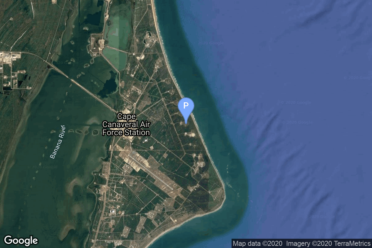
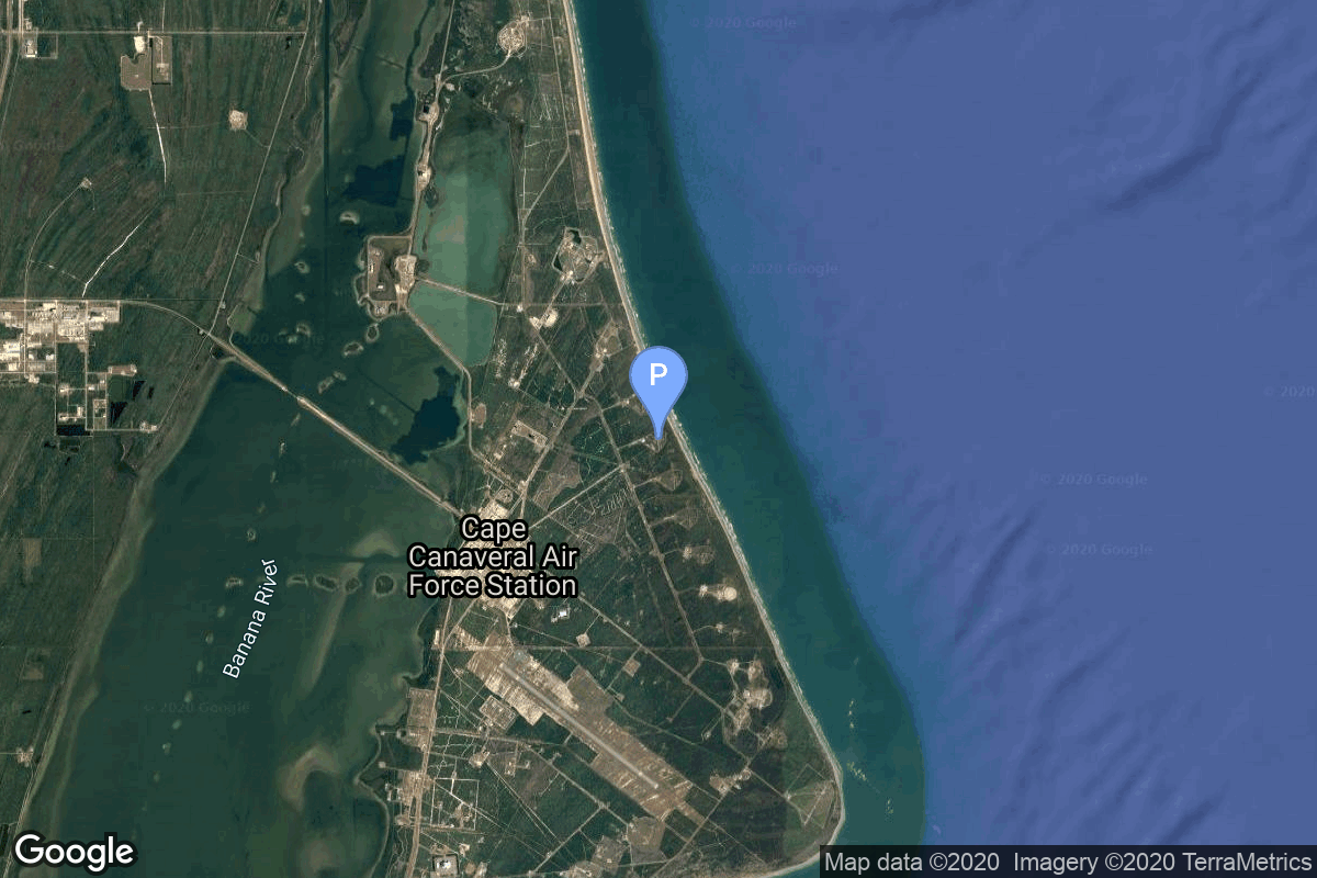
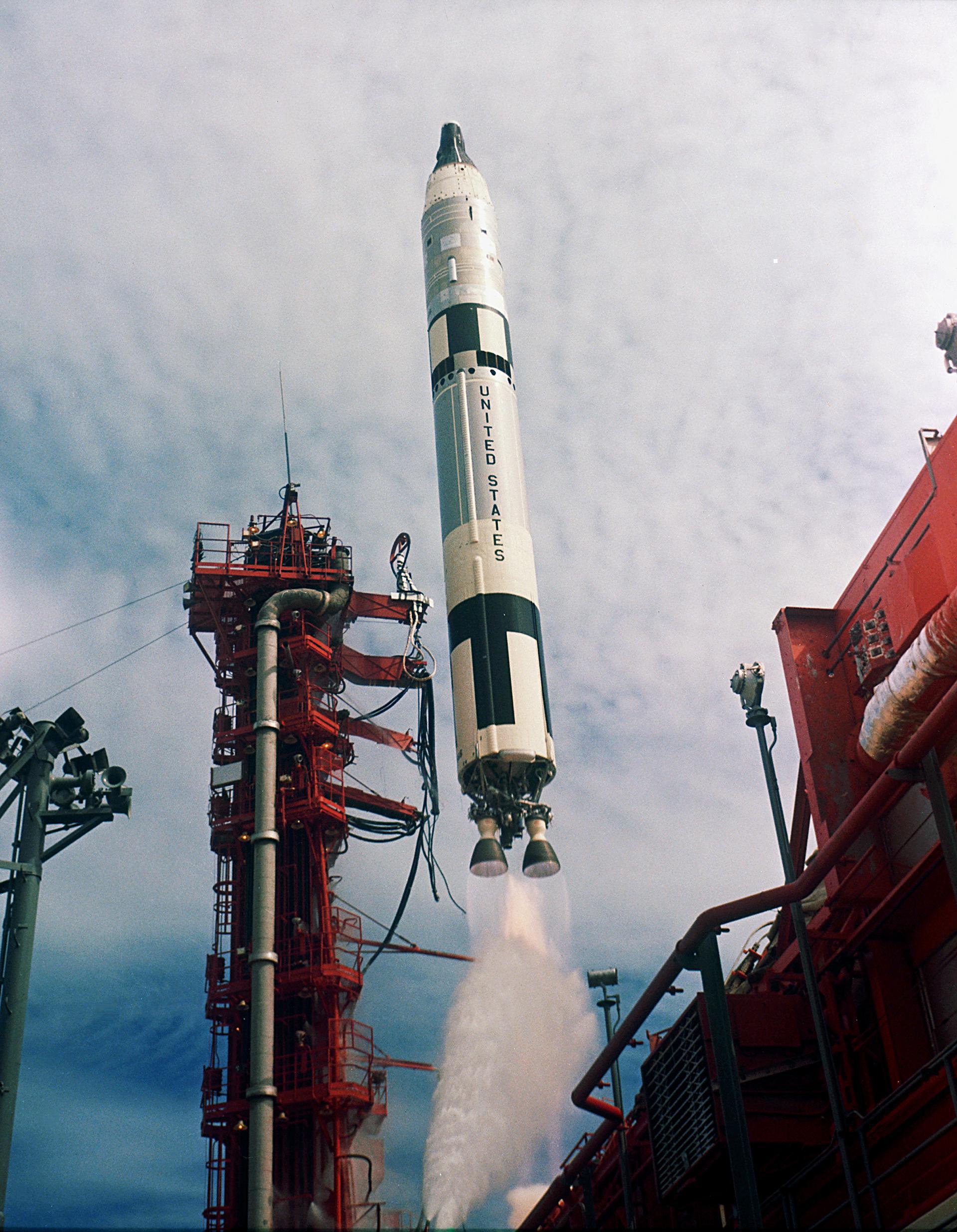
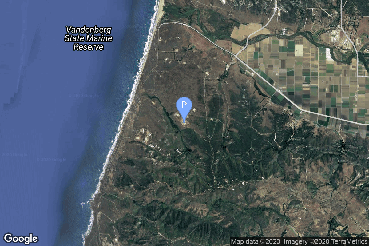
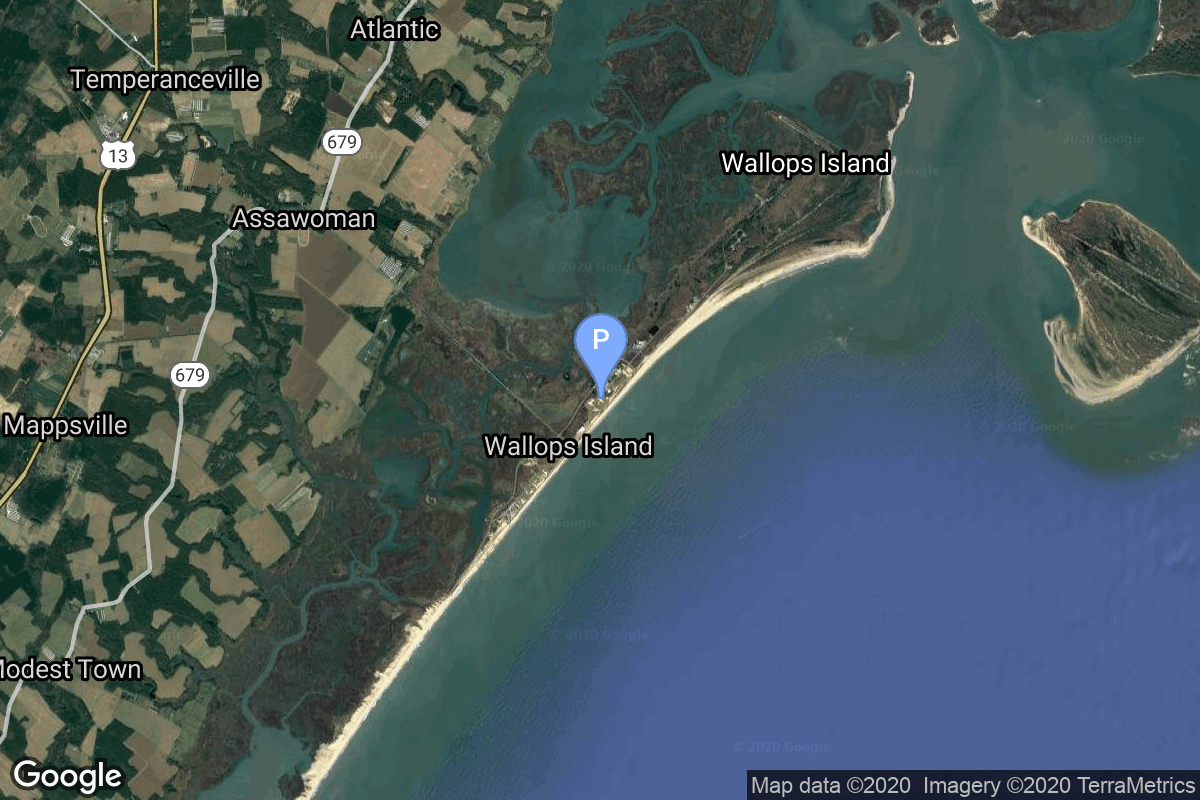
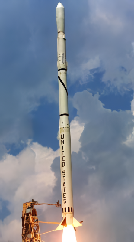
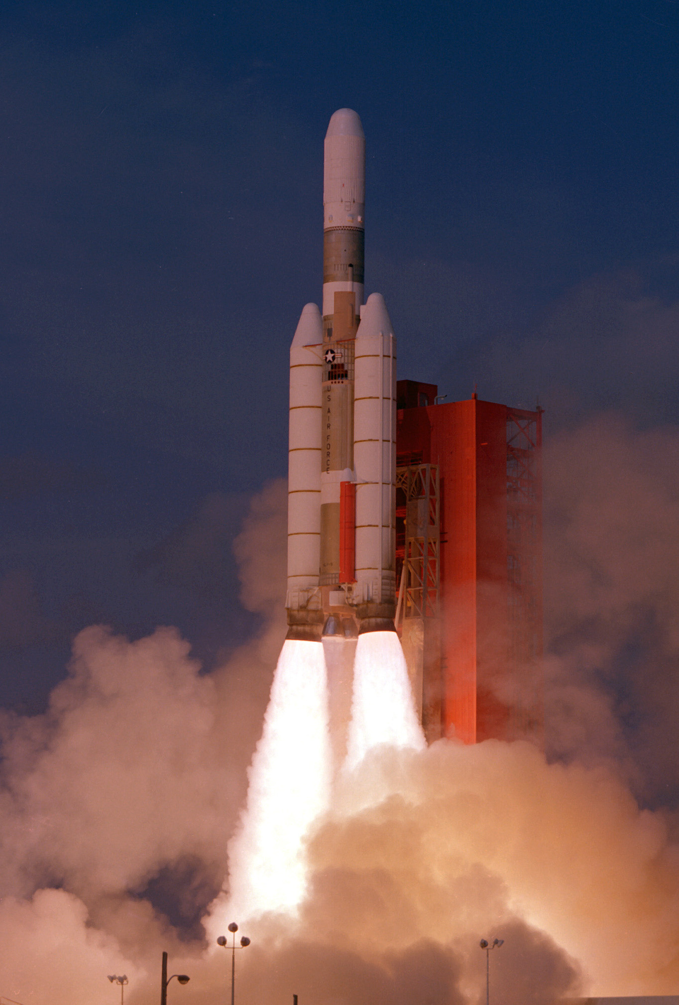
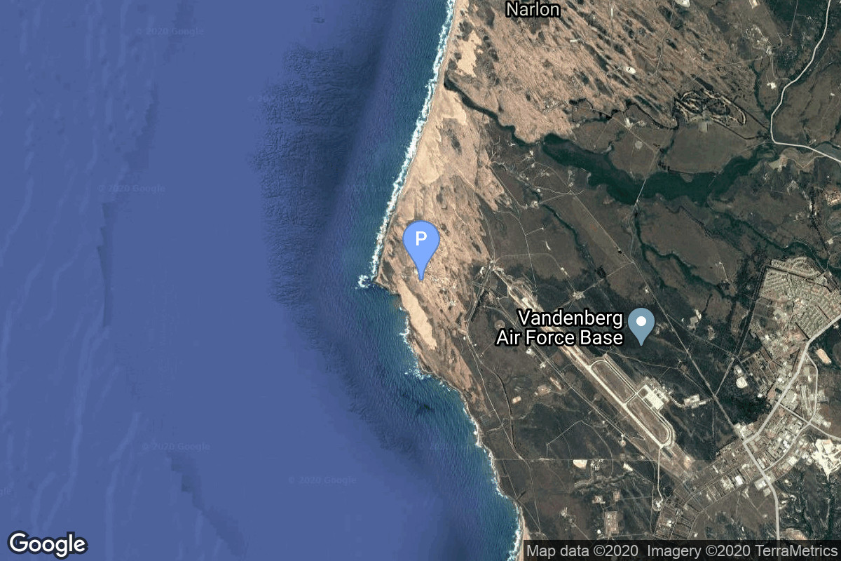
{ "count": 7865, "next": "https://ll.thespacedevs.com/2.0.0/launch/?format=api&limit=10&offset=640&ordering=net", "previous": "https://ll.thespacedevs.com/2.0.0/launch/?format=api&limit=10&offset=620&ordering=net", "results": [ { "id": "c70f48d4-711b-4e0b-9bdd-b973427f36b4", "url": "https://ll.thespacedevs.com/2.0.0/launch/c70f48d4-711b-4e0b-9bdd-b973427f36b4/?format=api", "launch_library_id": null, "slug": "atlas-slv-3-atda", "name": "Atlas SLV-3 | ATDA", "status": { "id": 3, "name": "Success" }, "net": "1966-06-01T15:00:02Z", "window_end": "1966-06-01T15:00:02Z", "window_start": "1966-06-01T15:00:02Z", "inhold": false, "tbdtime": false, "tbddate": false, "probability": null, "holdreason": "", "failreason": "", "hashtag": null, "launch_service_provider": { "id": 161, "url": "https://ll.thespacedevs.com/2.0.0/agencies/161/?format=api", "name": "United States Air Force", "type": "Government" }, "rocket": { "id": 3533, "configuration": { "id": 256, "launch_library_id": null, "url": "https://ll.thespacedevs.com/2.0.0/config/launcher/256/?format=api", "name": "Atlas SLV-3", "family": "Atlas", "full_name": "Atlas SLV-3", "variant": "SLV-3" } }, "mission": { "id": 1953, "launch_library_id": null, "name": "ATDA", "description": "The ATDA (Augmented Target Docking Adapter) had been prepared as a back-up target in case of an GATV (Gemini Agena Target Vehicle) failure. The ATDA was a short cylinder consisting of a target docking adapter cone mounted on front and containing a communications system, a guidance and control system, and a reaction control system. It also had running lights, but unlike the GATV, the ATDA had no propulsive capabilities for orbit changes.", "launch_designator": null, "type": "Test Target", "orbit": { "id": 8, "name": "Low Earth Orbit", "abbrev": "LEO" } }, "pad": { "id": 17, "url": "https://ll.thespacedevs.com/2.0.0/pad/17/?format=api", "agency_id": 1048, "name": "Space Launch Complex 14", "info_url": null, "wiki_url": "https://en.wikipedia.org/wiki/Cape_Canaveral_Air_Force_Station_Launch_Complex_14", "map_url": "https://www.google.com/maps?q=28.49103,-80.54687", "latitude": "28.49103", "longitude": "-80.54687", "location": { "id": 12, "url": "https://ll.thespacedevs.com/2.0.0/location/12/?format=api", "name": "Cape Canaveral SFS, FL, USA", "country_code": "USA", "map_image": "https://thespacedevs-prod.nyc3.digitaloceanspaces.com/media/map_images/location_12_20200803142519.jpg", "total_launch_count": 1108, "total_landing_count": 75 }, "map_image": "https://thespacedevs-prod.nyc3.digitaloceanspaces.com/media/map_images/pad_17_20200803143405.jpg", "total_launch_count": 20 }, "webcast_live": false, "image": null, "infographic": null, "program": [ { "id": 3, "url": "https://ll.thespacedevs.com/2.0.0/program/3/?format=api", "name": "Gemini", "description": "Project Gemini was NASA's second human spaceflight program. Conducted between projects Mercury and Apollo, Gemini started in 1961 and concluded in 1966.", "agencies": [ { "id": 44, "url": "https://ll.thespacedevs.com/2.0.0/agencies/44/?format=api", "name": "National Aeronautics and Space Administration", "type": "Government" } ], "image_url": "https://thespacedevs-prod.nyc3.digitaloceanspaces.com/media/images/project2520gem_program_20200820195350.png", "start_date": "1961-12-07T00:00:00Z", "end_date": "1966-11-15T19:21:04Z", "info_url": "https://www.nasa.gov/mission_pages/gemini/index.html", "wiki_url": "https://en.wikipedia.org/wiki/Project_Gemini" } ] }, { "id": "481a154b-2ae1-4af2-afce-2ba5bfe26dfe", "url": "https://ll.thespacedevs.com/2.0.0/launch/481a154b-2ae1-4af2-afce-2ba5bfe26dfe/?format=api", "launch_library_id": 1010, "slug": "titan-ii-glv-gemini-ix-a", "name": "Titan II GLV | Gemini IX-A", "status": { "id": 3, "name": "Success" }, "net": "1966-06-03T13:39:33Z", "window_end": "1966-06-03T13:39:33Z", "window_start": "1966-06-03T13:39:33Z", "inhold": false, "tbdtime": false, "tbddate": false, "probability": null, "holdreason": "", "failreason": null, "hashtag": null, "launch_service_provider": { "id": 44, "url": "https://ll.thespacedevs.com/2.0.0/agencies/44/?format=api", "name": "National Aeronautics and Space Administration", "type": "Government" }, "rocket": { "id": 207, "configuration": { "id": 98, "launch_library_id": 137, "url": "https://ll.thespacedevs.com/2.0.0/config/launcher/98/?format=api", "name": "Titan II", "family": "Titan", "full_name": "Titan II GLV", "variant": "GLV" } }, "mission": { "id": 257, "launch_library_id": 362, "name": "Gemini IX-A (Gemini 9A)", "description": "Gemini 9A was the seventh crewed mission of the NASA's Project Gemini. The mission was commanded by Command Pilot Thomas P. Stafford and Pilot Eugene Cernan. The astronauts rendezvoused with the Augmented Docking Target Adapter, but were unable to dock due to docking target's fairing which failed to deploy. The mission started on June 3, 1966, 13:39:33 UTC and ended on June 6, 1966, 14:00:23 UTC.", "launch_designator": null, "type": "Human Exploration", "orbit": { "id": 8, "name": "Low Earth Orbit", "abbrev": "LEO" } }, "pad": { "id": 18, "url": "https://ll.thespacedevs.com/2.0.0/pad/18/?format=api", "agency_id": null, "name": "Launch Complex 19", "info_url": null, "wiki_url": "https://en.wikipedia.org/wiki/Cape_Canaveral_Air_Force_Station_Launch_Complex_19", "map_url": "https://www.google.com/maps?q=28.506898,-80.554169", "latitude": "28.506898", "longitude": "-80.554169", "location": { "id": 12, "url": "https://ll.thespacedevs.com/2.0.0/location/12/?format=api", "name": "Cape Canaveral SFS, FL, USA", "country_code": "USA", "map_image": "https://thespacedevs-prod.nyc3.digitaloceanspaces.com/media/map_images/location_12_20200803142519.jpg", "total_launch_count": 1108, "total_landing_count": 75 }, "map_image": "https://thespacedevs-prod.nyc3.digitaloceanspaces.com/media/map_images/pad_18_20200803143356.jpg", "total_launch_count": 12 }, "webcast_live": false, "image": "https://thespacedevs-prod.nyc3.digitaloceanspaces.com/media/images/titan2520ii_image_20190222030027.jpeg", "infographic": null, "program": [ { "id": 3, "url": "https://ll.thespacedevs.com/2.0.0/program/3/?format=api", "name": "Gemini", "description": "Project Gemini was NASA's second human spaceflight program. Conducted between projects Mercury and Apollo, Gemini started in 1961 and concluded in 1966.", "agencies": [ { "id": 44, "url": "https://ll.thespacedevs.com/2.0.0/agencies/44/?format=api", "name": "National Aeronautics and Space Administration", "type": "Government" } ], "image_url": "https://thespacedevs-prod.nyc3.digitaloceanspaces.com/media/images/project2520gem_program_20200820195350.png", "start_date": "1961-12-07T00:00:00Z", "end_date": "1966-11-15T19:21:04Z", "info_url": "https://www.nasa.gov/mission_pages/gemini/index.html", "wiki_url": "https://en.wikipedia.org/wiki/Project_Gemini" } ] }, { "id": "c8ad088d-44e0-4b0b-9e66-6571c40b54dc", "url": "https://ll.thespacedevs.com/2.0.0/launch/c8ad088d-44e0-4b0b-9e66-6571c40b54dc/?format=api", "launch_library_id": null, "slug": "atlas-slv-3-agena-d-kh-7-29", "name": "Atlas SLV-3 Agena D | KH-7 29", "status": { "id": 3, "name": "Success" }, "net": "1966-06-03T19:25:00Z", "window_end": "1966-06-03T19:25:00Z", "window_start": "1966-06-03T19:25:00Z", "inhold": false, "tbdtime": false, "tbddate": false, "probability": null, "holdreason": "", "failreason": null, "hashtag": null, "launch_service_provider": { "id": 161, "url": "https://ll.thespacedevs.com/2.0.0/agencies/161/?format=api", "name": "United States Air Force", "type": "Government" }, "rocket": { "id": 3534, "configuration": { "id": 258, "launch_library_id": null, "url": "https://ll.thespacedevs.com/2.0.0/config/launcher/258/?format=api", "name": "Atlas SLV-3 Agena D", "family": "Atlas", "full_name": "Atlas SLV-3 Agena D", "variant": "SLV-3 Agena D" } }, "mission": { "id": 1954, "launch_library_id": null, "name": "KH-7 29", "description": "The Program 206 satellite, carrying the KH-7 (Keyhole 7) camera system (codenamed Gambit-1), was the first successful high resolution space reconnaissance program. It was managed by NRO's Program A, the USAF-led segment of the National Reconnaissance Program managed from Los Angeles AFB in El Segundo, California.", "launch_designator": null, "type": "Government/Top Secret", "orbit": { "id": 17, "name": "Sun-Synchronous Orbit", "abbrev": "SSO" } }, "pad": { "id": 16, "url": "https://ll.thespacedevs.com/2.0.0/pad/16/?format=api", "agency_id": null, "name": "Space Launch Complex 4E", "info_url": null, "wiki_url": "https://en.wikipedia.org/wiki/Vandenberg_Space_Launch_Complex_4#SLC-4E", "map_url": "https://www.google.com/maps?q=34.632,-120.611", "latitude": "34.632", "longitude": "-120.611", "location": { "id": 11, "url": "https://ll.thespacedevs.com/2.0.0/location/11/?format=api", "name": "Vandenberg SFB, CA, USA", "country_code": "USA", "map_image": "https://thespacedevs-prod.nyc3.digitaloceanspaces.com/media/map_images/location_11_20200803142416.jpg", "total_launch_count": 884, "total_landing_count": 34 }, "map_image": "https://thespacedevs-prod.nyc3.digitaloceanspaces.com/media/map_images/pad_16_20200803143532.jpg", "total_launch_count": 268 }, "webcast_live": false, "image": "https://thespacedevs-prod.nyc3.digitaloceanspaces.com/media/images/atlas-slv3_agen_image_20251102060811.jpg", "infographic": null, "program": [] }, { "id": "bb082b0f-47bf-4a72-b3b1-8f620c865467", "url": "https://ll.thespacedevs.com/2.0.0/launch/bb082b0f-47bf-4a72-b3b1-8f620c865467/?format=api", "launch_library_id": null, "slug": "atlas-slv-3-agena-b-ogo-3", "name": "Atlas SLV-3 Agena B | OGO 3", "status": { "id": 3, "name": "Success" }, "net": "1966-06-07T02:48:00Z", "window_end": "1966-06-07T02:48:00Z", "window_start": "1966-06-07T02:48:00Z", "inhold": false, "tbdtime": false, "tbddate": false, "probability": null, "holdreason": "", "failreason": null, "hashtag": null, "launch_service_provider": { "id": 161, "url": "https://ll.thespacedevs.com/2.0.0/agencies/161/?format=api", "name": "United States Air Force", "type": "Government" }, "rocket": { "id": 3535, "configuration": { "id": 257, "launch_library_id": null, "url": "https://ll.thespacedevs.com/2.0.0/config/launcher/257/?format=api", "name": "Atlas SLV-3 Agena B", "family": "Atlas", "full_name": "Atlas SLV-3 Agena B", "variant": "SLV-3 Agena B" } }, "mission": { "id": 1955, "launch_library_id": null, "name": "OGO 3", "description": "The OGO (Orbiting Geophysical Observatory) series was a series of large, complex research satellites.", "launch_designator": null, "type": "Earth Science", "orbit": { "id": 0, "name": "Elliptical Orbit", "abbrev": "Elliptical" } }, "pad": { "id": 99, "url": "https://ll.thespacedevs.com/2.0.0/pad/99/?format=api", "agency_id": 161, "name": "Launch Complex 12", "info_url": null, "wiki_url": "https://en.wikipedia.org/wiki/Cape_Canaveral_Air_Force_Station_Launch_Complex_12", "map_url": "https://www.google.com/maps?q=28.480607,-80.541938", "latitude": "28.480607", "longitude": "-80.541938", "location": { "id": 12, "url": "https://ll.thespacedevs.com/2.0.0/location/12/?format=api", "name": "Cape Canaveral SFS, FL, USA", "country_code": "USA", "map_image": "https://thespacedevs-prod.nyc3.digitaloceanspaces.com/media/map_images/location_12_20200803142519.jpg", "total_launch_count": 1108, "total_landing_count": 75 }, "map_image": "https://thespacedevs-prod.nyc3.digitaloceanspaces.com/media/map_images/pad_99_20200803143435.jpg", "total_launch_count": 23 }, "webcast_live": false, "image": null, "infographic": null, "program": [] }, { "id": "d6ca3a23-71f9-485c-a70d-911705ddff9c", "url": "https://ll.thespacedevs.com/2.0.0/launch/d6ca3a23-71f9-485c-a70d-911705ddff9c/?format=api", "launch_library_id": null, "slug": "voskhod-zenit-2-39", "name": "Voskhod | Zenit-2 39", "status": { "id": 3, "name": "Success" }, "net": "1966-06-08T11:00:00Z", "window_end": "1966-06-08T11:00:00Z", "window_start": "1966-06-08T11:00:00Z", "inhold": false, "tbdtime": false, "tbddate": false, "probability": null, "holdreason": "", "failreason": null, "hashtag": null, "launch_service_provider": { "id": 66, "url": "https://ll.thespacedevs.com/2.0.0/agencies/66/?format=api", "name": "Soviet Space Program", "type": "Government" }, "rocket": { "id": 3536, "configuration": { "id": 104, "launch_library_id": 138, "url": "https://ll.thespacedevs.com/2.0.0/config/launcher/104/?format=api", "name": "Voskhod", "family": "R-7", "full_name": "Voskhod", "variant": "Voskhod" } }, "mission": { "id": 1956, "launch_library_id": null, "name": "Zenit-2 39", "description": "Zenit-2 film-return and ELINT reconnaissance satellite.", "launch_designator": null, "type": "Government/Top Secret", "orbit": { "id": 8, "name": "Low Earth Orbit", "abbrev": "LEO" } }, "pad": { "id": 20, "url": "https://ll.thespacedevs.com/2.0.0/pad/20/?format=api", "agency_id": null, "name": "31/6", "info_url": null, "wiki_url": "https://en.wikipedia.org/wiki/Baikonur_Cosmodrome_Site_31", "map_url": "https://www.google.com/maps?q=45.996034,63.564003", "latitude": "45.996034", "longitude": "63.564003", "location": { "id": 15, "url": "https://ll.thespacedevs.com/2.0.0/location/15/?format=api", "name": "Baikonur Cosmodrome, Republic of Kazakhstan", "country_code": "KAZ", "map_image": "https://thespacedevs-prod.nyc3.digitaloceanspaces.com/media/map_images/location_15_20200803142517.jpg", "total_launch_count": 1563, "total_landing_count": 0 }, "map_image": "https://thespacedevs-prod.nyc3.digitaloceanspaces.com/media/map_images/pad_20_20200803143516.jpg", "total_launch_count": 428 }, "webcast_live": false, "image": "https://thespacedevs-prod.nyc3.digitaloceanspaces.com/media/images/voskhod_during__image_20251102062248.jpg", "infographic": null, "program": [] }, { "id": "a27b2ab4-bc93-42da-8881-fbed6dd94cda", "url": "https://ll.thespacedevs.com/2.0.0/launch/a27b2ab4-bc93-42da-8881-fbed6dd94cda/?format=api", "launch_library_id": null, "slug": "atlas-slv-3-agena-d-rts-1-1", "name": "Atlas SLV-3 Agena D | RTS-1 1", "status": { "id": 3, "name": "Success" }, "net": "1966-06-09T20:15:00Z", "window_end": "1966-06-09T20:15:00Z", "window_start": "1966-06-09T20:15:00Z", "inhold": false, "tbdtime": false, "tbddate": false, "probability": null, "holdreason": "", "failreason": null, "hashtag": null, "launch_service_provider": { "id": 161, "url": "https://ll.thespacedevs.com/2.0.0/agencies/161/?format=api", "name": "United States Air Force", "type": "Government" }, "rocket": { "id": 3537, "configuration": { "id": 258, "launch_library_id": null, "url": "https://ll.thespacedevs.com/2.0.0/config/launcher/258/?format=api", "name": "Atlas SLV-3 Agena D", "family": "Atlas", "full_name": "Atlas SLV-3 Agena D", "variant": "SLV-3 Agena D" } }, "mission": { "id": 1957, "launch_library_id": null, "name": "RTS-1 1", "description": "The RTS-1 (Research Test Series 1), also known as MIDAS-RTS-1 or AFP-461, was an extension to the MIDAS program of early warning satellites.", "launch_designator": null, "type": "Government/Top Secret", "orbit": { "id": 13, "name": "Polar Orbit", "abbrev": "PO" } }, "pad": { "id": 24, "url": "https://ll.thespacedevs.com/2.0.0/pad/24/?format=api", "agency_id": 161, "name": "Space Launch Complex 3E", "info_url": null, "wiki_url": "https://en.wikipedia.org/wiki/Vandenberg_Space_Launch_Complex_3#SLC-3E", "map_url": "https://www.google.com/maps?q=34.64,-120.5895", "latitude": "34.64", "longitude": "-120.5895", "location": { "id": 11, "url": "https://ll.thespacedevs.com/2.0.0/location/11/?format=api", "name": "Vandenberg SFB, CA, USA", "country_code": "USA", "map_image": "https://thespacedevs-prod.nyc3.digitaloceanspaces.com/media/map_images/location_11_20200803142416.jpg", "total_launch_count": 884, "total_landing_count": 34 }, "map_image": "https://thespacedevs-prod.nyc3.digitaloceanspaces.com/media/map_images/pad_24_20200803143552.jpg", "total_launch_count": 48 }, "webcast_live": false, "image": "https://thespacedevs-prod.nyc3.digitaloceanspaces.com/media/images/atlas-slv3_agen_image_20251102060811.jpg", "infographic": null, "program": [] }, { "id": "3bbdfdb4-2e75-4cd1-8005-63330033792f", "url": "https://ll.thespacedevs.com/2.0.0/launch/3bbdfdb4-2e75-4cd1-8005-63330033792f/?format=api", "launch_library_id": null, "slug": "scout-b-ov3-4", "name": "Scout B | OV3-4", "status": { "id": 3, "name": "Success" }, "net": "1966-06-10T04:15:00Z", "window_end": "1966-06-10T04:15:00Z", "window_start": "1966-06-10T04:15:00Z", "inhold": false, "tbdtime": false, "tbddate": false, "probability": null, "holdreason": "", "failreason": null, "hashtag": null, "launch_service_provider": { "id": 161, "url": "https://ll.thespacedevs.com/2.0.0/agencies/161/?format=api", "name": "United States Air Force", "type": "Government" }, "rocket": { "id": 3538, "configuration": { "id": 358, "launch_library_id": null, "url": "https://ll.thespacedevs.com/2.0.0/config/launcher/358/?format=api", "name": "Scout B", "family": "Scout", "full_name": "Scout B", "variant": "B" } }, "mission": { "id": 1958, "launch_library_id": null, "name": "OV3-4", "description": "The OV3 (Orbiting Vehicle 3) series were experimental satellites based on an octagonal bus structure. These were the only in the OV series launched on dedicated launchers.", "launch_designator": null, "type": "Earth Science", "orbit": { "id": 13, "name": "Polar Orbit", "abbrev": "PO" } }, "pad": { "id": 178, "url": "https://ll.thespacedevs.com/2.0.0/pad/178/?format=api", "agency_id": null, "name": "Launch Area 3A", "info_url": null, "wiki_url": null, "map_url": "https://www.google.com/maps?q=37.8495,-75.4725", "latitude": "37.8495", "longitude": "-75.4725", "location": { "id": 21, "url": "https://ll.thespacedevs.com/2.0.0/location/21/?format=api", "name": "Wallops Flight Facility, Virginia, USA", "country_code": "USA", "map_image": "https://thespacedevs-prod.nyc3.digitaloceanspaces.com/media/map_images/location_21_20200803142423.jpg", "total_launch_count": 86, "total_landing_count": 0 }, "map_image": "https://thespacedevs-prod.nyc3.digitaloceanspaces.com/media/map_images/pad_178_20200803143407.jpg", "total_launch_count": 18 }, "webcast_live": false, "image": "https://thespacedevs-prod.nyc3.digitaloceanspaces.com/media/images/scout-b_2528se_image_20251109064911.png", "infographic": null, "program": [] }, { "id": "0c8656cb-a0f3-41d7-9eb1-c56e60cef520", "url": "https://ll.thespacedevs.com/2.0.0/launch/0c8656cb-a0f3-41d7-9eb1-c56e60cef520/?format=api", "launch_library_id": null, "slug": "titan-iiic-idcsp-1-to-7", "name": "Titan IIIC | IDCSP 1 to 7", "status": { "id": 3, "name": "Success" }, "net": "1966-06-16T14:00:01Z", "window_end": "1966-06-16T14:00:01Z", "window_start": "1966-06-16T14:00:01Z", "inhold": false, "tbdtime": false, "tbddate": false, "probability": null, "holdreason": "", "failreason": null, "hashtag": null, "launch_service_provider": { "id": 161, "url": "https://ll.thespacedevs.com/2.0.0/agencies/161/?format=api", "name": "United States Air Force", "type": "Government" }, "rocket": { "id": 3539, "configuration": { "id": 439, "launch_library_id": null, "url": "https://ll.thespacedevs.com/2.0.0/config/launcher/439/?format=api", "name": "Titan IIIC", "family": "Titan", "full_name": "Titan IIIC", "variant": "IIIC" } }, "mission": { "id": 1959, "launch_library_id": null, "name": "IDCSP 1 to 7", "description": "The IDCSP (Initial Defense Communications satellite Program) provided the Pentagon with its first near-geosynchronous communications system and replaced the cancelled ADVENT project.", "launch_designator": null, "type": "Communications", "orbit": { "id": 3, "name": "Geosynchronous Orbit", "abbrev": "GSO" } }, "pad": { "id": 29, "url": "https://ll.thespacedevs.com/2.0.0/pad/29/?format=api", "agency_id": null, "name": "Space Launch Complex 41", "info_url": null, "wiki_url": "https://en.wikipedia.org/wiki/Cape_Canaveral_Air_Force_Station_Space_Launch_Complex_41", "map_url": "https://www.google.com/maps?q=28.58341025,-80.58303644", "latitude": "28.58341025", "longitude": "-80.58303644", "location": { "id": 12, "url": "https://ll.thespacedevs.com/2.0.0/location/12/?format=api", "name": "Cape Canaveral SFS, FL, USA", "country_code": "USA", "map_image": "https://thespacedevs-prod.nyc3.digitaloceanspaces.com/media/map_images/location_12_20200803142519.jpg", "total_launch_count": 1108, "total_landing_count": 75 }, "map_image": "https://thespacedevs-prod.nyc3.digitaloceanspaces.com/media/map_images/pad_29_20200803143528.jpg", "total_launch_count": 123 }, "webcast_live": false, "image": "https://thespacedevs-prod.nyc3.digitaloceanspaces.com/media/images/titan_iii-c_lau_image_20251103140641.jpeg", "infographic": null, "program": [] }, { "id": "adab6ad2-d6c9-437a-af35-8730d5724fc1", "url": "https://ll.thespacedevs.com/2.0.0/launch/adab6ad2-d6c9-437a-af35-8730d5724fc1/?format=api", "launch_library_id": null, "slug": "voskhod-zenit-4-19", "name": "Voskhod | Zenit-4 19", "status": { "id": 3, "name": "Success" }, "net": "1966-06-17T11:00:00Z", "window_end": "1966-06-17T11:00:00Z", "window_start": "1966-06-17T11:00:00Z", "inhold": false, "tbdtime": false, "tbddate": false, "probability": null, "holdreason": "", "failreason": null, "hashtag": null, "launch_service_provider": { "id": 66, "url": "https://ll.thespacedevs.com/2.0.0/agencies/66/?format=api", "name": "Soviet Space Program", "type": "Government" }, "rocket": { "id": 3540, "configuration": { "id": 104, "launch_library_id": 138, "url": "https://ll.thespacedevs.com/2.0.0/config/launcher/104/?format=api", "name": "Voskhod", "family": "R-7", "full_name": "Voskhod", "variant": "Voskhod" } }, "mission": { "id": 1960, "launch_library_id": null, "name": "Zenit-4 19", "description": "Zenit-4 film-return reconnaissance satellite.", "launch_designator": null, "type": "Government/Top Secret", "orbit": { "id": 8, "name": "Low Earth Orbit", "abbrev": "LEO" } }, "pad": { "id": 168, "url": "https://ll.thespacedevs.com/2.0.0/pad/168/?format=api", "agency_id": null, "name": "41/1", "info_url": null, "wiki_url": "https://en.wikipedia.org/wiki/Plesetsk_Cosmodrome", "map_url": "https://www.google.com/maps?q=62.941,40.526806", "latitude": "62.941", "longitude": "40.526806", "location": { "id": 6, "url": "https://ll.thespacedevs.com/2.0.0/location/6/?format=api", "name": "Plesetsk Cosmodrome, Russian Federation", "country_code": "RUS", "map_image": "https://thespacedevs-prod.nyc3.digitaloceanspaces.com/media/map_images/location_6_20200803142434.jpg", "total_launch_count": 1685, "total_landing_count": 0 }, "map_image": "https://thespacedevs-prod.nyc3.digitaloceanspaces.com/media/map_images/pad_168_20200803143446.jpg", "total_launch_count": 310 }, "webcast_live": false, "image": "https://thespacedevs-prod.nyc3.digitaloceanspaces.com/media/images/voskhod_during__image_20251102062248.jpg", "infographic": null, "program": [] }, { "id": "cc788479-fd15-4031-9385-4f49200a35bc", "url": "https://ll.thespacedevs.com/2.0.0/launch/cc788479-fd15-4031-9385-4f49200a35bc/?format=api", "launch_library_id": null, "slug": "thor-slv-2a-agena-d-kh-4a-34", "name": "Thor SLV-2A Agena D | KH-4A 34", "status": { "id": 3, "name": "Success" }, "net": "1966-06-21T21:31:30Z", "window_end": "1966-06-21T21:31:30Z", "window_start": "1966-06-21T21:31:30Z", "inhold": false, "tbdtime": false, "tbddate": false, "probability": null, "holdreason": "", "failreason": null, "hashtag": null, "launch_service_provider": { "id": 161, "url": "https://ll.thespacedevs.com/2.0.0/agencies/161/?format=api", "name": "United States Air Force", "type": "Government" }, "rocket": { "id": 3541, "configuration": { "id": 417, "launch_library_id": null, "url": "https://ll.thespacedevs.com/2.0.0/config/launcher/417/?format=api", "name": "Thor SLV-2A Agena D", "family": "Thor", "full_name": "Thor SLV-2A Agena D", "variant": "SLV-2A Agena D" } }, "mission": { "id": 1961, "launch_library_id": null, "name": "KH-4A 34", "description": "The KH-4A (Keyhole-4A) was the fifth optical reconnaissance satellite version in the Corona-program.", "launch_designator": null, "type": "Government/Top Secret", "orbit": { "id": 8, "name": "Low Earth Orbit", "abbrev": "LEO" } }, "pad": { "id": 96, "url": "https://ll.thespacedevs.com/2.0.0/pad/96/?format=api", "agency_id": 161, "name": "Space Launch Complex 1E", "info_url": null, "wiki_url": "https://en.wikipedia.org/wiki/Vandenberg_Space_Launch_Complex_1", "map_url": "https://www.google.com/maps?q=34.756,-120.6263", "latitude": "34.756", "longitude": "-120.6263", "location": { "id": 11, "url": "https://ll.thespacedevs.com/2.0.0/location/11/?format=api", "name": "Vandenberg SFB, CA, USA", "country_code": "USA", "map_image": "https://thespacedevs-prod.nyc3.digitaloceanspaces.com/media/map_images/location_11_20200803142416.jpg", "total_launch_count": 884, "total_landing_count": 34 }, "map_image": "https://thespacedevs-prod.nyc3.digitaloceanspaces.com/media/map_images/pad_96_20200803143221.jpg", "total_launch_count": 45 }, "webcast_live": false, "image": "https://thespacedevs-prod.nyc3.digitaloceanspaces.com/media/images/thor_slv-2a_age_image_20251102055131.jpg", "infographic": null, "program": [] } ] }