Launch List
API endpoint that returns all Launch objects or a single launch.
EXAMPLE - /launch/
GET: Return a list of all Launch objects.
FILTERS: Fields - 'name', 'id(s)', 'lsp_id', 'lsp_name', 'serial_number', 'launcher_config__id', 'rocket__spacecraftflight__spacecraft__name'
MODE: 'normal', 'list', 'detailed' EXAMPLE: ?mode=list
SEARCH: Searches through the launch name, rocket name, launch agency, mission name & spacecraft name. EXAMPLE - ?search=SpaceX
GET /2.0.0/launch/?format=api&offset=470&ordering=net
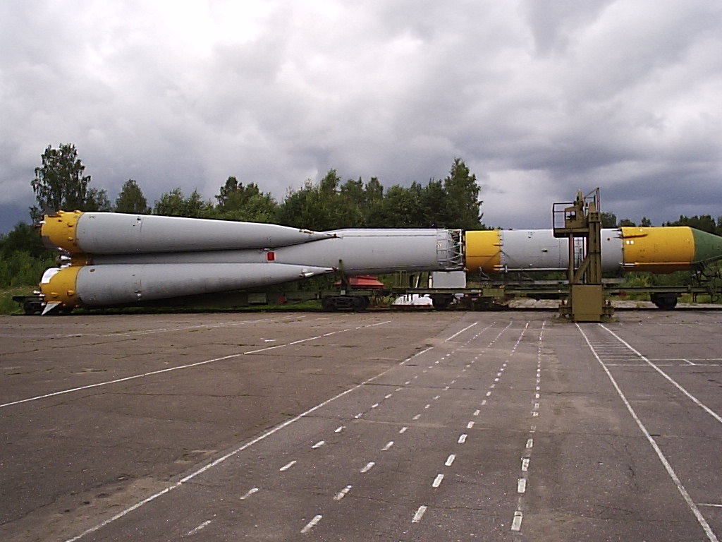
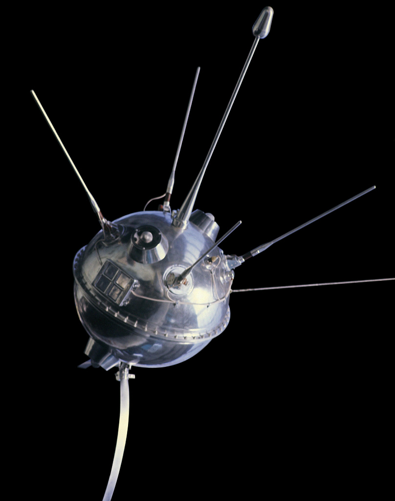
{ "count": 7500, "next": "https://ll.thespacedevs.com/2.0.0/launch/?format=api&limit=10&offset=480&ordering=net", "previous": "https://ll.thespacedevs.com/2.0.0/launch/?format=api&limit=10&offset=460&ordering=net", "results": [ { "id": "f9eb96a4-6011-480f-ad2c-597de757137d", "url": "https://ll.thespacedevs.com/2.0.0/launch/f9eb96a4-6011-480f-ad2c-597de757137d/?format=api", "launch_library_id": null, "slug": "molniya-8k78-luna-5d", "name": "Molniya 8K78 | Luna-5d", "status": { "id": 4, "name": "Failure" }, "net": "1965-04-10T08:39:01Z", "window_end": "1965-04-10T08:39:01Z", "window_start": "1965-04-10T08:39:01Z", "inhold": false, "tbdtime": false, "tbddate": false, "probability": null, "holdreason": "", "failreason": null, "hashtag": null, "launch_service_provider": { "id": 66, "url": "https://ll.thespacedevs.com/2.0.0/agencies/66/?format=api", "name": "Soviet Space Program", "type": "Government" }, "rocket": { "id": 3384, "configuration": { "id": 184, "launch_library_id": 207, "url": "https://ll.thespacedevs.com/2.0.0/config/launcher/184/?format=api", "name": "Molniya 8K78", "family": "R-7", "full_name": "Molniya 8K78", "variant": "8K78" } }, "mission": { "id": 1805, "launch_library_id": null, "name": "Luna-5d", "description": "Ye-6 series probe designed to land on the Moon. Failed to achieve orbit.", "launch_designator": null, "type": "Lunar Exploration", "orbit": { "id": 11, "name": "Lunar Orbit", "abbrev": "LO" } }, "pad": { "id": 32, "url": "https://ll.thespacedevs.com/2.0.0/pad/32/?format=api", "agency_id": null, "name": "1/5", "info_url": null, "wiki_url": "", "map_url": "https://www.google.com/maps?q=45.92,63.342", "latitude": "45.92", "longitude": "63.342", "location": { "id": 15, "url": "https://ll.thespacedevs.com/2.0.0/location/15/?format=api", "name": "Baikonur Cosmodrome, Republic of Kazakhstan", "country_code": "KAZ", "map_image": "https://thespacedevs-prod.nyc3.digitaloceanspaces.com/media/map_images/location_15_20200803142517.jpg", "total_launch_count": 1555, "total_landing_count": 0 }, "map_image": "https://thespacedevs-prod.nyc3.digitaloceanspaces.com/media/map_images/pad_32_20200803143513.jpg", "total_launch_count": 487 }, "webcast_live": false, "image": "https://thespacedevs-prod.nyc3.digitaloceanspaces.com/media/images/molniya25208k78_image_20191201210000.jpg", "infographic": null, "program": [ { "id": 38, "url": "https://ll.thespacedevs.com/2.0.0/program/38/?format=api", "name": "Luna", "description": "The Luna program was a series of robotic spacecraft missions sent to the Moon by the Soviet Union between 1959 and 1976. The program accomplished many firsts in space exploration, including first flyby of the Moon, first impact of the Moon and first photos of the far side of the Moon. Each mission was designed as either an orbiter or lander. They also performed many experiments, studying the Moon's chemical composition, gravity, temperature, and radiation.", "agencies": [ { "id": 66, "url": "https://ll.thespacedevs.com/2.0.0/agencies/66/?format=api", "name": "Soviet Space Program", "type": "Government" } ], "image_url": "https://thespacedevs-prod.nyc3.digitaloceanspaces.com/media/images/luna_1_impactor_image_20240813082956.jpg", "start_date": "1958-09-23T07:40:23Z", "end_date": "1976-08-22T17:55:00Z", "info_url": null, "wiki_url": "https://en.wikipedia.org/wiki/Luna_programme" } ] }, { "id": "614c096a-4dbd-4f15-aced-f9b6390ee8fa", "url": "https://ll.thespacedevs.com/2.0.0/launch/614c096a-4dbd-4f15-aced-f9b6390ee8fa/?format=api", "launch_library_id": null, "slug": "voskhod-zenit-4-6", "name": "Voskhod | Zenit-4 6", "status": { "id": 3, "name": "Success" }, "net": "1965-04-17T09:50:00Z", "window_end": "1965-04-17T09:50:00Z", "window_start": "1965-04-17T09:50:00Z", "inhold": false, "tbdtime": false, "tbddate": false, "probability": null, "holdreason": "", "failreason": null, "hashtag": null, "launch_service_provider": { "id": 66, "url": "https://ll.thespacedevs.com/2.0.0/agencies/66/?format=api", "name": "Soviet Space Program", "type": "Government" }, "rocket": { "id": 3385, "configuration": { "id": 104, "launch_library_id": 138, "url": "https://ll.thespacedevs.com/2.0.0/config/launcher/104/?format=api", "name": "Voskhod", "family": "R-7", "full_name": "Voskhod", "variant": "Voskhod" } }, "mission": { "id": 1806, "launch_library_id": null, "name": "Zenit-4 6", "description": "Zenit-4 film-return reconnaissance satellite.", "launch_designator": null, "type": "Government/Top Secret", "orbit": { "id": 8, "name": "Low Earth Orbit", "abbrev": "LEO" } }, "pad": { "id": 20, "url": "https://ll.thespacedevs.com/2.0.0/pad/20/?format=api", "agency_id": null, "name": "31/6", "info_url": null, "wiki_url": "https://en.wikipedia.org/wiki/Baikonur_Cosmodrome_Site_31", "map_url": "https://www.google.com/maps?q=45.996034,63.564003", "latitude": "45.996034", "longitude": "63.564003", "location": { "id": 15, "url": "https://ll.thespacedevs.com/2.0.0/location/15/?format=api", "name": "Baikonur Cosmodrome, Republic of Kazakhstan", "country_code": "KAZ", "map_image": "https://thespacedevs-prod.nyc3.digitaloceanspaces.com/media/map_images/location_15_20200803142517.jpg", "total_launch_count": 1555, "total_landing_count": 0 }, "map_image": "https://thespacedevs-prod.nyc3.digitaloceanspaces.com/media/map_images/pad_20_20200803143516.jpg", "total_launch_count": 422 }, "webcast_live": false, "image": null, "infographic": null, "program": [] }, { "id": "1cee50a6-7022-44f8-a0a1-041b09b36652", "url": "https://ll.thespacedevs.com/2.0.0/launch/1cee50a6-7022-44f8-a0a1-041b09b36652/?format=api", "launch_library_id": null, "slug": "molniya-8k78-molniya-1-1", "name": "Molniya 8K78 | Molniya-1 1", "status": { "id": 3, "name": "Success" }, "net": "1965-04-23T01:55:00Z", "window_end": "1965-04-23T01:55:00Z", "window_start": "1965-04-23T01:55:00Z", "inhold": false, "tbdtime": false, "tbddate": false, "probability": null, "holdreason": "", "failreason": null, "hashtag": null, "launch_service_provider": { "id": 66, "url": "https://ll.thespacedevs.com/2.0.0/agencies/66/?format=api", "name": "Soviet Space Program", "type": "Government" }, "rocket": { "id": 3386, "configuration": { "id": 184, "launch_library_id": 207, "url": "https://ll.thespacedevs.com/2.0.0/config/launcher/184/?format=api", "name": "Molniya 8K78", "family": "R-7", "full_name": "Molniya 8K78", "variant": "8K78" } }, "mission": { "id": 1807, "launch_library_id": null, "name": "Molniya-1 1", "description": "The Molniya were Soviet communication satellites operating from an inclined highly elliptical earth orbit of 500 km × 40000 km with 12 hour period for coverage of high northern latitudes.", "launch_designator": null, "type": "Communications", "orbit": { "id": 0, "name": "Elliptical Orbit", "abbrev": "Elliptical" } }, "pad": { "id": 32, "url": "https://ll.thespacedevs.com/2.0.0/pad/32/?format=api", "agency_id": null, "name": "1/5", "info_url": null, "wiki_url": "", "map_url": "https://www.google.com/maps?q=45.92,63.342", "latitude": "45.92", "longitude": "63.342", "location": { "id": 15, "url": "https://ll.thespacedevs.com/2.0.0/location/15/?format=api", "name": "Baikonur Cosmodrome, Republic of Kazakhstan", "country_code": "KAZ", "map_image": "https://thespacedevs-prod.nyc3.digitaloceanspaces.com/media/map_images/location_15_20200803142517.jpg", "total_launch_count": 1555, "total_landing_count": 0 }, "map_image": "https://thespacedevs-prod.nyc3.digitaloceanspaces.com/media/map_images/pad_32_20200803143513.jpg", "total_launch_count": 487 }, "webcast_live": false, "image": "https://thespacedevs-prod.nyc3.digitaloceanspaces.com/media/images/molniya25208k78_image_20191201210000.jpg", "infographic": null, "program": [] }, { "id": "ef1ff630-54f9-4587-99e8-edb9a16be995", "url": "https://ll.thespacedevs.com/2.0.0/launch/ef1ff630-54f9-4587-99e8-edb9a16be995/?format=api", "launch_library_id": null, "slug": "atlas-slv-3-agena-d-kh-7-17", "name": "Atlas SLV-3 Agena D | KH-7 17", "status": { "id": 3, "name": "Success" }, "net": "1965-04-28T21:15:00Z", "window_end": "1965-04-28T21:15:00Z", "window_start": "1965-04-28T21:15:00Z", "inhold": false, "tbdtime": false, "tbddate": false, "probability": null, "holdreason": "", "failreason": null, "hashtag": null, "launch_service_provider": { "id": 161, "url": "https://ll.thespacedevs.com/2.0.0/agencies/161/?format=api", "name": "United States Air Force", "type": "Government" }, "rocket": { "id": 3387, "configuration": { "id": 258, "launch_library_id": null, "url": "https://ll.thespacedevs.com/2.0.0/config/launcher/258/?format=api", "name": "Atlas SLV-3 Agena D", "family": "Atlas", "full_name": "Atlas SLV-3 Agena D", "variant": "SLV-3 Agena D" } }, "mission": { "id": 1808, "launch_library_id": null, "name": "KH-7 17", "description": "The Program 206 satellite, carrying the KH-7 (Keyhole 7) camera system (codenamed Gambit-1), was the first successful high resolution space reconnaissance program. It was managed by NRO's Program A, the USAF-led segment of the National Reconnaissance Program managed from Los Angeles AFB in El Segundo, California.", "launch_designator": null, "type": "Government/Top Secret", "orbit": { "id": 17, "name": "Sun-Synchronous Orbit", "abbrev": "SSO" } }, "pad": { "id": 16, "url": "https://ll.thespacedevs.com/2.0.0/pad/16/?format=api", "agency_id": null, "name": "Space Launch Complex 4E", "info_url": null, "wiki_url": "https://en.wikipedia.org/wiki/Vandenberg_Space_Launch_Complex_4#SLC-4E", "map_url": "https://www.google.com/maps?q=34.632,-120.611", "latitude": "34.632", "longitude": "-120.611", "location": { "id": 11, "url": "https://ll.thespacedevs.com/2.0.0/location/11/?format=api", "name": "Vandenberg SFB, CA, USA", "country_code": "USA", "map_image": "https://thespacedevs-prod.nyc3.digitaloceanspaces.com/media/map_images/location_11_20200803142416.jpg", "total_launch_count": 806, "total_landing_count": 26 }, "map_image": "https://thespacedevs-prod.nyc3.digitaloceanspaces.com/media/map_images/pad_16_20200803143532.jpg", "total_launch_count": 192 }, "webcast_live": false, "image": null, "infographic": null, "program": [] }, { "id": "40595a20-0c5b-4bc0-9f1a-e36b317e6baf", "url": "https://ll.thespacedevs.com/2.0.0/launch/40595a20-0c5b-4bc0-9f1a-e36b317e6baf/?format=api", "launch_library_id": null, "slug": "scout-x-4-beacon-explorer-c", "name": "Scout X-4 | Beacon Explorer C", "status": { "id": 3, "name": "Success" }, "net": "1965-04-29T14:17:00Z", "window_end": "1965-04-29T14:17:00Z", "window_start": "1965-04-29T14:17:00Z", "inhold": false, "tbdtime": false, "tbddate": false, "probability": null, "holdreason": "", "failreason": null, "hashtag": null, "launch_service_provider": { "id": 44, "url": "https://ll.thespacedevs.com/2.0.0/agencies/44/?format=api", "name": "National Aeronautics and Space Administration", "type": "Government" }, "rocket": { "id": 3388, "configuration": { "id": 370, "launch_library_id": null, "url": "https://ll.thespacedevs.com/2.0.0/config/launcher/370/?format=api", "name": "Scout X-4", "family": "Scout", "full_name": "Scout X-4", "variant": "4" } }, "mission": { "id": 1809, "launch_library_id": null, "name": "Beacon Explorer C", "description": "The BE (Beacon Explorer) satellites provided Laser reflectors for geodetic measurements as well measured the electron density in the ionosphere.", "launch_designator": null, "type": "Earth Science", "orbit": { "id": 8, "name": "Low Earth Orbit", "abbrev": "LEO" } }, "pad": { "id": 178, "url": "https://ll.thespacedevs.com/2.0.0/pad/178/?format=api", "agency_id": null, "name": "Launch Area 3A", "info_url": null, "wiki_url": null, "map_url": "https://www.google.com/maps?q=37.8495,-75.4725", "latitude": "37.8495", "longitude": "-75.4725", "location": { "id": 21, "url": "https://ll.thespacedevs.com/2.0.0/location/21/?format=api", "name": "Wallops Flight Facility, Virginia, USA", "country_code": "USA", "map_image": "https://thespacedevs-prod.nyc3.digitaloceanspaces.com/media/map_images/location_21_20200803142423.jpg", "total_launch_count": 80, "total_landing_count": 0 }, "map_image": "https://thespacedevs-prod.nyc3.digitaloceanspaces.com/media/map_images/pad_178_20200803143407.jpg", "total_launch_count": 18 }, "webcast_live": false, "image": null, "infographic": null, "program": [] }, { "id": "d3c7b22c-446d-468d-b2e7-c2446f3eaa0d", "url": "https://ll.thespacedevs.com/2.0.0/launch/d3c7b22c-446d-468d-b2e7-c2446f3eaa0d/?format=api", "launch_library_id": null, "slug": "thor-slv-2a-agena-d-kh-4a-19", "name": "Thor SLV-2A Agena D | KH-4A 19", "status": { "id": 3, "name": "Success" }, "net": "1965-04-29T21:44:56Z", "window_end": "1965-04-29T21:44:56Z", "window_start": "1965-04-29T21:44:56Z", "inhold": false, "tbdtime": false, "tbddate": false, "probability": null, "holdreason": "", "failreason": null, "hashtag": null, "launch_service_provider": { "id": 161, "url": "https://ll.thespacedevs.com/2.0.0/agencies/161/?format=api", "name": "United States Air Force", "type": "Government" }, "rocket": { "id": 3389, "configuration": { "id": 417, "launch_library_id": null, "url": "https://ll.thespacedevs.com/2.0.0/config/launcher/417/?format=api", "name": "Thor SLV-2A Agena D", "family": "Thor", "full_name": "Thor SLV-2A Agena D", "variant": "SLV-2A Agena D" } }, "mission": { "id": 1810, "launch_library_id": null, "name": "KH-4A 19", "description": "The KH-4A (Keyhole-4A) was the fifth optical reconnaissance satellite version in the Corona-program.", "launch_designator": null, "type": "Government/Top Secret", "orbit": { "id": 8, "name": "Low Earth Orbit", "abbrev": "LEO" } }, "pad": { "id": 93, "url": "https://ll.thespacedevs.com/2.0.0/pad/93/?format=api", "agency_id": 161, "name": "Space Launch Complex 3W", "info_url": null, "wiki_url": "https://en.wikipedia.org/wiki/Vandenberg_Space_Launch_Complex_3#SLC-3W", "map_url": "https://www.google.com/maps?q=34.644,-120.593", "latitude": "34.644", "longitude": "-120.593", "location": { "id": 11, "url": "https://ll.thespacedevs.com/2.0.0/location/11/?format=api", "name": "Vandenberg SFB, CA, USA", "country_code": "USA", "map_image": "https://thespacedevs-prod.nyc3.digitaloceanspaces.com/media/map_images/location_11_20200803142416.jpg", "total_launch_count": 806, "total_landing_count": 26 }, "map_image": "https://thespacedevs-prod.nyc3.digitaloceanspaces.com/media/map_images/pad_93_20200803143225.jpg", "total_launch_count": 81 }, "webcast_live": false, "image": null, "infographic": null, "program": [] }, { "id": "a5353983-b943-489e-97f1-d8e20a6df5e7", "url": "https://ll.thespacedevs.com/2.0.0/launch/a5353983-b943-489e-97f1-d8e20a6df5e7/?format=api", "launch_library_id": null, "slug": "nike-cajun-trailblazer-pellet-3", "name": "Nike Cajun | Trailblazer Pellet", "status": { "id": 3, "name": "Success" }, "net": "1965-05-04T05:50:00Z", "window_end": "1965-05-04T05:50:00Z", "window_start": "1965-05-04T05:50:00Z", "inhold": false, "tbdtime": false, "tbddate": false, "probability": null, "holdreason": "", "failreason": null, "hashtag": null, "launch_service_provider": { "id": 44, "url": "https://ll.thespacedevs.com/2.0.0/agencies/44/?format=api", "name": "National Aeronautics and Space Administration", "type": "Government" }, "rocket": { "id": 3390, "configuration": { "id": 342, "launch_library_id": null, "url": "https://ll.thespacedevs.com/2.0.0/config/launcher/342/?format=api", "name": "Nike Cajun", "family": "", "full_name": "Nike Cajun", "variant": "" } }, "mission": { "id": 1683, "launch_library_id": null, "name": "Trailblazer Pellet", "description": "Test mission. Reached an apogee of 110 km.", "launch_designator": null, "type": "Test Flight", "orbit": { "id": 15, "name": "Suborbital", "abbrev": "Sub" } }, "pad": { "id": 177, "url": "https://ll.thespacedevs.com/2.0.0/pad/177/?format=api", "agency_id": null, "name": "Unknown Pad", "info_url": null, "wiki_url": "https://en.wikipedia.org/wiki/Wallops_Flight_Facility", "map_url": "https://www.google.com/maps?q=37.9386111,-75.4594162", "latitude": "37.9386111", "longitude": "-75.4594162", "location": { "id": 21, "url": "https://ll.thespacedevs.com/2.0.0/location/21/?format=api", "name": "Wallops Flight Facility, Virginia, USA", "country_code": "USA", "map_image": "https://thespacedevs-prod.nyc3.digitaloceanspaces.com/media/map_images/location_21_20200803142423.jpg", "total_launch_count": 80, "total_landing_count": 0 }, "map_image": "https://thespacedevs-prod.nyc3.digitaloceanspaces.com/media/map_images/pad_177_20200803143406.jpg", "total_launch_count": 8 }, "webcast_live": false, "image": null, "infographic": null, "program": [] }, { "id": "40c8f0a1-8ab7-446a-9981-b2c17461cdaa", "url": "https://ll.thespacedevs.com/2.0.0/launch/40c8f0a1-8ab7-446a-9981-b2c17461cdaa/?format=api", "launch_library_id": null, "slug": "titan-iiia-les-2", "name": "Titan IIIA | LES 2", "status": { "id": 3, "name": "Success" }, "net": "1965-05-06T15:00:03Z", "window_end": "1965-05-06T15:00:03Z", "window_start": "1965-05-06T15:00:03Z", "inhold": false, "tbdtime": false, "tbddate": false, "probability": null, "holdreason": "", "failreason": null, "hashtag": null, "launch_service_provider": { "id": 161, "url": "https://ll.thespacedevs.com/2.0.0/agencies/161/?format=api", "name": "United States Air Force", "type": "Government" }, "rocket": { "id": 3391, "configuration": { "id": 437, "launch_library_id": null, "url": "https://ll.thespacedevs.com/2.0.0/config/launcher/437/?format=api", "name": "Titan IIIA", "family": "Titan", "full_name": "Titan IIIA", "variant": "IIIA" } }, "mission": { "id": 1811, "launch_library_id": null, "name": "LES 2", "description": "Experimental communications satellite featuring a single X-band transponder and an 8-horn electronically switched antenna.", "launch_designator": null, "type": "Communications", "orbit": { "id": 0, "name": "Elliptical Orbit", "abbrev": "Elliptical" } }, "pad": { "id": 120, "url": "https://ll.thespacedevs.com/2.0.0/pad/120/?format=api", "agency_id": 161, "name": "Space Launch Complex 20", "info_url": null, "wiki_url": "https://en.wikipedia.org/wiki/Cape_Canaveral_Space_Launch_Complex_20", "map_url": "https://www.google.com/maps?q=28.5122222,-80.5588607", "latitude": "28.5122222", "longitude": "-80.5588607", "location": { "id": 12, "url": "https://ll.thespacedevs.com/2.0.0/location/12/?format=api", "name": "Cape Canaveral SFS, FL, USA", "country_code": "USA", "map_image": "https://thespacedevs-prod.nyc3.digitaloceanspaces.com/media/map_images/location_12_20200803142519.jpg", "total_launch_count": 1023, "total_landing_count": 64 }, "map_image": "https://thespacedevs-prod.nyc3.digitaloceanspaces.com/media/map_images/pad_120_20200803143230.jpg", "total_launch_count": 4 }, "webcast_live": false, "image": null, "infographic": null, "program": [] }, { "id": "8295d6cc-9187-43b8-aef6-d311b932e4dc", "url": "https://ll.thespacedevs.com/2.0.0/launch/8295d6cc-9187-43b8-aef6-d311b932e4dc/?format=api", "launch_library_id": null, "slug": "vostok-8a92-zenit-2-27", "name": "Vostok 8A92 | Zenit-2 27", "status": { "id": 3, "name": "Success" }, "net": "1965-05-07T09:29:59Z", "window_end": "1965-05-07T09:29:59Z", "window_start": "1965-05-07T09:29:59Z", "inhold": false, "tbdtime": false, "tbddate": false, "probability": null, "holdreason": "", "failreason": null, "hashtag": null, "launch_service_provider": { "id": 66, "url": "https://ll.thespacedevs.com/2.0.0/agencies/66/?format=api", "name": "Soviet Space Program", "type": "Government" }, "rocket": { "id": 3392, "configuration": { "id": 451, "launch_library_id": null, "url": "https://ll.thespacedevs.com/2.0.0/config/launcher/451/?format=api", "name": "Vostok 8A92", "family": "Vostok", "full_name": "Vostok 8A92", "variant": "8A92" } }, "mission": { "id": 1812, "launch_library_id": null, "name": "Zenit-2 27", "description": "Zenit-2 film-return and ELINT reconnaissance satellite.", "launch_designator": null, "type": "Government/Top Secret", "orbit": { "id": 8, "name": "Low Earth Orbit", "abbrev": "LEO" } }, "pad": { "id": 20, "url": "https://ll.thespacedevs.com/2.0.0/pad/20/?format=api", "agency_id": null, "name": "31/6", "info_url": null, "wiki_url": "https://en.wikipedia.org/wiki/Baikonur_Cosmodrome_Site_31", "map_url": "https://www.google.com/maps?q=45.996034,63.564003", "latitude": "45.996034", "longitude": "63.564003", "location": { "id": 15, "url": "https://ll.thespacedevs.com/2.0.0/location/15/?format=api", "name": "Baikonur Cosmodrome, Republic of Kazakhstan", "country_code": "KAZ", "map_image": "https://thespacedevs-prod.nyc3.digitaloceanspaces.com/media/map_images/location_15_20200803142517.jpg", "total_launch_count": 1555, "total_landing_count": 0 }, "map_image": "https://thespacedevs-prod.nyc3.digitaloceanspaces.com/media/map_images/pad_20_20200803143516.jpg", "total_launch_count": 422 }, "webcast_live": false, "image": null, "infographic": null, "program": [] }, { "id": "190b7179-d885-4674-b66b-7fba7e61e589", "url": "https://ll.thespacedevs.com/2.0.0/launch/190b7179-d885-4674-b66b-7fba7e61e589/?format=api", "launch_library_id": null, "slug": "molniya-8k78-luna-5", "name": "Molniya 8K78 | Luna-5", "status": { "id": 3, "name": "Success" }, "net": "1965-05-09T07:49:37Z", "window_end": "1965-05-09T07:49:37Z", "window_start": "1965-05-09T07:49:37Z", "inhold": false, "tbdtime": false, "tbddate": false, "probability": null, "holdreason": "", "failreason": null, "hashtag": null, "launch_service_provider": { "id": 66, "url": "https://ll.thespacedevs.com/2.0.0/agencies/66/?format=api", "name": "Soviet Space Program", "type": "Government" }, "rocket": { "id": 3393, "configuration": { "id": 184, "launch_library_id": 207, "url": "https://ll.thespacedevs.com/2.0.0/config/launcher/184/?format=api", "name": "Molniya 8K78", "family": "R-7", "full_name": "Molniya 8K78", "variant": "8K78" } }, "mission": { "id": 1813, "launch_library_id": null, "name": "Luna-5", "description": "Ye-6 series probe designed to land on the Moon. Impacted the Moon due to a ground control error.", "launch_designator": null, "type": "Robotic Exploration", "orbit": { "id": 11, "name": "Lunar Orbit", "abbrev": "LO" } }, "pad": { "id": 32, "url": "https://ll.thespacedevs.com/2.0.0/pad/32/?format=api", "agency_id": null, "name": "1/5", "info_url": null, "wiki_url": "", "map_url": "https://www.google.com/maps?q=45.92,63.342", "latitude": "45.92", "longitude": "63.342", "location": { "id": 15, "url": "https://ll.thespacedevs.com/2.0.0/location/15/?format=api", "name": "Baikonur Cosmodrome, Republic of Kazakhstan", "country_code": "KAZ", "map_image": "https://thespacedevs-prod.nyc3.digitaloceanspaces.com/media/map_images/location_15_20200803142517.jpg", "total_launch_count": 1555, "total_landing_count": 0 }, "map_image": "https://thespacedevs-prod.nyc3.digitaloceanspaces.com/media/map_images/pad_32_20200803143513.jpg", "total_launch_count": 487 }, "webcast_live": false, "image": "https://thespacedevs-prod.nyc3.digitaloceanspaces.com/media/images/molniya25208k78_image_20191201210000.jpg", "infographic": null, "program": [ { "id": 38, "url": "https://ll.thespacedevs.com/2.0.0/program/38/?format=api", "name": "Luna", "description": "The Luna program was a series of robotic spacecraft missions sent to the Moon by the Soviet Union between 1959 and 1976. The program accomplished many firsts in space exploration, including first flyby of the Moon, first impact of the Moon and first photos of the far side of the Moon. Each mission was designed as either an orbiter or lander. They also performed many experiments, studying the Moon's chemical composition, gravity, temperature, and radiation.", "agencies": [ { "id": 66, "url": "https://ll.thespacedevs.com/2.0.0/agencies/66/?format=api", "name": "Soviet Space Program", "type": "Government" } ], "image_url": "https://thespacedevs-prod.nyc3.digitaloceanspaces.com/media/images/luna_1_impactor_image_20240813082956.jpg", "start_date": "1958-09-23T07:40:23Z", "end_date": "1976-08-22T17:55:00Z", "info_url": null, "wiki_url": "https://en.wikipedia.org/wiki/Luna_programme" } ] } ] }