Launch List
API endpoint that returns all Launch objects or a single launch.
EXAMPLE - /launch/
GET: Return a list of all Launch objects.
FILTERS: Fields - 'name', 'id(s)', 'lsp_id', 'lsp_name', 'serial_number', 'launcher_config__id', 'rocket__spacecraftflight__spacecraft__name'
MODE: 'normal', 'list', 'detailed' EXAMPLE: ?mode=list
SEARCH: Searches through the launch name, rocket name, launch agency, mission name & spacecraft name. EXAMPLE - ?search=SpaceX
GET /2.0.0/launch/?format=api&offset=420&ordering=-id
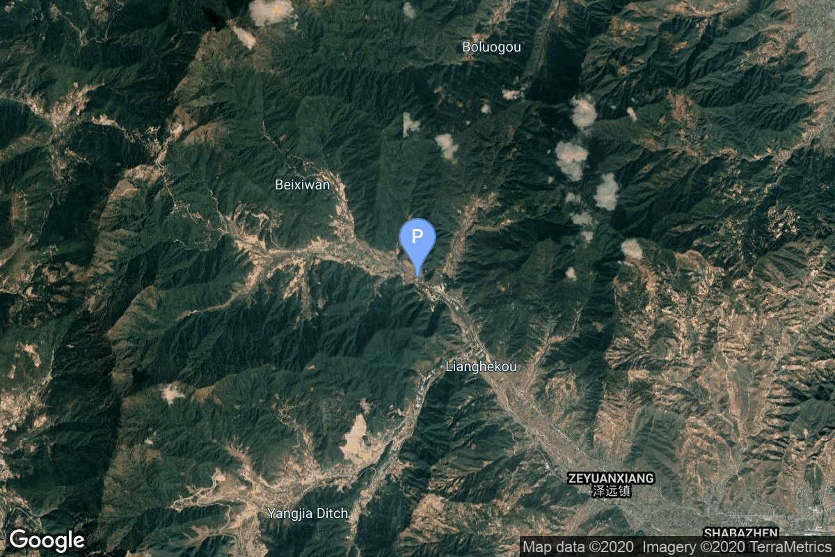
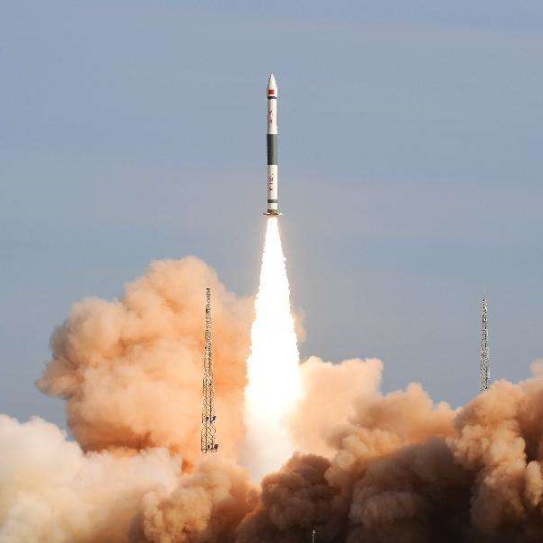
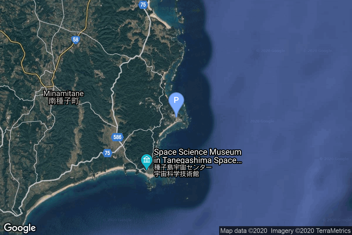
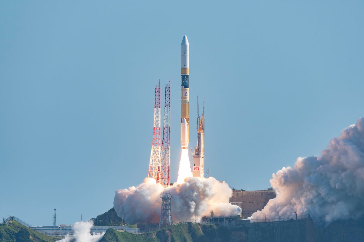
{ "count": 7498, "next": "https://ll.thespacedevs.com/2.0.0/launch/?format=api&limit=10&offset=430&ordering=-id", "previous": "https://ll.thespacedevs.com/2.0.0/launch/?format=api&limit=10&offset=410&ordering=-id", "results": [ { "id": "f0d5c664-a651-417d-974d-7ea45162b7b5", "url": "https://ll.thespacedevs.com/2.0.0/launch/f0d5c664-a651-417d-974d-7ea45162b7b5/?format=api", "launch_library_id": null, "slug": "m-v-nozomi", "name": "M-V | Nozomi", "status": { "id": 3, "name": "Success" }, "net": "1998-07-03T18:12:00Z", "window_end": "1998-07-03T18:12:00Z", "window_start": "1998-07-03T18:12:00Z", "inhold": false, "tbdtime": false, "tbddate": false, "probability": null, "holdreason": "", "failreason": "", "hashtag": null, "launch_service_provider": { "id": 1009, "url": "https://ll.thespacedevs.com/2.0.0/agencies/1009/?format=api", "name": "Institute of Space and Astronautical Science", "type": "Government" }, "rocket": { "id": 6865, "configuration": { "id": 334, "launch_library_id": null, "url": "https://ll.thespacedevs.com/2.0.0/config/launcher/334/?format=api", "name": "M-V", "family": "Mu", "full_name": "M-V", "variant": "V" } }, "mission": { "id": 5255, "launch_library_id": null, "name": "Nozomi", "description": "The primary scientific objective of Nozomi program is to study the Martian upper atmosphere with emphasis on its interaction with the solar wind.", "launch_designator": null, "type": "Robotic Exploration", "orbit": { "id": 6, "name": "Heliocentric N/A", "abbrev": "Helio-N/A" } }, "pad": { "id": 47, "url": "https://ll.thespacedevs.com/2.0.0/pad/47/?format=api", "agency_id": 37, "name": "Mu Center", "info_url": null, "wiki_url": "https://en.wikipedia.org/wiki/Uchinoura_Space_Center", "map_url": "https://www.google.com/maps?q=31.2509794,131.0821319", "latitude": "31.2509794", "longitude": "131.0821319", "location": { "id": 24, "url": "https://ll.thespacedevs.com/2.0.0/location/24/?format=api", "name": "Uchinoura Space Center, Japan", "country_code": "JPN", "map_image": "https://thespacedevs-prod.nyc3.digitaloceanspaces.com/media/map_images/location_24_20200803142411.jpg", "total_launch_count": 43, "total_landing_count": 0 }, "map_image": "https://thespacedevs-prod.nyc3.digitaloceanspaces.com/media/map_images/pad_47_20200803143524.jpg", "total_launch_count": 36 }, "webcast_live": false, "image": null, "infographic": null, "program": [] }, { "id": "f0d2b3d7-d475-4912-bbd6-6869e4e13de1", "url": "https://ll.thespacedevs.com/2.0.0/launch/f0d2b3d7-d475-4912-bbd6-6869e4e13de1/?format=api", "launch_library_id": 2032, "slug": "kuaizhou-1a-yinhe-1", "name": "Kuaizhou-1A | Yinhe-1", "status": { "id": 3, "name": "Success" }, "net": "2020-01-16T03:02:00Z", "window_end": "2020-01-16T03:07:00Z", "window_start": "2020-01-16T02:52:00Z", "inhold": false, "tbdtime": false, "tbddate": false, "probability": -1, "holdreason": "", "failreason": "", "hashtag": null, "launch_service_provider": { "id": 194, "url": "https://ll.thespacedevs.com/2.0.0/agencies/194/?format=api", "name": "ExPace", "type": "Commercial" }, "rocket": { "id": 2618, "configuration": { "id": 135, "launch_library_id": 155, "url": "https://ll.thespacedevs.com/2.0.0/config/launcher/135/?format=api", "name": "Kuaizhou", "family": "Kuaizhou", "full_name": "Kuaizhou-1A", "variant": "1A" } }, "mission": { "id": 1088, "launch_library_id": 1283, "name": "Yinhe-1", "description": "Yinhe 1 is technology demonstration mission for the planned 144 satellite global 5G communications constellation which is to be built by Chinese Galaxy Space company.", "launch_designator": null, "type": "Communications", "orbit": { "id": 13, "name": "Polar Orbit", "abbrev": "PO" } }, "pad": { "id": 21, "url": "https://ll.thespacedevs.com/2.0.0/pad/21/?format=api", "agency_id": null, "name": "Launch Area 95A", "info_url": null, "wiki_url": "https://en.wikipedia.org/wiki/Jiuquan_Satellite_Launch_Center", "map_url": "https://www.google.com/maps?q=40.969117,100.343333", "latitude": "40.969117", "longitude": "100.343333", "location": { "id": 17, "url": "https://ll.thespacedevs.com/2.0.0/location/17/?format=api", "name": "Jiuquan Satellite Launch Center, People's Republic of China", "country_code": "CHN", "map_image": "https://thespacedevs-prod.nyc3.digitaloceanspaces.com/media/map_images/location_17_20200803142429.jpg", "total_launch_count": 249, "total_landing_count": 0 }, "map_image": "https://thespacedevs-prod.nyc3.digitaloceanspaces.com/media/map_images/pad_21_20200803143253.jpg", "total_launch_count": 59 }, "webcast_live": false, "image": "https://thespacedevs-prod.nyc3.digitaloceanspaces.com/media/images/kuaizhou_image_20191027094423.jpeg", "infographic": null, "program": [] }, { "id": "f0cb6efa-7f90-4964-b249-8fdf205c5267", "url": "https://ll.thespacedevs.com/2.0.0/launch/f0cb6efa-7f90-4964-b249-8fdf205c5267/?format=api", "launch_library_id": 749, "slug": "h-iia-202-igs-radar-3", "name": "H-IIA 202 | IGS Radar 3", "status": { "id": 3, "name": "Success" }, "net": "2011-12-12T01:21:00Z", "window_end": "2011-12-12T01:21:00Z", "window_start": "2011-12-12T01:21:00Z", "inhold": false, "tbdtime": false, "tbddate": false, "probability": -1, "holdreason": "", "failreason": "", "hashtag": null, "launch_service_provider": { "id": 98, "url": "https://ll.thespacedevs.com/2.0.0/agencies/98/?format=api", "name": "Mitsubishi Heavy Industries", "type": "Commercial" }, "rocket": { "id": 1578, "configuration": { "id": 32, "launch_library_id": 53, "url": "https://ll.thespacedevs.com/2.0.0/config/launcher/32/?format=api", "name": "H-IIA", "family": "H-II", "full_name": "H-IIA 202", "variant": "202" } }, "mission": { "id": 6534, "launch_library_id": null, "name": "IGS Radar 3", "description": "The IGS Radar 3 is a Japanese radar reconnaissance satellite. The satellite is operated by the Cabinet Satellite Information Center. The satellite serves both Japan's national defense and civil natural disaster monitoring.", "launch_designator": null, "type": "Government/Top Secret", "orbit": { "id": 17, "name": "Sun-Synchronous Orbit", "abbrev": "SSO" } }, "pad": { "id": 41, "url": "https://ll.thespacedevs.com/2.0.0/pad/41/?format=api", "agency_id": 37, "name": "Yoshinobu Launch Complex LP-1", "info_url": null, "wiki_url": "https://en.wikipedia.org/wiki/Yoshinobu_Launch_Complex", "map_url": "https://www.google.com/maps?q=30.400813,130.977748", "latitude": "30.400813", "longitude": "130.977748", "location": { "id": 26, "url": "https://ll.thespacedevs.com/2.0.0/location/26/?format=api", "name": "Tanegashima Space Center, Japan", "country_code": "JPN", "map_image": "https://thespacedevs-prod.nyc3.digitaloceanspaces.com/media/map_images/location_26_20200803142507.jpg", "total_launch_count": 94, "total_landing_count": 0 }, "map_image": "https://thespacedevs-prod.nyc3.digitaloceanspaces.com/media/map_images/pad_41_20200803143551.jpg", "total_launch_count": 56 }, "webcast_live": false, "image": "https://thespacedevs-prod.nyc3.digitaloceanspaces.com/media/images/h-iia_202_lifto_image_20240325123250.jpg", "infographic": null, "program": [] }, { "id": "f0c41afb-9e8b-4a6d-9455-f5be60e2810d", "url": "https://ll.thespacedevs.com/2.0.0/launch/f0c41afb-9e8b-4a6d-9455-f5be60e2810d/?format=api", "launch_library_id": null, "slug": "vostok-8a92m-tselina-d-16", "name": "Vostok 8A92M | Tselina-D 16", "status": { "id": 3, "name": "Success" }, "net": "1978-10-10T19:44:00Z", "window_end": "1978-10-10T19:44:00Z", "window_start": "1978-10-10T19:44:00Z", "inhold": false, "tbdtime": false, "tbddate": false, "probability": null, "holdreason": "", "failreason": null, "hashtag": null, "launch_service_provider": { "id": 66, "url": "https://ll.thespacedevs.com/2.0.0/agencies/66/?format=api", "name": "Soviet Space Program", "type": "Government" }, "rocket": { "id": 5002, "configuration": { "id": 452, "launch_library_id": null, "url": "https://ll.thespacedevs.com/2.0.0/config/launcher/452/?format=api", "name": "Vostok 8A92M", "family": "Vostok", "full_name": "Vostok 8A92M", "variant": "8A92M" } }, "mission": { "id": 3416, "launch_library_id": null, "name": "Tselina-D 16", "description": "Tselina-D satellites provided detailed observation of radio sources detected by the smaller Tselina-O satellites as part of the Tselina ELINT system.", "launch_designator": null, "type": "Government/Top Secret", "orbit": { "id": 8, "name": "Low Earth Orbit", "abbrev": "LEO" } }, "pad": { "id": 85, "url": "https://ll.thespacedevs.com/2.0.0/pad/85/?format=api", "agency_id": 163, "name": "43/4 (43R)", "info_url": null, "wiki_url": null, "map_url": "https://www.google.com/maps?q=62.92883,40.457098", "latitude": "62.92883", "longitude": "40.457098", "location": { "id": 6, "url": "https://ll.thespacedevs.com/2.0.0/location/6/?format=api", "name": "Plesetsk Cosmodrome, Russian Federation", "country_code": "RUS", "map_image": "https://thespacedevs-prod.nyc3.digitaloceanspaces.com/media/map_images/location_6_20200803142434.jpg", "total_launch_count": 1674, "total_landing_count": 0 }, "map_image": "https://thespacedevs-prod.nyc3.digitaloceanspaces.com/media/map_images/pad_85_20200803143554.jpg", "total_launch_count": 323 }, "webcast_live": false, "image": null, "infographic": null, "program": [] }, { "id": "f0b08b12-0b6a-4e8f-9763-aff8231e453a", "url": "https://ll.thespacedevs.com/2.0.0/launch/f0b08b12-0b6a-4e8f-9763-aff8231e453a/?format=api", "launch_library_id": null, "slug": "scout-d-1-aeros-2", "name": "Scout D-1 | Aeros 2", "status": { "id": 3, "name": "Success" }, "net": "1974-07-16T11:51:01Z", "window_end": "1974-07-16T11:51:01Z", "window_start": "1974-07-16T11:51:01Z", "inhold": false, "tbdtime": false, "tbddate": false, "probability": null, "holdreason": "", "failreason": null, "hashtag": null, "launch_service_provider": { "id": 44, "url": "https://ll.thespacedevs.com/2.0.0/agencies/44/?format=api", "name": "National Aeronautics and Space Administration", "type": "Government" }, "rocket": { "id": 4492, "configuration": { "id": 360, "launch_library_id": null, "url": "https://ll.thespacedevs.com/2.0.0/config/launcher/360/?format=api", "name": "Scout D-1", "family": "Scout", "full_name": "Scout D-1", "variant": "D-1" } }, "mission": { "id": 2910, "launch_library_id": null, "name": "Aeros 2", "description": "Joint NASA-German ministry for science and education satellite to study the upper atmosphere.", "launch_designator": null, "type": "Earth Science", "orbit": { "id": 8, "name": "Low Earth Orbit", "abbrev": "LEO" } }, "pad": { "id": 154, "url": "https://ll.thespacedevs.com/2.0.0/pad/154/?format=api", "agency_id": null, "name": "Space Launch Complex 5", "info_url": "http://www.astronautix.com/v/vandenbergslc5.html", "wiki_url": "https://en.wikipedia.org/wiki/Vandenberg_Air_Force_Base_Space_Launch_Complex_5", "map_url": "https://www.google.com/maps?q=34.6080,-120.6247", "latitude": "34.608", "longitude": "-120.6247", "location": { "id": 11, "url": "https://ll.thespacedevs.com/2.0.0/location/11/?format=api", "name": "Vandenberg SFB, CA, USA", "country_code": "USA", "map_image": "https://thespacedevs-prod.nyc3.digitaloceanspaces.com/media/map_images/location_11_20200803142416.jpg", "total_launch_count": 806, "total_landing_count": 26 }, "map_image": "https://thespacedevs-prod.nyc3.digitaloceanspaces.com/media/map_images/pad_154_20200803143408.jpg", "total_launch_count": 69 }, "webcast_live": false, "image": null, "infographic": null, "program": [] }, { "id": "f0af308a-f4bf-46ae-94cd-93da7d3fc589", "url": "https://ll.thespacedevs.com/2.0.0/launch/f0af308a-f4bf-46ae-94cd-93da7d3fc589/?format=api", "launch_library_id": null, "slug": "tsiklon-2-us-p-3", "name": "Tsiklon-2 | US-P 3", "status": { "id": 3, "name": "Success" }, "net": "1976-07-02T10:30:00Z", "window_end": "1976-07-02T10:30:00Z", "window_start": "1976-07-02T10:30:00Z", "inhold": false, "tbdtime": false, "tbddate": false, "probability": null, "holdreason": "", "failreason": null, "hashtag": null, "launch_service_provider": { "id": 66, "url": "https://ll.thespacedevs.com/2.0.0/agencies/66/?format=api", "name": "Soviet Space Program", "type": "Government" }, "rocket": { "id": 4727, "configuration": { "id": 443, "launch_library_id": null, "url": "https://ll.thespacedevs.com/2.0.0/config/launcher/443/?format=api", "name": "Tsiklon-2", "family": "Tsiklon", "full_name": "Tsiklon-2", "variant": "2" } }, "mission": { "id": 3145, "launch_library_id": null, "name": "US-P 3", "description": "Ocean surveillance satellite using passive ELINT devices", "launch_designator": null, "type": "Government/Top Secret", "orbit": { "id": 8, "name": "Low Earth Orbit", "abbrev": "LEO" } }, "pad": { "id": 132, "url": "https://ll.thespacedevs.com/2.0.0/pad/132/?format=api", "agency_id": null, "name": "90", "info_url": null, "wiki_url": "https://en.wikipedia.org/wiki/Baikonur_Cosmodrome_Site_90", "map_url": "https://www.google.com/maps?q=46.081,62.929806", "latitude": "46.081", "longitude": "62.929806", "location": { "id": 15, "url": "https://ll.thespacedevs.com/2.0.0/location/15/?format=api", "name": "Baikonur Cosmodrome, Republic of Kazakhstan", "country_code": "KAZ", "map_image": "https://thespacedevs-prod.nyc3.digitaloceanspaces.com/media/map_images/location_15_20200803142517.jpg", "total_launch_count": 1555, "total_landing_count": 0 }, "map_image": "https://thespacedevs-prod.nyc3.digitaloceanspaces.com/media/map_images/pad_132_20200803143344.jpg", "total_launch_count": 74 }, "webcast_live": false, "image": "https://thespacedevs-prod.nyc3.digitaloceanspaces.com/media/images/tsyklon-2_lifto_image_20240411113159.jpg", "infographic": null, "program": [] }, { "id": "f09ec581-32b0-4d7f-82fa-8187f26c7f28", "url": "https://ll.thespacedevs.com/2.0.0/launch/f09ec581-32b0-4d7f-82fa-8187f26c7f28/?format=api", "launch_library_id": null, "slug": "tsiklon-3-sich-1m", "name": "Tsiklon-3 | Sich-1M", "status": { "id": 4, "name": "Failure" }, "net": "2004-12-24T11:20:00Z", "window_end": "2004-12-24T11:20:00Z", "window_start": "2004-12-24T11:20:00Z", "inhold": false, "tbdtime": false, "tbddate": false, "probability": null, "holdreason": "", "failreason": "", "hashtag": null, "launch_service_provider": { "id": 193, "url": "https://ll.thespacedevs.com/2.0.0/agencies/193/?format=api", "name": "Russian Space Forces", "type": "Government" }, "rocket": { "id": 7210, "configuration": { "id": 445, "launch_library_id": null, "url": "https://ll.thespacedevs.com/2.0.0/config/launcher/445/?format=api", "name": "Tsiklon-3", "family": "Tsiklon", "full_name": "Tsiklon-3", "variant": "3" } }, "mission": { "id": 5599, "launch_library_id": null, "name": "Sich-1M", "description": "Ukranian-built remote sensing satellite. Third stage apogee kick burn was too short, raising the perigee of the orbit from 78 km to 280 km, rather than the 650 km planned..", "launch_designator": null, "type": "Earth Science", "orbit": { "id": 8, "name": "Low Earth Orbit", "abbrev": "LEO" } }, "pad": { "id": 127, "url": "https://ll.thespacedevs.com/2.0.0/pad/127/?format=api", "agency_id": 63, "name": "32/2", "info_url": null, "wiki_url": "https://en.wikipedia.org/wiki/Plesetsk_Cosmodrome_Site_32", "map_url": "https://www.google.com/maps?q=62.9063889,40.7844727", "latitude": "62.9063889", "longitude": "40.7844727", "location": { "id": 6, "url": "https://ll.thespacedevs.com/2.0.0/location/6/?format=api", "name": "Plesetsk Cosmodrome, Russian Federation", "country_code": "RUS", "map_image": "https://thespacedevs-prod.nyc3.digitaloceanspaces.com/media/map_images/location_6_20200803142434.jpg", "total_launch_count": 1674, "total_landing_count": 0 }, "map_image": "https://thespacedevs-prod.nyc3.digitaloceanspaces.com/media/map_images/pad_127_20200803143245.jpg", "total_launch_count": 65 }, "webcast_live": false, "image": null, "infographic": null, "program": [] }, { "id": "f097fbf2-a1c3-4a1f-ab5a-e3af0e90f102", "url": "https://ll.thespacedevs.com/2.0.0/launch/f097fbf2-a1c3-4a1f-ab5a-e3af0e90f102/?format=api", "launch_library_id": null, "slug": "atlas-fois-solwind", "name": "Atlas F/OIS | Solwind", "status": { "id": 3, "name": "Success" }, "net": "1979-02-24T08:20:00Z", "window_end": "1979-02-24T08:20:00Z", "window_start": "1979-02-24T08:20:00Z", "inhold": false, "tbdtime": false, "tbddate": false, "probability": null, "holdreason": "", "failreason": null, "hashtag": null, "launch_service_provider": { "id": 161, "url": "https://ll.thespacedevs.com/2.0.0/agencies/161/?format=api", "name": "United States Air Force", "type": "Government" }, "rocket": { "id": 5050, "configuration": { "id": 247, "launch_library_id": null, "url": "https://ll.thespacedevs.com/2.0.0/config/launcher/247/?format=api", "name": "Atlas F/OIS", "family": "Atlas", "full_name": "Atlas F/OIS", "variant": "F/OIS" } }, "mission": { "id": 3462, "launch_library_id": null, "name": "Solwind", "description": "Experimental scientific satellite dedicated to solar wind", "launch_designator": null, "type": "Heliophysics", "orbit": { "id": 8, "name": "Low Earth Orbit", "abbrev": "LEO" } }, "pad": { "id": 93, "url": "https://ll.thespacedevs.com/2.0.0/pad/93/?format=api", "agency_id": 161, "name": "Space Launch Complex 3W", "info_url": null, "wiki_url": "https://en.wikipedia.org/wiki/Vandenberg_Space_Launch_Complex_3#SLC-3W", "map_url": "https://www.google.com/maps?q=34.644,-120.593", "latitude": "34.644", "longitude": "-120.593", "location": { "id": 11, "url": "https://ll.thespacedevs.com/2.0.0/location/11/?format=api", "name": "Vandenberg SFB, CA, USA", "country_code": "USA", "map_image": "https://thespacedevs-prod.nyc3.digitaloceanspaces.com/media/map_images/location_11_20200803142416.jpg", "total_launch_count": 806, "total_landing_count": 26 }, "map_image": "https://thespacedevs-prod.nyc3.digitaloceanspaces.com/media/map_images/pad_93_20200803143225.jpg", "total_launch_count": 81 }, "webcast_live": false, "image": null, "infographic": null, "program": [] }, { "id": "f0821ec7-31bf-4383-b1af-576aadfb7e92", "url": "https://ll.thespacedevs.com/2.0.0/launch/f0821ec7-31bf-4383-b1af-576aadfb7e92/?format=api", "launch_library_id": null, "slug": "proton-raduga-33", "name": "Proton | Raduga 33", "status": { "id": 3, "name": "Success" }, "net": "1996-02-19T08:19:00Z", "window_end": "1996-02-19T08:19:00Z", "window_start": "1996-02-19T08:19:00Z", "inhold": false, "tbdtime": false, "tbddate": false, "probability": null, "holdreason": "", "failreason": null, "hashtag": null, "launch_service_provider": { "id": 96, "url": "https://ll.thespacedevs.com/2.0.0/agencies/96/?format=api", "name": "Khrunichev State Research and Production Space Center", "type": "Government" }, "rocket": { "id": 6714, "configuration": { "id": 80, "launch_library_id": 99, "url": "https://ll.thespacedevs.com/2.0.0/config/launcher/80/?format=api", "name": "Proton", "family": "Proton / UR-500", "full_name": "Proton K/DM-2", "variant": "K/DM-2" } }, "mission": { "id": 5104, "launch_library_id": null, "name": "Raduga 33", "description": "Geostationary communications satellite for military and governmental puposes", "launch_designator": null, "type": "Communications", "orbit": { "id": 1, "name": "Geostationary Orbit", "abbrev": "Direct-GEO" } }, "pad": { "id": 15, "url": "https://ll.thespacedevs.com/2.0.0/pad/15/?format=api", "agency_id": null, "name": "200/39 (200L)", "info_url": null, "wiki_url": "", "map_url": "https://www.google.com/maps?q=46.039984,63.032093", "latitude": "46.039984", "longitude": "63.032093", "location": { "id": 15, "url": "https://ll.thespacedevs.com/2.0.0/location/15/?format=api", "name": "Baikonur Cosmodrome, Republic of Kazakhstan", "country_code": "KAZ", "map_image": "https://thespacedevs-prod.nyc3.digitaloceanspaces.com/media/map_images/location_15_20200803142517.jpg", "total_launch_count": 1555, "total_landing_count": 0 }, "map_image": "https://thespacedevs-prod.nyc3.digitaloceanspaces.com/media/map_images/pad_15_20200803143530.jpg", "total_launch_count": 167 }, "webcast_live": false, "image": "https://thespacedevs-prod.nyc3.digitaloceanspaces.com/media/images/proton_image_20231231095535.jpg", "infographic": null, "program": [] }, { "id": "f08172e1-e53e-4c5c-9f97-df620f934ed9", "url": "https://ll.thespacedevs.com/2.0.0/launch/f08172e1-e53e-4c5c-9f97-df620f934ed9/?format=api", "launch_library_id": null, "slug": "long-march-2d-piesat-1-x-4", "name": "Long March 2D | PIESAT-1 x 4", "status": { "id": 3, "name": "Success" }, "net": "2023-03-30T10:50:00Z", "window_end": "2023-03-30T11:26:00Z", "window_start": "2023-03-30T10:43:00Z", "inhold": false, "tbdtime": false, "tbddate": false, "probability": null, "holdreason": "", "failreason": "", "hashtag": null, "launch_service_provider": { "id": 88, "url": "https://ll.thespacedevs.com/2.0.0/agencies/88/?format=api", "name": "China Aerospace Science and Technology Corporation", "type": "Government" }, "rocket": { "id": 7835, "configuration": { "id": 17, "launch_library_id": 73, "url": "https://ll.thespacedevs.com/2.0.0/config/launcher/17/?format=api", "name": "Long March 2D", "family": "Long March", "full_name": "Long March 2D", "variant": "2D" } }, "mission": { "id": 6340, "launch_library_id": null, "name": "PIESAT-1 x 4", "description": "4 X-band synthetic-aperture radar Earth observation satellites for PIESAT (1 main, 3 sub-satellites), operating in tandem using very long baseline interferometry, with resolution at 0.5 - 5 m.", "launch_designator": null, "type": "Earth Science", "orbit": { "id": 17, "name": "Sun-Synchronous Orbit", "abbrev": "SSO" } }, "pad": { "id": 25, "url": "https://ll.thespacedevs.com/2.0.0/pad/25/?format=api", "agency_id": null, "name": "Launch Complex 9", "info_url": null, "wiki_url": null, "map_url": "https://www.google.com/maps?q=38.863128,111.589567", "latitude": "38.863128", "longitude": "111.589567", "location": { "id": 19, "url": "https://ll.thespacedevs.com/2.0.0/location/19/?format=api", "name": "Taiyuan Satellite Launch Center, People's Republic of China", "country_code": "CHN", "map_image": "https://thespacedevs-prod.nyc3.digitaloceanspaces.com/media/map_images/location_19_20200803142421.jpg", "total_launch_count": 141, "total_landing_count": 0 }, "map_image": "https://thespacedevs-prod.nyc3.digitaloceanspaces.com/media/map_images/pad_25_20200803143501.jpg", "total_launch_count": 76 }, "webcast_live": false, "image": "https://thespacedevs-prod.nyc3.digitaloceanspaces.com/media/images/long2520march_image_20230907065813.jpeg", "infographic": null, "program": [] } ] }