Launch List
API endpoint that returns all Launch objects or a single launch.
EXAMPLE - /launch/
GET: Return a list of all Launch objects.
FILTERS: Fields - 'name', 'id(s)', 'lsp_id', 'lsp_name', 'serial_number', 'launcher_config__id', 'rocket__spacecraftflight__spacecraft__name'
MODE: 'normal', 'list', 'detailed' EXAMPLE: ?mode=list
SEARCH: Searches through the launch name, rocket name, launch agency, mission name & spacecraft name. EXAMPLE - ?search=SpaceX
GET /2.0.0/launch/?format=api&offset=300&ordering=-id
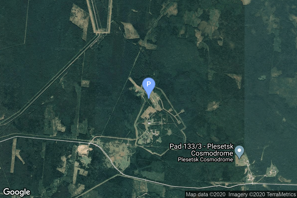
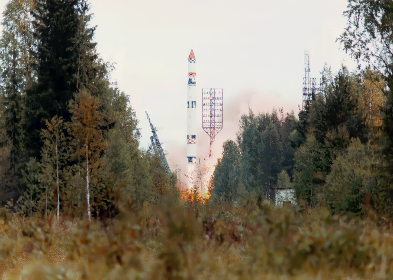
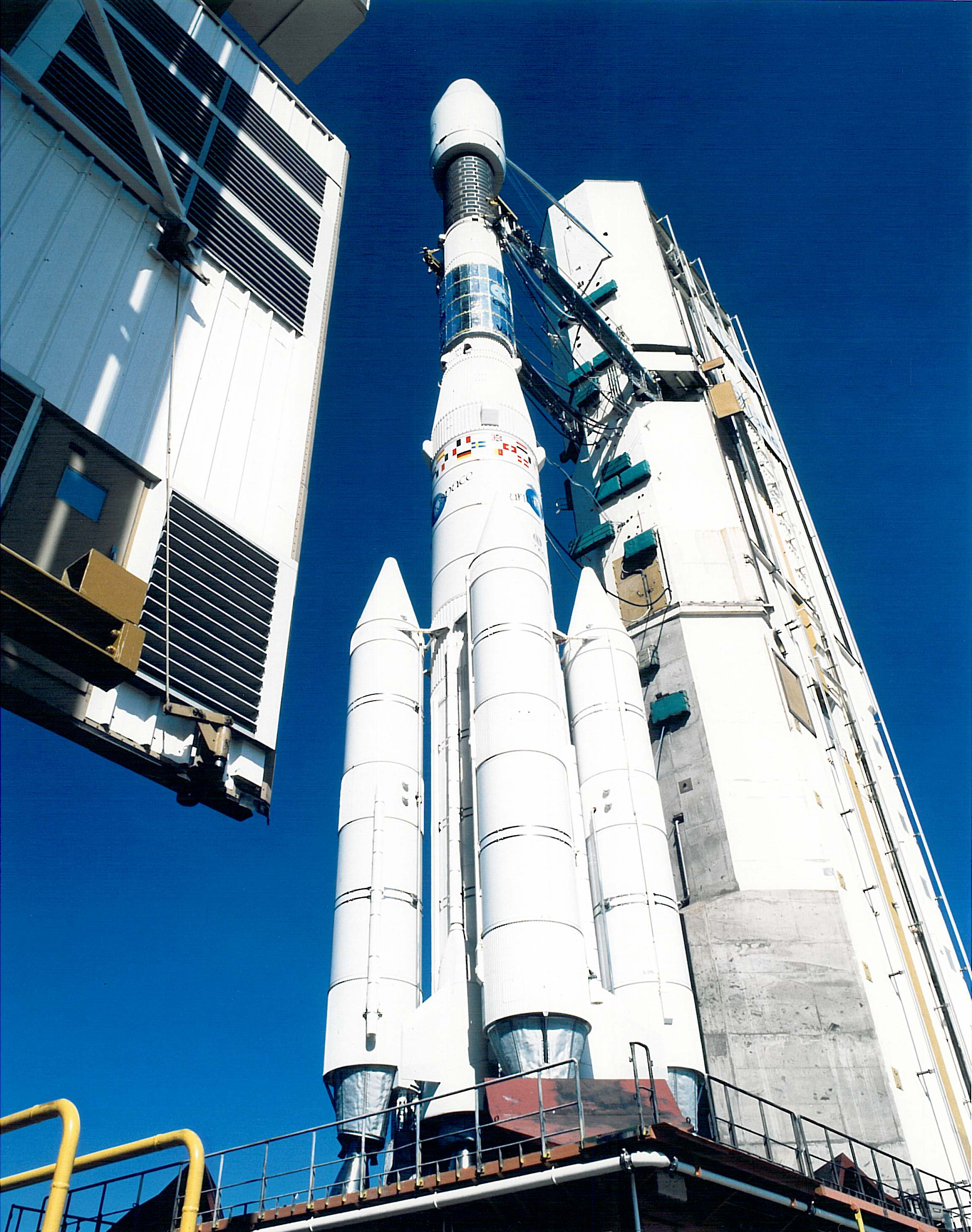
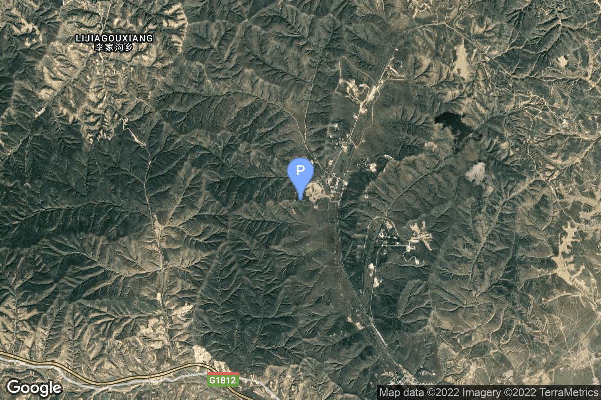
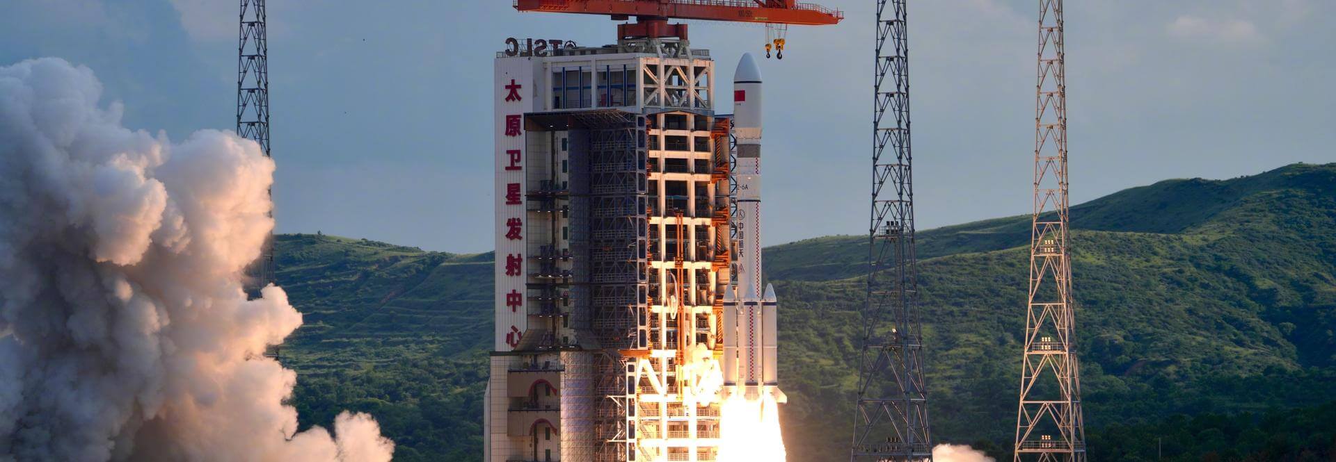
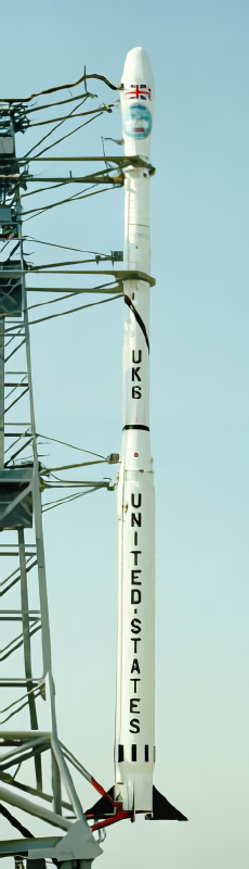
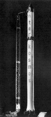
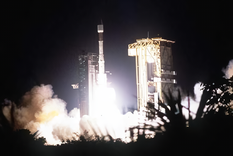
{ "count": 7820, "next": "https://ll.thespacedevs.com/2.0.0/launch/?format=api&limit=10&offset=310&ordering=-id", "previous": "https://ll.thespacedevs.com/2.0.0/launch/?format=api&limit=10&offset=290&ordering=-id", "results": [ { "id": "f57b8d20-660c-4dfb-b8ca-49287283bb70", "url": "https://ll.thespacedevs.com/2.0.0/launch/f57b8d20-660c-4dfb-b8ca-49287283bb70/?format=api", "launch_library_id": null, "slug": "soyuz-u-zenit-8-39", "name": "Soyuz U | Zenit-8 39", "status": { "id": 3, "name": "Success" }, "net": "1986-10-22T09:00:00Z", "window_end": "1986-10-22T09:00:00Z", "window_start": "1986-10-22T09:00:00Z", "inhold": false, "tbdtime": false, "tbddate": false, "probability": null, "holdreason": "", "failreason": null, "hashtag": null, "launch_service_provider": { "id": 66, "url": "https://ll.thespacedevs.com/2.0.0/agencies/66/?format=api", "name": "Soviet Space Program", "type": "Government" }, "rocket": { "id": 5902, "configuration": { "id": 37, "launch_library_id": 35, "url": "https://ll.thespacedevs.com/2.0.0/config/launcher/37/?format=api", "name": "Soyuz U", "family": "Soyuz", "full_name": "Soyuz U", "variant": "" } }, "mission": { "id": 4298, "launch_library_id": null, "name": "Zenit-8 39", "description": "Film-return reconnaissance satellite", "launch_designator": null, "type": "Government/Top Secret", "orbit": { "id": 8, "name": "Low Earth Orbit", "abbrev": "LEO" } }, "pad": { "id": 32, "url": "https://ll.thespacedevs.com/2.0.0/pad/32/?format=api", "agency_id": null, "name": "1/5", "info_url": null, "wiki_url": "", "map_url": "https://www.google.com/maps?q=45.92,63.342", "latitude": "45.92", "longitude": "63.342", "location": { "id": 15, "url": "https://ll.thespacedevs.com/2.0.0/location/15/?format=api", "name": "Baikonur Cosmodrome, Republic of Kazakhstan", "country_code": "KAZ", "map_image": "https://thespacedevs-prod.nyc3.digitaloceanspaces.com/media/map_images/location_15_20200803142517.jpg", "total_launch_count": 1560, "total_landing_count": 0 }, "map_image": "https://thespacedevs-prod.nyc3.digitaloceanspaces.com/media/map_images/pad_32_20200803143513.jpg", "total_launch_count": 487 }, "webcast_live": false, "image": "https://thespacedevs-prod.nyc3.digitaloceanspaces.com/media/images/soyuz2520u_image_20190222031023.jpeg", "infographic": null, "program": [] }, { "id": "f5797517-5e9b-46fc-b5ee-41c7a12e6036", "url": "https://ll.thespacedevs.com/2.0.0/launch/f5797517-5e9b-46fc-b5ee-41c7a12e6036/?format=api", "launch_library_id": null, "slug": "tsiklon-3-strela-3-61-to-66", "name": "Tsiklon-3 | Strela-3 61 to 66", "status": { "id": 3, "name": "Success" }, "net": "1991-05-16T21:40:54Z", "window_end": "1991-05-16T21:40:54Z", "window_start": "1991-05-16T21:40:54Z", "inhold": false, "tbdtime": false, "tbddate": false, "probability": null, "holdreason": "", "failreason": null, "hashtag": null, "launch_service_provider": { "id": 66, "url": "https://ll.thespacedevs.com/2.0.0/agencies/66/?format=api", "name": "Soviet Space Program", "type": "Government" }, "rocket": { "id": 6368, "configuration": { "id": 445, "launch_library_id": null, "url": "https://ll.thespacedevs.com/2.0.0/config/launcher/445/?format=api", "name": "Tsiklon-3", "family": "Tsiklon", "full_name": "Tsiklon-3", "variant": "3" } }, "mission": { "id": 4758, "launch_library_id": null, "name": "Strela-3 61 to 66", "description": "Second generation store-dump military communications satellite", "launch_designator": null, "type": "Government/Top Secret", "orbit": { "id": 8, "name": "Low Earth Orbit", "abbrev": "LEO" } }, "pad": { "id": 127, "url": "https://ll.thespacedevs.com/2.0.0/pad/127/?format=api", "agency_id": 63, "name": "32/2", "info_url": null, "wiki_url": "https://en.wikipedia.org/wiki/Plesetsk_Cosmodrome_Site_32", "map_url": "https://www.google.com/maps?q=62.9063889,40.7844727", "latitude": "62.9063889", "longitude": "40.7844727", "location": { "id": 6, "url": "https://ll.thespacedevs.com/2.0.0/location/6/?format=api", "name": "Plesetsk Cosmodrome, Russian Federation", "country_code": "RUS", "map_image": "https://thespacedevs-prod.nyc3.digitaloceanspaces.com/media/map_images/location_6_20200803142434.jpg", "total_launch_count": 1681, "total_landing_count": 0 }, "map_image": "https://thespacedevs-prod.nyc3.digitaloceanspaces.com/media/map_images/pad_127_20200803143245.jpg", "total_launch_count": 65 }, "webcast_live": false, "image": "https://thespacedevs-prod.nyc3.digitaloceanspaces.com/media/images/tsyklon-3_launc_image_20251112153513.png", "infographic": null, "program": [] }, { "id": "f5790c5e-ee52-4e75-b6ab-a2b89149f067", "url": "https://ll.thespacedevs.com/2.0.0/launch/f5790c5e-ee52-4e75-b6ab-a2b89149f067/?format=api", "launch_library_id": null, "slug": "ariane-44l-telecom-2a", "name": "Ariane 44L | Telecom 2A", "status": { "id": 3, "name": "Success" }, "net": "1991-12-16T23:19:48Z", "window_end": "1991-12-16T23:19:48Z", "window_start": "1991-12-16T23:19:48Z", "inhold": false, "tbdtime": false, "tbddate": false, "probability": null, "holdreason": "", "failreason": null, "hashtag": null, "launch_service_provider": { "id": 115, "url": "https://ll.thespacedevs.com/2.0.0/agencies/115/?format=api", "name": "Arianespace", "type": "Commercial" }, "rocket": { "id": 6411, "configuration": { "id": 225, "launch_library_id": null, "url": "https://ll.thespacedevs.com/2.0.0/config/launcher/225/?format=api", "name": "Ariane 44L", "family": "Ariane", "full_name": "Ariane 44L", "variant": "44L" } }, "mission": { "id": 4801, "launch_library_id": null, "name": "Telecom 2A", "description": "French communications satellite", "launch_designator": null, "type": "Communications", "orbit": { "id": 1, "name": "Geostationary Orbit", "abbrev": "Direct-GEO" } }, "pad": { "id": 124, "url": "https://ll.thespacedevs.com/2.0.0/pad/124/?format=api", "agency_id": 115, "name": "Ariane Launch Area 2", "info_url": null, "wiki_url": "https://en.wikipedia.org/wiki/ELA-2", "map_url": "https://www.google.com/maps?q=5.232,-52.778194", "latitude": "5.232", "longitude": "-52.778194", "location": { "id": 13, "url": "https://ll.thespacedevs.com/2.0.0/location/13/?format=api", "name": "Guiana Space Centre, French Guiana", "country_code": "GUF", "map_image": "https://thespacedevs-prod.nyc3.digitaloceanspaces.com/media/map_images/location_13_20200803142412.jpg", "total_launch_count": 331, "total_landing_count": 0 }, "map_image": "https://thespacedevs-prod.nyc3.digitaloceanspaces.com/media/map_images/pad_124_20200803143241.jpg", "total_launch_count": 119 }, "webcast_live": false, "image": "https://thespacedevs-prod.nyc3.digitaloceanspaces.com/media/images/ariane_44l_at_e_image_20240401082337.jpg", "infographic": null, "program": [] }, { "id": "f57800ca-4125-419b-9913-27c961c24cc8", "url": "https://ll.thespacedevs.com/2.0.0/launch/f57800ca-4125-419b-9913-27c961c24cc8/?format=api", "launch_library_id": null, "slug": "long-march-6a-yaogan-40-group-03", "name": "Long March 6A | Yaogan 40 Group 03", "status": { "id": 3, "name": "Success" }, "net": "2025-09-06T16:34:00Z", "window_end": "2025-09-06T16:52:00Z", "window_start": "2025-09-06T16:26:00Z", "inhold": false, "tbdtime": false, "tbddate": false, "probability": null, "holdreason": "", "failreason": "", "hashtag": null, "launch_service_provider": { "id": 88, "url": "https://ll.thespacedevs.com/2.0.0/agencies/88/?format=api", "name": "China Aerospace Science and Technology Corporation", "type": "Government" }, "rocket": { "id": 8700, "configuration": { "id": 478, "launch_library_id": null, "url": "https://ll.thespacedevs.com/2.0.0/config/launcher/478/?format=api", "name": "Long March 6A", "family": "Long March", "full_name": "Long March 6A", "variant": "A" } }, "mission": { "id": 7292, "launch_library_id": null, "name": "Yaogan 40 Group 03", "description": "3 Chinese reconnaissance satellites of unknown purposes, officially reported as for \"Electromagnetic environment probing\".", "launch_designator": null, "type": "Government/Top Secret", "orbit": { "id": 13, "name": "Polar Orbit", "abbrev": "PO" } }, "pad": { "id": 200, "url": "https://ll.thespacedevs.com/2.0.0/pad/200/?format=api", "agency_id": null, "name": "Launch Complex 9A", "info_url": null, "wiki_url": null, "map_url": "https://www.google.com/maps?q=38.8583,111.5802", "latitude": "38.8583", "longitude": "111.5802", "location": { "id": 19, "url": "https://ll.thespacedevs.com/2.0.0/location/19/?format=api", "name": "Taiyuan Satellite Launch Center, People's Republic of China", "country_code": "CHN", "map_image": "https://thespacedevs-prod.nyc3.digitaloceanspaces.com/media/map_images/location_19_20200803142421.jpg", "total_launch_count": 151, "total_landing_count": 0 }, "map_image": "https://thespacedevs-prod.nyc3.digitaloceanspaces.com/media/map_images/pad_launch_complex_9a_20220330003717.jpg", "total_launch_count": 22 }, "webcast_live": false, "image": "https://thespacedevs-prod.nyc3.digitaloceanspaces.com/media/images/long_march_6a__image_20251209050223.jpeg", "infographic": null, "program": [] }, { "id": "f56cbee8-ad8a-4cb9-98dd-8be0bad6b5d2", "url": "https://ll.thespacedevs.com/2.0.0/launch/f56cbee8-ad8a-4cb9-98dd-8be0bad6b5d2/?format=api", "launch_library_id": 907, "slug": "soyuz-u-soyuz-tm-30", "name": "Soyuz-U | Soyuz TM-30", "status": { "id": 3, "name": "Success" }, "net": "2000-04-04T05:01:29Z", "window_end": "2000-04-04T05:01:29Z", "window_start": "2000-04-04T05:01:29Z", "inhold": false, "tbdtime": false, "tbddate": false, "probability": null, "holdreason": "", "failreason": null, "hashtag": null, "launch_service_provider": { "id": 63, "url": "https://ll.thespacedevs.com/2.0.0/agencies/63/?format=api", "name": "Russian Federal Space Agency (ROSCOSMOS)", "type": "Government" }, "rocket": { "id": 452, "configuration": { "id": 37, "launch_library_id": 35, "url": "https://ll.thespacedevs.com/2.0.0/config/launcher/37/?format=api", "name": "Soyuz U", "family": "Soyuz", "full_name": "Soyuz U", "variant": "" } }, "mission": { "id": 923, "launch_library_id": 482, "name": "Soyuz TM-30", "description": "Soyuz TM-30 was the 39th mission and the 28th long-duration expedition to Mir space station. It was the final human spaceflight to Mir.\nThe mission began on April 4, 2000, 05:01:29 UTC, launching Commander Sergei Zalyotin and Flight Engineer Aleksandr Kaleri into orbit. They docked with Mir two days later. During their stay there, cosmonauts performed an EVA and various maintenance and repair tasks. Station crew was visited by several Progress resupply spacecrafts. The mission was privately funded by MirCorp company, which planned to refurbish and privatize the aging Mir space station, however insufficient funding and investment made these plans impossible to come true. \nThe mission concluded with a safe landing back on Earth on June 16, 2000, 00:44 UTC.", "launch_designator": null, "type": "Human Exploration", "orbit": { "id": 8, "name": "Low Earth Orbit", "abbrev": "LEO" } }, "pad": { "id": 32, "url": "https://ll.thespacedevs.com/2.0.0/pad/32/?format=api", "agency_id": null, "name": "1/5", "info_url": null, "wiki_url": "", "map_url": "https://www.google.com/maps?q=45.92,63.342", "latitude": "45.92", "longitude": "63.342", "location": { "id": 15, "url": "https://ll.thespacedevs.com/2.0.0/location/15/?format=api", "name": "Baikonur Cosmodrome, Republic of Kazakhstan", "country_code": "KAZ", "map_image": "https://thespacedevs-prod.nyc3.digitaloceanspaces.com/media/map_images/location_15_20200803142517.jpg", "total_launch_count": 1560, "total_landing_count": 0 }, "map_image": "https://thespacedevs-prod.nyc3.digitaloceanspaces.com/media/map_images/pad_32_20200803143513.jpg", "total_launch_count": 487 }, "webcast_live": false, "image": "https://thespacedevs-prod.nyc3.digitaloceanspaces.com/media/images/soyuz2520u_image_20190222031023.jpeg", "infographic": null, "program": [ { "id": 8, "url": "https://ll.thespacedevs.com/2.0.0/program/8/?format=api", "name": "Soyuz", "description": "The Soyuz programme is a human spaceflight programme initiated by the Soviet Union in the early 1960s. The Soyuz spacecraft was originally part of a Moon landing project intended to put a Soviet cosmonaut on the Moon. It was the third Soviet human spaceflight programme after the Vostok and Voskhod programmes.", "agencies": [ { "id": 63, "url": "https://ll.thespacedevs.com/2.0.0/agencies/63/?format=api", "name": "Russian Federal Space Agency (ROSCOSMOS)", "type": "Government" }, { "id": 66, "url": "https://ll.thespacedevs.com/2.0.0/agencies/66/?format=api", "name": "Soviet Space Program", "type": "Government" } ], "image_url": "https://thespacedevs-prod.nyc3.digitaloceanspaces.com/media/images/soyuz_program_20201129185543.png", "start_date": "1966-11-28T11:02:00Z", "end_date": null, "info_url": null, "wiki_url": "https://en.wikipedia.org/wiki/Soyuz_programme" }, { "id": 16, "url": "https://ll.thespacedevs.com/2.0.0/program/16/?format=api", "name": "Mir", "description": "Mir was a space station that operated in low Earth orbit from 1986 to 2001, operated by the Soviet Union and later by Russia. Mir was the first modular space station and was assembled in orbit from 1986 to 1996.", "agencies": [ { "id": 63, "url": "https://ll.thespacedevs.com/2.0.0/agencies/63/?format=api", "name": "Russian Federal Space Agency (ROSCOSMOS)", "type": "Government" }, { "id": 66, "url": "https://ll.thespacedevs.com/2.0.0/agencies/66/?format=api", "name": "Soviet Space Program", "type": "Government" } ], "image_url": "https://thespacedevs-prod.nyc3.digitaloceanspaces.com/media/images/mir_program_20200821092345.jpeg", "start_date": "1986-02-20T21:28:23Z", "end_date": "2001-03-23T05:59:00Z", "info_url": null, "wiki_url": "https://en.wikipedia.org/wiki/Mir" } ] }, { "id": "f5681f5a-fdc2-42e5-b301-79c40c8f3a67", "url": "https://ll.thespacedevs.com/2.0.0/launch/f5681f5a-fdc2-42e5-b301-79c40c8f3a67/?format=api", "launch_library_id": null, "slug": "scout-d-1-tip-2", "name": "Scout D-1 | TIP 2", "status": { "id": 3, "name": "Success" }, "net": "1975-10-12T06:39:36Z", "window_end": "1975-10-12T06:39:36Z", "window_start": "1975-10-12T06:39:36Z", "inhold": false, "tbdtime": false, "tbddate": false, "probability": null, "holdreason": "", "failreason": null, "hashtag": null, "launch_service_provider": { "id": 161, "url": "https://ll.thespacedevs.com/2.0.0/agencies/161/?format=api", "name": "United States Air Force", "type": "Government" }, "rocket": { "id": 4635, "configuration": { "id": 360, "launch_library_id": null, "url": "https://ll.thespacedevs.com/2.0.0/config/launcher/360/?format=api", "name": "Scout D-1", "family": "Scout", "full_name": "Scout D-1", "variant": "D-1" } }, "mission": { "id": 3053, "launch_library_id": null, "name": "TIP 2", "description": "Navigation satellite used as part of the Transit navigation system", "launch_designator": null, "type": "Navigation", "orbit": { "id": 13, "name": "Polar Orbit", "abbrev": "PO" } }, "pad": { "id": 154, "url": "https://ll.thespacedevs.com/2.0.0/pad/154/?format=api", "agency_id": null, "name": "Space Launch Complex 5", "info_url": "https://www.astronautix.com/v/vandenbergslc5.html", "wiki_url": "https://en.wikipedia.org/wiki/Vandenberg_Air_Force_Base_Space_Launch_Complex_5", "map_url": "https://www.google.com/maps?q=34.6080,-120.6247", "latitude": "34.608", "longitude": "-120.6247", "location": { "id": 11, "url": "https://ll.thespacedevs.com/2.0.0/location/11/?format=api", "name": "Vandenberg SFB, CA, USA", "country_code": "USA", "map_image": "https://thespacedevs-prod.nyc3.digitaloceanspaces.com/media/map_images/location_11_20200803142416.jpg", "total_launch_count": 870, "total_landing_count": 33 }, "map_image": "https://thespacedevs-prod.nyc3.digitaloceanspaces.com/media/map_images/pad_154_20200803143408.jpg", "total_launch_count": 69 }, "webcast_live": false, "image": "https://thespacedevs-prod.nyc3.digitaloceanspaces.com/media/images/scout-d1_2528a_image_20251115095638.png", "infographic": null, "program": [] }, { "id": "f54cecd2-d53d-4f5e-8858-346cf6b4d239", "url": "https://ll.thespacedevs.com/2.0.0/launch/f54cecd2-d53d-4f5e-8858-346cf6b4d239/?format=api", "launch_library_id": null, "slug": "kosmos-11k63-ds-p1-yu-69", "name": "Kosmos 11K63 | DS-P1-Yu 69", "status": { "id": 3, "name": "Success" }, "net": "1974-03-05T16:04:55Z", "window_end": "1974-03-05T16:04:55Z", "window_start": "1974-03-05T16:04:55Z", "inhold": false, "tbdtime": false, "tbddate": false, "probability": null, "holdreason": "", "failreason": null, "hashtag": null, "launch_service_provider": { "id": 66, "url": "https://ll.thespacedevs.com/2.0.0/agencies/66/?format=api", "name": "Soviet Space Program", "type": "Government" }, "rocket": { "id": 4448, "configuration": { "id": 327, "launch_library_id": null, "url": "https://ll.thespacedevs.com/2.0.0/config/launcher/327/?format=api", "name": "Kosmos 11K63", "family": "Kosmos", "full_name": "Kosmos 11K63", "variant": "11K63" } }, "mission": { "id": 2866, "launch_library_id": null, "name": "DS-P1-Yu 69", "description": "The DS-P1-Yu series of satellites was used to calibrate space surveillance and early warning radars.", "launch_designator": null, "type": "Test Target", "orbit": { "id": 8, "name": "Low Earth Orbit", "abbrev": "LEO" } }, "pad": { "id": 3, "url": "https://ll.thespacedevs.com/2.0.0/pad/3/?format=api", "agency_id": 163, "name": "133/3 (133L)", "info_url": null, "wiki_url": "", "map_url": "https://www.google.com/maps?q=62.886999,40.846984", "latitude": "62.886999", "longitude": "40.846984", "location": { "id": 6, "url": "https://ll.thespacedevs.com/2.0.0/location/6/?format=api", "name": "Plesetsk Cosmodrome, Russian Federation", "country_code": "RUS", "map_image": "https://thespacedevs-prod.nyc3.digitaloceanspaces.com/media/map_images/location_6_20200803142434.jpg", "total_launch_count": 1681, "total_landing_count": 0 }, "map_image": "https://thespacedevs-prod.nyc3.digitaloceanspaces.com/media/map_images/pad_3_20200803143438.jpg", "total_launch_count": 159 }, "webcast_live": false, "image": "https://thespacedevs-prod.nyc3.digitaloceanspaces.com/media/images/kosmos_11k63_image_20251104091702.jpg", "infographic": null, "program": [] }, { "id": "f54c4605-e6b5-41fc-9d58-823e1749b543", "url": "https://ll.thespacedevs.com/2.0.0/launch/f54c4605-e6b5-41fc-9d58-823e1749b543/?format=api", "launch_library_id": null, "slug": "voskhod-zenit-4m-39", "name": "Voskhod | Zenit-4M 39", "status": { "id": 3, "name": "Success" }, "net": "1972-07-19T13:45:00Z", "window_end": "1972-07-19T13:45:00Z", "window_start": "1972-07-19T13:45:00Z", "inhold": false, "tbdtime": false, "tbddate": false, "probability": null, "holdreason": "", "failreason": null, "hashtag": null, "launch_service_provider": { "id": 66, "url": "https://ll.thespacedevs.com/2.0.0/agencies/66/?format=api", "name": "Soviet Space Program", "type": "Government" }, "rocket": { "id": 4276, "configuration": { "id": 104, "launch_library_id": 138, "url": "https://ll.thespacedevs.com/2.0.0/config/launcher/104/?format=api", "name": "Voskhod", "family": "R-7", "full_name": "Voskhod", "variant": "Voskhod" } }, "mission": { "id": 2694, "launch_library_id": null, "name": "Zenit-4M 39", "description": "The soviet Zenit-4M (Rotor, 11F691) was an improved version of the Zenit-4 high resolution reconnaissance satellite and was part of the Vostok-based Zenit-family.", "launch_designator": null, "type": "Government/Top Secret", "orbit": { "id": 8, "name": "Low Earth Orbit", "abbrev": "LEO" } }, "pad": { "id": 36, "url": "https://ll.thespacedevs.com/2.0.0/pad/36/?format=api", "agency_id": 163, "name": "43/3 (43L)", "info_url": null, "wiki_url": null, "map_url": "https://www.google.com/maps?q=62.9273,40.45", "latitude": "62.9273", "longitude": "40.45", "location": { "id": 6, "url": "https://ll.thespacedevs.com/2.0.0/location/6/?format=api", "name": "Plesetsk Cosmodrome, Russian Federation", "country_code": "RUS", "map_image": "https://thespacedevs-prod.nyc3.digitaloceanspaces.com/media/map_images/location_6_20200803142434.jpg", "total_launch_count": 1681, "total_landing_count": 0 }, "map_image": "https://thespacedevs-prod.nyc3.digitaloceanspaces.com/media/map_images/pad_36_20200803143534.jpg", "total_launch_count": 231 }, "webcast_live": false, "image": "https://thespacedevs-prod.nyc3.digitaloceanspaces.com/media/images/voskhod_during__image_20251102062248.jpg", "infographic": null, "program": [] }, { "id": "f548c2f7-2989-40c6-85bd-b79dd2c26a65", "url": "https://ll.thespacedevs.com/2.0.0/launch/f548c2f7-2989-40c6-85bd-b79dd2c26a65/?format=api", "launch_library_id": null, "slug": "voskhod-zenit-2m-30", "name": "Voskhod | Zenit-2M 30", "status": { "id": 3, "name": "Success" }, "net": "1972-07-28T10:19:00Z", "window_end": "1972-07-28T10:19:00Z", "window_start": "1972-07-28T10:19:00Z", "inhold": false, "tbdtime": false, "tbddate": false, "probability": null, "holdreason": "", "failreason": null, "hashtag": null, "launch_service_provider": { "id": 66, "url": "https://ll.thespacedevs.com/2.0.0/agencies/66/?format=api", "name": "Soviet Space Program", "type": "Government" }, "rocket": { "id": 4279, "configuration": { "id": 104, "launch_library_id": 138, "url": "https://ll.thespacedevs.com/2.0.0/config/launcher/104/?format=api", "name": "Voskhod", "family": "R-7", "full_name": "Voskhod", "variant": "Voskhod" } }, "mission": { "id": 2697, "launch_library_id": null, "name": "Zenit-2M 30", "description": "The soviet Zenit-2M (Gektor, 11F690) was an improved version of the Zenit-2 area surveillance reconnaissance satellite. It was part of the Vostok-based Zenit-family.", "launch_designator": null, "type": "Government/Top Secret", "orbit": { "id": 8, "name": "Low Earth Orbit", "abbrev": "LEO" } }, "pad": { "id": 85, "url": "https://ll.thespacedevs.com/2.0.0/pad/85/?format=api", "agency_id": 163, "name": "43/4 (43R)", "info_url": null, "wiki_url": null, "map_url": "https://www.google.com/maps?q=62.92883,40.457098", "latitude": "62.92883", "longitude": "40.457098", "location": { "id": 6, "url": "https://ll.thespacedevs.com/2.0.0/location/6/?format=api", "name": "Plesetsk Cosmodrome, Russian Federation", "country_code": "RUS", "map_image": "https://thespacedevs-prod.nyc3.digitaloceanspaces.com/media/map_images/location_6_20200803142434.jpg", "total_launch_count": 1681, "total_landing_count": 0 }, "map_image": "https://thespacedevs-prod.nyc3.digitaloceanspaces.com/media/map_images/pad_85_20200803143554.jpg", "total_launch_count": 326 }, "webcast_live": false, "image": "https://thespacedevs-prod.nyc3.digitaloceanspaces.com/media/images/voskhod_during__image_20251102062248.jpg", "infographic": null, "program": [] }, { "id": "f53e5b9f-8b42-4097-8316-673c550cc7eb", "url": "https://ll.thespacedevs.com/2.0.0/launch/f53e5b9f-8b42-4097-8316-673c550cc7eb/?format=api", "launch_library_id": null, "slug": "ariane-44p-n-star-a", "name": "Ariane 44P | N-STAR a", "status": { "id": 3, "name": "Success" }, "net": "1995-08-29T06:41:00Z", "window_end": "1995-08-29T06:41:00Z", "window_start": "1995-08-29T06:41:00Z", "inhold": false, "tbdtime": false, "tbddate": false, "probability": null, "holdreason": "", "failreason": null, "hashtag": null, "launch_service_provider": { "id": 115, "url": "https://ll.thespacedevs.com/2.0.0/agencies/115/?format=api", "name": "Arianespace", "type": "Commercial" }, "rocket": { "id": 6679, "configuration": { "id": 227, "launch_library_id": null, "url": "https://ll.thespacedevs.com/2.0.0/config/launcher/227/?format=api", "name": "Ariane 44P", "family": "Ariane", "full_name": "Ariane 44P", "variant": "44P" } }, "mission": { "id": 5069, "launch_library_id": null, "name": "N-STAR a", "description": "Two Space Systems/Loral (SS/L) satellites with the highest capacity of any commercial payloads in space were delivered on orbit in 1995 and 1996 and are now providing a variety of fixed and mobile domestic communications services to customers throughout Japan. These satellites, N-STAR-a and -b, replace the service of the SS/L CS satellites, which have now exceeded their expected lifetimes, and will also provide significant new services, which range from providing alternate routes for telephony, to emergency communications, to marine and terrestrial mobile services, and ISDN.", "launch_designator": null, "type": "Communications", "orbit": { "id": 1, "name": "Geostationary Orbit", "abbrev": "Direct-GEO" } }, "pad": { "id": 124, "url": "https://ll.thespacedevs.com/2.0.0/pad/124/?format=api", "agency_id": 115, "name": "Ariane Launch Area 2", "info_url": null, "wiki_url": "https://en.wikipedia.org/wiki/ELA-2", "map_url": "https://www.google.com/maps?q=5.232,-52.778194", "latitude": "5.232", "longitude": "-52.778194", "location": { "id": 13, "url": "https://ll.thespacedevs.com/2.0.0/location/13/?format=api", "name": "Guiana Space Centre, French Guiana", "country_code": "GUF", "map_image": "https://thespacedevs-prod.nyc3.digitaloceanspaces.com/media/map_images/location_13_20200803142412.jpg", "total_launch_count": 331, "total_landing_count": 0 }, "map_image": "https://thespacedevs-prod.nyc3.digitaloceanspaces.com/media/map_images/pad_124_20200803143241.jpg", "total_launch_count": 119 }, "webcast_live": false, "image": "https://thespacedevs-prod.nyc3.digitaloceanspaces.com/media/images/ariane_44p_at_e_image_20240401083030.png", "infographic": null, "program": [] } ] }