Launch List
API endpoint that returns all Launch objects or a single launch.
EXAMPLE - /launch/
GET: Return a list of all Launch objects.
FILTERS: Fields - 'name', 'id(s)', 'lsp_id', 'lsp_name', 'serial_number', 'launcher_config__id', 'rocket__spacecraftflight__spacecraft__name'
MODE: 'normal', 'list', 'detailed' EXAMPLE: ?mode=list
SEARCH: Searches through the launch name, rocket name, launch agency, mission name & spacecraft name. EXAMPLE - ?search=SpaceX
GET /2.0.0/launch/?format=api&offset=1070&ordering=-id
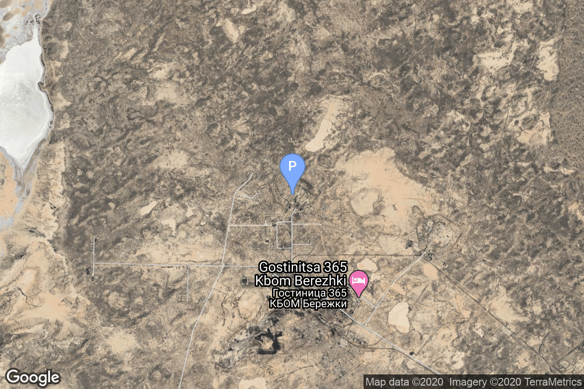
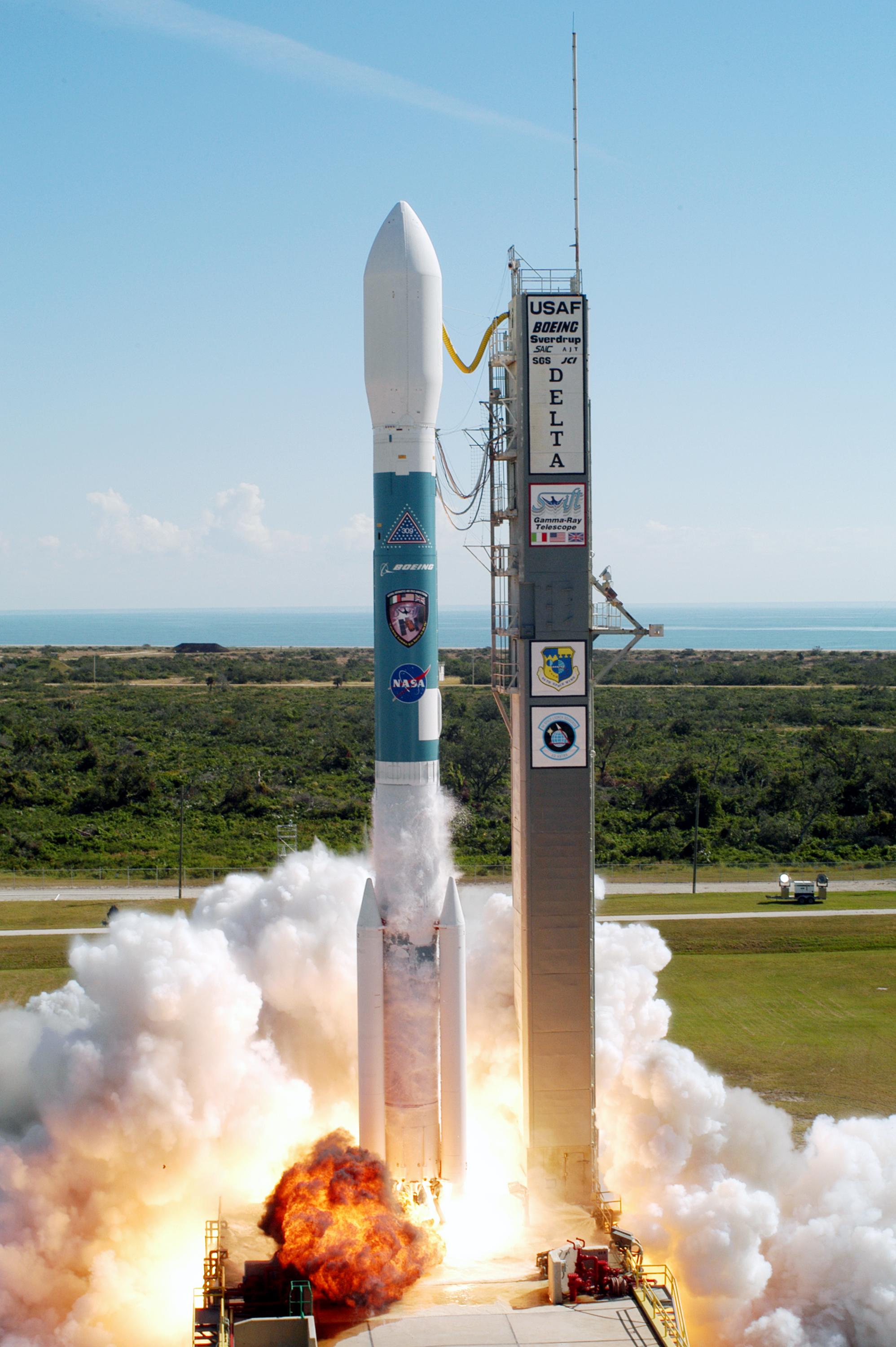
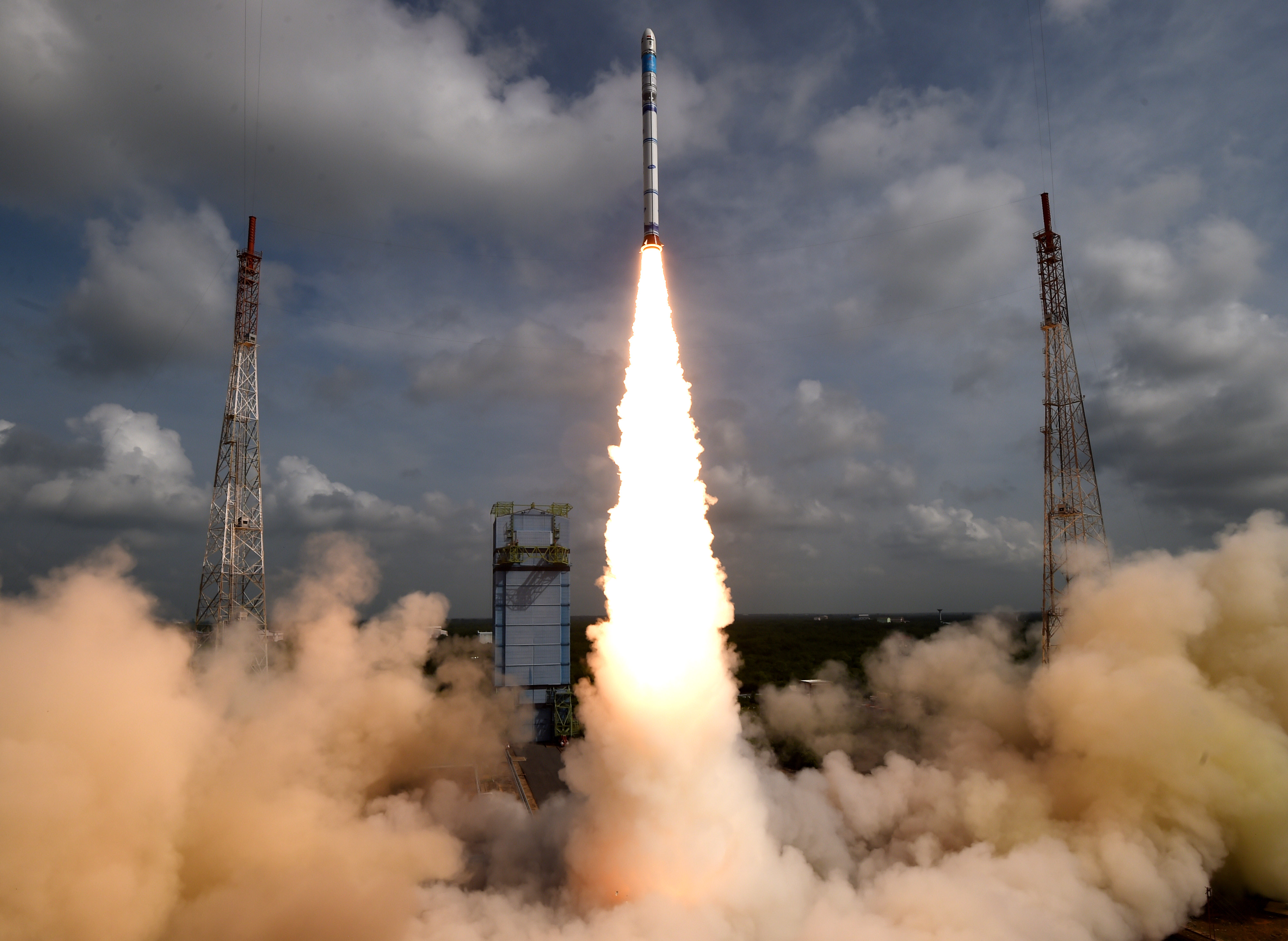
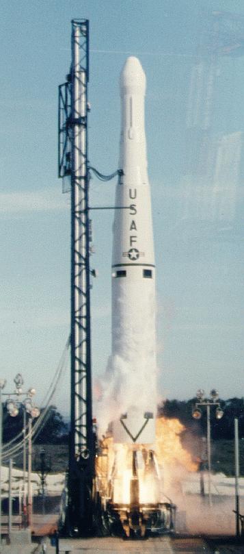
{ "count": 7507, "next": "https://ll.thespacedevs.com/2.0.0/launch/?format=api&limit=10&offset=1080&ordering=-id", "previous": "https://ll.thespacedevs.com/2.0.0/launch/?format=api&limit=10&offset=1060&ordering=-id", "results": [ { "id": "db05e288-34f4-408a-845d-896da6a48556", "url": "https://ll.thespacedevs.com/2.0.0/launch/db05e288-34f4-408a-845d-896da6a48556/?format=api", "launch_library_id": null, "slug": "tsiklon-2-us-a-21", "name": "Tsiklon-2 | US-A 21", "status": { "id": 3, "name": "Success" }, "net": "1982-06-01T13:58:00Z", "window_end": "1982-06-01T13:58:00Z", "window_start": "1982-06-01T13:58:00Z", "inhold": false, "tbdtime": false, "tbddate": false, "probability": null, "holdreason": "", "failreason": null, "hashtag": null, "launch_service_provider": { "id": 66, "url": "https://ll.thespacedevs.com/2.0.0/agencies/66/?format=api", "name": "Soviet Space Program", "type": "Government" }, "rocket": { "id": 5405, "configuration": { "id": 443, "launch_library_id": null, "url": "https://ll.thespacedevs.com/2.0.0/config/launcher/443/?format=api", "name": "Tsiklon-2", "family": "Tsiklon", "full_name": "Tsiklon-2", "variant": "2" } }, "mission": { "id": 3812, "launch_library_id": null, "name": "US-A 21", "description": "Active radar satellite for ocean surveillance powered by a nuclear reactor.", "launch_designator": null, "type": "Government/Top Secret", "orbit": { "id": 8, "name": "Low Earth Orbit", "abbrev": "LEO" } }, "pad": { "id": 132, "url": "https://ll.thespacedevs.com/2.0.0/pad/132/?format=api", "agency_id": null, "name": "90", "info_url": null, "wiki_url": "https://en.wikipedia.org/wiki/Baikonur_Cosmodrome_Site_90", "map_url": "https://www.google.com/maps?q=46.081,62.929806", "latitude": "46.081", "longitude": "62.929806", "location": { "id": 15, "url": "https://ll.thespacedevs.com/2.0.0/location/15/?format=api", "name": "Baikonur Cosmodrome, Republic of Kazakhstan", "country_code": "KAZ", "map_image": "https://thespacedevs-prod.nyc3.digitaloceanspaces.com/media/map_images/location_15_20200803142517.jpg", "total_launch_count": 1555, "total_landing_count": 0 }, "map_image": "https://thespacedevs-prod.nyc3.digitaloceanspaces.com/media/map_images/pad_132_20200803143344.jpg", "total_launch_count": 74 }, "webcast_live": false, "image": "https://thespacedevs-prod.nyc3.digitaloceanspaces.com/media/images/tsyklon-2_lifto_image_20240411113159.jpg", "infographic": null, "program": [] }, { "id": "db02116f-17ba-429a-b6c1-8e7f13b5e787", "url": "https://ll.thespacedevs.com/2.0.0/launch/db02116f-17ba-429a-b6c1-8e7f13b5e787/?format=api", "launch_library_id": null, "slug": "delta-ii-swift", "name": "Delta II | Swift", "status": { "id": 3, "name": "Success" }, "net": "2004-11-20T17:16:01Z", "window_end": "2004-11-20T17:16:01Z", "window_start": "2004-11-20T17:16:01Z", "inhold": false, "tbdtime": false, "tbddate": false, "probability": null, "holdreason": "", "failreason": "", "hashtag": null, "launch_service_provider": { "id": 161, "url": "https://ll.thespacedevs.com/2.0.0/agencies/161/?format=api", "name": "United States Air Force", "type": "Government" }, "rocket": { "id": 7208, "configuration": { "id": 56, "launch_library_id": 78, "url": "https://ll.thespacedevs.com/2.0.0/config/launcher/56/?format=api", "name": "Delta II", "family": "Delta", "full_name": "Delta II 7320-10C", "variant": "7320-10C" } }, "mission": { "id": 5597, "launch_library_id": null, "name": "Swift", "description": "NASA Medium-class Explorer satellite dedicated to study of gamma ray bursts, the third after the IMAGE and WMAP satellites.", "launch_designator": null, "type": "Astrophysics", "orbit": { "id": 8, "name": "Low Earth Orbit", "abbrev": "LEO" } }, "pad": { "id": 14, "url": "https://ll.thespacedevs.com/2.0.0/pad/14/?format=api", "agency_id": null, "name": "Space Launch Complex 17A", "info_url": null, "wiki_url": "https://en.wikipedia.org/wiki/Cape_Canaveral_Space_Launch_Complex_17", "map_url": "https://www.google.com/maps?q=28.4472,-80.565", "latitude": "28.4472", "longitude": "-80.565", "location": { "id": 12, "url": "https://ll.thespacedevs.com/2.0.0/location/12/?format=api", "name": "Cape Canaveral SFS, FL, USA", "country_code": "USA", "map_image": "https://thespacedevs-prod.nyc3.digitaloceanspaces.com/media/map_images/location_12_20200803142519.jpg", "total_launch_count": 1025, "total_landing_count": 64 }, "map_image": "https://thespacedevs-prod.nyc3.digitaloceanspaces.com/media/map_images/pad_14_20200803143451.jpg", "total_launch_count": 145 }, "webcast_live": false, "image": "https://thespacedevs-prod.nyc3.digitaloceanspaces.com/media/images/delta_ii_liftof_image_20240922114900.jpg", "infographic": null, "program": [] }, { "id": "daf65777-9fc0-4974-8b9e-b0a540a96520", "url": "https://ll.thespacedevs.com/2.0.0/launch/daf65777-9fc0-4974-8b9e-b0a540a96520/?format=api", "launch_library_id": null, "slug": "soyuz-u-yantar-4ks1m-7", "name": "Soyuz U | Yantar-4KS1M 7", "status": { "id": 3, "name": "Success" }, "net": "1995-09-29T04:25:00Z", "window_end": "1995-09-29T04:25:00Z", "window_start": "1995-09-29T04:25:00Z", "inhold": false, "tbdtime": false, "tbddate": false, "probability": null, "holdreason": "", "failreason": null, "hashtag": null, "launch_service_provider": { "id": 63, "url": "https://ll.thespacedevs.com/2.0.0/agencies/63/?format=api", "name": "Russian Federal Space Agency (ROSCOSMOS)", "type": "Government" }, "rocket": { "id": 6684, "configuration": { "id": 37, "launch_library_id": 35, "url": "https://ll.thespacedevs.com/2.0.0/config/launcher/37/?format=api", "name": "Soyuz U", "family": "Soyuz", "full_name": "Soyuz U", "variant": "" } }, "mission": { "id": 5074, "launch_library_id": null, "name": "Yantar-4KS1M 7", "description": "The Neman or Yantar-4KS1M satellites were improved versions of the Terilen elctro-optical reconnaissance satellites. They were transmitting the data via Potok (Geizer) relay satellites.", "launch_designator": null, "type": "Government/Top Secret", "orbit": { "id": 8, "name": "Low Earth Orbit", "abbrev": "LEO" } }, "pad": { "id": 20, "url": "https://ll.thespacedevs.com/2.0.0/pad/20/?format=api", "agency_id": null, "name": "31/6", "info_url": null, "wiki_url": "https://en.wikipedia.org/wiki/Baikonur_Cosmodrome_Site_31", "map_url": "https://www.google.com/maps?q=45.996034,63.564003", "latitude": "45.996034", "longitude": "63.564003", "location": { "id": 15, "url": "https://ll.thespacedevs.com/2.0.0/location/15/?format=api", "name": "Baikonur Cosmodrome, Republic of Kazakhstan", "country_code": "KAZ", "map_image": "https://thespacedevs-prod.nyc3.digitaloceanspaces.com/media/map_images/location_15_20200803142517.jpg", "total_launch_count": 1555, "total_landing_count": 0 }, "map_image": "https://thespacedevs-prod.nyc3.digitaloceanspaces.com/media/map_images/pad_20_20200803143516.jpg", "total_launch_count": 422 }, "webcast_live": false, "image": "https://thespacedevs-prod.nyc3.digitaloceanspaces.com/media/images/soyuz2520u_image_20190222031023.jpeg", "infographic": null, "program": [] }, { "id": "daf0e1a3-fa5d-4523-9f46-3a41e5527da6", "url": "https://ll.thespacedevs.com/2.0.0/launch/daf0e1a3-fa5d-4523-9f46-3a41e5527da6/?format=api", "launch_library_id": null, "slug": "sslv-eos-08microsat-2c", "name": "SSLV | EOS-08/Microsat-2C", "status": { "id": 3, "name": "Success" }, "net": "2024-08-16T03:47:00Z", "window_end": "2024-08-16T04:47:00Z", "window_start": "2024-08-16T03:47:00Z", "inhold": false, "tbdtime": false, "tbddate": false, "probability": null, "holdreason": "", "failreason": "", "hashtag": null, "launch_service_provider": { "id": 31, "url": "https://ll.thespacedevs.com/2.0.0/agencies/31/?format=api", "name": "Indian Space Research Organization", "type": "Government" }, "rocket": { "id": 8284, "configuration": { "id": 150, "launch_library_id": 189, "url": "https://ll.thespacedevs.com/2.0.0/config/launcher/150/?format=api", "name": "SSLV", "family": "", "full_name": "SSLV", "variant": "" } }, "mission": { "id": 6865, "launch_library_id": null, "name": "EOS-08/Microsat-2C", "description": "Earth observation micro-satellite for ISRO designed to test new technologies for building an Earth observation satellite in a micro-satellite bus. The satellite hoists an Electro-Optical Infrared Payload (EOIR) for Earth observation, a Global Navigation Satellite System-Reflectometry payload (GNSS-R) for weather studies, and an UV Dosimeter to measure UV radiation in low Earth orbit.\r\nAlso flying is the cubesat Space Rickshaw-0.", "launch_designator": null, "type": "Earth Science", "orbit": { "id": 8, "name": "Low Earth Orbit", "abbrev": "LEO" } }, "pad": { "id": 50, "url": "https://ll.thespacedevs.com/2.0.0/pad/50/?format=api", "agency_id": 31, "name": "Satish Dhawan Space Centre First Launch Pad", "info_url": null, "wiki_url": "https://en.wikipedia.org/wiki/Satish_Dhawan_Space_Centre_First_Launch_Pad", "map_url": "https://www.google.com/maps?q=13.733,80.235", "latitude": "13.733", "longitude": "80.235", "location": { "id": 14, "url": "https://ll.thespacedevs.com/2.0.0/location/14/?format=api", "name": "Satish Dhawan Space Centre, India", "country_code": "IND", "map_image": "https://thespacedevs-prod.nyc3.digitaloceanspaces.com/media/map_images/location_14_20200803142403.jpg", "total_launch_count": 99, "total_landing_count": 0 }, "map_image": "https://thespacedevs-prod.nyc3.digitaloceanspaces.com/media/map_images/pad_50_20200803143457.jpg", "total_launch_count": 62 }, "webcast_live": false, "image": "https://thespacedevs-prod.nyc3.digitaloceanspaces.com/media/images/sslv_liftoff_2_image_20240818061425.JPG", "infographic": null, "program": [] }, { "id": "dae8cfed-408d-4572-a461-d71e8d40e396", "url": "https://ll.thespacedevs.com/2.0.0/launch/dae8cfed-408d-4572-a461-d71e8d40e396/?format=api", "launch_library_id": null, "slug": "thor-dm-21-ablestar-courier-1b", "name": "Thor DM-21 Ablestar | Courier 1B", "status": { "id": 3, "name": "Success" }, "net": "1960-10-04T17:50:00Z", "window_end": "1960-10-04T17:50:00Z", "window_start": "1960-10-04T17:50:00Z", "inhold": false, "tbdtime": false, "tbddate": false, "probability": null, "holdreason": "", "failreason": null, "hashtag": null, "launch_service_provider": { "id": 161, "url": "https://ll.thespacedevs.com/2.0.0/agencies/161/?format=api", "name": "United States Air Force", "type": "Government" }, "rocket": { "id": 3082, "configuration": { "id": 187, "launch_library_id": 202, "url": "https://ll.thespacedevs.com/2.0.0/config/launcher/187/?format=api", "name": "Thor DM-21 Ablestar", "family": "Thor", "full_name": "Thor DM-21 Ablestar", "variant": "DM-21" } }, "mission": { "id": 1504, "launch_library_id": null, "name": "Courier 1B", "description": "An active repeater communications satellite. The vehicle succesfully launched and successfully operated for a few weeks proving the experimental system.", "launch_designator": null, "type": "Communications", "orbit": { "id": 8, "name": "Low Earth Orbit", "abbrev": "LEO" } }, "pad": { "id": 1, "url": "https://ll.thespacedevs.com/2.0.0/pad/1/?format=api", "agency_id": null, "name": "Space Launch Complex 17B", "info_url": null, "wiki_url": "https://en.wikipedia.org/wiki/Cape_Canaveral_Space_Launch_Complex_17", "map_url": "https://www.google.com/maps?q=28.4458,-80.5657", "latitude": "28.4458", "longitude": "-80.5657", "location": { "id": 12, "url": "https://ll.thespacedevs.com/2.0.0/location/12/?format=api", "name": "Cape Canaveral SFS, FL, USA", "country_code": "USA", "map_image": "https://thespacedevs-prod.nyc3.digitaloceanspaces.com/media/map_images/location_12_20200803142519.jpg", "total_launch_count": 1025, "total_landing_count": 64 }, "map_image": "https://thespacedevs-prod.nyc3.digitaloceanspaces.com/media/map_images/pad_1_20200803143208.jpg", "total_launch_count": 132 }, "webcast_live": false, "image": "https://thespacedevs-prod.nyc3.digitaloceanspaces.com/media/images/thor2520dm-212520ablestar_image_20191201205131.jpg", "infographic": null, "program": [] }, { "id": "dadda961-7b4d-4a33-bfb9-0298401fce5a", "url": "https://ll.thespacedevs.com/2.0.0/launch/dadda961-7b4d-4a33-bfb9-0298401fce5a/?format=api", "launch_library_id": null, "slug": "voskhod-zenit-4m-9", "name": "Voskhod | Zenit-4M 9", "status": { "id": 3, "name": "Success" }, "net": "1970-12-15T10:00:01Z", "window_end": "1970-12-15T10:00:01Z", "window_start": "1970-12-15T10:00:01Z", "inhold": false, "tbdtime": false, "tbddate": false, "probability": null, "holdreason": "", "failreason": null, "hashtag": null, "launch_service_provider": { "id": 66, "url": "https://ll.thespacedevs.com/2.0.0/agencies/66/?format=api", "name": "Soviet Space Program", "type": "Government" }, "rocket": { "id": 4086, "configuration": { "id": 104, "launch_library_id": 138, "url": "https://ll.thespacedevs.com/2.0.0/config/launcher/104/?format=api", "name": "Voskhod", "family": "R-7", "full_name": "Voskhod", "variant": "Voskhod" } }, "mission": { "id": 2504, "launch_library_id": null, "name": "Zenit-4M 9", "description": "The soviet Zenit-4M (Rotor, 11F691) was an improved version of the Zenit-4 high resolution reconnaissance satellite and was part of the Vostok-based Zenit-family.", "launch_designator": null, "type": "Government/Top Secret", "orbit": { "id": 8, "name": "Low Earth Orbit", "abbrev": "LEO" } }, "pad": { "id": 20, "url": "https://ll.thespacedevs.com/2.0.0/pad/20/?format=api", "agency_id": null, "name": "31/6", "info_url": null, "wiki_url": "https://en.wikipedia.org/wiki/Baikonur_Cosmodrome_Site_31", "map_url": "https://www.google.com/maps?q=45.996034,63.564003", "latitude": "45.996034", "longitude": "63.564003", "location": { "id": 15, "url": "https://ll.thespacedevs.com/2.0.0/location/15/?format=api", "name": "Baikonur Cosmodrome, Republic of Kazakhstan", "country_code": "KAZ", "map_image": "https://thespacedevs-prod.nyc3.digitaloceanspaces.com/media/map_images/location_15_20200803142517.jpg", "total_launch_count": 1555, "total_landing_count": 0 }, "map_image": "https://thespacedevs-prod.nyc3.digitaloceanspaces.com/media/map_images/pad_20_20200803143516.jpg", "total_launch_count": 422 }, "webcast_live": false, "image": null, "infographic": null, "program": [] }, { "id": "dac63c8a-27e0-4cf9-a2cf-473710d99abb", "url": "https://ll.thespacedevs.com/2.0.0/launch/dac63c8a-27e0-4cf9-a2cf-473710d99abb/?format=api", "launch_library_id": null, "slug": "thor-delta-c1-oso-4", "name": "Thor Delta C1 | OSO 4", "status": { "id": 3, "name": "Success" }, "net": "1967-10-18T15:58:00Z", "window_end": "1967-10-18T15:58:00Z", "window_start": "1967-10-18T15:58:00Z", "inhold": false, "tbdtime": false, "tbddate": false, "probability": null, "holdreason": "", "failreason": null, "hashtag": null, "launch_service_provider": { "id": 161, "url": "https://ll.thespacedevs.com/2.0.0/agencies/161/?format=api", "name": "United States Air Force", "type": "Government" }, "rocket": { "id": 3717, "configuration": { "id": 402, "launch_library_id": null, "url": "https://ll.thespacedevs.com/2.0.0/config/launcher/402/?format=api", "name": "Thor Delta C1", "family": "Thor", "full_name": "Thor Delta C1", "variant": "Delta C1" } }, "mission": { "id": 2135, "launch_library_id": null, "name": "OSO 4", "description": "OSO (Orbital Solar Observatory) satellite. Its purpose was to return data on the ultraviolet, X-ray and gamma ray emissions of the sun and galaxy.", "launch_designator": null, "type": "Astrophysics", "orbit": { "id": 8, "name": "Low Earth Orbit", "abbrev": "LEO" } }, "pad": { "id": 1, "url": "https://ll.thespacedevs.com/2.0.0/pad/1/?format=api", "agency_id": null, "name": "Space Launch Complex 17B", "info_url": null, "wiki_url": "https://en.wikipedia.org/wiki/Cape_Canaveral_Space_Launch_Complex_17", "map_url": "https://www.google.com/maps?q=28.4458,-80.5657", "latitude": "28.4458", "longitude": "-80.5657", "location": { "id": 12, "url": "https://ll.thespacedevs.com/2.0.0/location/12/?format=api", "name": "Cape Canaveral SFS, FL, USA", "country_code": "USA", "map_image": "https://thespacedevs-prod.nyc3.digitaloceanspaces.com/media/map_images/location_12_20200803142519.jpg", "total_launch_count": 1025, "total_landing_count": 64 }, "map_image": "https://thespacedevs-prod.nyc3.digitaloceanspaces.com/media/map_images/pad_1_20200803143208.jpg", "total_launch_count": 132 }, "webcast_live": false, "image": null, "infographic": null, "program": [] }, { "id": "dac070cf-6e76-4f31-9990-93e68dc91c91", "url": "https://ll.thespacedevs.com/2.0.0/launch/dac070cf-6e76-4f31-9990-93e68dc91c91/?format=api", "launch_library_id": null, "slug": "long-march-2d-6-x-jilin-1-qilu-23-others", "name": "Long March 2D | 6 x Jilin-1, Qilu-2/3 & others", "status": { "id": 3, "name": "Success" }, "net": "2023-01-15T03:14:00Z", "window_end": "2023-01-15T03:39:00Z", "window_start": "2023-01-15T03:04:00Z", "inhold": false, "tbdtime": false, "tbddate": false, "probability": null, "holdreason": "", "failreason": "", "hashtag": null, "launch_service_provider": { "id": 88, "url": "https://ll.thespacedevs.com/2.0.0/agencies/88/?format=api", "name": "China Aerospace Science and Technology Corporation", "type": "Government" }, "rocket": { "id": 7761, "configuration": { "id": 17, "launch_library_id": 73, "url": "https://ll.thespacedevs.com/2.0.0/config/launcher/17/?format=api", "name": "Long March 2D", "family": "Long March", "full_name": "Long March 2D", "variant": "2D" } }, "mission": { "id": 6281, "launch_library_id": null, "name": "6 x Jilin-1, Qilu-2/3 & others", "description": "This launch carries multiple payloads, including 6 new satellites for the Jilin-1 commercial Earth observation satellite constellation and Qilu-2/3, 2 optical Earth observation satellites for the Shandong Province Industrial Technology Research Institute.", "launch_designator": null, "type": "Earth Science", "orbit": { "id": 17, "name": "Sun-Synchronous Orbit", "abbrev": "SSO" } }, "pad": { "id": 25, "url": "https://ll.thespacedevs.com/2.0.0/pad/25/?format=api", "agency_id": null, "name": "Launch Complex 9", "info_url": null, "wiki_url": null, "map_url": "https://www.google.com/maps?q=38.863128,111.589567", "latitude": "38.863128", "longitude": "111.589567", "location": { "id": 19, "url": "https://ll.thespacedevs.com/2.0.0/location/19/?format=api", "name": "Taiyuan Satellite Launch Center, People's Republic of China", "country_code": "CHN", "map_image": "https://thespacedevs-prod.nyc3.digitaloceanspaces.com/media/map_images/location_19_20200803142421.jpg", "total_launch_count": 141, "total_landing_count": 0 }, "map_image": "https://thespacedevs-prod.nyc3.digitaloceanspaces.com/media/map_images/pad_25_20200803143501.jpg", "total_launch_count": 76 }, "webcast_live": false, "image": "https://thespacedevs-prod.nyc3.digitaloceanspaces.com/media/images/long2520march_image_20230907134308.jpeg", "infographic": null, "program": [] }, { "id": "daac73ed-d119-4db3-85b3-f9d867490b6b", "url": "https://ll.thespacedevs.com/2.0.0/launch/daac73ed-d119-4db3-85b3-f9d867490b6b/?format=api", "launch_library_id": null, "slug": "kosmos-3m-tsikada-21", "name": "Kosmos-3M | Tsikada 21", "status": { "id": 3, "name": "Success" }, "net": "1995-07-05T03:09:03Z", "window_end": "1995-07-05T03:09:03Z", "window_start": "1995-07-05T03:09:03Z", "inhold": false, "tbdtime": false, "tbddate": false, "probability": null, "holdreason": "", "failreason": null, "hashtag": null, "launch_service_provider": { "id": 154, "url": "https://ll.thespacedevs.com/2.0.0/agencies/154/?format=api", "name": "Production Corporation Polyot", "type": "Commercial" }, "rocket": { "id": 6668, "configuration": { "id": 102, "launch_library_id": 122, "url": "https://ll.thespacedevs.com/2.0.0/config/launcher/102/?format=api", "name": "Kosmos-3M", "family": "Kosmos", "full_name": "Kosmos-3M (11K65M)", "variant": "-3M" } }, "mission": { "id": 5058, "launch_library_id": null, "name": "Tsikada 21", "description": "Civilian navigation satellite equivalent to the purely military Parus", "launch_designator": null, "type": "Navigation", "orbit": { "id": 8, "name": "Low Earth Orbit", "abbrev": "LEO" } }, "pad": { "id": 28, "url": "https://ll.thespacedevs.com/2.0.0/pad/28/?format=api", "agency_id": 163, "name": "132/1 (132L)", "info_url": null, "wiki_url": "", "map_url": "https://www.google.com/maps?q=62.883229,40.868549", "latitude": "62.883229", "longitude": "40.868549", "location": { "id": 6, "url": "https://ll.thespacedevs.com/2.0.0/location/6/?format=api", "name": "Plesetsk Cosmodrome, Russian Federation", "country_code": "RUS", "map_image": "https://thespacedevs-prod.nyc3.digitaloceanspaces.com/media/map_images/location_6_20200803142434.jpg", "total_launch_count": 1675, "total_landing_count": 0 }, "map_image": "https://thespacedevs-prod.nyc3.digitaloceanspaces.com/media/map_images/pad_28_20200803143254.jpg", "total_launch_count": 212 }, "webcast_live": false, "image": null, "infographic": null, "program": [] }, { "id": "daab6c80-bcea-4f82-a974-0f8a320b7a04", "url": "https://ll.thespacedevs.com/2.0.0/launch/daab6c80-bcea-4f82-a974-0f8a320b7a04/?format=api", "launch_library_id": null, "slug": "delta-ii-gps-iir-11", "name": "Delta II | GPS IIR-11", "status": { "id": 3, "name": "Success" }, "net": "2004-03-20T17:53:00Z", "window_end": "2004-03-20T17:53:00Z", "window_start": "2004-03-20T17:53:00Z", "inhold": false, "tbdtime": false, "tbddate": false, "probability": null, "holdreason": "", "failreason": "", "hashtag": null, "launch_service_provider": { "id": 161, "url": "https://ll.thespacedevs.com/2.0.0/agencies/161/?format=api", "name": "United States Air Force", "type": "Government" }, "rocket": { "id": 7174, "configuration": { "id": 140, "launch_library_id": 181, "url": "https://ll.thespacedevs.com/2.0.0/config/launcher/140/?format=api", "name": "Delta II", "family": "Delta", "full_name": "Delta II 7925-9.5", "variant": "7925-9.5" } }, "mission": { "id": 5563, "launch_library_id": null, "name": "GPS IIR-11", "description": "GPS-2R (Global Positioning System) or Navstar-2R (Navigation System using Timing And Ranging) are the third evolution stage of the second generation of the GPS satellites.", "launch_designator": null, "type": "Navigation", "orbit": { "id": 12, "name": "Medium Earth Orbit", "abbrev": "MEO" } }, "pad": { "id": 1, "url": "https://ll.thespacedevs.com/2.0.0/pad/1/?format=api", "agency_id": null, "name": "Space Launch Complex 17B", "info_url": null, "wiki_url": "https://en.wikipedia.org/wiki/Cape_Canaveral_Space_Launch_Complex_17", "map_url": "https://www.google.com/maps?q=28.4458,-80.5657", "latitude": "28.4458", "longitude": "-80.5657", "location": { "id": 12, "url": "https://ll.thespacedevs.com/2.0.0/location/12/?format=api", "name": "Cape Canaveral SFS, FL, USA", "country_code": "USA", "map_image": "https://thespacedevs-prod.nyc3.digitaloceanspaces.com/media/map_images/location_12_20200803142519.jpg", "total_launch_count": 1025, "total_landing_count": 64 }, "map_image": "https://thespacedevs-prod.nyc3.digitaloceanspaces.com/media/map_images/pad_1_20200803143208.jpg", "total_launch_count": 132 }, "webcast_live": false, "image": "https://thespacedevs-prod.nyc3.digitaloceanspaces.com/media/images/delta_ii_7925-9_image_20240312090356.jpeg", "infographic": null, "program": [ { "id": 29, "url": "https://ll.thespacedevs.com/2.0.0/program/29/?format=api", "name": "Global Positioning System", "description": "The Global Positioning System (GPS), originally Navstar GPS, is a satellite-based radio navigation system owned by the United States government and operated by the United States Space Force. It is one of the global navigation satellite systems (GNSS) that provide geolocation and time information to a GPS receiver anywhere on or near the Earth where there is an unobstructed line of sight to four or more GPS satellites.", "agencies": [ { "id": 1041, "url": "https://ll.thespacedevs.com/2.0.0/agencies/1041/?format=api", "name": "United States Space Force", "type": "Government" } ], "image_url": "https://thespacedevs-prod.nyc3.digitaloceanspaces.com/media/images/global2520posi_program_20231229182501.png", "start_date": "1978-02-22T00:00:00Z", "end_date": null, "info_url": "https://www.gps.gov/", "wiki_url": "https://en.wikipedia.org/wiki/Global_Positioning_System" } ] } ] }