Launch List
API endpoint that returns all Launch objects or a single launch.
EXAMPLE - /launch/
GET: Return a list of all Launch objects.
FILTERS: Fields - 'name', 'id(s)', 'lsp_id', 'lsp_name', 'serial_number', 'launcher_config__id', 'rocket__spacecraftflight__spacecraft__name'
MODE: 'normal', 'list', 'detailed' EXAMPLE: ?mode=list
SEARCH: Searches through the launch name, rocket name, launch agency, mission name & spacecraft name. EXAMPLE - ?search=SpaceX
GET /2.0.0/launch/?format=api&offset=1050&ordering=id
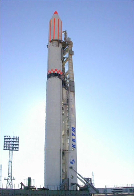
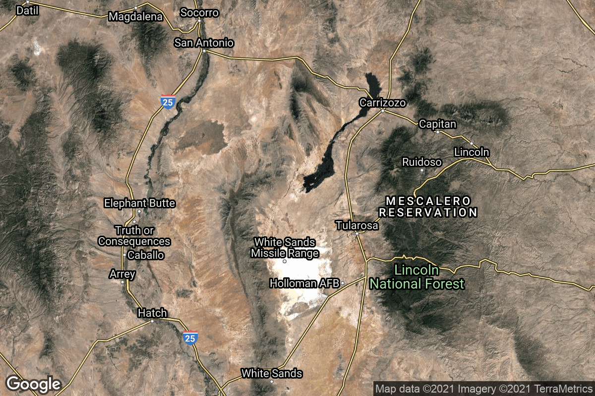
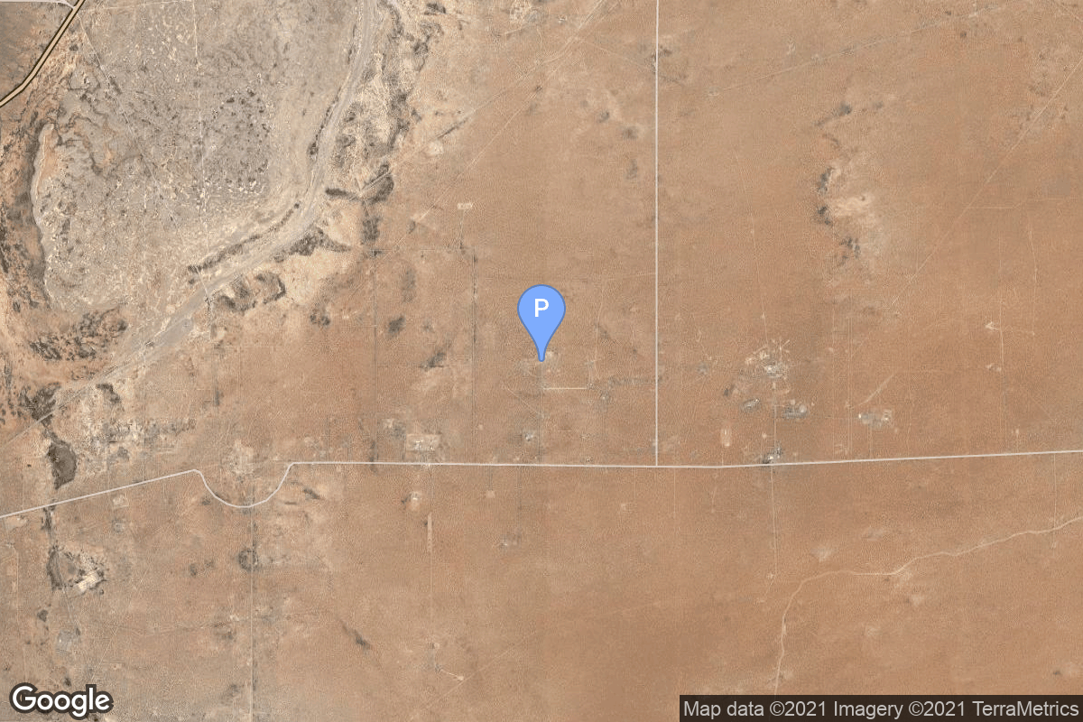
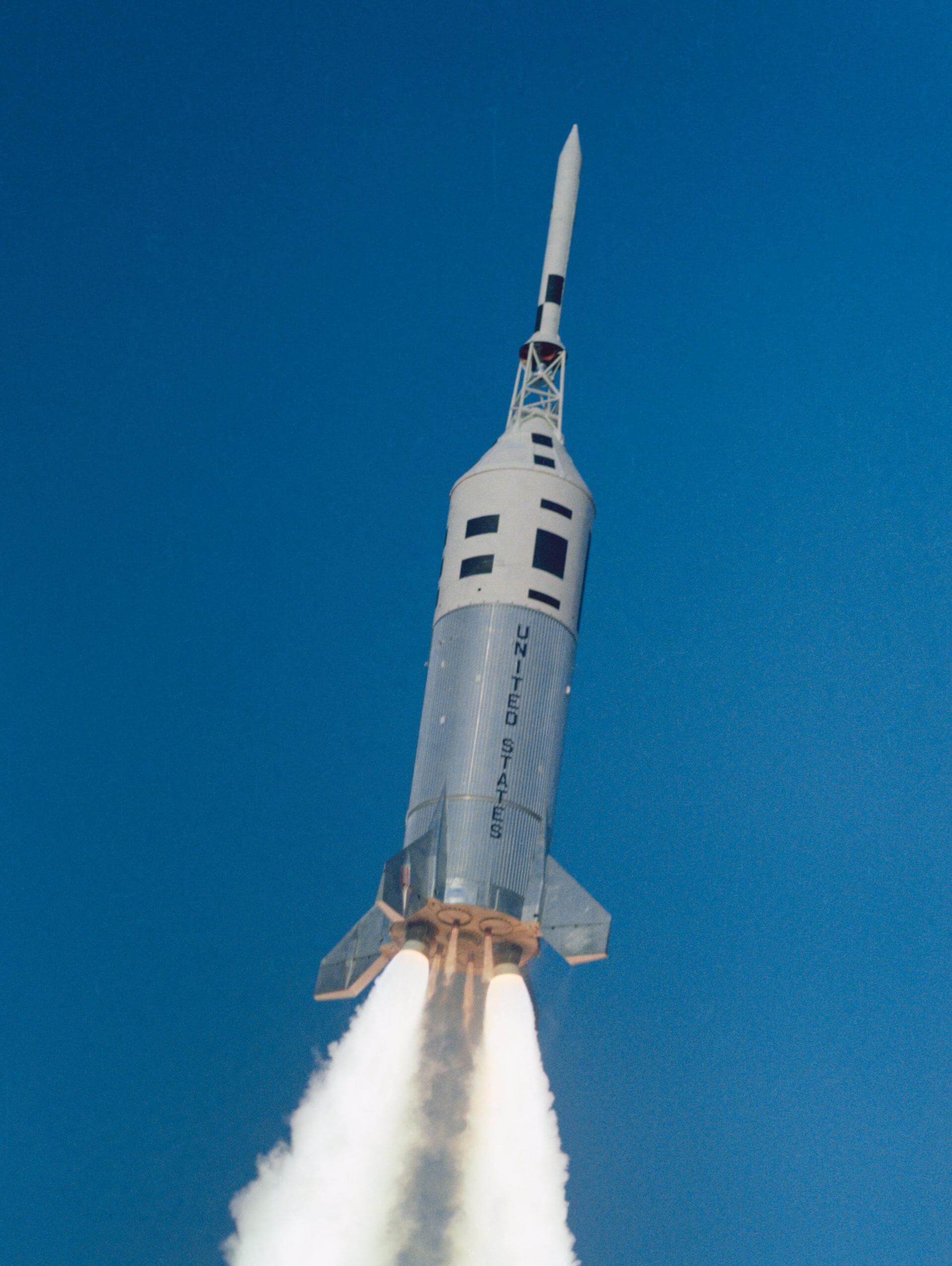
{ "count": 7927, "next": "https://ll.thespacedevs.com/2.0.0/launch/?format=api&limit=10&offset=1060&ordering=id", "previous": "https://ll.thespacedevs.com/2.0.0/launch/?format=api&limit=10&offset=1040&ordering=id", "results": [ { "id": "229267d8-74ca-4d0b-8711-b2efe621fc6b", "url": "https://ll.thespacedevs.com/2.0.0/launch/229267d8-74ca-4d0b-8711-b2efe621fc6b/?format=api", "launch_library_id": null, "slug": "falcon-9-block-5-starlink-group-10-54", "name": "Falcon 9 Block 5 | Starlink Group 10-54", "status": { "id": 3, "name": "Success" }, "net": "2026-06-12T12:37:00Z", "window_end": "2026-06-12T16:27:00Z", "window_start": "2026-06-12T12:27:00Z", "inhold": false, "tbdtime": false, "tbddate": false, "probability": 80, "holdreason": "", "failreason": "", "hashtag": null, "launch_service_provider": { "id": 121, "url": "https://ll.thespacedevs.com/2.0.0/agencies/121/?format=api", "name": "SpaceX", "type": "Commercial" }, "rocket": { "id": 9039, "configuration": { "id": 164, "launch_library_id": 188, "url": "https://ll.thespacedevs.com/2.0.0/config/launcher/164/?format=api", "name": "Falcon 9", "family": "Falcon", "full_name": "Falcon 9 Block 5", "variant": "Block 5" } }, "mission": { "id": 7634, "launch_library_id": null, "name": "Starlink Group 10-54", "description": "A batch of 29 satellites for the Starlink mega-constellation - SpaceX's project for space-based Internet communication system.", "launch_designator": null, "type": "Communications", "orbit": { "id": 8, "name": "Low Earth Orbit", "abbrev": "LEO" } }, "pad": { "id": 80, "url": "https://ll.thespacedevs.com/2.0.0/pad/80/?format=api", "agency_id": 121, "name": "Space Launch Complex 40", "info_url": null, "wiki_url": "https://en.wikipedia.org/wiki/Cape_Canaveral_Air_Force_Station_Space_Launch_Complex_40", "map_url": "https://www.google.com/maps?q=28.56194122,-80.57735736", "latitude": "28.56194122", "longitude": "-80.57735736", "location": { "id": 12, "url": "https://ll.thespacedevs.com/2.0.0/location/12/?format=api", "name": "Cape Canaveral SFS, FL, USA", "country_code": "USA", "map_image": "https://thespacedevs-prod.nyc3.digitaloceanspaces.com/media/map_images/location_12_20200803142519.jpg", "total_launch_count": 1121, "total_landing_count": 75 }, "map_image": "https://thespacedevs-prod.nyc3.digitaloceanspaces.com/media/map_images/pad_80_20200803143323.jpg", "total_launch_count": 393 }, "webcast_live": false, "image": "https://thespacedevs-prod.nyc3.digitaloceanspaces.com/media/images/falcon2520925_image_20221009234147.png", "infographic": null, "program": [ { "id": 25, "url": "https://ll.thespacedevs.com/2.0.0/program/25/?format=api", "name": "Starlink", "description": "Starlink is a satellite internet constellation operated by American aerospace company SpaceX", "agencies": [ { "id": 121, "url": "https://ll.thespacedevs.com/2.0.0/agencies/121/?format=api", "name": "SpaceX", "type": "Commercial" } ], "image_url": "https://thespacedevs-prod.nyc3.digitaloceanspaces.com/media/images/starlink_program_20231228154508.jpeg", "start_date": "2018-02-22T14:17:00Z", "end_date": null, "info_url": "https://starlink.com", "wiki_url": "https://en.wikipedia.org/wiki/Starlink" } ] }, { "id": "2299562f-2266-4f95-b050-35c3dac3d692", "url": "https://ll.thespacedevs.com/2.0.0/launch/2299562f-2266-4f95-b050-35c3dac3d692/?format=api", "launch_library_id": 560, "slug": "ariane-5-eca-eutelsat-25b-eshail-1-gsat-7", "name": "Ariane 5 ECA | Eutelsat 25B / Es'hail 1 & GSAT-7", "status": { "id": 3, "name": "Success" }, "net": "2013-08-29T20:30:07Z", "window_end": "2013-08-29T20:30:07Z", "window_start": "2013-08-29T20:30:07Z", "inhold": false, "tbdtime": false, "tbddate": false, "probability": null, "holdreason": "", "failreason": null, "hashtag": null, "launch_service_provider": { "id": 115, "url": "https://ll.thespacedevs.com/2.0.0/agencies/115/?format=api", "name": "Arianespace", "type": "Commercial" }, "rocket": { "id": 902, "configuration": { "id": 20, "launch_library_id": 27, "url": "https://ll.thespacedevs.com/2.0.0/config/launcher/20/?format=api", "name": "Ariane 5 ECA", "family": "Ariane", "full_name": "Ariane 5 ECA", "variant": "ECA" } }, "mission": { "id": 630, "launch_library_id": 822, "name": "Eutelsat 25B / Es'hail 1 & GSAT-7", "description": "Eutelsat 25B / Es'hail 1 is built by SSL and operates in geostationary orbit at 25.5 degrees East. GSAT-7 is a multi-band military communications satellite developed by ISRO for the Indian Navy. It operates at 74 drgees East.", "launch_designator": null, "type": "Communications", "orbit": { "id": 2, "name": "Geostationary Transfer Orbit", "abbrev": "GTO" } }, "pad": { "id": 77, "url": "https://ll.thespacedevs.com/2.0.0/pad/77/?format=api", "agency_id": 115, "name": "Ariane Launch Area 3", "info_url": null, "wiki_url": "https://en.wikipedia.org/wiki/ELA-3", "map_url": "https://www.google.com/maps?q=5.239,-52.768", "latitude": "5.239", "longitude": "-52.768", "location": { "id": 13, "url": "https://ll.thespacedevs.com/2.0.0/location/13/?format=api", "name": "Guiana Space Centre, French Guiana", "country_code": "GUF", "map_image": "https://thespacedevs-prod.nyc3.digitaloceanspaces.com/media/map_images/location_13_20200803142412.jpg", "total_launch_count": 334, "total_landing_count": 0 }, "map_image": "https://thespacedevs-prod.nyc3.digitaloceanspaces.com/media/map_images/pad_77_20200803143458.jpg", "total_launch_count": 118 }, "webcast_live": false, "image": "https://thespacedevs-prod.nyc3.digitaloceanspaces.com/media/images/ariane252052520eca_image_20190224012333.jpeg", "infographic": null, "program": [] }, { "id": "229a1cec-d1bb-43f5-ba21-4efac0ecd6cf", "url": "https://ll.thespacedevs.com/2.0.0/launch/229a1cec-d1bb-43f5-ba21-4efac0ecd6cf/?format=api", "launch_library_id": null, "slug": "kosmos-3m-tselina-o-30", "name": "Kosmos-3M | Tselina-O 30", "status": { "id": 3, "name": "Success" }, "net": "1976-01-22T22:26:01Z", "window_end": "1976-01-22T22:26:01Z", "window_start": "1976-01-22T22:26:01Z", "inhold": false, "tbdtime": false, "tbddate": false, "probability": null, "holdreason": "", "failreason": null, "hashtag": null, "launch_service_provider": { "id": 66, "url": "https://ll.thespacedevs.com/2.0.0/agencies/66/?format=api", "name": "Soviet Space Program", "type": "Government" }, "rocket": { "id": 4669, "configuration": { "id": 102, "launch_library_id": 122, "url": "https://ll.thespacedevs.com/2.0.0/config/launcher/102/?format=api", "name": "Kosmos-3M", "family": "Kosmos", "full_name": "Kosmos-3M (11K65M)", "variant": "-3M" } }, "mission": { "id": 3087, "launch_library_id": null, "name": "Tselina-O 30", "description": "The Tselina-O (11F616) was one component of two-satellite Tselina ELINT satellite system. Tselina-O provided general ELINT surveillance to be examined in detail by the larger Tselina-D satellites.", "launch_designator": null, "type": "Government/Top Secret", "orbit": { "id": 8, "name": "Low Earth Orbit", "abbrev": "LEO" } }, "pad": { "id": 28, "url": "https://ll.thespacedevs.com/2.0.0/pad/28/?format=api", "agency_id": 163, "name": "132/1 (132L)", "info_url": null, "wiki_url": "", "map_url": "https://www.google.com/maps?q=62.883229,40.868549", "latitude": "62.883229", "longitude": "40.868549", "location": { "id": 6, "url": "https://ll.thespacedevs.com/2.0.0/location/6/?format=api", "name": "Plesetsk Cosmodrome, Russian Federation", "country_code": "RUS", "map_image": "https://thespacedevs-prod.nyc3.digitaloceanspaces.com/media/map_images/location_6_20200803142434.jpg", "total_launch_count": 1685, "total_landing_count": 0 }, "map_image": "https://thespacedevs-prod.nyc3.digitaloceanspaces.com/media/map_images/pad_28_20200803143254.jpg", "total_launch_count": 212 }, "webcast_live": false, "image": "https://thespacedevs-prod.nyc3.digitaloceanspaces.com/media/images/kosmos-3m_durin_image_20251101171325.jpg", "infographic": null, "program": [] }, { "id": "229df13d-5ee5-486b-a506-1830abba729d", "url": "https://ll.thespacedevs.com/2.0.0/launch/229df13d-5ee5-486b-a506-1830abba729d/?format=api", "launch_library_id": null, "slug": "proton-kdm-2m-ekspress-3a", "name": "Proton-K/DM-2M | Ekspress 3A", "status": { "id": 3, "name": "Success" }, "net": "2000-06-24T00:28:00Z", "window_end": "2000-06-24T00:28:00Z", "window_start": "2000-06-24T00:28:00Z", "inhold": false, "tbdtime": false, "tbddate": false, "probability": null, "holdreason": "", "failreason": null, "hashtag": null, "launch_service_provider": { "id": 96, "url": "https://ll.thespacedevs.com/2.0.0/agencies/96/?format=api", "name": "Khrunichev State Research and Production Space Center", "type": "Government" }, "rocket": { "id": 6989, "configuration": { "id": 350, "launch_library_id": null, "url": "https://ll.thespacedevs.com/2.0.0/config/launcher/350/?format=api", "name": "Proton-K/DM-2M", "family": "Proton / UR-500", "full_name": "Proton-K/DM-2M", "variant": "DM-2M" } }, "mission": { "id": 5378, "launch_library_id": null, "name": "Ekspress 3A", "description": "Express-A satellites are designed for operation in the fixed satellite service. Their transponder payloads make it possible to retransmit all types of traffic, including television and radio programming, telephony, data, videoconferencing as well as high-speed Internet.", "launch_designator": null, "type": "Communications", "orbit": { "id": 1, "name": "Geostationary Orbit", "abbrev": "Direct-GEO" } }, "pad": { "id": 15, "url": "https://ll.thespacedevs.com/2.0.0/pad/15/?format=api", "agency_id": null, "name": "200/39 (200L)", "info_url": null, "wiki_url": "", "map_url": "https://www.google.com/maps?q=46.039984,63.032093", "latitude": "46.039984", "longitude": "63.032093", "location": { "id": 15, "url": "https://ll.thespacedevs.com/2.0.0/location/15/?format=api", "name": "Baikonur Cosmodrome, Republic of Kazakhstan", "country_code": "KAZ", "map_image": "https://thespacedevs-prod.nyc3.digitaloceanspaces.com/media/map_images/location_15_20200803142517.jpg", "total_launch_count": 1564, "total_landing_count": 0 }, "map_image": "https://thespacedevs-prod.nyc3.digitaloceanspaces.com/media/map_images/pad_15_20200803143530.jpg", "total_launch_count": 167 }, "webcast_live": false, "image": "https://thespacedevs-prod.nyc3.digitaloceanspaces.com/media/images/proton_image_20231231095535.jpg", "infographic": null, "program": [] }, { "id": "22a27d95-f9f4-4eaf-b890-4b473d3bb474", "url": "https://ll.thespacedevs.com/2.0.0/launch/22a27d95-f9f4-4eaf-b890-4b473d3bb474/?format=api", "launch_library_id": null, "slug": "titan-iiid-kh-9-2", "name": "Titan IIID | KH-9 2", "status": { "id": 3, "name": "Success" }, "net": "1972-01-20T18:36:00Z", "window_end": "1972-01-20T18:36:00Z", "window_start": "1972-01-20T18:36:00Z", "inhold": false, "tbdtime": false, "tbddate": false, "probability": null, "holdreason": "", "failreason": null, "hashtag": null, "launch_service_provider": { "id": 161, "url": "https://ll.thespacedevs.com/2.0.0/agencies/161/?format=api", "name": "United States Air Force", "type": "Government" }, "rocket": { "id": 4221, "configuration": { "id": 440, "launch_library_id": null, "url": "https://ll.thespacedevs.com/2.0.0/config/launcher/440/?format=api", "name": "Titan IIID", "family": "Titan", "full_name": "Titan IIID", "variant": "IIID" } }, "mission": { "id": 2639, "launch_library_id": null, "name": "KH-9 2", "description": "Large reconnaissance satellite equipped with four return capsules.", "launch_designator": null, "type": "Government/Top Secret", "orbit": { "id": 8, "name": "Low Earth Orbit", "abbrev": "LEO" } }, "pad": { "id": 16, "url": "https://ll.thespacedevs.com/2.0.0/pad/16/?format=api", "agency_id": null, "name": "Space Launch Complex 4E", "info_url": null, "wiki_url": "https://en.wikipedia.org/wiki/Vandenberg_Space_Launch_Complex_4#SLC-4E", "map_url": "https://www.google.com/maps?q=34.632,-120.611", "latitude": "34.632", "longitude": "-120.611", "location": { "id": 11, "url": "https://ll.thespacedevs.com/2.0.0/location/11/?format=api", "name": "Vandenberg SFB, CA, USA", "country_code": "USA", "map_image": "https://thespacedevs-prod.nyc3.digitaloceanspaces.com/media/map_images/location_11_20200803142416.jpg", "total_launch_count": 899, "total_landing_count": 35 }, "map_image": "https://thespacedevs-prod.nyc3.digitaloceanspaces.com/media/map_images/pad_16_20200803143532.jpg", "total_launch_count": 283 }, "webcast_live": false, "image": "https://thespacedevs-prod.nyc3.digitaloceanspaces.com/media/images/titan_iiid_laun_image_20251117073514.jpg", "infographic": null, "program": [] }, { "id": "22a6f1ed-afcd-455d-9316-5aaf8f39e864", "url": "https://ll.thespacedevs.com/2.0.0/launch/22a6f1ed-afcd-455d-9316-5aaf8f39e864/?format=api", "launch_library_id": null, "slug": "long-march-2d-skysight-as-01-to-03-lingxi-03", "name": "Long March 2D | Skysight AS-01 to 03 & Lingxi-03", "status": { "id": 3, "name": "Success" }, "net": "2023-07-23T02:50:00Z", "window_end": "2023-07-23T03:20:00Z", "window_start": "2023-07-23T02:41:00Z", "inhold": false, "tbdtime": false, "tbddate": false, "probability": null, "holdreason": "", "failreason": "", "hashtag": null, "launch_service_provider": { "id": 88, "url": "https://ll.thespacedevs.com/2.0.0/agencies/88/?format=api", "name": "China Aerospace Science and Technology Corporation", "type": "Government" }, "rocket": { "id": 7957, "configuration": { "id": 17, "launch_library_id": 73, "url": "https://ll.thespacedevs.com/2.0.0/config/launcher/17/?format=api", "name": "Long March 2D", "family": "Long March", "full_name": "Long March 2D", "variant": "D" } }, "mission": { "id": 6475, "launch_library_id": null, "name": "Skysight AS-01 to 03 & Lingxi-03", "description": "Skysight AS-01 to 03: 3 Earth observation satellites by Skysight, including optical, radar and infrared observation capabilities.\r\n\r\nLingxi-03: Flat-panel satellite bus LEO communication demonstration satellite for Galaxy Space.", "launch_designator": null, "type": "Earth Science", "orbit": { "id": 17, "name": "Sun-Synchronous Orbit", "abbrev": "SSO" } }, "pad": { "id": 25, "url": "https://ll.thespacedevs.com/2.0.0/pad/25/?format=api", "agency_id": null, "name": "Launch Complex 9", "info_url": null, "wiki_url": null, "map_url": "https://www.google.com/maps?q=38.863128,111.589567", "latitude": "38.863128", "longitude": "111.589567", "location": { "id": 19, "url": "https://ll.thespacedevs.com/2.0.0/location/19/?format=api", "name": "Taiyuan Satellite Launch Center, People's Republic of China", "country_code": "CHN", "map_image": "https://thespacedevs-prod.nyc3.digitaloceanspaces.com/media/map_images/location_19_20200803142421.jpg", "total_launch_count": 157, "total_landing_count": 0 }, "map_image": "https://thespacedevs-prod.nyc3.digitaloceanspaces.com/media/map_images/pad_25_20200803143501.jpg", "total_launch_count": 78 }, "webcast_live": false, "image": "https://thespacedevs-prod.nyc3.digitaloceanspaces.com/media/images/long2520march_image_20230723045115.jpeg", "infographic": null, "program": [] }, { "id": "22b6ed8d-7083-4c57-8caf-0c5cc76161f8", "url": "https://ll.thespacedevs.com/2.0.0/launch/22b6ed8d-7083-4c57-8caf-0c5cc76161f8/?format=api", "launch_library_id": null, "slug": "zenit-2-gvm-tselina-2-2", "name": "Zenit-2 | GVM Tselina-2", "status": { "id": 4, "name": "Failure" }, "net": "1985-06-21T08:29:32Z", "window_end": "1985-06-21T08:29:32Z", "window_start": "1985-06-21T08:29:32Z", "inhold": false, "tbdtime": false, "tbddate": false, "probability": null, "holdreason": "", "failreason": null, "hashtag": null, "launch_service_provider": { "id": 66, "url": "https://ll.thespacedevs.com/2.0.0/agencies/66/?format=api", "name": "Soviet Space Program", "type": "Government" }, "rocket": { "id": 5757, "configuration": { "id": 455, "launch_library_id": null, "url": "https://ll.thespacedevs.com/2.0.0/config/launcher/455/?format=api", "name": "Zenit-2", "family": "Zenith", "full_name": "Zenit-2", "variant": "2" } }, "mission": { "id": 4136, "launch_library_id": null, "name": "GVM Tselina-2", "description": "Dynamic simulator of the Tselina-2 ELINT satellite", "launch_designator": null, "type": "Test Flight", "orbit": { "id": 8, "name": "Low Earth Orbit", "abbrev": "LEO" } }, "pad": { "id": 2, "url": "https://ll.thespacedevs.com/2.0.0/pad/2/?format=api", "agency_id": null, "name": "45/1", "info_url": null, "wiki_url": "", "map_url": "https://www.google.com/maps?q=45.943492,63.653014", "latitude": "45.943492", "longitude": "63.653014", "location": { "id": 15, "url": "https://ll.thespacedevs.com/2.0.0/location/15/?format=api", "name": "Baikonur Cosmodrome, Republic of Kazakhstan", "country_code": "KAZ", "map_image": "https://thespacedevs-prod.nyc3.digitaloceanspaces.com/media/map_images/location_15_20200803142517.jpg", "total_launch_count": 1564, "total_landing_count": 0 }, "map_image": "https://thespacedevs-prod.nyc3.digitaloceanspaces.com/media/map_images/pad_2_20200803143256.jpg", "total_launch_count": 47 }, "webcast_live": false, "image": "https://thespacedevs-prod.nyc3.digitaloceanspaces.com/media/images/zenit-2_image_20251104090154.jpg", "infographic": null, "program": [] }, { "id": "22ca4523-2194-4e36-a611-4774db2afd7b", "url": "https://ll.thespacedevs.com/2.0.0/launch/22ca4523-2194-4e36-a611-4774db2afd7b/?format=api", "launch_library_id": null, "slug": "kosmos-3m-tselina-o-35", "name": "Kosmos-3M | Tselina-O 35", "status": { "id": 3, "name": "Success" }, "net": "1977-07-04T22:20:00Z", "window_end": "1977-07-04T22:20:00Z", "window_start": "1977-07-04T22:20:00Z", "inhold": false, "tbdtime": false, "tbddate": false, "probability": null, "holdreason": "", "failreason": null, "hashtag": null, "launch_service_provider": { "id": 66, "url": "https://ll.thespacedevs.com/2.0.0/agencies/66/?format=api", "name": "Soviet Space Program", "type": "Government" }, "rocket": { "id": 4850, "configuration": { "id": 102, "launch_library_id": 122, "url": "https://ll.thespacedevs.com/2.0.0/config/launcher/102/?format=api", "name": "Kosmos-3M", "family": "Kosmos", "full_name": "Kosmos-3M (11K65M)", "variant": "-3M" } }, "mission": { "id": 3267, "launch_library_id": null, "name": "Tselina-O 35", "description": "The Tselina-O (11F616) was one component of two-satellite Tselina ELINT satellite system. Tselina-O provided general ELINT surveillance to be examined in detail by the larger Tselina-D satellites.", "launch_designator": null, "type": "Government/Top Secret", "orbit": { "id": 8, "name": "Low Earth Orbit", "abbrev": "LEO" } }, "pad": { "id": 167, "url": "https://ll.thespacedevs.com/2.0.0/pad/167/?format=api", "agency_id": null, "name": "132/2", "info_url": null, "wiki_url": "https://en.wikipedia.org/wiki/Plesetsk_Cosmodrome", "map_url": "https://www.google.com/maps?q=62.883,40.869806", "latitude": "62.883", "longitude": "40.869806", "location": { "id": 6, "url": "https://ll.thespacedevs.com/2.0.0/location/6/?format=api", "name": "Plesetsk Cosmodrome, Russian Federation", "country_code": "RUS", "map_image": "https://thespacedevs-prod.nyc3.digitaloceanspaces.com/media/map_images/location_6_20200803142434.jpg", "total_launch_count": 1685, "total_landing_count": 0 }, "map_image": "https://thespacedevs-prod.nyc3.digitaloceanspaces.com/media/map_images/pad_167_20200803143417.jpg", "total_launch_count": 172 }, "webcast_live": false, "image": "https://thespacedevs-prod.nyc3.digitaloceanspaces.com/media/images/kosmos-3m_durin_image_20251101171325.jpg", "infographic": null, "program": [] }, { "id": "22e0a37b-de0c-450c-8680-dca3696dcdd9", "url": "https://ll.thespacedevs.com/2.0.0/launch/22e0a37b-de0c-450c-8680-dca3696dcdd9/?format=api", "launch_library_id": null, "slug": "molniya-m-molniya-2-7", "name": "Molniya-M | Molniya-2 7", "status": { "id": 3, "name": "Success" }, "net": "1973-10-19T10:26:01Z", "window_end": "1973-10-19T10:26:01Z", "window_start": "1973-10-19T10:26:01Z", "inhold": false, "tbdtime": false, "tbddate": false, "probability": null, "holdreason": "", "failreason": null, "hashtag": null, "launch_service_provider": { "id": 66, "url": "https://ll.thespacedevs.com/2.0.0/agencies/66/?format=api", "name": "Soviet Space Program", "type": "Government" }, "rocket": { "id": 4406, "configuration": { "id": 106, "launch_library_id": 126, "url": "https://ll.thespacedevs.com/2.0.0/config/launcher/106/?format=api", "name": "Molniya-M", "family": "R-7", "full_name": "Molniya-M 2BL", "variant": "2BL" } }, "mission": { "id": 2824, "launch_library_id": null, "name": "Molniya-2 7", "description": "Government communications satellite.", "launch_designator": null, "type": "Government/Top Secret", "orbit": { "id": 0, "name": "Elliptical Orbit", "abbrev": "Elliptical" } }, "pad": { "id": 168, "url": "https://ll.thespacedevs.com/2.0.0/pad/168/?format=api", "agency_id": null, "name": "41/1", "info_url": null, "wiki_url": "https://en.wikipedia.org/wiki/Plesetsk_Cosmodrome", "map_url": "https://www.google.com/maps?q=62.941,40.526806", "latitude": "62.941", "longitude": "40.526806", "location": { "id": 6, "url": "https://ll.thespacedevs.com/2.0.0/location/6/?format=api", "name": "Plesetsk Cosmodrome, Russian Federation", "country_code": "RUS", "map_image": "https://thespacedevs-prod.nyc3.digitaloceanspaces.com/media/map_images/location_6_20200803142434.jpg", "total_launch_count": 1685, "total_landing_count": 0 }, "map_image": "https://thespacedevs-prod.nyc3.digitaloceanspaces.com/media/map_images/pad_168_20200803143446.jpg", "total_launch_count": 310 }, "webcast_live": false, "image": "https://thespacedevs-prod.nyc3.digitaloceanspaces.com/media/images/molniya_m_image_20251102061752.jpg", "infographic": null, "program": [] }, { "id": "22e0b528-dff5-4cc8-a4ed-6111096a5859", "url": "https://ll.thespacedevs.com/2.0.0/launch/22e0b528-dff5-4cc8-a4ed-6111096a5859/?format=api", "launch_library_id": null, "slug": "little-joe-ii-a-001", "name": "Little Joe II | A-001", "status": { "id": 3, "name": "Success" }, "net": "1964-05-13T12:59:59Z", "window_end": "1964-05-13T12:59:59Z", "window_start": "1964-05-13T12:59:59Z", "inhold": false, "tbdtime": false, "tbddate": false, "probability": null, "holdreason": "", "failreason": "", "hashtag": null, "launch_service_provider": { "id": 44, "url": "https://ll.thespacedevs.com/2.0.0/agencies/44/?format=api", "name": "National Aeronautics and Space Administration", "type": "Government" }, "rocket": { "id": 7424, "configuration": { "id": 470, "launch_library_id": null, "url": "https://ll.thespacedevs.com/2.0.0/config/launcher/470/?format=api", "name": "Little Joe II", "family": "Little Joe", "full_name": "Little Joe II", "variant": "II" } }, "mission": { "id": 5813, "launch_library_id": null, "name": "A-001", "description": "Second abort test of the Apollo spacecraft.", "launch_designator": null, "type": "Test Flight", "orbit": { "id": 15, "name": "Suborbital", "abbrev": "Sub" } }, "pad": { "id": 194, "url": "https://ll.thespacedevs.com/2.0.0/pad/194/?format=api", "agency_id": 165, "name": "Launch Complex 36", "info_url": null, "wiki_url": "https://en.wikipedia.org/wiki/White_Sands_Launch_Complex_36", "map_url": "https://www.google.com/maps?q=32.416944,-106.321944", "latitude": "32.416944", "longitude": "-106.321944", "location": { "id": 155, "url": "https://ll.thespacedevs.com/2.0.0/location/155/?format=api", "name": "White Sands Missile Range", "country_code": "USA", "map_image": "https://thespacedevs-prod.nyc3.digitaloceanspaces.com/media/map_images/location_white_sands_missile_range_20210901072636.jpg", "total_launch_count": 5, "total_landing_count": 0 }, "map_image": "https://thespacedevs-prod.nyc3.digitaloceanspaces.com/media/map_images/pad_launch_complex_36_20210901072730.jpg", "total_launch_count": 5 }, "webcast_live": false, "image": "https://thespacedevs-prod.nyc3.digitaloceanspaces.com/media/images/little_joe_ii_image_20210901072351.jpeg", "infographic": null, "program": [ { "id": 4, "url": "https://ll.thespacedevs.com/2.0.0/program/4/?format=api", "name": "Apollo", "description": "The Apollo program was the third United States human spaceflight program carried out by the National Aeronautics and Space Administration (NASA), which succeeded in landing the first humans on the Moon from 1969 to 1972.", "agencies": [ { "id": 44, "url": "https://ll.thespacedevs.com/2.0.0/agencies/44/?format=api", "name": "National Aeronautics and Space Administration", "type": "Government" } ], "image_url": "https://thespacedevs-prod.nyc3.digitaloceanspaces.com/media/images/apollo_program_20200820200202.png", "start_date": "1966-11-16T00:00:00Z", "end_date": "1972-12-19T19:24:59Z", "info_url": "https://www.nasa.gov/mission_pages/apollo/index.html", "wiki_url": "https://en.wikipedia.org/wiki/Apollo_program" } ] } ] }